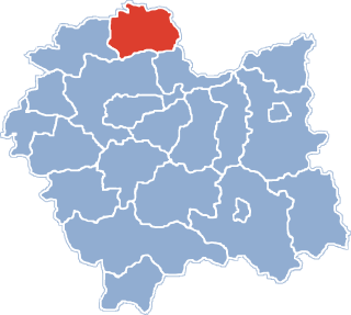
Biskupice is a village in the administrative district of Gmina Miechów, within Miechów County, Lesser Poland Voivodeship, in southern Poland. It lies approximately 4 kilometres (2 mi) west of Miechów and 33 km (21 mi) north of the regional capital Kraków.
Kalina-Lisiniec is a village in the administrative district of Gmina Miechów, within Miechów County, Lesser Poland Voivodeship, in southern Poland. It lies approximately 8 kilometres (5 mi) east of Miechów and 35 km (22 mi) north-east of the regional capital Kraków.
Podmiejska Wola is a village in the administrative district of Gmina Miechów, within Miechów County, Lesser Poland Voivodeship, in southern Poland. It lies approximately 4 kilometres (2 mi) west of Miechów and 35 km (22 mi) north of the regional capital Kraków.
Pstroszyce Drugie is a village in the administrative district of Gmina Miechów, within Miechów County, Lesser Poland Voivodeship, in southern Poland. It lies approximately 7 kilometres (4 mi) north-west of Miechów and 39 km (24 mi) north of the regional capital Kraków.
Strzeżów Pierwszy is a village in the administrative district of Gmina Miechów, within Miechów County, Lesser Poland Voivodeship, in southern Poland. It lies approximately 4 kilometres (2 mi) north-east of Miechów and 37 km (23 mi) north of the regional capital Kraków.
Chodów is a village in the administrative district of Gmina Charsznica, within Miechów County, Lesser Poland Voivodeship, in southern Poland. It lies approximately 4 kilometres (2 mi) south-east of Charsznica, 6 km (4 mi) north-west of Miechów, and 36 km (22 mi) north of the regional capital Kraków.
Uniejów-Parcela is a village in the administrative district of Gmina Charsznica, within Miechów County, Lesser Poland Voivodeship, in southern Poland. It lies approximately 3 kilometres (2 mi) north-east of Charsznica, 10 km (6 mi) north-west of Miechów, and 41 km (25 mi) north of the regional capital Kraków.
Witowice is a village in the administrative district of Gmina Charsznica, within Miechów County, Lesser Poland Voivodeship, in southern Poland. It lies approximately 4 kilometres (2 mi) south of Charsznica, 8 km (5 mi) west of Miechów, and 35 km (22 mi) north of the regional capital Kraków.
Adamowice is a village in the administrative district of Gmina Gołcza, within Miechów County, Lesser Poland Voivodeship, in southern Poland. It lies approximately 8 kilometres (5 mi) north-west of Gołcza, 14 km (9 mi) west of Miechów, and 36 km (22 mi) north of the regional capital Kraków.
Chobędza is a village in the administrative district of Gmina Gołcza, within Miechów County, Lesser Poland Voivodeship, in southern Poland. It lies approximately 3 kilometres (2 mi) west of Gołcza, 10 km (6 mi) west of Miechów, and 32 km (20 mi) north of the regional capital Kraków.
Cieplice is a village in the administrative district of Gmina Gołcza, within Miechów County, Lesser Poland Voivodeship, in southern Poland. It lies approximately 2 kilometres (1 mi) north-west of Gołcza, 9 km (6 mi) west of Miechów, and 33 km (21 mi) north of the regional capital Kraków.
Czaple Wielkie is a village in the administrative district of Gmina Gołcza, within Miechów County, Lesser Poland Voivodeship, in southern Poland. It lies approximately 7 kilometres (4 mi) south-east of Gołcza, 8 km (5 mi) south-west of Miechów, and 27 km (17 mi) north of the regional capital Kraków.
Przybysławice is a village in the administrative district of Gmina Gołcza, within Miechów County, Lesser Poland Voivodeship, in southern Poland. It lies approximately 6 kilometres (4 mi) north-west of Gołcza, 11 km (7 mi) west of Miechów, and 36 km (22 mi) north of the regional capital Kraków.
Rzeżuśnia is a village in the administrative district of Gmina Gołcza, within Miechów County, Lesser Poland Voivodeship, in southern Poland. It lies approximately 3 kilometres (2 mi) east of Gołcza, 6 km (4 mi) south-west of Miechów, and 31 km (19 mi) north of the regional capital Kraków.
Szreniawa is a village in the administrative district of Gmina Gołcza, within Miechów County, Lesser Poland Voivodeship, in southern Poland. It lies approximately 6 kilometres (4 mi) north-west of Gołcza, 13 km (8 mi) west of Miechów, and 35 km (22 mi) north of the regional capital Kraków.
Marcinowice is a village in the administrative district of Gmina Kozłów, within Miechów County, Lesser Poland Voivodeship, in southern Poland. It lies approximately 3 kilometres (2 mi) north-west of Kozłów, 16 km (10 mi) north of Miechów, and 49 km (30 mi) north of the regional capital Kraków.

Przysieka is a village in the administrative district of Gmina Kozłów, within Miechów County, Lesser Poland Voivodeship, in southern Poland. It lies approximately 3 kilometres (2 mi) south-west of Kozłów, 14 km (9 mi) north of Miechów, and 46 km (29 mi) north of the regional capital Kraków.
Klonów is a village in the administrative district of Gmina Racławice, within Miechów County, Lesser Poland Voivodeship, in southern Poland. It lies approximately 4 kilometres (2 mi) west of Racławice, 11 km (7 mi) east of Miechów, and 36 km (22 mi) north-east of the regional capital Kraków.
Nowa Wieś is a village in the administrative district of Gmina Rybno, within Działdowo County, Warmian-Masurian Voivodeship, in northern Poland. It lies approximately 5 kilometres (3 mi) east of Rybno, 22 km (14 mi) north-west of Działdowo, and 55 km (34 mi) south-west of the regional capital Olsztyn.
Międzylesie is a village in the administrative district of Gmina Ostróda, within Ostróda County, Warmian-Masurian Voivodeship, in northern Poland. It lies approximately 4 kilometres (2 mi) north-east of Ostróda and 34 km (21 mi) west of the regional capital Olsztyn.