
EuroVelo is a network of 17 long-distance cycling routes criss-crossing Europe, with 2 more in early construction across various stages of completion. When completed, the EuroVelo network's total length will be almost 60,875 km (37,826 mi). As of 2023 more than 56,000 km (35,000 mi) were in place. EuroVelo is a project of the European Cyclists' Federation (ECF). The multinational project aims to connect 40 countries via the 19 unique routes across the European continent.

The E2 European long distance path or E2 path is a 4850 km (3010-mile) series of long-distance footpaths that is intended to run from Galway in Ireland to France's Mediterranean coast and currently runs through Northern Ireland, Scotland, England, Belgium, Luxembourg and France, with an alternative midsection equally designated via the Netherlands and east coast of England. It is one of the network of European long-distance paths.
The International Naturist Federation (INF) or Fédération naturiste internationale (FNI) or Internationalen Naturisten Föderation (INF) is the global umbrella organisation representing official national naturist societies.

European route E 59 is a north-south Class-A intermediate European route. It begins in Prague, Czech Republic, passes through Vienna, Austria and Maribor, Slovenia, ending near Zagreb, Croatia. The total length of the route is 644 km (400 mi). The E59 largely consists of motorways but some sections are developed either as expressways or two-lane roads with at-grade intersections. The motorway sections are generally tolled through varying systems and rates. Individual segments of the E59 route are shared with several other European routes. Originally, the route extended through Bihać, Bosnia and Herzegovina to Split, Croatia.

The E5 European long distance path or E5 path is one of the European long-distance paths from the French Atlantic coast in Brittany through Switzerland, Austria and Germany over the Alps to Venice in Italy. It is waymarked over the whole 3200 km distance. The heaviest used section is the last part, which crosses Europe’s highest mountains from Lake Constance to Italy. Even this part does not require climbing experience.
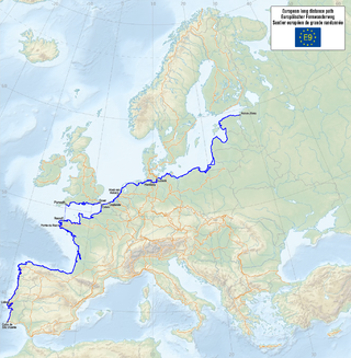
The E9 European long distance path, E9 path or European Coastal Path is one of the twelve European long-distance paths, running for 9880 km from Tarifa, Spain to Narva-Jõesuu in Estonia. In 2019, the southern terminus was extended from Cabo de São Vicente in Portugal to Tarifa in Spain, the southern-most point of continental Europe, and also the starting point of E4 and E12.

The E1 European long-distance path, or just E1 path, is one of the European long-distance paths designated by the European Ramblers' Association. It has a total length of some 7,000 kilometres (4,300 mi). It begins in Norway at the North Cape in Nordkapp Municipality, it progresses to the south and crosses the Kattegat between Sweden and Denmark by ferry. It passes through Denmark, Germany, and Switzerland to finish at Capo Passero, Italy. This path was extended southwards to Sicily, in Italy, in 2018.

The European route E751, or E751, as defined by the Declaration on the Construction of Main International Traffic Arteries of 1975, and subsequent documents which amended the treaty, is an east–west Class-B branching European road route. Originating in Rijeka, Croatia, where it diverges from European route E61 before passing through the Kanfanar interchange, the route connects Pula, Rovinj, Poreč and Umag in Croatia with Koper in Slovenia. The route provides a high-performance road link in Istria and Slovenian Littoral. Unlike most routes, the E751 centers on the Kanfanar interchange and has three arms, each extending to Rijeka, Pula and Koper. The total length of the route, including all the route arms, is 160 km (99 mi).
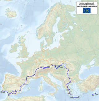
The E4 European long distance path or E4 path is one of the European long-distance paths. Starting at Tarifa Andalusia, located at the southernmost end of the Iberian Peninsula, across the Strait of Gibraltar facing Morocco, it continues through Spain, France, Switzerland, Germany, Austria, Hungary, Romania, Bulgaria and Greece to end in Cyprus. It also visits the Greek island of Crete.
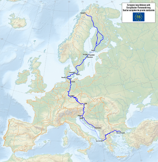
The E6 European long distance path or E6 path is one of the European long-distance paths from the northwest tip of Finland through Sweden, Denmark, Germany and Austria to the Adriatic coast in Slovenia. A second section starts again in Greece to finish in Turkey.

The E7 European long distance path or E7 path is one of the European long-distance paths from the Portuguese-Spanish border eastwards through Andorra, France, Italy, Slovenia, Hungary and Serbia. It is projected to be extended to Lisbon and into Romania, so that it reaches from the Atlantic to the Black Sea, however these stages, as well as parts of the route through Italy, are still in planning.

The E10 European long distance path or E10 path is one of the European long-distance paths, running from Finland through Germany, Czech Republic, Austria, Italy and France to finish at Nice on the south coast of France.

A long-distance trail is a longer recreational trail mainly through rural areas used for hiking, backpacking, cycling, horse riding or cross-country skiing. They exist on all continents except Antarctica.

The GR 7 is a long-distance footpath in Spain, Andorra and France. It is part of both the Spanish network of Senderos de Gran Recorrido and the French network of Sentiers de Grandes Randonnées. Part of GR 7 forms the south-westernmost part of the European walking route E4 in Spain. GR 7 runs from Tarifa, near Gibraltar, across Spain, through France into Andorra, and back into France to Mont Aigoual and Aire-de-Côte in the Cevennes. GR 7 continues north from the Cevennes mountains and the final 250 km end on the top of the Ballon d'Alsace, Alsace, northern France; here it meets E5.
The European Ramblers Association is a network organisation working for promotion of walking, hiking, creating trails, exchange of the know-how over the borders and secure the rights of free access to nature for the walkers. Through this work, ERA also cares for protecting and developing of European cultural heritage and for strengthening of mutual understanding between European citizens.
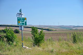
EuroVelo 9 (EV9), named the Amber Route - is a 1,930 km (1,200 mi) long EuroVelo long-distance cycling route running from the city of Gdańsk, Poland on the Baltic Sea to Pula, Croatia on the Adriatic Sea. It is called the Amber Route as historically the precious stone amber found in the Baltic region was taken by routes such as this to the Mediterranean Sea. This north-south cycle route runs through Central Europe and passes successively through six countries: Poland, Czech Republic, Austria, Slovenia, Italy, and Croatia.
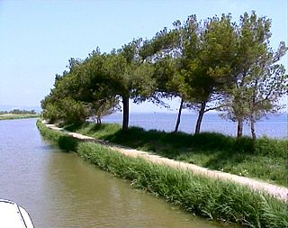
EuroVelo 8 (EV8), named the Mediterranean Route, is a 7,560 km (4,700 mi) long EuroVelo long-distance cycling route running from Cadiz, Spain to Athens, Greece, and then continuing to İzmir, Turkey and to the island of Cyprus. The route runs east-west across Europe mainly along or close to the Mediterranean coast, passing successively through 12 countries: Spain, France, Monaco, Italy, Slovenia, Croatia, Bosnia-Herzegovina, Montenegro, Albania, Greece, Turkey, and Cyprus.

The GR 14 is a Percurso pedestre de grande rota in Portugal, which connects with a corresponding path into Spain. In Portugal, it is known as the Rota dos Vinhos da Europa, and Portuguese tourist maps mark it as continuing through wine-growing areas of Spain and France to terminate at Strasbourg. As of 2015 it is not included in the list of "E-paths" published by the European Ramblers' Association; however, a long-distance route of the same number (GR 14, known as the Senda del Duero does continue the route into Spain from the border at Salto de Saucelle
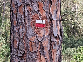
The GR 92 is part of the extensive GR footpath network of paths, tracks and trails in Spain. It will eventually run the length of the Mediterranean coast of Spain, from Portbou, on the border with France to Tarifa, the most southerly point of Spain. In doing so it will pass through the autonomous communities of Catalonia, Valencia, Murcia and Andalusia. The sections in Catalunya and Murcia are complete and fully signposted, but work is still in progress on the sections in Valencia and Andalusia, and sources differ on the eventual length of the path.


