East | |
|---|---|
Municipalities of East Caracas | |
 | |
 Interactive map of East | |
| Coordinates: 10°15′N66°31′W / 10.25°N 66.52°W | |
| Sovereign state | Venezuela |
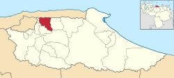
| State | Miranda |
| City | Metropolitan District of Caracas |
| Comprises | Chacao, Altamira, Baruta, El Hatillo, Petare |
| Area | |
• Total | 344.1 km2 (132.9 sq mi) |
| Population | |
• Total | 1,140,756 |
| • Density | 3,315/km2 (8,586/sq mi) |
| Time zone | UTC−4 (VET) |
East Caracas generally refers to the eastern portions of Caracas, and may refer specifically to the municipalities from the Metropolitan District of Caracas located in Miranda State: Chacao, Baruta, Sucre, and El Hatillo. It concentrates the 34.8% population of the Metropolitan District of Caracas, and the 21.7% population of the Greater Caracas Area. Caracas Country Club, the richest neighborhood of the city, is located between El Recreo and Chacao districts.
Contents
Until some years ago, it was one of the safest regions of Caracas since most neighbourhoods on the eastern side had a slightly lower crime rate, [1] [2] [3] [4] but now the situation has changed. Crime is rampant in all the districts of the city. [5] Some of the eastern neighborhoods of Caracas report a high rate of kidnappings, but also some neighborhoods in downtown such as San Bernardino. [6]