
Harker's Run is a stream originating in Preble County, Ohio. Harker's Run drains into Four Mile Creek on the eastern edge of the campus of Miami University in Oxford just north of where the Trenton Oxford Road crosses Four Mile/Talawanda Creek. The stream flows roughly from north to south, and is approximately 5.5 miles (8.9 km) in total length. The elevation at the mouth of the stream is 775 feet (236 m) above sea level. At its highest point, the stream is at approximately 1,000 feet (305 m) elevation. The stream is crossed by bridges on Bonham Road, Somerville Road, Hamilton Richmond Road, and Oxford Germantown Road.
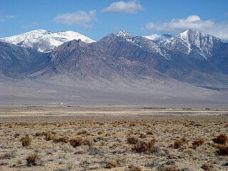
Deep Creek Valley is a 35-mile (56 km) long valley located in southwest Tooele County at the Utah-Nevada border; the extreme south of the valley is in northwest Juab County. The valley parallels the west flank of the Deep Creek Range, both north-trending. In the north-northeast, its outlet widens into the southwest of the Great Salt Lake Desert region.
Wallace Run is a tributary of Bald Eagle Creek in Centre County, Pennsylvania, in the United States. It is 12.1 miles (19.5 km) long and is a low-alkalinity stream. The stream flows through Union Township and Boggs Township in Centre County. Most of the watershed is in Boggs Township. North Branch Wallace Run is one tributary of the stream. The watershed has an area of 24 square miles. Oaks, maples, ash trees, birches, hemlocks, and rhododendrons all exist in the upper reaches of the stream, which is mostly forested. The lower reaches of the stream are mostly developed.
Meeker Run is a tributary of Heberly Run in Sullivan County, Pennsylvania, in the United States. It is approximately 0.9 miles (1.4 km) long and flows through Davidson Township. Its watershed has an area of 0.41 square miles (1.1 km2). The stream has a low pH, although that could potentially be remedied. The main rock formations in the area are the Huntley Mountain Formation and the Burgoon Sandstone. The main soil associations in the vicinity of the stream are the Deep-Wellsboro-Oquaga association, the Wellsboro association, the Norwich association, and the Oquaga association.

Shanty Run is a tributary of Quinn Run in Sullivan County, Pennsylvania, in the United States. It is approximately 1.4 miles (2.3 km) long and flows through Davidson Township. The watershed of the stream has an area of 0.67 square miles (1.7 km2). The stream is acidic and is considered by the Pennsylvania Department of Environmental Protection to be impaired by atmospheric deposition. Rock formations in the watershed include the Huntley Mountain Formation and the Burgoon Sandstone. Soils in the watershed include the Deep-Wellsboro-Oquaga, Oquaga, and Norwich soil associations.
Spies Run is a tributary of Catawissa Creek in Schuylkill County, Pennsylvania, in the United States. It is approximately 1.0 mile (1.6 km) long and flows through East Union Township. The stream has a pH that is fairly close to neutral. The stream is in the United States Geological Survey quadrangle of Conyngham. Trout naturally reproduce in it.
Cross Run is a tributary of Catawissa Creek in Luzerne County, Pennsylvania, in the United States. It is approximately 1.1 miles (1.8 km) long and flows through Hazle Township. The stream is in the United States Geological Survey quadrangle of Conyngham. The stream has two reservoirs on it and has been used as a water supply for Hazleton since at least the late 1800s or early 1900s. Both of the stream's reservoirs have dams. The stream has one unnamed tributary. Cross Run and its unnamed tributary are considered by the Pennsylvania Department of Environmental Protection to be impaired for part of their lengths.
Boulder Creek is a 5 mile long tributary stream of Myer Creek in Imperial County, California. It has its source at 32°37′39″N116°05′59″W. The mouth of Boulder Creek is at its confluence with Myer Creek at an elevation of 1,775 feet / 541 meters in In-Ko-Pah Gorge.
Palm Canyon Wash is an arroyo and tributary ephemeral stream or wash of the Whitewater River, in Riverside County, California.
Cahuilla Creek is a tributary stream of Wilson Creek which is in turn a tributary of Temecula Creek, and the Santa Margarita River in Riverside County, California. Its mouth is at its confluence with Wilson Creek at an elevation of 2,106 feet / 642 meters. Its source is at 33°36′40″N116°40′10″W, at an elevation of 5,800 feet, on the west slope of Thomas Mountain 0.6 miles west-southwest of Tool Box Spring. It flows southwest through the Anza Valley and Cahuilla Valley in the Cahuilla Indian Reservation to Wilson Creek, 7 miles south-southwest of Cahuilla Mountain and 20 miles south-southeast of San Jacinto.
Pike Creek is a stream in Carter and Shannon counties in the Ozarks of southern Missouri. It is a tributary of the Current River.
Calumet Creek is a stream in Pike County in the U.S. state of Missouri. It is a tributary of the Mississippi River. The stream headwaters arise at 39°16′40″N91°03′01″W at an elevation of about 830 feet. The source area is about one mile east of the community of Edgewood and U.S. Route 61 and the stream flows to the northeast passing south of the community of Calumet. The stream continues to the northeast and enters the Mississippi about one mile north of Clarksville. The confluence is at 39°22′44″N90°55′15″W and an elevation of 449 feet.
Beaverdam Creek is a stream in Butler and Ripley counties in the Ozarks of southern Missouri. It is a tributary of the Little Black River.

Currant Creek is a stream in eastern Juab County and southern Utah County in northern Utah, United States.
Spring Creek formerly known as West Creek, and Round Valley Creek, is a stream, tributary to West Deep Creek in White Pine County, Nevada with its source in Juab County, Utah.
West Deep Creek also known as Round Valley Creek, Spring Creek and West Creek is a tributary stream with its head at the confluence of Spring Creek and an unnamed stream, in White Pine County, Nevada, and its mouth in Tooele County, Utah at its confluence with East Deep Creek that forms the head of Deep Creek.
Ferber Hills is a range of hills in Elko County, Nevada and Tooele County, Utah. The range is formed in three parallel ridges of hills trending northwest to southeast. Its highest summit is Utah Peak, in the center of the central ridge of the range, at an elevation of 6,680 feet / 2,036 meters, just east of the state line in Tooele County, Utah. Its second highest Summit is Ferber Peak, that rises to and elevation of 6,601 feet / 2,012 meters, at the south end of the southernmost ridge of the range at 40°12′43″N114°03′18″W just west of the state line in Elko County, Nevada. The highest point in the smaller northernmost ridge is an unnamed summit at 40°17′12″N113°59′48″W with an elevation of 5,745 feet / 1,751 meters in Tooele County.
Chimney Gulch is a valley and arroyo in the Diablo Range, in Santa Clara, California. Its mouth is at an elevation of 932 feet / 284 meters at its confluence with an unnamed creek tributary to East Fork Pacheco Creek that runs westward down below Hagerman Peak to join the East Fork about an eighth of a mile below its confluence with Chimney Gulch. The head of Chimney Gulch and the source of the stream, is a pond south of the Fifield Ranch on the northeast slope of Hagerman Peak at 37°06′52″N121°13′55″W.


