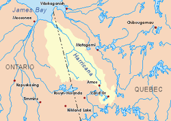
Forestry is the main economic activity of the sector; recreational tourism activities, second. The west side of this slope is served by the Ontario Highway 652.
The surface of the river is usually frozen from early November to mid-May, but safe circulation on the ice generally occurs from mid-November to the end of April.
Geography
The adjacent hydrographic slopes of the East Kabika River are:
The East Kabika River originates at the mouth of a small forest lake (elevation: 312 metres (1,024ft)) in township of Abbotsford. Its mouth is located 20.7 kilometres (12.9mi) north of the North East Bay of Abitibi Lake.
From the mouth of the small head lake, the East Kabika River flows over 53.0 kilometres (32.9mi) according to the following segments:
10.4 kilometres (6.5mi) northerly in Abbotsford Township to Abbotsford Creek (coming from the West);
2.8 kilometres (1.7mi) northerly forming a hook to the east to the boundary of Singer Township;
24.0 kilometres (14.9mi) northerly winding through Singer Township to the edge of Hurtubise Township;
15.8 kilometres (9.8mi) north winding through Hurtubise Township to its mouth.[2]
The confluence of Kabika River East in Hurtubise Township, at 22.6 kilometres (14.0mi) west of the boundary Ontario - Quebec; 3.9 kilometres (2.4mi) southwest of the mouth of the Kabika River; 22.2 kilometres (13.8mi) west of the mouth of the Burntbush River (confluence with the Turgeon River); 93.6 kilometres (58.2mi) Southwest of the mouth of the Turgeon River (confluence with the Harricana River); to 87.4 kilometres (54.3mi) south-east of a bay south of Kesagami Lake and 35.8 kilometres (22.2mi) east of Ontario Highway 652.
Toponymy
The following names are of the same origin and are in the same area of Cochrane District: Kabika River, Kakiba River East. The term "Kabika" is an African name.
This page is based on this Wikipedia article Text is available under the CC BY-SA 4.0 license; additional terms may apply. Images, videos and audio are available under their respective licenses.