East Street Valley (neighborhood)

Last updated
East Street Valley
East Street in 1922.png
East Street, photographed by the Pittsburgh City Photographer on July 6, 1922.
East Street Valley, from "An Atlas of the East Street Valley Neighborhood of Pittsburgh".jpg
Country United States
State Pennsylvania
County Allegheny County
City Pittsburgh

East Street Valley was a neighborhood on Pittsburgh's North Side that stretched northward along the historic path of Butcher's Run, once home to residences, shops, industries, and civic and religious institutions. The neighborhood was demolished prior to the construction of Parkway North, causing the displacement of hundreds of residents over several decades.

Contents

History

Early history

As the region formerly known as the city of Allegheny grew in the early 18th century from a borough of hundreds to a city of thousands, people including many German immigrants began to settle in the valley between Nunnery Hill and Spring Hill. The corridor became a dense offshoot of Allegheny's Deutschtown section, with residences developing alongside factories and other industrial structures. Mass transit first arrived in the neighborhood in the early 1880s in the form of horse-drawn streetcars operated by the People's Park Passenger Railway Company. By 1907, when Pittsburgh annexed the valley along with the rest of Allegheny, the East Street Valley was home to a school, a lumberyard, a soap factory, a singing society, two meatpackers, three churches, and numerous other small shops and institutions. [1] [2]

"Urban renewal" and the East Street Valley Expressway

St. Boniface Roman Catholic Church located at 2208 East Street in the Spring Hill-City View neighborhood of Pittsburgh, Pennsylvania, on December 12, 2009. St.BonifaceRomanCatholicChurch.jpg
St. Boniface Roman Catholic Church located at 2208 East Street in the Spring Hill–City View neighborhood of Pittsburgh, Pennsylvania, on December 12, 2009.

Efforts to remake the Lower North Side in the image of a prosperous, car-friendly, "towers in the park" city center began as early as 1939, when a local coalition called the Federation of Civic Bodies advocated for slum clearance, street improvements, and real estate development. Plans coalesced further in 1954 with the publishing of the North Side Study. Again, planners and business leaders expressed their intention to overhaul much of the Lower North Side's built environment in order to remove blight, increase commerce, reduce traffic congestion, and provide more parking. They proposed several new highways, one of which would connect car-owning suburbanites to Downtown Pittsburgh and the North Shore via the East Street Valley. Though it was not explicitly stated within the North Side Study, most if not all of the valley's residents would be displaced by such a highway. [1] [3]

Public planning meetings for the East Street Valley Expressway, as the project came to be known, commenced in 1963 and continued through the decade, during which time a highway cut through the Manchester neighborhood and some 850 families and dozens of businesses fled the wrecking ball in the newly-dubbed Allegheny Center. Government planners thus faced heightened resistance from local residents — especially members of the Highway Emergency and Relocation Team, or HEART, who sought fairer treatment and better recompensation for affected property owners — as well as from historic preservationists, who fought for a route alteration unveiled in 1974 that would spare St. Boniface Roman Catholic Church. There was relatively little remonstration against the expressway itself. [1] [4]

In 1963, PennDOT estimated that there were either 480 or 640 families living within proposed rights-of-way in the East Street Valley. By 1981, 805 families and individuals had been relocated and 134 business had been relocated or closed. Meanwhile, 133 families, 130 individuals, and 88 businesses still required relocation. The turmoil and heartache of relocation for residents, many of whom were working class, was compounded by deindustrialization and rampant unemployment in the Pittsburgh region during the 1970s and 1980s. [5] [6]

On June 16, 1982, nearly three decades after the North Side Study, and just as the fervor for urban expressways had already begun to wane, civic leaders including Mayor Richard Caliguiri, Governor Dick Thornburgh, and Pittsburgh Steelers owner and Northsider Art Rooney celebrated the expressway's groundbreaking. Optometrist and HEART organizer Marty Krauss told a reporter, "I can assure you that the people celebrating today live comfortably. They live in places like Mt. Lebanon or Fox Chapel. They are not threatened by relocation. If they would be, they could get a good attorney." [7]

Related Research Articles

<span class="mw-page-title-main">Downtown Pittsburgh</span> Neighborhood of Pittsburgh in Allegheny County, Pennsylvania, United States

Downtown Pittsburgh, colloquially referred to as the Golden Triangle, and officially the Central Business District, is the urban downtown center of Pittsburgh. It is located at the confluence of the Allegheny River and the Monongahela River whose joining forms the Ohio River. The triangle is bounded by the two rivers.

<span class="mw-page-title-main">Interstate 376</span> Highway in Pennsylvania

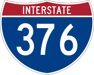
Interstate 376 (I-376) is a major auxiliary route of the Interstate Highway System in the US state of Pennsylvania, located within the Allegheny Plateau. It runs from I-80 near Sharon south and east to a junction with the Pennsylvania Turnpike in Monroeville, after having crossed the Pennsylvania Turnpike at an interchange in Big Beaver. The route serves Pittsburgh and its surrounding areas and is the main access road to Pittsburgh International Airport (PIT). Portions of the route are known as the Beaver Valley Expressway, Southern Expressway, and Airport Parkway. Within Allegheny County, the route runs along the majority of the Penn-Lincoln Parkway, known locally as Parkway West and Parkway East. It is currently the ninth-longest auxiliary Interstate route in the system and second only to I-476 within Pennsylvania.

<span class="mw-page-title-main">Interstate 579</span> Highway in Pennsylvania

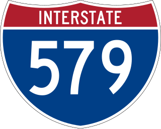
Interstate 579 (I-579) is a north–south Interstate Highway entirely within Pittsburgh, Pennsylvania. The highway is 2.73 miles (4.39 km) long. I-579 is also known as the Crosstown Boulevard since it crosses the backside of Downtown Pittsburgh.

<span class="mw-page-title-main">Allegheny, Pennsylvania</span> Former city in Pennsylvania, United States

Allegheny City was a municipality that existed in the U.S. state of Pennsylvania from 1788 until it was annexed by Pittsburgh in 1907. It was located north across the Allegheny River from downtown Pittsburgh, with its southwest border formed by the Ohio River, and is known today as the North Side. The city's waterfront district, along the Allegheny and Ohio rivers, became Pittsburgh's North Shore neighborhood.

<span class="mw-page-title-main">Interstate 76 (Ohio–New Jersey)</span> Interstate from Ohio to New Jersey

Interstate 76 (I-76) is an east–west Interstate Highway in the Eastern United States. The highway runs approximately 435 miles (700 km) from an interchange with I-71 west of Akron, Ohio, east to I-295 in Bellmawr, New Jersey. This route is not contiguous with I-76 in Colorado and Nebraska.

<span class="mw-page-title-main">Allegheny Center (Pittsburgh)</span> Neighborhood of Pittsburgh in Allegheny County, Pennsylvania, United States

Allegheny Center is a neighborhood on Pittsburgh's North Side. Its zip code is 15212, and it has representation on Pittsburgh City Council by both council members for District 6 and District 1 (Northside).

<span class="mw-page-title-main">East Allegheny (Pittsburgh)</span> Neighborhood of Pittsburgh in Allegheny County, Pennsylvania, United States

East Allegheny, also known as Deutschtown, is a neighborhood on Pittsburgh's North Side. It has a ZIP Code of 15212, and has representation on Pittsburgh City Council by the council member for District 1. The Pittsburgh Bureau of Fire houses 32 Engine and 32 Truck in Deutschtown.

<span class="mw-page-title-main">Marshall-Shadeland, Pittsburgh</span> Neighborhood of Pittsburgh in Allegheny County, Pennsylvania, United States

Marshall-Shadeland is a neighborhood on Pittsburgh, Pennsylvania's North Side. It has a zip codes of both 15212 and 15214, and has representation on Pittsburgh City Council by the council member for District 1.

<span class="mw-page-title-main">Troy Hill (Pittsburgh)</span> Neighborhood of Pittsburgh in Allegheny County, Pennsylvania, United States

Troy Hill is a neighborhood on Pittsburgh, Pennsylvania's North Side. It has a zip code of 15212, and has representation on Pittsburgh City Council by the council member for District 1.

<span class="mw-page-title-main">West End (Pittsburgh)</span> Neighborhood of Pittsburgh in Allegheny County, Pennsylvania, United States

West End Village is a neighborhood in Pittsburgh, Pennsylvania's west city area. It has a zip code of 15220, and has representation on Pittsburgh City Council by the council member for District 2.

<span class="mw-page-title-main">Pennsylvania Route 576</span> Toll highway in Pennsylvania

Pennsylvania Route 576 (PA Turnpike 576), also known as the Southern Beltway, is a tolled freeway in the southern and western suburbs of Pittsburgh, Pennsylvania, United States. It is envisioned to serve as a southern beltway around the Greater Pittsburgh area between Pittsburgh International Airport and the historic Steel Valley of the Monongahela River.

<span class="mw-page-title-main">Pennsylvania Route 28</span> State highway in Pennsylvania, US

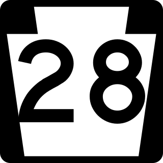
Pennsylvania Route 28 is a major state highway which runs for 98 miles (158 km) from Anderson Street in Pittsburgh to U.S. Route 219 (US 219) in Brockway in Pennsylvania. From Pittsburgh to Kittanning it is a 44.5-mile-long (71.6 km) limited access expressway named the Alexander H. Lindsay Memorial Highway or the Allegheny Valley Expressway.

<span class="mw-page-title-main">Pennsylvania Route 60</span> State highway in Allegheny County, Pennsylvania, US

Pennsylvania Route 60 (PA 60) is a state highway located in the western suburbs of Pittsburgh, Pennsylvania. Although the route follows a mostly east–west alignment, it is signed as a north–south highway. The southern terminus of the route is at a partial interchange with U.S. Route 19 (US 19) and PA 51 in Pittsburgh's West End while the northern terminus is at an interchange with Interstate 376 (I-376), US 22, and US 30 in Robinson Township. The portion of PA 60 outside of Pittsburgh is known as the Steubenville Pike; within the city, PA 60 follows several different streets.

<span class="mw-page-title-main">Transportation in Pittsburgh</span> Overview of transportation in Pittsburgh, Penssylvania, United States

Pittsburgh, surrounded by rivers and hills, has a unique transportation infrastructure that includes roads, tunnels, bridges, railroads, inclines, bike paths, and stairways.

<span class="mw-page-title-main">Pennsylvania Route 65</span> State highway in Pennsylvania, US

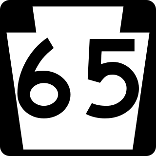
Pennsylvania Route 65, is a major 51-mile-long (82 km) state highway located in western Pennsylvania, United States. The route, traveling north–south from the Interstate 279/U.S. Route 19 Truck concurrency in Pittsburgh north to the PA 108/PA 168 concurrency in New Castle, connects downtown Pittsburgh to the northwestern portion of the Pittsburgh Metropolitan Area. PA 65 is similar in its purpose to PA 18 and PA 51, both of which run parallel to PA 65 at one point or another; however, the three routes pass through different cities for most of their respective alignments.

<span class="mw-page-title-main">Interstate 95 in Pennsylvania</span> Section of Interstate Highway in Pennsylvania, United States

Interstate 95 (I-95) is a major north–south Interstate Highway that runs along the East Coast of the United States from Miami, Florida, north to Houlton, Maine. In the state of Pennsylvania, it runs 44.25 miles (71.21 km) from the Delaware state line near Marcus Hook in Delaware County northeast to the Delaware River–Turnpike Toll Bridge at the New Jersey state line near Bristol in Bucks County.

<span class="mw-page-title-main">Pennsylvania Route 51</span> State highway in Pennsylvania

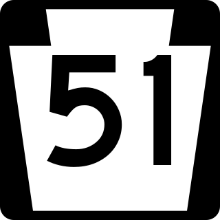
Pennsylvania Route 51 is a major state highway in Western Pennsylvania. It runs for 89 miles (143 km) from Uniontown to the Ohio state line near Darlington, where it connects with Ohio State Route 14. PA 51 is the termination point for Pennsylvania Route 43, Pennsylvania Route 48 and Pennsylvania Route 88. The route is a major connection from Uniontown and the rest of Fayette County to Pittsburgh.

<span class="mw-page-title-main">U.S. Route 22 in Pennsylvania</span> Highway in Pennsylvania

U.S. Route 22 is an east–west U.S. highway that stretches from Cincinnati, Ohio, in the west to Newark, New Jersey, in the east. In Pennsylvania, the route runs for 338.20 miles (544.28 km) between the West Virginia state line in Washington County, where it is a freeway through the western suburbs of Pittsburgh, and then all the way to the Pennsylvania-New Jersey state line in the Lehigh Valley at Easton in the east.

<span class="mw-page-title-main">Pennsylvania Route 130</span> State highway in Pennsylvania, US

Pennsylvania Route 130 (PA 130) is a 49-mile-long (79 km) state highway located in Allegheny and Westmoreland counties in Pennsylvania. The western terminus is at PA 8 in Pittsburgh, and the eastern terminus is at PA 381 near Kregar.

References

  1. 1 2 3 Rooney, Dan; Carol, Peterson (2013). Allegheny City: A History of Pittsburgh's North Side. Pittsburgh, Pa.: University of Pittsburgh Press.
  2. G.M. Hopkins & Co. (1907). Real estate plat-book of the city of Allegheny, Volume 1. Philadelphia: G.M. Hopkins & Co. Retrieved 4 July 2022.
  3. Pittsburgh Regional Planning Association and Pittsburgh City Planning Commission (1954). North Side Study. Pittsburgh, Pa. Retrieved 3 May 2022.
  4. U.S. General Accounting Office (1976). History and Status of the East Street Valley Expressway, Interstate Highway 279, Pittsburgh, Pennsylvania . Retrieved 4 May 2022.
  5. Pittsburgh Department of City Planning (1963). East Street Valley Highway Study. Pittsburgh, Pa. Retrieved 4 May 2022.
  6. U.S. Department of Transportation; PennDOT (1981). Final Environmental Impact Statement: Interstate Route 279 & East Street Exchange . Retrieved 4 July 2022.
  7. Leo, Peter (17 Jun 1982). "Raining on their parade". Pittsburgh Post-Gazette. Retrieved 4 July 2022.