This article does not cite any sources .(December 2019) (Learn how and when to remove this template message) |

The East Sudanian Savanna is a hot, dry, tropical savanna ecoregion of Central and East Africa.
This article does not cite any sources .(December 2019) (Learn how and when to remove this template message) |
The East Sudanian Savanna is a hot, dry, tropical savanna ecoregion of Central and East Africa.
This is the eastern half of the broad savanna belt which runs east and west across Africa, this section lying east of the Cameroon Highlands. The Sahel belt of drier acacia savanna lies to the north and beyond that is the Sahara Desert, while to the south lies the humid forests of the DR Congo.
The Sudd flooded grasslands of southern Sudan divide this area into eastern and western blocks. The land is mainly flat, although there are some hillier sections around Lake Albert and in western Ethiopia.
The climate is tropical with a rainy season (from April to October) and a dry season.
Typical species are deciduous Terminalia trees with and undergrowth of shrubs and grasses such as Combretum and tall elephant grass (Pennisetum purpureum). There are more than 1,000 endemic plant species.
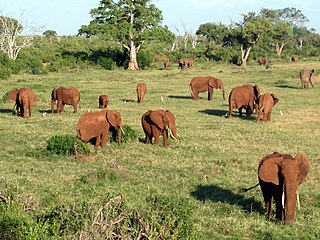
Threatened species include the African bush elephant (Loxodonta africana) (in Chad and the CAE), East African wild dog (Lycaon pictus lupinus), Northeast African cheetah (Acinonyx jubatus soemmeringii), African leopard (Panthera pardus paruds), lion (Panthera leo), and giant eland (Taurotragus derbianus).
In Cameroon the region is more or less contiguous with the North Region, where Bénoué National Park and Bouba Njida National Park contain some of the endangered species mentioned above. In Chad East Sudanian savanna covers the south including the industrial city of Moundou, Chad's second largest city, the oil town of Doba and the cotton-growing towns of Sarh and Pala. In the Central African Republic the region covers the sparsely populated north of the country, the larger towns include Bossangoa. In Sudan west of the Sudd swamp east Sudanian savanna covers the Bahr el Ghazal area including the town of Wau. East of the Sudd the ecoregion runs north to south from northern Uganda, through south-eastern Sudan east of the White Nile (including the area around the southern cities of Juba and Eastern Equatoria around Torit), and up along the Sudan-Ethiopia border. Here in Gambela is the proposed Gambela National Park. Much of this area has seen combat in recent decades and is in various states of reconstruction.
Seasonal cultivation and herding are lifestyles which lead the population of the savanna to overgraze, overharvest the trees for firewood or charcoal and cause fires. This has reduced the woodland considerably. However large areas of unspoilt habitat remain even outside protected areas, especially compared with the more heavily populated West Sudanian Savanna.
Poaching is another problem, indeed the black rhinoceros (Diceros bicornis) and northern white rhinoceros (Ceratotherium simum cottoni) were formerly native to the ecoregion but have been eliminated through over-hunting.
There are national parks at the edges of the region, in Cameroon and Ethiopia, and other protected areas but most of these are severely under-resourced, and apart from hunting for sport in the Central African Republic there is very little wildlife-based tourism.
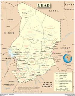
Chad is one of the 48 land-locked countries in the world and is located in North Central Africa, measuring 1,284,000 square kilometers (495,755 sq mi), nearly twice the size of France and slightly more than three times the size of California. Most of its ethnically and linguistically diverse population lives in the south, with densities ranging from 54 persons per square kilometer in the Logone River basin to 0.1 persons in the northern B.E.T. (Borkou-Ennedi-Tibesti) desert region, which itself is larger than France. The capital city of N'Djaména, situated at the confluence of the Chari and Logone Rivers, is cosmopolitan in nature, with a current population in excess of 700,000 people.

Sudan is located in East Central Africa. It is bordered by Egypt to the north, the Red Sea to the northeast, Eritrea and Ethiopia to the east, South Sudan to the south, the Central African Republic to the southwest, Chad to the west and Libya to the northwest. Sudan is the third largest country in Africa, after Algeria and East Congo. It had been the largest country on the continent until the 2011 independence of South Sudan.

The Sahel is the ecoclimatic and biogeographic zone of transition in Africa between the Sahara to the north and the Sudanian Savanna to the south. Having a semi-arid climate, it stretches across the south-central latitudes of Northern Africa between the Atlantic Ocean and the Red Sea. The name is derived from the Arabic term for "coast, shore": this is explained as being used in a figurative sense. However, such figurative use is unattested in Classical Arabic, and it has been suggested that the word may originally have been derived from Arabic word sahl سهل "plain" instead.
The Global 200 is the list of ecoregions identified by WWF, the global conservation organization, as priorities for conservation. According to WWF, an ecoregion is defined as a "relatively large unit of land or water containing a characteristic set of natural communities that share a large majority of their species dynamics, and environmental conditions". So, for example, based on their levels of endemism, Madagascar gets multiple listings, ancient Lake Baikal gets one, and the North American Great Lakes get none.
![Afrotropical realm One of the Earths eight [[biogeographic realm]]s](https://upload.wikimedia.org/wikipedia/commons/thumb/8/8d/Ecozone_Afrotropic.svg/320px-Ecozone_Afrotropic.svg.png)
The Afrotropical realm is one of the Earth's eight biogeographic realms. It includes Africa south of the Sahara Desert, the majority of the Arabian Peninsula, the island of Madagascar, southern Iran and extreme southwestern Pakistan, and the islands of the western Indian Ocean. It was formerly known as the Ethiopian Zone or Ethiopian Region.

The Sudan is the geographic region to the south of the Sahara, stretching from Western to eastern Central Africa. The name derives from the Arabic bilād as-sūdān, or "the lands of the Blacks", referring to West Africa and northern Central Africa. The Arabic name was translated as Negroland on older English maps.
The East Saharan montane xeric woodlands is an ecoregion of central Africa, a number of high mountains in the middle of the huge area of savanna on the edge of the Sahara Desert.

The Ethiopian Highlands is a rugged mass of mountains in Ethiopia, situated in the Horn region in northeast Africa. It forms the largest continuous area of its elevation in the continent, with little of its surface falling below 1,500 m (4,900 ft), while the summits reach heights of up to 4,550 m (14,930 ft). It is sometimes called the Roof of Africa due to its height and large area. Most of the Ethiopian Highlands are part of central and northern Ethiopia, and its northernmost portion reaches into Eritrea.
The Upper Guinean forests is a tropical seasonal forest region of West Africa. The Upper Guinean forests extend from Guinea and Sierra Leone in the west through Liberia, Côte d'Ivoire and Ghana to Togo in the east, and a few hundred kilometers inland from the Atlantic coast. A few enclaves of montane forest lie further inland in the mountains of central Guinea and central Togo and Benin.

The Guinean forest-savanna mosaic is an ecoregion of West Africa, a band of interlaced forest, savanna, and grassland running east to west and dividing the tropical moist forests near the coast from the West Sudanian savanna of the interior.
Forest-savanna mosaic is a transitory ecotone between the tropical moist broadleaf forests of Equatorial Africa and the drier savannas and open woodlands to the north and south of the forest belt. The forest-savanna mosaic consists of drier forests, often gallery forest, interspersed with savannas and open grasslands.

The Sudanian Savanna is a broad belt of tropical savanna that runs east and west across the African continent, from the Atlantic Ocean in the west to the western lowlands in the east. The Sahel, a belt of drier grasslands and acacia savannas, lies to the north, between the Sudanian Savanna and the Sahara Desert. To the south the forest-savanna mosaic is a transition zone between the Sudanian Savanna and the Guinean moist forests and Congolian forests that lie nearer the equator.

The Northern Congolian forest-savanna mosaic is a forest and savanna ecoregion of central Africa, part of the belt of transitional forest-savanna mosaic that lie between Africa's equatorial forests and the tropical dry forests, savannas, and grasslands that lie to the north and south. The Northern Congolian forest-savanna mosaic lies between the equatorial Congolian forests to the south and the drier East Sudanian savanna to the north. It extends from the Cameroon Highlands in the west, across central Cameroon and the southern Central African Republic to southwestern South Sudan and northeastern Democratic Republic of the Congo, where it is bounded on the east by flooded grasslands of the Sudd, the eastern block of the East Sudanian savanna, and the Albertine Rift montane forests.
The wildlife of Cameroon is composed of its flora and fauna. Bordering Nigeria, it is considered one of the wettest parts of Africa and records Africa's second highest concentration of biodiversity. To preserve its wildlife, Cameroon has more than 20 protected reserves comprising national parks, zoos, forest reserves and sanctuaries. The protected areas were first created in the northern region under the colonial administration in 1932; the first two reserves established were Mozogo Gokoro Reserve and the Bénoué Reserve, which was followed by the Waza Reserve on 24 March 1934. The coverage of reserves was initially about 4 percent of the country's area, rising to 12 percent; the administration proposes to cover 30 percent of the land area.

The wildlife of Chad is composed of its flora and fauna. Animal and plant life correspond to the three climatic zones. In the Saharan region, the only flora is the date-palm groves of the oasis. Palms and acacia trees grow in the Sahelian region. The southern, or Sudanic, zone consists of broad grasslands or prairies suitable for grazing. As of 2002, there were at least 134 species of mammals, 532 species of birds, and over 1,600 species of plants throughout the country.

The Chad Basin National Park is a national park in northeastern Nigeria, in the Chad Basin, with a total area of about 2,258 km2. The park is fragmented, with three sectors. The Chingurmi-Duguma sector is in Borno State, in a Sudanian Savanna ecological zone. The Bade-Nguru Wetlands and Bulatura sectors are in Yobe State in the Sahel ecological zone.
The Northern Acacia-Commiphora bushlands and thickets are a tropical grasslands, savannas, and shrublands ecoregion in eastern Africa. The ecoregion is mostly located in Kenya, extending north into southeastern South Sudan, northeastern Uganda, and southwestern Ethiopia, and south into Tanzania along the Kenya-Tanzania border.