Related Research Articles

Jharkhand is a state in eastern India. The state shares its border with the states of West Bengal to the east, Chhattisgarh to the west, Uttar Pradesh to the northwest, Bihar to the north and Odisha to the south. It is the 15th largest state by area, and the 14th largest by population. Hindi is the official language of the state. The city of Ranchi is its capital and Dumka its sub-capital. The state is known for its waterfalls, hills and holy places; Baidyanath Dham, Parasnath, Dewri and Rajrappa are major religious sites.

The Chota Nagpur Plateau is a plateau in eastern India, which covers much of Jharkhand state as well as adjacent parts of Chhattisgarh, Odisha, West Bengal and Bihar. The Indo-Gangetic plain lies to the north and east of the plateau, and the basin of the Mahanadi river lies to the south. The total area of the Chota Nagpur Plateau is approximately 65,000 square kilometres (25,000 sq mi).

The Communist Party of India (Maoist) is a Marxist–Leninist–Maoist banned communist political party and militant organization in India which aims to overthrow the "semi-colonial and semi-feudal Indian state" through protracted people's war. It was founded on 21 September 2004, through the merger of the Communist Party of India (Marxist–Leninist) People's War (People's War Group) and the Maoist Communist Centre of India (MCCI). The party has been designated as a terrorist organisation in India under the Unlawful Activities (Prevention) Act since 2009.

The Eastern States Agency was an agency or grouping of princely states in eastern India, during the latter years of the Indian Empire. It was created in 1933, by the unification of the former Chhattisgarh States Agency and the Orissa States Agency; the agencies remained intact within the grouping. In 1936, the Bengal States Agency was added.

Eastern India is a region of India consisting of the Indian states of Bihar, Jharkhand, Odisha and West Bengal and also the union territory of the Andaman and Nicobar Islands. The region roughly corresponds to the historical region of Magadha from which it inherits its various Eastern Indo-Aryan languages.
The red corridor, also called the red zone, is the region in the eastern, central and the southern parts of India where the Naxalite–Maoist insurgency has the strongest presence. It has been steadily diminishing in terms of geographical coverage and number of violent incidents, and in 2021 it was confined to 25 "most affected" and 70 "total affected" districts across 10 states in two coal rich, remote, forested hilly clusters in and around Dandakaranya-Chhattisgarh-Odisha region and tri-junction area of Jharkhand-Bihar and-West Bengal.

The following outline is provided as an overview of, and topical guide to, India:
Freight equalisationpolicy was adopted by the Government of India to facilitate the equal growth of industry all over India. This meant a factory could be set up anywhere in India and the transportation of minerals would be subsidised by the Union Government. The policy was introduced in 1952, and remained in force until 1993. The policy hurt the economic prospects of the mineral-rich Indian states like Jharkhand, West Bengal, Madhya Pradesh, Assam, Chhattisgarh, and Odisha. Since it weakened the incentives for private capital to establish production facilities in these states. As a result of the policy, businesses preferred setting up industrial locations closer to the coastal trade Indian states like Maharashtra, Gujarat, Tamil Nadu, Karnataka and Andhra Pradesh and markets in the India cities like Mumbai, Delhi, Bangalore, Chennai, Hyderabad, Ahmedabad and Pune.

The Naxalite–Maoist insurgency is an ongoing conflict between Maoist groups known as Naxalites or Naxals and the Indian government. The influence zone of the Naxalites is called the red corridor, which has been steadily declining in terms of geographical coverage and number of violent incidents, and in 2021 it was confined to the 25 "most affected" locations, accounting for 85% of Left Wing Extremism (LWE) violence, and 70 "total affected" districts across 10 states in two coal-rich, remote, forested hilly clusters in and around the Dandakaranya-Chhattisgarh-Odisha region and the tri-junction area of Jharkhand-Bihar and-West Bengal. The Naxalites have frequently targeted police and government workers in what they say is a fight for improved land rights and more jobs for neglected agricultural labourers and the poor.
The Trans-Arunachal Highway (TAH), which includes an existing 1,811 km (1,125 mi) route comprising NH-13 and parts of NH-15, NH-215 and SH-25, is an under-construction 2-lane more than 2,407 km (1,496 mi) long highway passing through 16 districts in Arunachal Pradesh state in India. It runs from LAC in Tawang in northwest to Kanubari in southeast at tri-junction of Assam-Nagaland-Arunachal Pradesh. It connects at least 16 districts of Arunachal Pradesh.
Operation Green Hunt is the name used by the Indian media to describe the "all-out offensive by paramilitary forces and the states forces" against the Naxalites. The operation is believed to have begun in November 2009 along five states in the "Red Corridor."

The Bangladesh, China, India and Myanmar Economic Corridor (BCIM) was a proposed corridor connecting India and China through Myanmar and Bangladesh as a corridor.

The Tatanagar–Bilaspur section is part of the Howrah–Nagpur–Mumbai line and connects Tatanagar in the Indian state of Jharkhand and Bilaspur in Chhattisgarh. Part of one of the major trunk lines in the country, it passes through an industrial-mining area and handles high volumes of freight, particularly coal and iron ore.

The East Coast Economic Corridor (ECEC) is India’s first coastal economic corridor covering 2500 km of India's coastline, to be developed with the help of the Asian Development Bank (ADB). The ADB is to invest $500 million in infrastructural development of the project. Since late 2013, ADB has been supporting studies on transport corridors in India. Phase 1 of the ECEC is Visakhapatnam-Chennai Industrial Corridor (VCIC) which had been approved by the ADB board in October 2016. The ECEC running along the entire east coast of India from Kolkata to Kanyakumari, is a multimodal, regional maritime corridor that can play a vital role in unifying the large domestic market, as well as integrating the Indian economy with the dynamic global value chains of Southeast and East Asia. It would play a crucial role in the Government of India’s (GoI) Make in India campaign and also supports the port-led industrialization strategy under the Sagar Mala initiative and the Act East Policy by linking domestic companies with the vibrant global production networks of East and Southeast Asia.

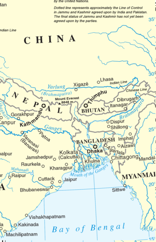
Eastern South Asia is a geographical area in the Southern Asian subregion, precisely the eastern region of the subcontinent. It includes the countries of Bangladesh, Bhutan, Nepal and India. Geographically, it lies between the Eastern Himalayas and the Bay of Bengal. Two of the world's largest rivers, the Ganges and the Brahmaputra, flow into the sea through the Bengal region. The region includes the world's highest mountainous terrain and the world's largest delta, and has a climate ranging from alpine and subalpine to subtropical and tropical. Since Nepal, Bhutan, and northeast India are landlocked, the coastlines of Bangladesh and East India serve as the principal gateways to the region.
Sunil Kumar Misra is the Director General of Indian Electrical and Electronics Manufacturers' Association (IEEMA), in office since 7 October 2013. Before joining IEEMA, he served the Confederation of Indian Industry as Head of Public Policy.
Raipur–Visakhapatnam Expressway (NH-130CD), part of Raipur–Visakhapatnam Economic Corridor (EC-15), is an under-construction, six-lane, 464 km (288 mi) long access-controlled greenfield expressway, which will pass through the states of Chhattisgarh, Odisha and Andhra Pradesh in central and east-central India. At present, from Durg, it runs between NH-30 and NH-130C till Boriguma, then runs east of NH-26 till Sunabeda and then west of NH-26 till Visakhapatnam after terminating with NH-16 at Vizianagaram. Along the new route, it will connect Raipur by starting at Abhanpur in Raipur district with the cities of Dhamtari, Kanker, Kondagaon, Koraput, and Sabbavaram before terminating at Visakhapatnam Port.
Gorakhpur–Siliguri Expressway is an approved 519 km (322 mi) long, four-lane access-controlled greenfield expressway, which will connect the city of Gorakhpur in Uttar Pradesh with the city of Siliguri in West Bengal, India. It will run almost parallel to the India–Nepal border, and will pass through three states–Uttar Pradesh, Bihar and West Bengal. The expressway is a part of Bharatmala Pariyojana, and it will reduce both travel time and distance, from 14-15 hours only 8-9 hours, and from 640 km (400 mi) to 519 km (322 mi). As it will pass through close to the India–Nepal border, the project is of strategic importance for the country, as it will also benefit Nepal. It will be built at a cost of ₹ 32,000 crore, and will be completed by 2025, which was earlier scheduled at 2028/29. In the future, it will be extended to the capital of Assam and the largest city of Northeast India, Guwahati.
Raipur–Ranchi-Dhanbad Expressway (NH), part of Raipur–Dhanbad Economic Corridor (EC-07), is an under-construction, Four-lane, 707 km (439 mi) long access-controlled greenfield expressway, which will pass through the states of Chhattisgarh, and Jharkhand from central to eastern India. It will pass through the coal reserves belt and Industrial towns of Raipur, Bilaspur, Korba, Jashpur, Ranchi, Bokaro, and Dhanbad between Chhattisgarh and Jharkhand in order to promote Industrialization in this region. This project will be mix of greenfield and brownfield. The existing part between Raipur-Bilaspur Expressway will be brownfield which will convert into Six lane expressway while the rest of the part between Bilaspur to Dhanbad will be fully greenfield.
References
- ↑ Eastern Economic Corridor of India
- ↑ "Archived copy". Archived from the original on 2012-01-18. Retrieved 2012-01-25.
{{cite web}}: CS1 maint: archived copy as title (link) - ↑ "Government of India, Ministry of Tourism". tourism.gov.in. Archived from the original on 27 October 2011. Retrieved 5 February 2022.
- ↑ "Special Package Tours :: Bihar State Tourism Development Corporation". Archived from the original on 2012-02-12. Retrieved 2012-01-25.
- ↑ Bhubaneswar-Konarak-Puri-Chilka