Related Research Articles
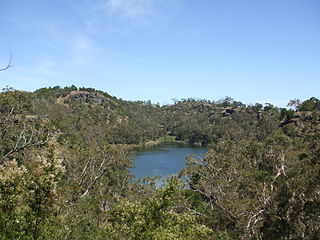
The Budj Bim National Park, formerly known as Mount Eccles National Park, is a national park located in the Western District of Victoria, Australia. The 5,470-hectare (13,500-acre) national park is situated approximately 270 kilometres (170 mi) west of Melbourne and approximately 15 kilometres (9.3 mi) southwest of Macarthur. It derives its name from Budj Bim, formerly Mount Eccles, which is situated in the north-east of the park.

The Shire of Moyne is a local government area in the Barwon South West region of Victoria, Australia, located in the south-western part of the state. It covers an area of 5,481 square kilometres (2,116 sq mi) and in June 2018 had a population of 16,887. It includes the towns of Port Fairy, Koroit, Mortlake, Macarthur, Peterborough, Caramut, Ellerslie, Framlingham, Garvoc, Hawkesdale, Kirkstall, Panmure, Mailors Flat, Purnim, Wangoom and Woolsthorpe. It also entirely surrounds the City of Warrnambool, a separate local government area. It was formed in 1994 from the amalgamation of the Shire of Belfast, Shire of Minhamite, Borough of Port Fairy, and parts of the Shire of Mortlake, Shire of Warrnambool, Shire of Dundas, Shire of Mount Rouse and Shire of Hampden.

Stawell ( "stall"), is an Australian town in the Wimmera region of Victoria 237 kilometres (147 mi) west-north-west of the state capital, Melbourne. Located within the Shire of Northern Grampians local government area, it is a seat of local government for the shire and its main administrative centre. At the 2021 census, Stawell had a population of 6,220.

Peterborough is a town on the Great Ocean Road in Victoria, Australia, approximately three hours' drive from Melbourne. The town is situated on land to the west side of the mouth of the Curdies River.

Ararat is a town in south-west Victoria, Australia, about 198 kilometres (120 mi) west of Melbourne, on the Western Highway on the eastern slopes of the Ararat Hills and Cemetery Creek valley between Victoria's Western District and the Wimmera. Its urban population according to 2021 census is 8,500 and services the region of 11,880 residents across the Rural City's boundaries. It is also the home of the 2018/19 GMGA Golf Championship Final.
Native title refers to rights, recognised by Australian law, held by Aboriginal and Torres Strait Islander groups or individuals to land that derive from their maintenance of their traditional laws and customs. These Aboriginal title rights were first recognised as a part of Australian common law with the decision of Mabo v Queensland in 1992. The doctrine was subsequently implemented and modified via statute with the Native Title Act 1993.
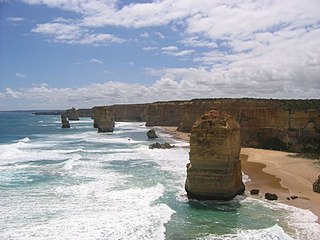
The Western District comprises western regions of the Australian state of Victoria. It is said to be an ill–defined district, sometimes incorrectly referred to as an economic region,. The district is located within parts of the Barwon South West and the Grampians regions; extending from the south-west corner of the state to Ballarat in the east and as far north as Ararat. The district is bounded by the Wimmera district in the north, by the Goldfields district in the east, by Bass Strait and the Southern Ocean in the south, and by the South Australian border in the west. The district is well known for the production of wool. The most populated city in the Western District is the Ballarat region, with 96,940 inhabitants.

Mortlake is a town in the Western District of Victoria, Australia on the Hamilton Highway, 50 kilometres (31 mi) north-east of Warrnambool. It is in the Shire of Moyne local government area and the federal Division of Wannon. As per the 2001 census, Mortlake had a population of 941, which rose to 996 in 2006, and to 1,073 in 2011.
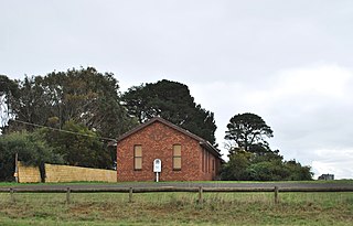
Framlingham is a rural township located by the Hopkins River in the Western District of Victoria, Australia, about 20 kilometres (12 mi) north-east of the coastal city of Warrnambool. In the 2016 census, the township had a population of 158.
The Gunditjmara or Gunditjamara, also known as Dhauwurd Wurrung, are an Aboriginal Australian people of southwestern Victoria. They are the traditional owners of the areas now encompassing Warrnambool, Port Fairy, Woolsthorpe and Portland. Their land includes much of the Budj Bim heritage areas. The Kerrup Jmara are a clan of the Gunditjmara, whose traditional lands are around Lake Condah. The Koroitgundidj are another clan group, whose lands are around Tower Hill.
Yambuk is a town in Victoria, Australia.
The Convincing Ground Massacre was a massacre of the Indigenous Gunditjmara people Kilcarer gundidj clan by British settler whalers based at Portland Bay in South-Eastern Australia. It was part of the wider Eumeralla Wars between the British colonisers and Gunditjmara. Tensions between the two groups had been building since the establishment of the town as a whaling station some five years previously, however, around 1833 or 1834, a dispute over a beached whale caused events to escalate.
Purnim is a small town in Victoria, Australia. The town is located 250 kilometres (155 mi) south west of the state capital, Melbourne, on the Hopkins Highway midway between Warrnambool and Mortlake. At the 2006 census, Purnim and the surrounding area had a population of 459.

Macarthur originally known as Eumeralla, is a town in the Western District of Victoria, Australia on the Hamilton-Port Fairy Road. It is in the Shire of Moyne local government area and the federal Division of Wannon. At the 2016 census, Macarthur and the surrounding area had a population of 522.
Caramut is a town in the Western District of Victoria, Australia on the Hamilton Highway. It is in the Shire of Moyne local government area and the federal Division of Wannon.
Woolsthorpe is a small town in the Shire of Moyne, Victoria, Australia. It is situated at the intersection of the Woolsthorpe-Heywood, Koroit-Woolsthorpe, and Warrnambool-Caramut Roads, on the banks of Spring Creek. There is a local pub, the National Hotel. At the 2016 census, Woolsthorpe had a population of 422, down from 694 in 2006. The nearest large town is Warrnambool 26.5 kilometres further south.

A Registered Aboriginal Party (RAP) is a recognised representative body of an Aboriginal Australian people per the Aboriginal Heritage Act 2006 (Vic.), whose function is to protect and manage the Aboriginal cultural heritage in the state of Victoria in Australia.
Cudgee is a locality in south west Victoria, Australia. The locality is in the Shire of Moyne, 241 kilometres (150 mi) west of the state capital, Melbourne.
Mepunga is a locality in south west Victoria, Australia. The locality is in the Shire of Moyne, 243 kilometres (151 mi) west of the state capital, Melbourne.

Rosebrook is a locality in southwest Victoria, Australia. The locality is in the Shire of Moyne, 282 kilometres (175 mi) west of the state capital, Melbourne.
References
- 1 2 3 "About" . Retrieved 12 July 2020.
- ↑ Smyth and Bahrdt Consultants (2004). Kooyang Sea Country Plan (PDF). Report prepared by Smyth and Bahrdt Consultants on behalf of the Framlingham Aboriginal Trust and Winda Mara Aboriginal Corporation. p. 4.
- ↑ "Map of formally recognised traditional owners". Aboriginal Victoria. Retrieved 12 July 2019.
- ↑ "Proposed Eastern Maar recognition and settlement agreement". Victoria State Government. Justice and Community Safety. 2 June 2020. Retrieved 12 July 2020.