
Weedpatch is an unincorporated community and census-designated place (CDP) in Kern County, California, United States. Weedpatch is 10 miles (16 km) south-southeast of Bakersfield. It is considered to be one of the poorest areas in Kern County. As of the 2010 census it had a population of 2,658.

The Governor Edmund G. Brown California Aqueduct is a system of canals, tunnels, and pipelines that conveys water collected from the Sierra Nevada Mountains and valleys of Northern and Central California to Southern California. Named after California Governor Edmund Gerald "Pat" Brown Sr., the over 400-mile (640 km) aqueduct is the principal feature of the California State Water Project.
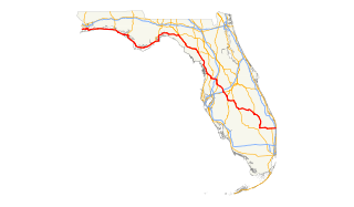
State Road 100 is a 153-mile-long (246 km) east–west highway serving northeastern Florida. Its western terminus is at the Georgia-Florida border four miles (6 km) north of Avoca, Florida ; its eastern terminus is an intersection with Shore Scenic Highway in Flagler Beach. The portion west of Lake City is only signed as portions of US 41 and US 129, both of which run north-south.
State Road 44 is an east–west state highway in the U.S. state of Florida. It runs from Crystal River on the Gulf of Mexico east to New Smyrna Beach on the Atlantic Ocean, passing through Inverness, Wildwood, Leesburg and DeLand.

State Route 223 is a state route in Kern County, California, and is locally known as Bear Mountain Boulevard. It is a truck route, connecting the agricultural land south of Bakersfield and east of SR 99/I-5, and the city of Arvin, to three major transportation corridors without having to drive through Bakersfield. It connects to I-5 for goods traveling north and east of Sacramento. It connects to SR 99 for goods traveling to major San Joaquin Valley communities. It also connects to SR 58, for goods traveling to all points southeast, except for Los Angeles. For goods traveling south, trucks use SR 99 while cars can use Wheeler Ridge Road, which is a north-south county road that connects to I-5 south of SR 99.

U.S. Route 17 (US 17) in Florida is a north–south United States Highway. It runs 317 miles (510 km) from the Punta Gorda, Florida Metropolitan Statistical Area northeast to the Greater Jacksonville Metropolitan Area.
U.S. Route 98 is an east-west United States highway that runs 671 miles (1,080 km) from the Alabama-Florida state line to southern Florida. It is the longest US road in Florida. It was established in 1933 as a route between Pensacola and Apalachicola, and has since been extended eastward across the Florida Peninsula and westward into Mississippi. It runs along much of the Gulf Coast between Mobile, Alabama and Crystal River, Florida, including extensive sections closely following the coast eastward from the Alabama-Florida state line to St. Marks. At a length of 671 miles, US 98 is the longest numbered route in the state of Florida.

Ohio State Route 118 (SR 118) is a 55.30-mile (89.00 km) long north–south state highway in western Ohio, connecting the cities of Greenville and Van Wert. SR 118 runs northward through Darke, Mercer and Van Wert counties, starting from a roundabout with SR 49, SR 571, SR 121 and SR 502 in Greenville. The route crosses through the farming villages of Ansonia, St. Henry, Rossburg and Ohio City as well as the villages of Coldwater and Rockford. Just north of Rossburg, SR 118 serves Eldora Speedway, a clay oval racetrack owned by NASCAR driver Tony Stewart. The northern terminus of SR 118 is at a junction with U.S. Route 127 in the city of Van Wert.
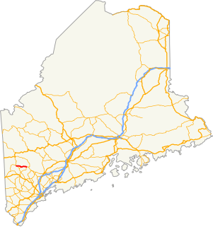
State Route 118 is a secondary highway located in eastern Oxford County, Maine. It runs for 13.04 miles (20.99 km) between the towns of Waterford and Norway. Its western terminus in Waterford is at State Route 35 and its eastern terminus in Norway is at the intersection of Main Street and Paris Street, where it is overlapped by State Route 117.

Kern County’s transportation system was quoted as the “unseen industry.” Located at the southern end of the San Joaquin Valley, the county is at a prime location to ship goods west to the central coast, south to ports in Los Angeles, and east to corridors that connect to the rest of the country. It is also on major corridors that link to all northern points.

The Mountain View Oil Field is a large, mature, but still-productive oil field in Kern County, California, in the United States, in the extreme southern part of the San Joaquin Valley southeast of Bakersfield. It underlies the town of Arvin, as well as some smaller agricultural communities. The field is spread out across a large area, covering just under 8 square miles (21 km2), with wells and storage facilities widely dispersed throughout the area, scattered among working agricultural fields of broccoli and carrots as well as citrus orchards. Discovered in 1933, it has produced over 90 million barrels (14,000,000 m3) of oil in its lifetime, and although declining in production is one of the few inland California fields in which new oil is still being discovered.
Kern Island Canal is an irrigation canal in Kern County, California. It primarily irrigates farmland located on the Kern Lakebed, south of Bakersfield. It originates from a common diversion at Manor Street in Bakersfield, which also supplies the Carrier Canal and Eastside Canal. The common diversion originates from the Kern River about 1 mile (1.6 km) south of Gordon's Ferry.
Carrier Canal is an irrigation canal in Kern County, California. It originates from a common diversion at Manor Street in Bakersfield, which also supplies the Kern Island Canal and Eastside Canal. The common diversion originates from the Kern River about 1 mile (1.6 km) south of Gordon's Ferry. There are additional diversions from the Kern River at Golden State Highway and Coffee Road. The canal terminates at the Kern River, near Enos Lane west of Bakersfield. For its entire length, it runs roughly parallel to the Kern River.

Calloway Canal is an irrigation canal owned by the North Kern Water Storage District in Kern County, California. It originates from the Kern River, just east of Golden State Highway in Bakersfield. It terminates at reservoirs located south of Whisler Road and east of SR 99, near McFarland.
Beardsley Canal is an irrigation canal in Kern County, California. It originates at the Kern River, east of Gordon's Ferry and just west of the First Point of Measurement. It is the first diversion from the river in the San Joaquin Valley for agriculture irrigation. It terminates at reservoirs located in Famoso, just east of SR 99.
Stine Canal is an irrigation canal in Kern County, California. It originates from the Carrier Canal adjacent to SR 99. It terminates at a reservoir on Bear Mountain Boulevard, just east of Gosford Road.
Buena Vista Canal is an irrigation canal in Kern County, California. It originates from the Carrier Canal at Coffee Road. The canal terminates at Lake Webb and the Kern River.
Pioneer Canal is an irrigation canal in Kern County, California, United States. It originates from the Kern River just east of the Stockdale Highway bridge. It terminates at reservoirs just east of Interstate 5.
State Road 464 is a short state and county road in Marion County, Florida. The road is primarily in southern Ocala, but extends outside of the city limits.

Buena Vista Slough was the joint outlet of an overflowing Buena Vista Lake and a distributary of the Kern River into Tulare Lake. It is now diverted into a system of canals by the Outlet Canal of the Central Valley Project.


