California State Route 178

Last updated

California 178.svg

State Route 178

California State Route 178
Map of eastern California with SR 178 highlighted in red
Route information
Maintained by Caltrans
Length166.81 mi [1]  (268.45 km)
Section 1
West endCalifornia 99.svg SR 99 in Bakersfield
Major intersections
East endTrona Road near Trona
Section 2
West end Death Valley
Major intersectionsCalifornia 127.svg SR 127 at Shoshone
East endNevada 372.svg SR 372 towards Pahrump, NV
Location
Country United States
State California
Counties Kern, San Bernardino, Inyo
Highway system
California 177.svg SR 177 California 180.svg SR 180

State Route 178 (SR 178) is a state highway in the U.S. state of California that exists in two constructed segments. The gap in between segments is connected by various local roads and State Route 190 through Death Valley National Park. The western segment runs from State Route 99 in Bakersfield and over the Walker Pass in the Sierra Nevada to the turnoff for the Trona Pinnacles National Natural Landmark. The eastern segment runs from the southeasterly part of Death Valley to Nevada State Route 372 at the Nevada state line.

Contents

SR 178 serves many different purposes. It connects Downtown Bakersfield with East Bakersfield and Lake Isabella. It is one of three crossings over the Sierra Nevada south of Yosemite (SR 120, Tioga Pass Road), connecting the southern San Joaquin Valley with the upper Mojave Desert and the Owens Valley. This also provides access to Death Valley National Park. If the unconstructed portion were built, it would also provide an easy route between Ridgecrest, California and Las Vegas, via Pahrump, Nevada.

Route description

SR 178 is part of the California Freeway and Expressway System, [2] and through Bakersfield and Ridgecrest is part of the National Highway System, [3] a network of highways that are considered essential to the country's economy, defense, and mobility by the Federal Highway Administration. [4] It is eligible for the State Scenic Highway System, [5] but it is not officially designated as a scenic highway by the California Department of Transportation. [6]

Western segment

SR 178 follows the Kern River through the Kern Canyon, just northeast of Bakersfield 01-2007-KernCanyon-Hwy178.jpg
SR 178 follows the Kern River through the Kern Canyon, just northeast of Bakersfield

The first segment starts at State Route 99 just west of Downtown Bakersfield. The road continues as 24th Street but then splits at B Street, utilizing 24th Street for westbound traffic and 23rd Street for eastbound traffic through Downtown Bakersfield. SR 178 becomes a freeway as it leaves Downtown and winds through East Bakersfield. The freeway then travels east as it enters Northeast Bakersfield. A mile east of the Morning Drive interchange, the freeway segment ends with the first at-grade intersection at Canteria Drive. The highway continues through the rural, but growing Rio Bravo section of Bakersfield, crossing SR 184. Turning northeast, the road narrows to a 4-lane highway and continues to the mouth of Kern Canyon (which is also the northeastern city limits of Bakersfield). For the next approximately 8 miles, the route is a narrow 2-lane road (average width of 18 ft. to 24 ft.), as it ascends the lower Sierra Nevada. Average speed is 35 mph, with sharp turns and steep dropoffs. After approximately 8 miles, the road becomes a much gentler 4-lane, 60 ft. expressway. The route continues east and reaches the town of Lake Isabella, which is just south of the Lake Isabella Reservoir. The road briefly expands to a divided freeway through Lake Isabella, before narrowing to a 2-lane conventional highway at the intersection with Lake Isabella Boulevard. The road continues to wind until it ascends to Walker Pass, an elevation of 5,250 feet (1,600 m). The highway then descends from the mountains to its junction with State Route 14. It then proceeds eastward across US 395 into the city of Ridgecrest. The constructed highway then ends east of Ridgecrest at the turnoff for the Trona Pinnacles National Natural Landmark. The right-of-way then continues north as the county-maintained routes of Trona Road, Trona-Wildrose Road, and then Panamint Valley Road, running through the community of Trona to SR 190 east of Panamint Springs.

Eastern segment

Looking west from the state line State Line 2-welcome-to-california.jpg
Looking west from the state line

The second segment resumes four miles (6 km) west of Salisberry Pass in the southeasterly part of Death Valley National Park in Inyo County at what had been the former boundary of Death Valley National Monument until 1994. It then meets up with State Route 127. SR 178 then branches northward from SR 127 to the California-Nevada State Line. In Nevada, the roadway continues as State Route 372 ending at State Route 160 near the center of Pahrump in Nye County.

The segment of State Route 178 from State Route 127 to the California-Nevada state line, as well as all of Nevada State Route 372, are both known as the Charles Brown Highway. Charles Brown, a former California State Legislator, was a major proponent for the incorporation of the segment of State Route 178 between State Route 14 and the California-Nevada state line into the California Highway System.

History

SR 178 was one of the routes created with the third bond act of 1919. It defined a route 202 miles long between Santa Maria and Freeman Junction through Bakersfield. Freeman does not exist today; it was originally located near (and later at) the junction of SR 178 and SR 14. The route was defined as Legislative Route 57. The 1919 bond act also created the first segment of LRN 58. The route was extended several times since 1919. [7] In 1933, the final segment was added to LRN 58, which created a route from US 101 near Santa Margarita to the Nevada state line via Bakersfield. [8] Construction on the route between Bakersfield and Isabella through Kern Canyon started in 1922. Progress moved slowly, as sheer rock walls had to be blasted with dynamite. In 1931, 9 years after construction started, the 26-mile highway segment was completed. [9]

In 1933, with the creation of signed routes, portions of LRN 57 and LRN 58 would be signed as Route 178. LRN 58 would be signed between Route 33 and US 99, and LRN 57 would be signed between US 99 and US 6. [10] Later, in 1947, LRN 212 was created, and defined to run from LRN 23 (signed as US 6) near Inyokern, east to the Nevada state line. It was an unsigned route. [11]

From 1950 to 1953, a portion of SR 178 in Lake Isabella was rerouted around the Isabella Auxiliary Dam. The dam was built over the old route and parts of it are inundated by Isabella Lake. The new route goes over the dam's southern abutment and along the shoreline of Isabella Lake toward Onyx.

In 1964, all of the California routes were renumbered. LRN 58 was dropped from Route 178 and combined with the eastern portion of the decommissioned US 466 (also defined as part of LRN 58) to create SR 58. The remaining Route 178 was combined with LRN 212 to create SR 178. It was originally defined to start at SR 99 in Bakersfield, but later that year it was changed to simply start in Bakersfield. [10] This change was probably done to avoid a cosign with SR 58 along 23rd/24th St. After SR 58 was moved to the freeway south of Brundage Lane in 1976, SR 178 was extended west to SR 99.

Construction on the initial freeway in Bakersfield was completed in 1968. It ran from M St, on the eastern edge of Downtown, through East Bakersfield to Haley Street. Eastern extensions have been constructed since 1968, one interchange at a time as the need arises. In the Kern Canyon section, which is between Bakersfield and the Kern River Valley, a bypass route was identified in 1964. By 1968, a deed from the US Forest Service issued an easement to the State for the construction of the highway through National Forest lands. The first phase of construction was completed in 1974, which created a short freeway near Lake Isabella and a 60’ wide expressway extending west to China Garden. Subsequent phases were not funded. [12]

Abandoned western freeway extension

The freeway portion of Route 178, completed in the late 1950s, ends as it approaches downtown Bakersfield from the east. Weak public support and subsequent lack of funds hindered efforts to complete the freeway through downtown and Westchester to its proposed terminus at the beginning of the modern-day Westside Parkway. Although freeway alternatives through various neighborhoods have been studied several times following the existing portion's completion in 1968, the city of Bakersfield never formally endorsed a route. Caltrans formally announced preference for an alignment through downtown and Westchester in 1973, but fierce public opposition coupled with the historic integrity of the neighborhoods slated to be demolished greatly hindered momentum of the project. In 1977, then-Governor Jerry Brown issued a moratorium on all new freeway construction. Formal studies on possible routes continued and resulted in recommendations of a more southern alignment near Truxtun Avenue executed by the Kern Council of Governors (KernCOG) in 1986 and the 2001 Bakersfield System Study.

A Westchester alignment would have extended the freeway west from its current terminus at M Street and through Downtown Bakersfield in the vicinity of 23rd street. As it continued through Westchester the freeway would turn southwest, cross under SR 99 and terminate at the newly completed Westside Parkway. [13]

A southern alignment would start at SR 178 at Baker Street, about 0.7 miles east of its current terminus. From there, it would turn southwest and run parallel to Baker Street, through East Bakersfield, to the BNSF railroad yard. It would then turn west and run south of the railroad tracks through the southern end of Downtown Bakersfield. At Bakersfield High School, it would run north of the tracks (avoiding the high school). It would continue under SR 99 and terminate at the proposed Westside Parkway. [14]

City of Bakersfield 24th Street Improvements

Still needing to address the increasing crosstown congestion and with a freeway through downtown effectively out of the question, the City of Bakersfield approved construction in the late 2000s to increase capacity on 24th Street through Westchester and 23rd and 24th streets through Downtown using TRIP funds. The project widened, realigned and re-striped 24th Street from west of State Route 99 to east of M Street, as well as realigned and re-striped 23rd Street from west of C Street to east of M Street, in order to add two travel lanes (one in each direction) to the roadway. The project also encompassed improvements to the 24th Street/State Route 99 interchange and widened the Oak Street/24th Street intersection. [15] This solution required the acquisition of several properties north of 24th Street, which was completed in early 2015, as well as the closure of access of B Street through Elm Street from the north. The project was completed in December 2020. [16]

Future

Death Valley Segment

This segment is unconstructed from 15 miles east of Ridgecrest to 15 miles west of SR 127 (10 miles from the eastern boundary of the Death Valley National Park at what had been its former boundary prior to 1994). The state is considering three options: select an alignment to connect with the current eastern segment at its present location; select an alignment to avoid traversing the Death Valley Wilderness; or delete this unconstructed segment from the State Highway System. [17]

The County of Inyo has offered three alternatives:

Major intersections

Except where prefixed with a letter, postmiles were measured on the road as it was in 1964, based on the alignment that existed at the time, and do not necessarily reflect current mileage. R reflects a realignment in the route since then, M indicates a second realignment, L refers to an overlap due to a correction or change, and T indicates postmiles classified as temporary (for a full list of prefixes, see California postmile § Official postmile definitions ). [18] Segments that remain unconstructed or have been relinquished to local control may be omitted. The numbers reset at county lines; the start and end postmiles in each county are given in the county column.

CountyLocationPostmile
[18] [1] [19]
Exit
[20]
DestinationsNotes
Kern
KER 0.00-104.62
Bakersfield 0.00Rosedale HighwayContinuation beyond SR 99; former SR 58 west
0.00California 99.svg SR 99  Sacramento, Los Angeles Interchange; west end of SR 178; former SR 58 east (as a former overlap); SR 99 north exit 26A, south exit 26
0.36Oak Street southFormer Legislative Route 141 south
1.48–
1.50
Chester Avenue – Central District
West end of freeway
R2.012AQ Street, Golden State Avenue (SR 204, SR 99 Bus.)Eastbound exit and westbound entrance; former US 99 south
R2.012ANorth plate California.svg
California 204.svg
SR 204 north (Golden State Avenue, SR 99 Bus. north)
Westbound exit and eastbound entrance
R2.412BUnion Avenue (SR 204 south, SR 99 Bus. south)Former US 99 south
R3.403Beale Avenue
R4.104Haley StreetEastbound exit and westbound entrance
R4.635Mount Vernon Avenue
R5.646Oswell Street
R6.777Fairfax Road
R7.768Morning Drive
East end of freeway
T9.61South plate California.svg
California 184.svg
SR 184 south (Kern Canyon Road) Lamont, Los Angeles
Northern terminus of SR 184
Lake Isabella West end of freeway
R41.6542 Bodfish, Lake Isabella (Elizabeth Norris Road)
R42.9443West plate California.svg
California 155.svg
SR 155 west Wofford Heights, Lake Isabella, Kernville
Eastern terminus of SR 155
East end of freeway
Weldon 55.68Sierra Way – Kernville Serves Kern Valley Airport
79.73 [21] Walker Pass, elevation 5,250 feet (1,600 m) [21]
Freeman Junction 88.26
57.77 [N 1]
South plate California.svg
California 14.svg
SR 14 south (Aerospace Highway) Mojave
West end of SR 14 overlap; former US 6 south
60.57 [N 1]
88.38
North plate California.svg
California 14.svg
SR 14 north (Aerospace Highway) Bishop
East end of SR 14 overlap; former US 6 north
R93.24US 395 (1961 cutout).svg US 395  Bishop, San Bernardino Interchange; west end of US 395 Bus. overlap
Ridgecrest 100.60Inyokern Road, Sandquist Road
102.61South plate 1961.svg
Business plate 1961.svg
US 395 (1961 cutout).svg
To plate 1961.svg
US 395 (1961 cutout).svg
US 395 Bus. south (China Lake Boulevard) to US 395  / Ridgecrest Boulevard
East end of US 395 Bus. overlap; China Lake Boulevard serves Cerro Coso Community College
San Bernardino
SBD 0.00-14.78
7.35Trona Road – Red Mountain
14.78 Trona Pinnacles (Pinnacle Road)East end of western segment of SR 178
Trona Road – Trona, Furnace Creek Continuation beyond the Trona Pinnacles turnoff
Gap in route
Inyo
INY 28.00-62.19
28.00Jubilee Pass Road – Badwater Continuation beyond the west end of eastern segment of SR 178, at the former Death Valley National Monument boundary
42.92
16.25 [N 2]
North plate California.svg
California 127.svg
To plate.svg
US 95 (1961 cutout).svg
SR 127 north to US 95
West end of SR 127 overlap
Shoshone 14.75 [N 2]
42.93
South plate California.svg
California 127.svg
SR 127 south Baker
East end of SR 127 overlap
62.19East plate.svg
Nevada 372.svg
SR 372 east Pahrump
Continuation into Nevada; east end of SR 178
1.000 mi = 1.609 km; 1.000 km = 0.621 mi
  1. 1 2 Indicates that the postmile represents the distance along SR 14 rather than SR 178.
  2. 1 2 Indicates that the postmile represents the distance along SR 127 rather than SR 178.

See also

Related Research Articles

<span class="mw-page-title-main">California State Route 14</span> State highway in Los Angeles and Kern counties in California, United States

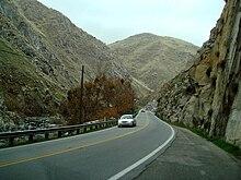
State Route 14 (SR 14) is a north–south state highway in the U.S. state of California that connects Los Angeles to the northern Mojave Desert. The southern portion of the highway is signed as the Antelope Valley Freeway. Its southern terminus is at Interstate 5 in the Los Angeles neighborhoods of Granada Hills and Sylmar just immediately to the south of the border of the city of Santa Clarita. SR 14's northern terminus is at U.S. Route 395 (US 395) near Inyokern. Legislatively, the route extends south of I-5 to SR 1 in the Pacific Palisades area of Los Angeles; however, the portion south of the junction with I-5 has not been constructed. The southern part of the constructed route is a busy commuter freeway serving and connecting the cities of Santa Clarita, Palmdale, and Lancaster to the rest of the Greater Los Angeles area. The northern portion, from Vincent to US 395, is legislatively named the Aerospace Highway, as the highway serves Edwards Air Force Base, once one of the primary landing strips for NASA's Space Shuttle, as well as the Naval Air Weapons Station China Lake that supports military aerospace research, development and testing. This section is rural, following the line between the hot Mojave desert and the forming Sierra Nevada mountain range. Most of SR 14 is loosely paralleled by a rail line originally built by the Southern Pacific Railroad, and was once the primary rail link between Los Angeles and Northern California. While no longer a primary rail line, the southern half of this line is now used for the Antelope Valley Line of the Metrolink commuter rail system.

<span class="mw-page-title-main">California State Route 58</span> Major state highway in California

State Route 58 is a major east-west state highway in the U.S. state of California that runs across the Coast Ranges, the southern San Joaquin Valley, the Tehachapi Mountains, which border the southern Sierra Nevada, and the Mojave Desert. It runs between U.S. Route 101 near Santa Margarita and Interstate 15 in Barstow. It has junctions with Interstate 5 near Buttonwillow, State Route 99 in Bakersfield, State Route 202 in Tehachapi, State Route 14 near Mojave, and U.S. Route 395 at Kramer Junction. SR 58 also provides access to Edwards Air Force Base. At various points it is known as the Calf Canyon Highway, Carrisa Highway, Bakersfield-McKittrick Highway, Rosa Parks Highway, Westside Parkway, Barstow-Bakersfield Highway, Bakersfield Tehachapi Highway, Kern County Korean War Veterans Memorial Highway, and Mojave-Barstow Highway.

<span class="mw-page-title-main">California State Route 99</span> State highway in California, United States

State Route 99 (SR 99) is a north–south state highway in the U.S. state of California, stretching almost the entire length of the Central Valley. From its southern end at Interstate 5 (I-5) near Wheeler Ridge to its northern end at SR 36 near Red Bluff, SR 99 goes through the densely populated eastern parts of the valley. Cities served include Bakersfield, Delano, Tulare, Visalia, Fresno, Madera, Merced, Turlock, Modesto, Manteca, Stockton, Sacramento, Yuba City, and Chico.

<span class="mw-page-title-main">California State Route 82</span> Highway in California

State Route 82 is a state highway in the U.S. state of California that runs from Interstate 880 (I-880) in San Jose to I-280 in San Francisco following the San Francisco Peninsula. It is the spinal arterial road of the peninsula and runs parallel to the nearby Caltrain line along much of the route. For much of its length, the highway is named El Camino Real and formed part of the historic El Camino Real mission trail. It passes through and near the historic downtowns of many Peninsula cities, including Burlingame, San Mateo, Redwood City, Menlo Park, Palo Alto, Mountain View, and Sunnyvale, and through some of the most walkable and transit-oriented neighborhoods in the region.

<span class="mw-page-title-main">California State Route 118</span> Highway in California

State Route 118 is a state highway in the U.S. state of California that runs west to east through Ventura and Los Angeles counties. It travels from State Route 126 at the eastern edge of Ventura immediately northwest of Saticoy, then through Saticoy, in Ventura County east to Interstate 210 near Lake View Terrace in Los Angeles. SR 118 crosses the Santa Susana Pass and the northern rim of the San Fernando Valley along its route.

<span class="mw-page-title-main">California State Route 4</span> State highway in California

State Route 4 is a state highway in the U.S. state of California, routed from Interstate 80 in the San Francisco Bay Area to State Route 89 in the Sierra Nevada. It roughly parallels the Sacramento-San Joaquin River Delta, a popular area for boating and fishing, with a number of accesses to marinas and other attractions. After crossing the Central Valley, the highway ascends up the Sierra foothills. It passes through Ebbetts Pass and contains the Ebbetts Pass Scenic Byway, a National Scenic Byway.

<span class="mw-page-title-main">California State Route 33</span> Highway in California

State Route 33 is a north–south state highway in the U.S. state of California. It runs north from U.S. Route 101 in Ventura through the Transverse Ranges and the western side of the San Joaquin Valley to Interstate 5 at a point east of Tracy. SR 33 replaced part of U.S. Route 399 in 1964 during the "great renumbering" of routes. In the unincorporated sections of Kern County it is known as the West Side Highway. In addition, the California Legislature designated the entire Kern County portion as the Petroleum Highway in 2004. The southernmost portion in Ventura is a freeway known as the Ojai Freeway, while it is known as the Maricopa Highway from Ojai to Maricopa.

<span class="mw-page-title-main">California State Route 119</span> Highway in California

State Route 119, named as the Taft Highway along its entire length, is a state highway in the U.S. state of California that runs in an east–west direction from State Route 33 in Taft to State Route 99 in Bakersfield. SR 119 is part of the former U.S. Route 399, which ran along SR 33 and State Route 166 before ending at SR 99. Today, it serves as the main connector between the extreme southwestern corner of the San Joaquin Valley and Bakersfield.

<span class="mw-page-title-main">California State Route 32</span> Highway in California

State Route 32 is an east–west state highway in the U.S. State of California which is routed from Interstate 5 in Orland, across the Sacramento Valley and through Chico, through the northern Sierra Nevada, and ending at SR 36 and SR 89 in eastern Tehama County.

<span class="mw-page-title-main">California State Route 43</span> Highway in California

State Route 43 is a north–south state highway in the U.S. State of California, routed along the southern San Joaquin Valley between SR 119 southwest of Bakersfield and SR 99 in Selma. SR 43 runs roughly parallel to SR 99, connecting the towns of Shafter, Wasco, Corcoran, Hanford, and Selma.

<span class="mw-page-title-main">California State Route 184</span> Highway in California

State Route 184, locally known as Weedpatch Highway, is a state highway in the U.S. state of California. Located in Kern County, it runs from the intersection of SR 223 and Wheeler Ridge Road near Arvin north to SR 178 in Bakersfield. It is mainly a 2-lane conventional highway, expanding to four lanes in Lamont and Bakersfield. The highway serves local agricultural land south of Bakersfield.

<span class="mw-page-title-main">California State Route 108</span> Highway in California

State Route 108 is a state highway in the U.S. state of California that runs from the Central Valley and across the Sierra Nevada via the Sonora Pass. It generally runs northeast from downtown Modesto near the SR 99/SR 132 interchange, to U.S. Route 395 near the Nevada state line. The route was once recommended to continue south of Modesto to Interstate 5, although today that portion exists as a county road. Parts of SR 108 are closed annually during the winter due to inclement weather along the summit.

<span class="mw-page-title-main">California State Route 204</span> Highway in California

State Route 204 is a state highway in the U.S. state of California that connects SR 58 and SR 99 in the Bakersfield area. Passing through downtown Bakersfield, SR 204 also connects Bakersfield's three major freeways together. Only the northern 1.4 miles (2.3 km) has been built to freeway standards; the rest is a six-lane arterial road.

<span class="mw-page-title-main">California State Route 63</span> Highway in California

State Route 63 is a north–south state highway in the U.S. state of California in the Central Valley. It begins from near Tulare at Route 137, runs north through the city of Visalia and the towns of Cutler and Orosi, before ending 8 miles (13 km) north of Orange Cove, where it reaches its northern terminus at Route 180, roughly 2 and 1/2 miles southwest of the town of Yokuts Valley. State Route 63 runs concurrent with Route 198 within Visalia.

<span class="mw-page-title-main">California State Route 65</span> Highway in California

State Route 65 is a north-south state highway in the U.S. state of California. It is composed of two segments in the Central Valley. The southern segment begins at SR 99, near Bakersfield and terminates at SR 198 near Exeter. It also serves the communities of Oildale, Ducor, Terra Bella, Porterville, Strathmore, and Lindsay. The northern segment begins at Interstate 80 in Roseville and terminates at SR 70 at Olivehurst. It also serves the communities of Rocklin, Lincoln, and Wheatland.

<span class="mw-page-title-main">California State Route 127</span> Highway in California

State Route 127 is a state highway in the U.S. state of California that connects Interstate 15 in Baker to Nevada State Route 373 at the Nevada state line, passing near the eastern boundary of Death Valley National Park. The entire length of the highway closely follows the central portion of the former Tonopah and Tidewater Railroad and loosely follows the Amargosa River.

<span class="mw-page-title-main">California State Route 136</span> Highway in California

State Route 136 is a state highway in the U.S. state of California, running along the northern edge of Owens Lake in Inyo County from U.S. Route 395 in Lone Pine to State Route 190.

<span class="mw-page-title-main">California State Route 180</span> Highway in California

State Route 180 is a state highway in the U.S. state of California. It runs through the heart of the San Joaquin Valley from State Route 33 in Mendota through Fresno, and then east towards the Sierra Nevada to Kings Canyon National Park.

<span class="mw-page-title-main">California State Route 155</span> Highway in California

State Route 155 is a state highway in the U.S. state of California connecting State Route 99 and State Route 178, going through the southern part of the Sierra Nevada mountain range. This highway runs from west to east. Its western terminus is in Delano and its eastern terminus is in the small town of Lake Isabella. Locally it is known as the Garces Highway.

<span class="mw-page-title-main">Transportation in Kern County, California</span>

Kern County’s transportation system was quoted as the “unseen industry.” Located at the southern end of the San Joaquin Valley, the county is at a prime location to ship goods west to the central coast, south to ports in Los Angeles, and east to corridors that connect to the rest of the country. It is also on major corridors that link to all northern points.

References

  1. 1 2 California Department of Transportation (July 2007). "Log of Bridges on State Highways". Sacramento: California Department of Transportation.
  2. "Article 2 of Chapter 2 of Division 1". California Streets and Highways Code. Sacramento: California Office of Legislative Counsel. Retrieved February 6, 2019.
  3. Federal Highway Administration (March 25, 2015). National Highway System: Bakersfield, CA (PDF) (Map). Scale not given. Washington, DC: Federal Highway Administration. Retrieved September 16, 2017.
    Federal Highway Administration (March 25, 2015). National Highway System: California (South) (PDF) (Map). Scale not given. Washington, DC: Federal Highway Administration. Retrieved September 16, 2017.
  4. Natzke, Stefan; Neathery, Mike & Adderly, Kevin (June 20, 2012). "What is the National Highway System?". National Highway System. Washington, DC: Federal Highway Administration. Retrieved July 1, 2012.
  5. "Article 2.5 of Chapter 2 of Division 1". California Streets & Highways Code. Sacramento: California Office of Legislative Counsel. Retrieved February 6, 2019.
  6. California Department of Transportation (August 2019). "Officially Designated State Scenic Highways and Historic Parkways" (XLSX). Sacramento: California Department of Transportation.
  7. Chronology of California Highways - Phase II: Early Growth. CAHighway.org. Accessed: 01-14-2010.
  8. Chronology of California Highways - Phase III: A Significant System is Created. CAHighway.org. Accessed: 01-14-2010.
  9. Draft Report of Kern Canyon Highway Corridor Study Archived January 5, 2009, at the Wayback Machine . KernCOG. September 1984. Page 5.
  10. 1 2 Route 177-184. CAHighway.org. Accessed: 01-14-2010.
  11. Route 209-216. CAHighway.org. Accessed: 01-14-2010.
  12. Draft Report of Kern Canyon Highway Corridor Study Archived January 5, 2009, at the Wayback Machine . KernCOG. September 1984. Page 4-5.
  13. Route 178 Corridor Study Archived 2015-04-11 at the Wayback Machine . Kern Council of Governments. December 1986. Pages 39-41. Retrieved on April 5, 2015.
  14. Route 178 Corridor Study Archived 2015-04-11 at the Wayback Machine . Kern Council of Governments. December 1986. Pages 42-43. Retrieved on April 5, 2015.
  15. "Bakersfield Freeways Current Projects". Bakersfield Freeways. City of Bakersfield. Retrieved 27 November 2017.
  16. Californian, The Bakersfield. "City preps for completion of 24th Street widening project". The Bakersfield Californian. Retrieved 2021-04-14.
  17. 1 2 "Transportation Concept Report for State Route 178, July 2016" (PDF). Caltrans District 9. Caltrans. Retrieved 27 November 2017.
  18. 1 2 California Department of Transportation. "State Truck Route List". Sacramento: California Department of Transportation. Archived from the original (XLS file) on June 30, 2015. Retrieved June 30, 2015.
  19. California Department of Transportation, All Traffic Volumes on CSHS, 2005 and 2006
  20. California Department of Transportation, California Numbered Exit Uniform System, SR-178 Eastbound and SR-178 Westbound, accessed February 2008
  21. 1 2 "Elevation and Location of Summits and Passes in California". California Department of Transportation. Archived from the original on March 1, 2017.
Template:Attached KML/California State Route 178
KML is from Wikidata