California State Route 155

Last updated

California 155.svg

State Route 155

California State Route 155 Map.svg
Map of Kern County in south central California with SR 155 highlighted in red
Route information
Maintained by Caltrans
Length74.79 mi [1]  (120.36 km)
Existed1964–present
Major junctions
West endCalifornia 99.svg SR 99 in Delano
East endCalifornia 178.svg SR 178 near Lake Isabella
Location
Country United States
State California
Counties Kern
Highway system
California 154.svg SR 154 California 156.svg SR 156

State Route 155 (SR 155) is a state highway in the U.S. state of California connecting State Route 99 and State Route 178, going through the southern part of the Sierra Nevada mountain range. This highway runs from west to east. Its western terminus is in Delano and its eastern terminus is in the small town of Lake Isabella. Locally it is known as the Garces Highway.

Contents

Route description

SR 155 starts in Delano at SR 99. The route travels south on Fremont St. and then turns east onto Garces Hwy. From there, it leaves the city and enters agricultural land. Continuing east, it leaves the farmland just before crossing SR 65 (Porterville Hwy.). From there, it starts a gentle climb into the foothills of the Eastern San Joaquin Valley. The route reaches the small town of Woody, where it turns onto Bakersfield-Glennville Rd. The road then begins its steep climb, as it winds through the Greenhorn Mountains. It then reaches the small town of Glennville. At Glennville, the road turns onto Evans Rd, as it continues to travel east. It then reaches its highest elevation at Greenhorn Summit – 6102 ft – and starts its descent. The road crosses the small town of Alta Sierra. Continuing east, it enters the Kern River Valley. In the town of Wofford Heights, the route turns south onto Wofford Heights Blvd. It then travels along the western shore of Lake Isabella. The route then terminates at SR 178 in the town of Lake Isabella, south of the lake.

SR 155 in Delano is part of the National Highway System, [2] a network of highways that are considered essential to the country's economy, defense, and mobility by the Federal Highway Administration. [3]

History

SR 155 was adopted as an unsigned state route in 1933 as Legislative Route 142. Originally it was defined to run from LRN 4 (signed as US 99, currently SR 204) near Bakersfield to LRN 57 (signed as SR 178) near Isabella via Glennville. [4] The route started in Oildale, north of Bakersfield on Airport Dr. The route traveled north on Airport Dr, which becomes Bakersfield-Glennville Rd. It continues north, to the town of Woody, where it joins the current route. In 1963, when US 99 and LRN 141 where swapped, the definition was changed to run from LRN 141, instead of LRN 4. That definition never took effect since in 1964, all of the state routes were renumbered. LRN 142 became SR 155, and was defined to run from SR 204 near Bakersfield to SR 178 near Isabella via Glennville. That definition only lasted one year, since in 1965, the route was realigned to its current routing, which starts in Delano. [5]

The western portion of the route was adopted as an unsigned state route in 1933 as Legislative Route 136. It ran from LRN 4 (signed US 99, currently SR 99) to LRN 129 (currently SR 65). In 1964, the route became a signed route as SR 211. [6] This should not be confused with SR 211 in Humboldt County. That definition only lasted one year, since in 1965, the route became a part of SR 155. The state route was also extended east on Garces Hwy, to the town of Woody, where it connected with the existing SR 155 segment. [5]

Major intersections

Except where prefixed with a letter, postmiles were measured on the road as it was in 1964, based on the alignment that existed at the time, and do not necessarily reflect current mileage. R reflects a realignment in the route since then, M indicates a second realignment, L refers to an overlap due to a correction or change, and T indicates postmiles classified as temporary (for a full list of prefixes, see California postmile § Official postmile definitions ). [7] Segments that remain unconstructed or have been relinquished to local control may be omitted. The entire route is in Kern County.

LocationPostmile
[7] [1] [8]
DestinationsNotes
Delano 0.00Garces HighwayContinuation beyond SR 99
0.00California 99.svg SR 99  Sacramento, Bakersfield, Los Angeles Interchange; west end of SR 155; SR 99 north exit 56, south exit 56A
0.39High StreetFormer US 99
R6.55Famoso-Porterville Highway – Richgrove, Famoso
R10.99California 65.svg SR 65  Porterville, Bakersfield
Woody 30.31Woody Road – Bakersfield Former SR 155 west
Wofford Heights 60.64Wofford Boulevard – Kernville
Lake Isabella R70.99California 178.svg SR 178  Bakersfield, Ridgecrest Interchange; east end of SR 155; SR 178 exit 43
R70.99Kernville RoadContinuation beyond SR 178
1.000 mi = 1.609 km; 1.000 km = 0.621 mi

Route 155 (near the intersection with 6th Ave/Dairy Ave) was the location of the famous "crop duster" scene from the Alfred Hitchcock film North by Northwest . [9] (35°45'38.9"N 119°33'42.0"W)

See also

Related Research Articles

<span class="mw-page-title-main">California State Route 58</span> Major state highway in California

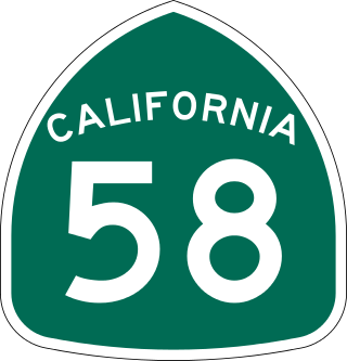
State Route 58 is a major east-west state highway in the U.S. state of California that runs across the Coast Ranges, the southern San Joaquin Valley, the Tehachapi Mountains, which border the southern Sierra Nevada, and the Mojave Desert. It runs between U.S. Route 101 near Santa Margarita and Interstate 15 in Barstow. It has junctions with Interstate 5 near Buttonwillow, State Route 99 in Bakersfield, State Route 202 in Tehachapi, State Route 14 near Mojave, and U.S. Route 395 at Kramer Junction. SR 58 also provides access to Edwards Air Force Base. At various points it is known as the Calf Canyon Highway, Carrisa Highway, Bakersfield-McKittrick Highway, Rosa Parks Highway, Rosedale Highway, Barstow-Bakersfield Highway, Bakersfield Tehachapi Highway, Kern County Korean War Veterans Memorial Highway, and Mojave-Barstow Highway.

<span class="mw-page-title-main">California State Route 99</span> State highway in California, United States

State Route 99 (SR 99) is a north–south state highway in the U.S. state of California, stretching almost the entire length of the Central Valley. From its southern end at Interstate 5 (I-5) near Wheeler Ridge to its northern end at SR 36 near Red Bluff, SR 99 goes through the densely populated eastern parts of the valley. Cities served include Bakersfield, Delano, Tulare, Visalia, Fresno, Madera, Merced, Turlock, Modesto, Manteca, Stockton, Sacramento, Yuba City, and Chico.

<span class="mw-page-title-main">California State Route 23</span> Highway in California

State Route 23 is a state highway in the U.S. state of California that connects the Pacific coast and the Santa Monica Mountains to the Conejo and Santa Clara River valleys. It runs from Pacific Coast Highway in Malibu in Los Angeles County to Ventura Street in Fillmore in Ventura County.

<span class="mw-page-title-main">California State Route 12</span> State highway in California, United States

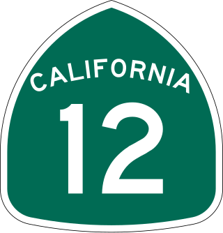
State Route 12 is a state highway in the U.S. state of California that travels in an east–west direction from State Route 116 in Sebastopol in Sonoma County to State Route 49 just north of San Andreas in Calaveras County. The route connects the Sonoma and Napa valleys with the Sacramento–San Joaquin River Delta and the Sierra Foothills. It is constructed to freeway standards from the Fulton Road/South Wright Road stoplight in Santa Rosa, to its partial interchange with Farmers Lane.

<span class="mw-page-title-main">California State Route 4</span> State highway in California

State Route 4 is a state highway in the U.S. state of California, routed from Interstate 80 in the San Francisco Bay Area to State Route 89 in the Sierra Nevada. It roughly parallels the Sacramento-San Joaquin River Delta, a popular area for boating and fishing, with a number of accesses to marinas and other attractions. After crossing the Central Valley, the highway ascends up the Sierra foothills. It passes through Ebbetts Pass and contains the Ebbetts Pass Scenic Byway, a National Scenic Byway.

<span class="mw-page-title-main">U.S. Route 399</span> Former highway in California

U.S. Route 399 was a U.S. Highway in the state of California that ran from Ventura to Bakersfield. It was established in 1934 and decommissioned in 1964, as it was only 124 miles (200 km) long, less than the 300-mile (480 km) minimum that the American Association of State Highway and Transportation Officials (AASHTO) set as the threshold for U.S. Highways. It has been replaced with a segment of State Route 33 (SR 33), all of SR 119, and a segment of SR 99.

<span class="mw-page-title-main">California State Route 119</span> Highway in California

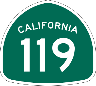
State Route 119, named as the Taft Highway along its entire length, is a state highway in the U.S. state of California that runs in an east–west direction from State Route 33 in Taft to State Route 99 in Bakersfield. SR 119 is part of the former U.S. Route 399, which ran along SR 33 and State Route 166 before ending at SR 99. Today, it serves as the main connector between the extreme southwestern corner of the San Joaquin Valley and Bakersfield.

<span class="mw-page-title-main">California State Route 43</span> Highway in California

State Route 43 is a north–south state highway in the U.S. State of California, routed along the southern San Joaquin Valley between SR 119 southwest of Bakersfield and SR 99 in Selma. SR 43 runs roughly parallel to SR 99, connecting the towns of Shafter, Wasco, Corcoran, Hanford, and Selma.

<span class="mw-page-title-main">California State Route 184</span> Highway in California

State Route 184, locally known as Weedpatch Highway, is a state highway in the U.S. state of California. Located in Kern County, it runs from the intersection of SR 223 and Wheeler Ridge Road near Arvin north to SR 178 in Bakersfield. It is mainly a 2-lane conventional highway, expanding to four lanes in Lamont and Bakersfield. The highway serves local agricultural land south of Bakersfield.

<span class="mw-page-title-main">California State Route 204</span> Highway in California

State Route 204 is a state highway in the U.S. state of California that connects SR 58 and SR 99 in the Bakersfield area. Passing through downtown Bakersfield, SR 204 also connects Bakersfield's three major freeways together. Only the northern 1.4 miles (2.3 km) has been built to freeway standards; the rest is a six-lane arterial road.

<span class="mw-page-title-main">California State Route 65</span> Highway in California

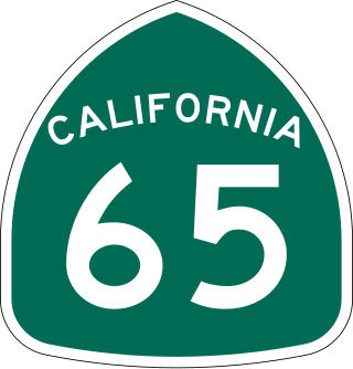
State Route 65 is a north-south state highway in the U.S. state of California. It is composed of two segments in the Central Valley. The southern segment begins at SR 99, near Bakersfield and terminates at SR 198 near Exeter. It also serves the communities of Oildale, Ducor, Terra Bella, Porterville, Strathmore, and Lindsay. The northern segment begins at Interstate 80 in Roseville and terminates at SR 70 at Olivehurst. It also serves the communities of Rocklin, Lincoln, and Wheatland.

<span class="mw-page-title-main">California State Route 104</span> Highway in California

State Route 104 is a west–east state highway in the U.S. state of California that runs from the Central Valley to the Sierra Foothills. It connects State Route 99 near Galt to State Route 49 in Sutter Creek via the city of Ione. It is known as Twin Cities Road from its western terminus up until just before Ione. West of the SR 104/SR 99 interchange, Twin Cities Road continues to Interstate 5 and then eventually end at State Route 160 north of Walnut Grove.

<span class="mw-page-title-main">California State Route 128</span> Highway in California from the Mendocino coast to the Sacramento Valley

State Route 128 is a state highway in the U.S. state of California, connecting the Mendocino coast to the Sacramento Valley, through the state's Wine Country. It runs from State Route 1 near Albion to Interstate 505 in Winters.

<span class="mw-page-title-main">California State Route 136</span> Highway in California

State Route 136 is a state highway in the U.S. state of California, running along the northern edge of Owens Lake in Inyo County from U.S. Route 395 in Lone Pine to State Route 190.

<span class="mw-page-title-main">California State Route 269</span> Highway in California

State Route 269 is a state highway in the U.S. state of California. It runs in the San Joaquin Valley from State Route 33 in Avenal to State Route 145 in the community of Five Points.

<span class="mw-page-title-main">California State Route 229</span> Highway in California

State Route 229 is a state highway in the U.S. state of California, running in San Luis Obispo County from State Route 58 to State Route 41. It connects the small community of Creston with the rural state routes. Also, in conjunction with SR 58 and SR 41, it provides a slower, more scenic route between the Central Coast and the San Joaquin Valley.

<span class="mw-page-title-main">California State Route 162</span> Highway in California

State Route 162 is a state highway in the U.S. state of California that runs roughly west–east through the Coast Ranges and the Sacramento Valley to the western slopes of the Sierra Nevada. It begins at U.S. Route 101 near Longvale, in Mendocino County, and ends at Brush Creek, in Butte County. For most of its length, it is a two lane, undivided highway. SR 162 is not signed as a contiguous route through Mendocino National Forest in Mendocino and Glenn counties. Instead, the portion inside the national forest is federally maintained by the U.S. Forest Service as Forest Highway 7 (FH 7), and is not included in the state route logs.

<span class="mw-page-title-main">California State Route 178</span> Highway in California

State Route 178 is a state highway in the U.S. state of California that exists in two constructed segments. The gap in between segments is connected by various local roads and State Route 190 through Death Valley National Park. The western segment runs from State Route 99 in Bakersfield and over the Walker Pass in the Sierra Nevada to the turnoff for the Trona Pinnacles National Natural Landmark. The eastern segment runs from the southeasterly part of Death Valley to Nevada State Route 372 at the Nevada state line.

<span class="mw-page-title-main">California State Route 223</span> Highway in California

State Route 223, locally known as Bear Mountain Boulevard, is a state highway in the U.S. state of California that runs west to east through the agricultural land south of Bakersfield in Kern County. Running from Interstate 5 (I-5) to State Route 58 near the city of Arvin, it also intersects with State Route 99 near Greenfield. SR 223 forms a truck route for transporting goods to the three main corridors in the area, I-5, SR 58 and SR 99, without having to drive through Bakersfield.

<span class="mw-page-title-main">California State Route 227</span> Highway in California

State Route 227 is a state highway in the U.S. state of California and located in San Luis Obispo County. It is an alternate route of U.S. Route 101 between Arroyo Grande and the city of San Luis Obispo, serving the community of Edna and San Luis Obispo County Regional Airport. There is also an unconstructed routing from Route 1 south of Oceano to its present terminus in Arroyo Grande.

References

  1. 1 2 California Department of Transportation (July 2007). "Log of Bridges on State Highways". Sacramento: California Department of Transportation.
  2. Federal Highway Administration (March 25, 2015). National Highway System: Delano, CA (PDF) (Map). Scale not given. Washington, DC: Federal Highway Administration. Retrieved September 24, 2017.
  3. Natzke, Stefan; Neathery, Mike & Adderly, Kevin (June 20, 2012). "What is the National Highway System?". National Highway System. Washington, DC: Federal Highway Administration. Retrieved July 1, 2012.
  4. Route 137-144. CAHighways.org. Accessed: 11-23-2009.
  5. 1 2 Route 153-160. CAHighways.org. Accessed: 11-23-2009.
  6. Route 129-136. CAHighways.org. Accessed: 11-23-2009.
  7. 1 2 California Department of Transportation. "State Truck Route List". Sacramento: California Department of Transportation. Archived from the original (XLS file) on June 30, 2015. Retrieved June 30, 2015.
  8. California Department of Transportation, All Traffic Volumes on CSHS, 2005 and 2006
  9. North by Northwest Movie Locations - accessed 26/Jan/2008

Route map:

Template:Attached KML/California State Route 155
KML is from Wikidata