Eching am Ammersee

Last updated
Eching a.Ammersee
EchingAmmerseeStPeterPaul.jpg
Church of Saints Peter and Paul
Wappen Eching am Ammersee.svg
Location of Eching a.Ammersee within Landsberg district
Eching am Ammersee in LL.svgWeilRottPenzingKauferingHofstettenFinning
Germany adm location map.svg
Red pog.svg
Eching a.Ammersee
Bavaria location map.svg
Red pog.svg
Eching a.Ammersee
Coordinates: 48°08′N11°12′E / 48.133°N 11.200°E / 48.133; 11.200 Coordinates: 48°08′N11°12′E / 48.133°N 11.200°E / 48.133; 11.200
Country Germany
State Bavaria
Admin. region Upper Bavaria
District Landsberg
Municipal assoc. Schondorf
Subdivisions2  Quarters
Government
   Mayor (202026) Siegfried Luge [1] (CSU)
Area
  Total6.15 km2 (2.37 sq mi)
Elevation
541 m (1,775 ft)
Population
 (2021-12-31) [2]
  Total1,704
  Density280/km2 (720/sq mi)
Time zone UTC+01:00 (CET)
  Summer (DST) UTC+02:00 (CEST)
Postal codes
82279
Dialling codes 08143
Vehicle registration LL
Website www.eching.info

Eching am Ammersee is a municipality in the district of Landsberg in Bavaria in Germany. It has a size of 6.15km2. [3]

Contents

Situated at the northern shore of the Ammersee at an elevation of 541m, [3] it borders the Naturschutzgebiet "Ampermoos" and the wooded recreation area "Weingarten".

Districts

History

Eching belonged to the Electorate of Bavaria and was part of the Hofmark Greifenberg of the Freiherrn von Perfall. [4] [5] Its current form was established in the Gemeindeedikt of 1818.

Population

Date [6] Population
December 1, 1840241
December 1, 1871265
December 1, 1900308
June 16, 1925378
May 17, 1939458
September 13, 1950761
June 6, 1961607
May 27, 1970749
May 25, 19871293
May 9, 20111654
DatePopulation
December 31, 20071625
December 31, 20081609
December 31, 20091638
December 31, 20101654
December 31, 20111681
December 31, 20121657
December 31, 20131661
December 31, 20141660
December 31, 20151681
December 31, 20161703

Politics

Mayor

Mayor since May 1996 is Siegfried Luge (CSU) (born 1943). The last election was on 15 March 2020. [1]

Town Council

For the first time after 36 years CSU and the local grouping "Bürgerblock" had separate lists in the election. The "Bürgerblock" won 9 seats, CSU won 3. [6]

The distribution of seats in municipal council. [7] [8]
Year CSU CSU/BürgerblockBürgerblockMenschen für MenschenTurnout
20143967.5%
200810267.3%
200211170.3%
199611172.7%
19901277.3%
19841280.0%
19781274.5%

Related Research Articles

<span class="mw-page-title-main">Bavaria</span> State in Germany

Bavaria, officially the Free State of Bavaria, is a state in the south-east of Germany. With an area of 70,550.19 km2 (27,239.58 sq mi), Bavaria is the largest German state by land area, comprising roughly a fifth of the total land area of Germany. With over 13 million inhabitants, it is the second largest German state in terms of population only to North Rhine-Westphalia, but due to its large size its population density is below the German average. Bavaria's main cities are Munich, Nuremberg, and Augsburg.

<span class="mw-page-title-main">Upper Bavaria</span> Regierungsbezirk in Bavaria, Germany

Upper Bavaria is one of the seven administrative districts of Bavaria, Germany.

Landsberg am Lech is a Landkreis (district) in Bavaria, Germany. It is bounded by the districts of Aichach-Friedberg, Fürstenfeldbruck, Starnberg, Weilheim-Schongau, Ostallgäu and Augsburg.

Weilheim-Schongau is a Landkreis (district) in the south of Bavaria, Germany. Neighboring districts are Landsberg, Starnberg, Bad Tölz-Wolfratshausen, Garmisch-Partenkirchen and Ostallgäu.

Starnberg is a Landkreis (district) in the southern part of Bavaria, Germany. Neighboring districts are Fürstenfeldbruck, Munich, Bad Tölz-Wolfratshausen, Weilheim-Schongau and Landsberg.

<span class="mw-page-title-main">Schongau, Bavaria</span> Town in Bavaria, Germany

Schongau is a town in Bavaria, near the Alps. It is located along the Lech, between Landsberg am Lech and Füssen. It has about 12,000 inhabitants. Schongau has a well-preserved old wall around the center.

<span class="mw-page-title-main">Greifenberg</span> Municipality in Bavaria, Germany

Greifenberg is a municipality in the district of Landsberg in Bavaria in Germany.

<span class="mw-page-title-main">Aldersbach</span> Municipality in Bavaria, Germany

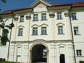
Aldersbach is a municipality in the district of Passau in Bavaria in Germany. The former Cistercian Aldersbach Abbey, of which the Baroque church remains, is located in the village. There is also a brewery with museum. Aldersbach has around 4,500 inhabitants.

<span class="mw-page-title-main">Oberasbach</span> Town in Bavaria, Germany

Oberasbach is a municipality in the district of Fürth, in Bavaria, Germany. It is situated 6 km southwest of Fürth, and 10 km west of Nuremberg (centre).

<span class="mw-page-title-main">Cadolzburg</span> Municipality in Bavaria, Germany

Cadolzburg is a municipality in the Middle Franconian district of Fürth, in Bavaria, Germany. It is situated 11 km (6.8 mi) west of Fürth. Its name derives from its central castle, first being mentioned in the year 1157.

<span class="mw-page-title-main">Neunburg vorm Wald</span> Town in Bavaria, Germany

Neunburg vorm Wald is a municipality in the district of Schwandorf, in Bavaria, Germany. It is situated 21 km east of Schwandorf on the river Schwarzach, a tributary of the Naab.

<span class="mw-page-title-main">Euerdorf</span> Municipality in Bavaria, Germany

Euerdorf is a municipality in the district of Bad Kissingen in Bavaria, Germany.

<span class="mw-page-title-main">Heroldsberg</span> Municipality in Bavaria, Germany

Heroldsberg is a municipality in the district of Erlangen-Höchstadt, in Bavaria, Germany. It is located eleven kilometers north-east from the city of Nuremberg and 23 kilometers east from Erlangen and is the headquarters of Schwan-Stabilo.

<span class="mw-page-title-main">Dießen am Ammersee</span> Municipality in Bavaria, Germany

Dießen am Ammersee is a municipality in the district of Landsberg in Bavaria in Germany. It is located on the shores of the Ammersee.

<span class="mw-page-title-main">Utting am Ammersee</span> Place in Bavaria, Germany

Utting am Ammersee is a municipality in the district of Landsberg in Bavaria in Germany.

<span class="mw-page-title-main">Pähl</span> Municipality in Bavaria, Germany

Pähl am Ammersee is a municipality in the Weilheim-Schongau district, in Bavaria, Germany. It is on the lake of Ammersee to the southwest of Munich.

<span class="mw-page-title-main">Schondorf</span> Municipality in Bavaria, Germany

Schondorf am Ammersee is a municipality in the district Landsberg am Lech, Bavaria, Germany and is a member of the municipal association Schondorf am Ammersee The municipal association based in Schondorf.

<span class="mw-page-title-main">Schondorf (Verwaltungsgemeinschaft)</span> Verwaltungsgemeinschaft in Bavaria, Germany

Schondorf am Ammersee is a Verwaltungsgemeinschaft in the Upper Bavarian district of Landsberg am Lech, Germany. It was created on 1 May 1978 by regulation by the government of Upper Bavaria.

<span class="mw-page-title-main">Weinzierlein</span> Ortsteil of Zirndorf in Bavaria, Germany

Weinzierlein is a village in the town of Zirndorf in the Central Franconian district of Fürth in Bavaria, Germany.

<span class="mw-page-title-main">Häusling (Erlangen)</span> Village in Middle Franconia, Bavaria

Häusling is a village in the city of Erlangen. Its resident population was 203 in 2020.

References

  1. 1 2 Liste der ersten Bürgermeister/Oberbürgermeister in kreisangehörigen Gemeinden, Bayerisches Landesamt für Statistik, 15 July 2021.
  2. "Tabelle 12411-003r Fortschreibung des Bevölkerungsstandes: Gemeinden, Stichtag" (in German). Bayerisches Landesamt für Statistik. June 2022.
  3. 1 2 "Gemeinde Eching am Ammersee | Landkreis Landsberg am Lech". www.landkreis-landsberg.de (in German).
  4. Maximilian von Perfall:: Urkundliche Mittheilungen über Schloß Greifenberg und seine Besitzer. München 1846 (Volltext).
  5. Maximilian von Perfall: Historische Beschreibung mehrerer Ortschaften der Umgegend von Greifenberg. München 1848 (Volltext).
  6. 1 2 "Statistik kommunal 2017" (PDF). GENESIS-Online Bayern. Retrieved 24 May 2018.
  7. "Bayerisches Landesamt für Statistik - GENESIS-Online Bayern". www.statistikdaten.bayern.de (in German). Bayerisches Landesamt für Statistik, Fürth. 24 May 2018. Retrieved 24 May 2018.
  8. "Bayerisches Landesamt für Statistik - GENESIS-Online Bayern". www.statistikdaten.bayern.de (in German). Bayerisches Landesamt für Statistik, Fürth. 24 May 2018. Retrieved 24 May 2018.