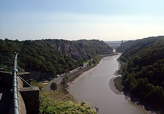
The River Avon is a river in the south west of England. To distinguish it from a number of other rivers of the same name, it is often called the Bristol Avon. The name 'Avon' is a cognate of the Welsh word afon, meaning 'river'.

The Kennet and Avon Canal is a waterway in southern England with an overall length of 87 miles (140 km), made up of two lengths of navigable river linked by a canal. The name is used to refer to the entire length of the navigation rather than solely to the central canal section. From Bristol to Bath the waterway follows the natural course of the River Avon before the canal links it to the River Kennet at Newbury, and from there to Reading on the River Thames. In all, the waterway incorporates 105 locks.

Evesham is a market town and parish in the Wychavon district of Worcestershire, in the West Midlands region of England. It is located roughly equidistant between Worcester, Cheltenham and Stratford-upon-Avon. It lies within the Vale of Evesham, an area comprising the flood plain of the River Avon, which has been renowned for market gardening. The town centre, situated within a meander of the river, is subjected regularly to flooding. The 2007 floods were the most severe in recorded history.

The River Teme rises in Mid Wales, south of Newtown, and flows southeast roughly forming the border between England and Wales for several miles through Knighton before becoming fully English in the vicinity of Bucknell and continuing east to Ludlow in Shropshire, then to the north of Tenbury Wells on the Shropshire/Worcestershire border there, on its way to join the River Severn south of Worcester. The whole of the River Teme was designated as an SSSI, by English Nature, in 1996.

Bradford-on-Avon is a town and civil parish in west Wiltshire, England, near the border with Somerset, which had a population of 9,402 at the 2011 census. The town's canal, historic buildings, shops, pubs and restaurants make it popular with tourists.

Warwickshire is a county in the West Midlands region of England. The county town is Warwick, and the largest town is Nuneaton. The county is famous for being the birthplace of William Shakespeare at Stratford-upon-Avon and Victorian novelist George Eliot,, at Nuneaton. Other significant towns include Rugby, Leamington Spa, Bedworth, Kenilworth and Atherstone. The county offers a mix of historic towns and large rural areas. It is a popular destination for international and domestic tourists to explore both medieval and more recent history.

The Moss is a brook in North East Derbyshire, England.

Bristol Harbour is the harbour in the city of Bristol, England. The harbour covers an area of 70 acres. It is the former natural tidal river Avon through the city but was made into its current form in 1809 when the tide was prevented from going out permanently. A tidal by-pass was dug for 2 miles through the fields of Bedminster for the river, known as the "River Avon New Cut", "New Cut", or simply "The Cut". It is often called the Floating Harbour as the water level remains constant and it is not affected by the state of the tide on the river in the Avon Gorge, The New Cut or the natural river southeast of Temple Meads to its source.

Bidford-on-Avon is a large village and civil parish in the English county of Warwickshire, very close to the border with Worcestershire. In the 2001 census it had a population of 4,830, increasing to 5,350 at the 2011 census.

Eckington is a small village near to the southern border of the English county of Worcestershire, according to the 2001 census it had a population of 1,202.

Bredon Hill is a hill in Worcestershire, England, south-west of Evesham in the Vale of Evesham. The summit of the hill is in the parish of Kemerton, and it extends over parts of eight other parishes. The hill is geologically part of the Cotswolds and lies within the Cotswolds Area of Outstanding Natural Beauty. However, it now stands isolated in the Vale of Evesham due to natural causes.
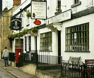
Batheaston is a village and civil parish 2 miles (3.2 km) east of the English city of Bath, on the north bank of the River Avon. The parish had a population of 2,735 in 2011. The northern area of the parish, on the road to St Catherine, is an area known as Northend.

The Sheffield & Tinsley Canal is a canal in the City of Sheffield, England. It runs 3.9 miles (6.3 km) from Tinsley, where it leaves the River Don, to the Sheffield Canal Basin in the city centre, passing through 11 locks. The maximum craft length that can navigate this lock system is 61 feet 6 inches (18.75 m) with a beam of 15 feet 6 inches (4.72 m).
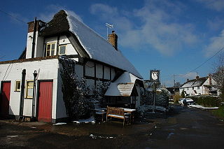
Birlingham is a village and civil parish in the Wychavon district of Worcestershire. The village is south of Pershore, located in a bend of the River Avon.

Bristol Bridge is a bridge over the floating harbour in Bristol, England. The floating harbour was constructed on the original course of the River Avon, and there has been a bridge on the site since long before the harbour was created by impounding the river in 1809. The current bridge was completed in 1768 and is a Grade II listed building.
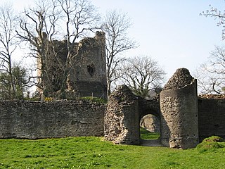
Longtown Castle, also termed Ewias Lacey Castle in early accounts, is a ruined Norman motte-and-bailey fortification in Longtown, Herefordshire. It was established in the 11th century by Walter de Lacy, reusing former Roman earthworks. The castle was then rebuilt in stone by Gilbert de Lacy after 1148, who also established the adjacent town to help pay for the work. By the 14th century, Longtown Castle had fallen into decline. Despite being pressed back into use during the Owain Glyndŵr rising in 1403, it fell into ruin. In the 21st century the castle is maintained by English Heritage and operated as a tourist attraction.

Strensham is a village in the Wychavon district of Worcestershire. In the 2001 census, the civil parish of Strensham had a population of 314 across 127 households. Since 1991, the population has risen 28.7% from 244 residents.

Bath and North East Somerset is a unitary authority created on 1 April 1996, following the abolition of the County of Avon, which had existed since 1974. Part of the ceremonial county of Somerset, Bath and North East Somerset occupies an area of 220 square miles (570 km2), two-thirds of which is green belt. It stretches from the outskirts of Bristol, south into the Mendip Hills and east to the southern Cotswold Hills and Wiltshire border. The city of Bath is the principal settlement in the district, but BANES also covers Keynsham, Midsomer Norton, Radstock and the Chew Valley. The area has a population of 170,000, about half of whom live in Bath, making it 12 times more densely populated than the rest of the area.


