Devakottai is a first-grade municipality in the state of Tamil Nadu, India. Located in the Sivaganga district, the town is situated close to the Karaikudi, near Rameswaram National Highway Road (NH-210). It is one of the major cities comes under the Chettinad area with rich heritage of houses built with limestone called "Karai Veedu". This Region is one of the towns in Chettinad belt. The town is famous for its ancient temple Sri Meenakshi Sundareswarar temple also known as Nagara Sivan Kovil.

Didwana serves as the temporary district headquarters for Didwana-Kuchaman district of Rajasthan, India. Known as the lion gateway of Marwar and the archway of Merta, it is mentioned in puranic texts as Abhanagri and Upakashi, and is situated on the northern side of Didwana Salt lake. It was administered as a tehsil of Nagaur district before being notified as a district. The people of Didwana speak the Rajasthani language Marwadi, a dialect in the Indo-Aryan language family, which is similar to Hindi.

Bhongir, officially known as Bhuvanagiri, is a city and a district headquarters of the Yadadri Bhuvanagiri district and part of the Hyderabad Metropolitan Region of the Indian state of Telangana.
Pal Lahara is a small town in Angul district of the state of Odisha and located on NH6, where it intersects with NH23, 91 kilometres (57 mi) by road north of Angul. Not far from the banks of the Rengali Reservoir which is to the west, the Malayagiri Forest Range is to the southeast. Pallahara is one of the sub divisional headquarters in the Angul district.
Bathalapalle is a village in Sri Sathya Sai district of the Indian state of Andhra Pradesh. It is the mandal headquarters of Bathalapalle mandal in Dharmavaram revenue division. It is about 25 kilometres south east of Anantapur on National Highway 205.
Chengalam is a village situated in the east of Kottayam District in India.
Amadagur is a village in Sri Sathya Sai district of the Indian state of Andhra Pradesh. It is the headquarters of Amadagur mandal in Kadiri revenue division. According to 2011 census of India, Total Amadagur population is 29,520 people are living in this Mandal, of which 14,704 are male and 14,816 are female. Population of Amadagur in 2020 is 35,424 Literate people are 15,309 out of 9,169 are male and 6,140 are female. Total workers are 16,599 depends on multi skills out of which 8,878 are men and 7,721 are women. Total 5,032 Cultivators are depended on agriculture farming out of 3,295 are cultivated by men and 1,737 are women. 6,755 people works in agricultural land as a labour in Amadagur, men are 3,135 and 3,620 are women.

Tikamgarh Lok Sabha constituency is one of the 29 Lok Sabha (parliamentary) constituencies in Madhya Pradesh state in central India. This constituency came into existence in 2008 as a part of the implementation of the delimitation of parliamentary constituencies. It is reserved for the candidates belonging to the Scheduled castes

Rampurwa is a village situated in Mehsi, East Champaran District in the Indian state of Bihar. The village is commonly known as Rampurwa among the localities. It lies in the Mirjapur Panchayat region. It is situated at the bank of river Burhi Gandak River on whose bank the village has flourished. It is well connected by road and railways. The nearest city Kaswa Mehsi in Mehsi, which is 2 km from the village. The nearest railway station is Mehsi railway station, which is around 5 km from the village.
Mohada is a village in Yavatmal district of Maharashtra State in India. Mohada is located at: SH-234 It is situated 47 kilometres (29 mi) from district place Yavatmal.
Noklak is the headquarters of Noklak district. The district was officially inaugurated by Nagaland's Chief Minister, Neiphiu Rio on January 20, 2021, and is located in the easternmost part of India. Noklak district is the headquarter of Khiamniungan Nagas in the Indian state of Nagaland.
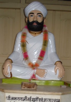
Jasrasar is a tehsil located in Bikaner district of Rajasthan state, India. It is located 280 kilometres (174 mi) from Jaipur, 225 kilometres (140 mi) from Jodhpur and 483 kilometres (300 mi) from Mount Abu.

Rokha is a large village in Dih block of Rae Bareli district, Uttar Pradesh, India. Historically the namesake of a pargana, Rokha is a predominantly agricultural village consisting of many hamlets. It is located 28 km from Raebareli, the district headquarters. The large village of Mau also borders Rokha to the north. Rokha is connected by road with Nasirabad and Jais to the northeast and Suchi to the southwest.

Lakhangaon is a village in Sareni block of Rae Bareli district, Uttar Pradesh, India. As of 2011, it has a population of 1,233 people, in 210 households. It has no healthcare facilities and hosts both a weekly haat and a permanent market. It belongs to the nyaya panchayat of Malkegaon.

Khargapur is a village in Khiron block of Rae Bareli district, Uttar Pradesh, India. It is located 13 km from Lalganj, the tehsil headquarters. As of 2011, it has a population of 2,246 people, in 397 households. It has 1 primary school and no healthcare facilities and it does not host a weekly haat or a permanent market. It belongs to the nyaya panchayat of Bakuliha.
Bakuliha is a village in Khiron block of Rae Bareli district, Uttar Pradesh, India. It is located 16 km from Lalganj, the tehsil headquarters. As of 2011, it has a population of 4,244 people, in 768 households. It has 4 primary schools and no healthcare facilities and it does not host a weekly haat or a permanent market. It serves as the headquarters of a nyaya panchayat which also includes 7 other villages.

Paraura is a village in Rahi block of Rae Bareli district, Uttar Pradesh, India. It is located 13 km from Rae Bareli, the district headquarters. As of 2011, it has a total population of 1,060 people, in 191 households. It has one primary school and no medical facilities and it does not host a weekly haat or a permanent market. It belongs to the nyaya panchayat of Bhaon.
Bakwara is a village in Rahi block of Rae Bareli district, Uttar Pradesh, India. It is located 15 km from Rae Bareli, the district headquarters. As of 2011, it has a total population of 1,540 people, in 257 households. It has one primary school and no medical facilities and it hosts a weekly haat but not a permanent market. It belongs to the nyaya panchayat of Rustampur.
Paintemau is a village in Rahi block of Rae Bareli district, Uttar Pradesh, India. It is located 6 km from Rae Bareli, the district headquarters. As of 2011, it has a total population of 617 people, in 112 households. It has one primary school and no medical facilities and it does not host a weekly haat or a permanent market. It belongs to the nyaya panchayat of Rustampur.
Musen Mata is a village of Atru tehsil in the Baran district, in Rajasthan, India. The nearest town is Atru, which is 11 km away. It is located 46 km from the district headquarter, Baran. Its population is 892. It comes under Antana Gram Panchayat. In the village, there is an upper primary school and a small health care center.

