Edelbach (Kahl)

Last updated
Edelbach
Edelbach.JPG
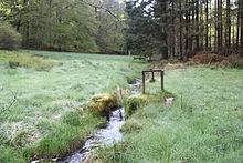
The Edelbach north of the sawmill at the village Edelbach
Location
Country Germany
Location Bavaria
Physical characteristics
Source 
  locationsoutheast of Edelbach, (Kleinkahl)
  elevation334 metres (1,096 ft) above sea level (Normalhöhennull)
Mouth  
  location
west of Edelbach into the Kahl
  coordinates
50°06′45″N9°16′56″E / 50.1124°N 9.2823°E / 50.1124; 9.2823 Coordinates: 50°06′45″N9°16′56″E / 50.1124°N 9.2823°E / 50.1124; 9.2823
  elevation
238 metres (781 ft) above sea level (Normalhöhennull)
Length2.6 kilometres (1.6 mi)
Basin sizeabout 4.2 square kilometres (1.6 sq mi)
Basin features
Progression KahlMainRhineNorth Sea

Edelbach is a small river of the district Aschaffenburg in the Bavarian part of the Spessart, Germany.

Aschaffenburg is a Landkreis (district) in Bavaria, Germany. It is bounded by the districts of Darmstadt-Dieburg, Offenbach, Main-Kinzig, the districts Main-Spessart and Miltenberg, and the town of Aschaffenburg.

Bavaria State in Germany

Bavaria, officially the Free State of Bavaria, is a landlocked federal state of Germany, occupying its southeastern corner. With an area of 70,550.19 square kilometres, Bavaria is the largest German state by land area comprising roughly a fifth of the total land area of Germany. With 13 million inhabitants, it is Germany's second-most-populous state after North Rhine-Westphalia. Bavaria's main cities are Munich, Nuremberg and Augsburg.

Spessart low mountain range in Germany

Spessart is a Mittelgebirge, a range of low wooded mountains, in the States of Bavaria and Hesse in Germany. It is bordered by the Vogelsberg, Rhön and Odenwald. The highest elevation is the Geiersberg at 586 metres NN.

Contents

It is a left tributary of the Kahl. The Edelbach gave its name to the village of Edelbach in Kleinkahl. Up to the 20th century, both the river and the village bore the name Ölbach.

Kahl (river) river in Germany

The Kahl is a river in the northern Spessart in Bavaria and Hesse, Germany. It is a right tributary of the Main and is 35.6 km (22.1 mi) long. The name Kahl comes from the Old High German word kaldaha, which means cool and clear. The Kahl rises from two sources left and right of the road at the foot of the Spessart hills, near Kleinkahl. These springs produce 50–60 litres per second. The Kahl flows into the river Main in Kahl am Main. The mouth is near the old Kahl Nuclear Power Plant. The largest tributaries are Westerbach, Sommerkahl, Reichenbach and Geiselbach.

Kleinkahl Place in Bavaria, Germany

Kleinkahl is a community in the Aschaffenburg district in the Regierungsbezirk of Lower Franconia (Unterfranken) in Bavaria, Germany, and a member of the Verwaltungsgemeinschaft of Schöllkrippen. Kleinkahl has around 1,800 inhabitants.

The main source of the Edelbach Edelbachquelle.jpg
The main source of the Edelbach
The Edelbach below its sources Edelbach1.jpg
The Edelbach below its sources
The Edelbach (on the right) flowing into the Kahl Edelbachmundung.JPG
The Edelbach (on the right) flowing into the Kahl

Course

The Edelbach springs in a forest at the foot of the back of the mountain Eselshöhe, below the mountain Edelberg477 metres (1,565 ft), between its two northern foothills, Sommerberg466 metres (1,529 ft) and Ölberg461 metres (1,512 ft). The springs are located in the 130 metres (430 ft) deep notched Ringgrund on the left mountain side. The main source is located on the boundary to the unincorporated area Gemarkung Schöllkrippener Forst, below the hiking trail K2. The drainage basin above ground is about 4 square kilometres (1.5 sq mi) and reaches up to the Spessart-Höhenstraße (a scenic route). The Ringgrund from there to the spring is a dry valley.

Unincorporated area Region of land not governed by own local government

In law, an unincorporated area is a region of land that is not governed by a local municipal corporation; similarly an unincorporated community is a settlement that is not governed by its own local municipal corporation, but rather is administered as part of larger administrative divisions, such as a township, parish, borough, county, city, canton, state, province or country. Occasionally, municipalities dissolve or disincorporate, which may happen if they become fiscally insolvent, and services become the responsibility of a higher administration. Widespread unincorporated communities and areas are a distinguishing feature of the United States and Canada. In most other countries of the world, there are either no unincorporated areas at all, or these are very rare; typically remote, outlying, sparsely populated or uninhabited areas.

<i>Gemarkung</i> district in German, Swiss and some other European cadastral systems

A Gemarkung is the entirety of all land plots of a specific municipality recorded in the cadastre in the countries of Germany, Austria and Switzerland. Gemarkung registers record the parcels' location, usage and geomorphology and the like qualities, however, the rights to the land are kept in the Grundbuch. A Gemarkung is made up of a number of, usually contiguous, plots of urban (Grundstücke) or rural land (Flurstücke). Between the levels of Flurstück and Gemarkung is often found the level of Flur, usually a tract of open land or forest.

Drainage basin Area of land where precipitation collects and drains off into a common outlet

A drainage basin is any area of land where precipitation collects and drains off into a common outlet, such as into a river, bay, or other body of water. The drainage basin includes all the surface water from rain runoff, snowmelt, and nearby streams that run downslope towards the shared outlet, as well as the groundwater underneath the earth's surface. Drainage basins connect into other drainage basins at lower elevations in a hierarchical pattern, with smaller sub-drainage basins, which in turn drain into another common outlet.

The Edelbach runs parallel to the Kreisstraße AB 20 to the north-west. After about 250 metres (820 ft), on which it declines about 20 metres (66 ft), it leaves the forest. Here it is strengthened by a larger spring at a forest house and the brook from the Kafloosquelle. In the village Edelbach, which is part of Kleinkahl, it is crossed by the Degen-Weg, a hiking trail, then takes up the water of other springs. In older times, it drove a sawmill there. North of the sawmill, opposite a Kneipp water-treading basin, it crosses the Kahltal-Spessart cycle path and flows into the Kahl.

Kreisstraße class of road in Germany

A Kreisstraße is a class of road in Germany. It carries traffic between the towns and villages within a Kreis or district or between two neighbouring districts. In importance, the Kreisstraße ranks below a Landesstraße, but above a Gemeindestraße or "local road". Kreisstraßen are usually the responsibility of the respective rural district (Landkreis) or urban district, with the exception of high streets through larger towns and villages. Kreisstraßen are usually dual-lane roads but, in a few cases, can be built as limited-access dual carriageways in densely populated areas.

History

At the spring of the Edelbach, in the late Middle Ages or in the early modern times, a now abandoned glass hut was situated. Its former location is now protected as a ground monument. Immediately to the east, there was the quarry from which the raw materials were extracted.

Quarry A place from which a geological material has been excavated from the ground

A quarry is a type of open-pit mine in which dimension stone, rock, construction aggregate, riprap, sand, gravel, or slate is excavated from the ground.

See also

Related Research Articles

Ticino (river) river in Switzerland and Italy

The river Ticino is the most important perennial left-bank tributary of the Po. It has given its name to the Swiss canton through which its upper portion flows.

Mount Whitney mountain in Sierra Nevada, California

Mount Whitney is the tallest mountain in the contiguous United States and the Sierra Nevada, with an elevation of 14,505 feet (4,421 m). It is located in East–Central California, on the boundary between California's Inyo and Tulare counties, 84.6 miles (136.2 km) west-northwest of the lowest point in North America at Badwater Basin in Death Valley National Park at 282 ft (86 m) below sea level. The west slope of the mountain is in Sequoia National Park and the summit is the southern terminus of the John Muir Trail which runs 211.9 mi (341.0 km) from Happy Isles in Yosemite Valley. The east slope is in the Inyo National Forest in Inyo County.

Rocky Mountain National Park national park of the United States

Rocky Mountain National Park is an American national park located approximately 76 mi (122 km) northwest of Denver International Airport in north-central Colorado, within the Front Range of the Rocky Mountains. The park is situated between the towns of Estes Park to the east and Grand Lake to the west. The eastern and western slopes of the Continental Divide run directly through the center of the park with the headwaters of the Colorado River located in the park's northwestern region. The main features of the park include mountains, alpine lakes and a wide variety of wildlife within various climates and environments, from wooded forests to mountain tundra.

Delaware Water Gap Geological feature along the Delaware River

The Delaware Water Gap is a water gap on the border of the U.S. states of New Jersey and Pennsylvania where the Delaware River cuts through a large ridge of the Appalachian Mountains. The gap constitutes the southern portion of the Delaware Water Gap National Recreation Area, which is used primarily for recreational purposes, such as rafting, canoeing, swimming, fishing, hiking, and rock climbing.

San Bernardino Valley valley in California, United States of America

The San Bernardino Valley is a valley in Southern California. It lies at the south base of the Transverse Ranges. It is bordered on the north by the eastern San Gabriel Mountains and the San Bernardino Mountains; on the east by the San Jacinto Mountains; and on the south by the Temescal Mountains and Santa Ana Mountains; and on the west by the Pomona Valley. Elevation varies from 180 metres (590 ft) on valley floors near Chino, where it gradually increases to about 420 metres (1,380 ft) near San Bernardino and Redlands. The valley floor houses roughly over 80% of the over 4 million total human population in the Inland Empire region.

Blue Knob State Park

Blue Knob State Park is a 6,128-acre (2,480 ha) Pennsylvania state park in Kimmel, Lincoln, and Pavia townships in Bedford County, Pennsylvania, in the United States. The average annual snowfall at the park is about 12 feet (370 cm). The park is named for Blue Knob, the second highest mountain in Pennsylvania at 3,146 feet (959 m). It is the location of Blue Knob All Seasons Resort, the ski slope in Pennsylvania with the highest elevation. Blue Knob State Park is just off Interstate 99 on Pennsylvania Route 869 west of Pavia.

Salmon River (Clackamas County, Oregon) river in Oregons Cascade Range

The Salmon River is a 33.5-mile (53.9 km) river in the Cascade Range in the U.S. state of Oregon that drains part of southwestern Mount Hood. The entire length of the river is a protected National Wild and Scenic River. Several portions are in protected wilderness. It is affluent to the Sandy River, a tributary of the Columbia River.

The Appalachian National Scenic Trail spans fourteen U.S. states during its roughly 2,200 miles (3,500 km)-long journey: Georgia, North Carolina, Tennessee, Virginia, West Virginia, Maryland, Pennsylvania, New Jersey, New York, Connecticut, Massachusetts, Vermont, New Hampshire, and Maine. It begins at Springer Mountain, Georgia, and follows the ridgeline of the Appalachian Mountains, crossing many of its highest peaks and running with only a few exceptions almost continuously through wilderness before ending at Mount Katahdin, Maine.

Biebergemünd Place in Hesse, Germany

Biebergemünd is a municipality in the Main-Kinzig district, in Hesse, Germany. It has a population of over 8,000 and lies in the wooded hills of the Spessart.

Salt Creek Falls waterfall

Salt Creek Falls is a cascade and plunge waterfall on Salt Creek, a tributary of the Middle Fork Willamette River, that plunges into a gaping canyon near Willamette Pass in the Willamette National Forest, near Oakridge, Oregon. The waterfall is notable for its main drop of 286 feet (87 m) which makes it the third highest plunge waterfall in Oregon after Multnomah Falls and Watson Falls the second highest, which was re-measured in 2009 and found to be 293 feet rather than an earlier measurement of 272 feet passing Salt Creek Falls. The pool at the bottom of the waterfall is 20 metres (66 ft) deep.

Hydrology of Hungary

The hydrology of Hungary is mostly determined by Hungary's lying in the middle of the Carpathian Basin, half surrounded by the Carpathian Mountains. All parts of the country have some outflow. All surface water gravitates towards its southern centre, and from there, is united in the Danube, which flows into the Black Sea. The whole of Hungary lies within the Danube drainage basin.

Inca Trail to Machu Picchu

The Inca Trail to Machu Picchu is a hiking trail in Peru that terminates at Machu Picchu. It consists of three overlapping trails: Mollepata, Classic, and One Day. Mollepata is the longest of the three routes with the highest mountain pass and intersects with the Classic route before crossing Warmiwañusqa. Located in the Andes mountain range, the trail passes through several types of Andean environments including cloud forest and alpine tundra. Settlements, tunnels, and many Incan ruins are located along the trail before ending the terminus at the Sun Gate on Machu Picchu mountain. The two longer routes require an ascent to beyond 4,200 metres (13,800 ft) above sea level, which can result in altitude sickness.

Rennsteig hiking trail in Germany

The Rennsteig is a ridge walk as well as an historical boundary path in the Thuringian Forest, Thuringian Highland and Franconian Forest in Central Germany. The long-distance trail runs for about 170 km from Eisenach and the Werra valley in the northwest to Blankenstein and the Selbitz river in the southeast.

Alb (High Rhine) river in Germany

The Alb is a river in the Black Forest. It arises from two headwaters, the Menzenschwander Alb and Bernauer Alb and flows in a southerly direction. It ends after 43.6 kilometres (27.1 mi) at a confluence with the High Rhine at Albbruck.

Crone Woods Forest in Wicklow, Ireland

Crone Woods is located in the northeastern section of the Wicklow Mountains, just below the summit of Maulin 570 metres (1,870 ft), in Wicklow in the Ireland. Crone Woods have an extensive network of forest trails and hikes which can be accessed from the village of Enniskerry.

Eselsweg

The Eselsweg is a long-distance hiking trail that follows an ancient trade route through the Mittelgebirge Spessart, in the states of Hesse and Bavaria, Germany. It is 111 km long and leads from Schlüchtern in the valley of the Kinzig river to Großheubach on the river Main. The trail follows an ancient trade route on which donkey caravans used to transport salt, thus giving rise to the name.

Vogelsberg low mountain range in Germany

The Vogelsberg  is a large volcanic mountain range in the German Central Uplands in the state of Hesse, separated from the Rhön Mountains by the Fulda river valley. Emerging approximately 19 million years ago, the Vogelsberg is Central Europe's largest basalt formation, consisting of a multitude of layers that descend from their peak in ring-shaped terraces to the base.