Hook of Holland is a coastal village in the southwestern corner of Holland, hence the name; hoek means "corner" and was in use before the word kaap – "cape". The English translation using Hook is a false cognate of the Dutch Hoek, but has become commonplace. It is located at the mouth of the New Waterway shipping canal into the North Sea. The village is administered as a district of the municipality of Rotterdam. Its district covers an area of 16.7 km2, of which 13.92 km2 is land. On 1 January 1999 it had an estimated population of 9,400.

Rotterdam is the second-largest city in the Netherlands after the national capital of Amsterdam. It is in the province of South Holland, part of the North Sea mouth of the Rhine–Meuse–Scheldt delta, via the "New Meuse" inland shipping channel, dug to connect to the Meuse at first and now to the Rhine.
Groningen is the capital city and main municipality of Groningen province in the Netherlands. Dubbed the "capital of the north", Groningen is the largest place as well as the economic and cultural centre of the northern part of the country; as of December 2021, it had 235,287 inhabitants, making it the sixth largest city/municipality in the Netherlands and the second largest outside the Randstad.

Nederlandse Spoorwegen is the principal passenger railway operator in the Netherlands. It is a Dutch state-owned company founded in 1938. The Dutch rail network is the busiest in the European Union, and the third busiest in the world after Switzerland and Japan.

Prins Alexander is a borough in the northeast of Rotterdam, Netherlands. As of 2017, it had 94.905 inhabitants, making it the most populated borough in the city.

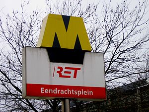
The Rotterdam Metro is a rapid transit system operated in Rotterdam, Netherlands and surrounding municipalities by RET. The first line, called Noord – Zuidlijn opened in 1968 and ran from Centraal Station to Zuidplein, crossing the river Nieuwe Maas in a tunnel. It was the first metro system to open in the Netherlands. At the time it was also one of the shortest metro lines in the world with a length of only 5.9 km (3.7 mi).

Rail transport in the Netherlands uses a dense railway network which connects nearly all major towns and cities. There are as many train stations as there are municipalities in the Netherlands. The network totals 3,223 route km (2,003 mi) on 6,830 kilometres (4,240 mi) of track; a line may run both ways, or two lines may run on major routes. Three-quarters of the lines have been electrified.

Beurs is a major subway interchange station in the center of Rotterdam. Underneath Churchill Square, the two lines through the city center intersect. Passengers for Rotterdam Central Station change here to line D or E if they started their journey on line A, B, or C.

Coolhaven is an underground subway station in the Dutch city of Rotterdam. It is served by Rotterdam Metro lines A, B, and C. The station, with one island platform, opened on 10 May 1982 as the western terminus of the East-West Line. Coolhaven was the terminus until 1986, when the line was extended to Marconiplein. The station is named for the adjacent Coolhaven harbour basin. It also has images of Rotterdam along its platforms.

Dijkzigt is an underground subway station in the city of Rotterdam, and is served by Rotterdam Metro lines A, B, and C. The station is located next to the Erasmus MC and the Erasmus University. Dijkzigt station was opened on 10 May 1982 as a station of the East-West Line. The station is located underneath the Rochussenstraat and there is interchange with buslines 44 and 46.

Rotterdam Centraal station is the main railway station of the city Rotterdam in South Holland, Netherlands. The station received an average of 112,000 passengers daily in 2019. The current station building, located at Station Square, was officially opened in March 2014.

Rotterdam Blaak is a railway and metro station in Rotterdam, Netherlands. Located in the centre of the city, not far from the cube houses and the Markthal, the station is served by trains operating on the Breda–Rotterdam railway between Rotterdam Centraal and Dordrecht.
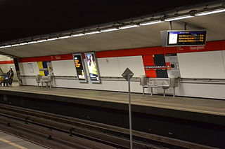
Oostplein is an underground station in the city of Rotterdam, located on the Rotterdam Metro lines A, B, and C. The station opened on 10 May 1982, the same date that the East-West Line, of which it is a part, was opened.

Schiedam Centrum is a railway station and metro station in Schiedam, just to the west of Rotterdam, Netherlands, on the railway line between The Hague and Rotterdam Centraal. Train services are operated by Nederlandse Spoorwegen, and metro, tram and bus services are operated by Rotterdamse Elektrische Tram.

Capelsebrug is a station on lines A, B, and C of the Rotterdam Metro. The station is situated in the eastern part of Rotterdam in the Netherlands, at the boundary with Capelle aan den IJssel municipality. At Capelsebrug station, lines A and B turn north towards Schenkel station, while line C continues east towards Slotlaan station..

Delfshaven is an underground subway station in the Dutch city of Rotterdam, served by lines A, B, and C of the Rotterdam Metro. The station is part of the two station long extension of the East-West Line, and it opened on 25 April 1986. This extension connected the line's former terminus Coolhaven with the new Marconiplein station.

Marconiplein is an underground subway station in the Dutch city of Rotterdam, and is part of Rotterdam Metro lines A, B, and C. The station is part of the two station long extension of the East-West Line and opened on 25 April 1986. This extension connected the new Marconiplein and Delfshaven stations with the line's former terminus Coolhaven.
The main public transport in the Netherlands for longer distances is by train. Long-distance buses are limited to a few missing railway connections. Regional and local public transport is by bus and in some cities by metro and tram. There are also ferries.

The Rotterdam tramway network is a key element of the overall public transport arrangements in Rotterdam, Netherlands.
The Noord-Brabantsch-Deutsche Spoorweg-Maatschappij (NBDS) was a railway company undertaking and providing rail transport between Boxtel and Wesel via Uden, Veghel, Gennep, Goch and Xanten. This railway was known in the Netherlands as "Duits lijntje ". On July 15, 1873, the section from Boxtel to Goch could be opened. On July 1, 1878, the second section of the line, the section from Goch to Wesel, could be opened. The total length of the line was 92.7 kilometers, of which 52.7 kilometers on Dutch territory. From Büderich, another 8.2 kilometers of the Köln-Mindener Eisenbahn was used, so was a part of the line from Venlo via Wesel to Haltern, Münster and Hamburg.