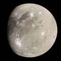
El (crater)

Last updated
El
Ganymede Khensu PIA01090.jpg
An image of El, partly visible in the upper right, along with another crater named Khensu to the west, taken by the Galileo space probe on November 26, 1997.
Feature typeMulti-ringed, pit crater
Coordinates 1°01′N151°22′W / 1.01°N 151.36°W / 1.01; -151.36 [1]
Diameter55 kilometres (34 mi)
Eponym El

El is a crater on Ganymede. It has a small "pit" in its center. Craters with such a "central pit" are common across Ganymede and are especially intriguing since they may reveal secrets about the structure of the satellite's shallow subsurface. [2]

Contents

Naming

El is the supreme deity and “father of all gods and goddesses” in many Middle Eastern mythologies, including Canaanite, Ugaritic, Hittite, and Hebrew traditions, among others. His name, “El,” is also the generic term for “god” or “deity” in many Semitic and Anatolian languages, though its pronunciation and rendering vary across cultures. [3] El assumed several different roles in mythology, ranging from a storm god to a sky god.

The International Astronomical Union (IAU) chose this name in line with the theme that craters on Ganymede be named after deities, figures and places from Ancient Middle Eastern mythology. The name was approved by the IAU in 1997. [4]

Location

El is located entirely within Uruk Sulcus. To its west is the dark-ray crater Khensu. To its north east is the dark region called Galileo Regio while to its southwest is another massive dark region called Marius Regio. [5]

El is located in the Uruk quadrangle on Ganymede (designated Jg8). [6]

References

  1. "El". Gazetteer of Planetary Nomenclature. USGS Astrogeology Research Program. (Center Latitude: 1.01°, Center Longitude: 151.36°; Planetographic, +West)
  2. "Khensu Crater on Ganymede". Archived from the original on 2011-05-20. Retrieved 2008-04-06.
  3. "El Semitic deity". Britannica. 2015. Retrieved 2025-12-12.
  4. "GANYMEDE – El". USGS. 2015. Retrieved 2025-12-14.
  5. "Controlled Color Photomosaic Map of Ganymede" (PDF). USGS. 2003. Retrieved 2025-12-14.
  6. Ganymede Map Images Archived 2007-11-19 at the Wayback Machine