Ricardo García Posada Airport, formerly El Salvador Bajo Airport, is an airport serving the copper mining community of El Salvador, in the Atacama Region of Chile.

San Tomé Airport or El Tigre Airport is an airport at the town of San Tomé, in the Venezuelan state of Anzoátegui. Also known as Don Edmundo Barrios Airport, it serves the cities of El Tigre and San José de Guanipa, located 9 kilometres (5.6 mi) southwest of San Tomé.

The Lempa River is a 422-kilometre (262 mi) long river in Central America.

El Salvador Airport is an airstrip in the pampa of the Beni Department in Bolivia. The nearest town is San Borja, 40 kilometres (25 mi) to the south.

Nueva Ocotepeque Airport is an airport serving the town of Nueva Ocotepeque in Ocotepeque Department, Honduras. Nueva Ocotepeque is in a north-south valley 5 kilometres (3.1 mi) north of the El Salvador border, and 13 kilometres (8.1 mi) east of the Guatemala border.

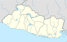
Barrillas Airport is an airport serving Puerto Barillas, a small-craft dockage on an arm of the Bahia de Jiquilisco, 10 kilometres (6.2 mi) southwest of Usulután in Usulután Department, El Salvador.
Ceiba Doblada Airport is an airstrip serving the village of Ceiba Doblada in Usulután Department, El Salvador. The unmarked grass runway is 8 kilometres (5.0 mi) east of the village.
Punta San Juan Airport is an airport serving the village of Corral De Mulas in Usulután Department, El Salvador. The unmarked grass runway is 7 kilometres (4.3 mi) east of the village on Punta San Juan, the western shore of the entrance to Bahia de Jiquilisco. Corral de Mulas is also served by Corral de Mulas Airport.
Casas Nuevas Airport is an airstrip serving the city of Jiquilisco in Usulután Department, El Salvador. The unmarked grass runway is 7 kilometres (4.3 mi) east of the city.
El Palmer Airport, also known as Santa Ana Airport was an airstrip serving a number of communities in west-central Santa Ana Department, 11 kilometres (6.8 mi) northwest of the city of Santa Ana, El Salvador. It is currently used as a dragstrip, called the Santa Ana Airport Pista Singuil car racing track.
El Papalon Airport is an airport serving the city of San Miguel in San Miguel Department, El Salvador. The runway is 5 kilometres (3.1 mi) southeast of the city, alongside the Pan American Highway.
Los Comandos Airport is an airstrip serving the town of San Francisco Gotera in Morazán Department, El Salvador.
Santa Rosa de Lima Airport is an airport serving the city of Santa Rosa de Lima in La Unión Department, El Salvador. The runway is 3 kilometres (1.9 mi) east of the city.
La Aramuaca Airport is an airport serving the city of San Miguel in San Miguel Department, El Salvador. The runway is 5 kilometres (3.1 mi) southeast of the city.
El Jocotillo Airport is an airport serving several small towns and villages in southern Sonsonate Department, El Salvador. The largest nearby city is the Pacific coastal port of Acajutla, at 10 kilometres (6.2 mi) west.
El Ronco Airport was an airport formerly serving the Holcim, Ltd. El Ronco cement plant 5 kilometres (3.1 mi) west of Metapán in Santa Ana Department, El Salvador.
La Cabaña Airport is an airstrip serving the town of La Cabaña in San Salvador Department, El Salvador.
La Carrera Airport is an airport serving the city of Jiquilisco in Usulután Department, El Salvador. The runway is 5 kilometres (3.1 mi) east of Jiquilisco.
Usulután Airport is an airstrip serving the city of Usulután in Usulután Department, El Salvador. It is 6 kilometres (3.7 mi) west of the city on highway CA2E. There is a hangar and fueling tank next to the north end of the runway.

San Marcos Airport is an airport serving the town of San Marcos, in the Sucre Department of Colombia. The runway is 4 kilometres (2.5 mi) northwest of the town.