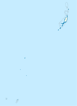
Koror is the state comprising the main commercial centre of the Republic of Palau. It consists of several islands, the most prominent being Koror Island. It is Palau’s most populous state.

Verona is a town in southwestern Oneida County, New York, United States. The population was 6,293 at the 2010 census. The town was named after Verona, Italy.

Iwami is a town located in Iwami District, Tottori Prefecture, Japan. As of 1 December 2022, the town had an estimated population of 10,998 in 4429 households and a population density of 90 persons per km². The total area of the town is 122.32 square kilometres (47.23 sq mi). Iwami lies entirely within the San'in Kaigan Geopark.

Ngarchelong is a state in Palau. Ngarchelong is at the northernmost tip of the island of Babeldaob. Only the state of Kayangel is farther north.

Ngaraard is the eighth state of the Republic of Palau, and was originally named Kerradel.

Port Shepstone is a large town situated on the mouth of the Mzimkhulu River, the largest river on the KwaZulu-Natal South Coast of South Africa. It is located halfway between Hibberdene and Margate and is positioned 120 km south of Durban. It is the administrative, educational and commercial centre for southern Natal.

Ngiwal is one of the sixteen states of Palau. It has a population of 282 and an area of 26 km2
Ngeremlengui is one of Palau's sixteen states. It has a population of 350, and is just west of the capital in Melekeok state.

Twin Waters is a coastal suburb of Maroochydore in the Sunshine Coast Region, Queensland, Australia. In the 2016 census, Twin Waters had a population of 2,687 people.
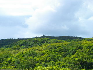
Ngebuked is a village on the west coast of Ngaraard State, Palau, where the Chief of Ngaraard, Maderangebuked is from. It has many stone pathways, ruins and graves scattered all over the surrounding hamlet. Its ruins consist of multi-leveled platforms where clans and families lived. At the center of the ancient site is the Bai ra Ngeruau, a large high platform where a bai, or men's meeting house, stood. The village even has a man-made channel from the sea for easy fishing and transportation access in ancient times.
Chol (Choll) is a village at the northern end of Ngaraard State in Palau. This village consists of a large, long, beach that runs along its entire east coast. The village has a series of ancient paths and platforms, similar to the rest of the villages in Ngaraard. There is also a large man-made channel that connects the village to the sea on the western coast. At the center of the village, along the compact road, there is a small marketplace with benches where one can purchase some village refreshments.
The village of Ulimang is where the Ngaraard State Office is located. Another state office branch is located in Meketii, Koror. Ngaraard Elementary school is located here. Ulimang's coast is an orange, sandy beach, and a small, high dock reaching out into the ocean. There is a large, red, public resting house near the dock. The villages of Ngesang in Elab are located north of this village. To the west is Ngebuked and to the south is Ngkeklau.
Ngkeklau is a populated area in the southern region of the state of Ngaraard in the Republic of Palau. The town has a small population, on the east coastal plains of Ngaraard. The town includes several ancient relics of stone, such as stone paths, platforms, and burial sites.
Ngesang is a small portion of the village of Elab is an area where most of Elab's inhabitants live. It is also the location of Ngaraard's Bethania High School for girls. Ngesang is located on the eastern shore of Ngaraard State. It has shady beaches canopied with large trees. On the northern end of Ngesang is the beginning of the ancient stone pathways that connects the east and the west coasts. Ngesang is also the location of the Catholic Church of Ngaraard.

Melekeok is a state of the Republic of Palau located on the central east coast of Babeldaob Island. The seat of government of the country, Ngerulmud, is located in the state. The state consists of long beaches, hills, steep ridges, rivers, and the largest and only natural freshwater lake in Palau and Micronesia, Lake Ngardok.

Russian River State Marine Recreational Management Area (SMRMA) and Russian River State Marine Conservation Area (SMCA) are two adjoining marine protected areas in the Russian River estuary area in Sonoma County, California, on the north-central coast of the state. The combined area of these marine protected areas is 1.21 square miles (3.1 km2), with 0.35 square miles (0.91 km2) in the SMRMA and 0.86 square miles (2.2 km2) in the SMCA.
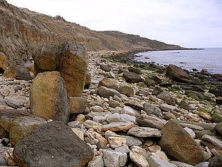
Broadrock is a cliff on the coast in Dorset, southern England. It faces out into Weymouth Bay between Bowleaze Cove and Redcliff Point. There are many landslips on the cliffs at this point.

El Castillo is a census-designated place located in Starr County, Texas. It is a new CDP formed from part of the old La Victoria CDP for the 2010 census with a population of 188.
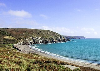
Kennack Sands is a beach and sand-dune system on the east coast of the Lizard Peninsula, Cornwall, England, UK.