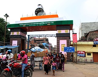
Datia, also known as Daityavakra is the district headquarter of the Datia District in north central Madhya Pradesh, a state of Central India. It is an ancient town, mentioned in the Mahabharata ruled by King Dantavakra. The city is 78 km from Gwalior, 325 km south of New Delhi and 344 km north of Bhopal. About 18 km from Datia is Sonagiri, a sacred Jain hill. Datia is also about 28 km from Jhansi and 52 km from Orchha. The nearest airport is at Gwalior. It was formerly the seat of the eponymous princely state in the British Raj. Datia is situated near Gwalior and on the border with Uttar Pradesh.

Osmanabad District, officially known as Dharashiv District, is an administrative district in the Marathwada region in the Indian state of Maharashtra. The district headquarter is located at Osmanabad. The District of Osmanabad derives its name from the last ruler of Hyderabad, the 7th Nizam, Mir Osman Ali Khan, of which the region was a part till 1947. This region was earlier part of The Hyderabad State until Independence.This primarily rural district occupies an area of 7,569 km2 (2,922 sq mi) of which 241.4 km2 (93.2 sq mi) is urban and has a population of 1,657,576 of which 16.96% were urban.

Kaimur district is one of the 38 districts of Bihar, India. The district headquarters are at Bhabua. Before 1991, it was part of Rohtas District. Till 1764 the region was a part of Ghazipur District and was a part of Kamsaar Raj and later it was a part of Chainpur Estate till 1837.

Maharajganj district is one of the 75 districts of Uttar Pradesh state in northern India, and the town of Maharajganj is the district headquarters. District is a part Gorakhpur division. It is located in Terai region of Himalayas, bordering Nepal in North. Gandak, Rapti, Rohin are some major river flowing through the district.

Vithura, also known as the Hill City Of Trivandrum, is located 36 km from Thiruvananthapuram capital of the Kerala state in India. Vithura is the culmination of the crossroads to many tourist, cultural, and religious centres. Surrounded by the Western Ghats (Sahyadris), Vithura is a tourist spot. The village has a good climate year-round. The Indian Institute of Science Education and Research, Thiruvananthapuram campus is situated here.

Khargone is a city and administrative headquarters of the Khargone district in the Indian state of Madhya Pradesh. The city is located on the bank of the Kunda river and is known for its cotton and chilly production. It is also known for Navgraha Mandir, a temple devoted to the nav grahas. Khargone topped the nation in municipality and received a national award for 'India's Fastest Moving City' under a population of two lakh. Khargone ranked 10th Cleanest city in India in Swachh Survekshan 2020 City ranked the 15th cleanest city in India in Swachh Survekshan 2018 and ranked 17th cleanest city in India in Swachh Survekshan 2017.

Kollur is a village in the southern state of Karnataka, India. It is located in the Byndoor taluk of Udupi district in Karnataka.

Vadakkekara is a census town, in Paravur Taluk, Ernakulam District, Kerala state in India. It is also a part of Vadakkekara Grama Panchayat. Paravur town is situated 5 km from this village. The main centre in this village is Moothakunnam. Vadakkekara is one of the early formed panchayat in the state. The cultural and historical place in Ernakulam Dristrict, combines the parts of the early Muzaris. Maliankara is famous for being the landing place of St. Thomas.
Mulakuzha or മുളക്കുഴ is a village in Alappuzha district in the state of Kerala, India. Mulakuzha is located in Chengannur tehsil, and residents are mostly artisans and farmers.
Pallippad is a village near Haripad in Alappuzha district in the Indian state of Kerala. The name Pallippad is believed to be derived from Buddhist terminology.The famous River Achankovil Aar passes by Pallippad before it reaches Veeyapuram. The village has abundant water resources, small lakes, and water paths that connect to Alappuzha.

Mynagappally is a village in Kollam district in the Indian state of Kerala.
Pattancherry is a village in the Palakkad district, state of Kerala, India. It forms a part of the Pattencherry gram panchayat.
Kavumbhagom, also spelled Kavumbhagam, is a ward and a census village in Thiruvalla municipality, in the Pathanamthitta district of Kerala, India. The village has a population of 6644 as of 2011. Kavumbhagom is an important junction serving as a major road route connecting Changanasserry, Thiruvalla, Chathenkary, and Mavelikkara. The Thiruvalla Sree Vallabha temple, after which the town of Thiruvalla has been named, is located in Kavumbhagom.
Andoorkonam is an area in Trivandrum city in the Indian state of Kerala.

Chundale is a village in Wayanad district in the state of Kerala, India. Chundale is located near Kalpetta, the district headquarters of Wayanad.
Ugar Budruk is a village in the southern state of Karnataka, India. It is located in the Athni taluk of Belgaum district in Karnataka. It is around 38 km from the city of Sangli, Maharashtra. Ugar comes under the Kagwad constituency.
Towdur is a village in the southern state of Karnataka, India. It can also be spelt as Thoudur, Tavadur or Thouduru. It is located in the Harapanahalli taluk of Bellary district in Karnataka. It is a Grama Panchayat, consisting of 11 villages. The village has mostly farmers, a few middle-class families, and very few rich people. The village consists of 7 main historical temples. Udisalambika Devi Temple and Veeranjaneya temples are the famous among them. Basavanna Temple is like an assembly for the villagers. Villagers assemble here for Important discussions in the name of Panchayat meet. Thoudur owns 1 Government Higher Primary School and Government High school named Ayyanahalli Matada Kadamma Veerayya High School land donated by AM Ajjaiah & Kotraiah brothers on remembrance of his Parents.
Gudgeri is a village in the Kundgol taluk of Dharwad district in the Indian state of Karnataka. It is located in the Kundgol taluk of Dharwad district in Karnataka.
Babalad or Muttyna Babalad is a village in the southern state of Karnataka, India. It is located in Bijapur taluk of Bijapur district, Karnataka. It is nearly 25 km from the district headquarters, Bijapur. It's one of several small villages near Bijapur.
Yaragalla is a village in the southern state of Karnataka, India.


