This article is about the region. For the county, see Elbe-Elster.
Region around the tripoint of the German states of Brandenburg, Saxony-Anhalt and Saxonyy
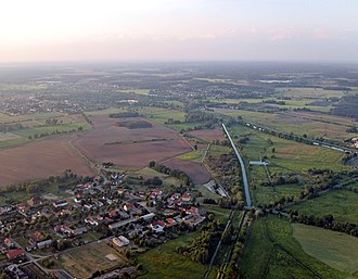
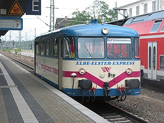
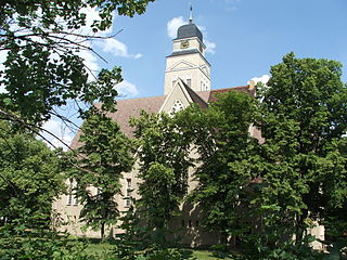
Elbe-Elster valley with the confluence of the Little Röder and the Black Elster, and the villages of Zobersdorf and Bad LiebenwerdaHerzberg; town hall and St. Mary's ChurchThe Elbe-Elster Express
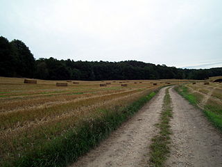
Elbe-Elster Land (German: Elbe-Elster-Land), also called the Elbe-Elster region (Elbe-Elster-Gebiet) is a region around the tripoint of the German states of Brandenburg, Saxony-Anhalt and Saxony. It is part of the North German Plain and is named after the two major rivers that have their confluence here: the Elbe and the Black Elster.
In older sources the northwestern parts of the present-day Elbe-Elster Land were called Mezumroka or "land between the rivers". It was part of the Gau Nizizi and almost unpopulated.
Today the territory of the county of Elbe-Elster which was created in 1993 is marketed and advertised for tourist purposes as the holiday region of Elbe-Elster-Land, but it also includes the western parts of Lower Lusatia around Finsterwalde and the Schraden region.
Literature
Oskar Brachwitz (1926), Geschichtliche Bilder vom Südfläming und aus der Elbe-Elster-Gegend (in German)
Autorenkollektiv des MUG Brandenburg e. V. (1996), Heimatbuch Landkreis Elbe-Elster (in German), Herzberg{{citation}}: CS1 maint: location missing publisher (link)
Denkmale in Brandenburg, Landkreis Elbe-Elster (in German), vol.7
Renate Völker, Anja Schmidke (1995), Entdeckungen im Landkreis Elbe-Elster (in German), Delitzsch: Druck- und Verlagshaus Delitzsch, 950458996
Manfred Woitzik (2000), Kulturamt des Landkreises Elbe-Elster (ed.), "Wer zuerst kommt – mahlt zuerst" eine Kulturgeschichte der Mühlen im Landkreis Elbe-Elster (in German), Herzberg, 967763517{{citation}}: CS1 maint: location missing publisher (link)
Andreas Pöschl (Hrsg.): Kohle, Wind und Wasser. Ein energiehistorischer Streifzug durch das Elbe-Elsterland. Hrsg. v. Kulturamt des Landkreises Elbe-Elster. Herzberg/Elster 2001, ISBN3-00-008956-X.
Kulturamt des Landkreises Elbe-Elster, ed. (2005), Orgellandschaft Elbe-Elster (in German), Herzberg/Elster{{citation}}: CS1 maint: location missing publisher (link)
Sven Gückel (2005), Im Elbe-Elster Land – In Elbe-Elster Country (in German), Cottbus: KDI Euroverlag, ISBN3-938634-09-X (deutsch/englisch)
Baudenkmale des Landkreises Elbe-Elster. (= Blattsammlung denkmalgeschützter Bauten des Landkreises Elbe-Elster)
Matthias Donath (2007), Schlösser zwischen Elbe und Elster (in German), Meißen, 1024219674{{citation}}: CS1 maint: location missing publisher (link)
Juliane Stückrad (2011), Ich schimpfe nicht, ich sage nur die Wahrheit. – Eine Ethnographie des Unmuts am Beispiel der Bewohner des Elbe-Elster-Kreises (Brandenburg) (in German), Ludwig, ISBN978-3-86935-046-2
1 2 Karl Friedrich von Klöden: Diplomatische Geschichte des Markgrafen Waldemar von Brandenburg vom Jahre 1295 bis 1323. Teil II. M. Simion, Berlin 1844, S. 109. (Volltext, p. 109, at Google Books)
↑ Ralf Uschner (2012), Arbeitsgemeinschaft für Heimatkunde e. V. Bad Liebenwerda (ed.), "Auf Spuren- und Identitätssuche – 700 Jahre Land zwischen Elbe und Elster (1312–2012)", Heimatkalender für den Altkreis Bad Liebenwerda, das Mückenberger Ländchen, Ortrand am Schraden und Uebigau-Falkenberg (in German), Bad Liebenwerda, pp.4–12
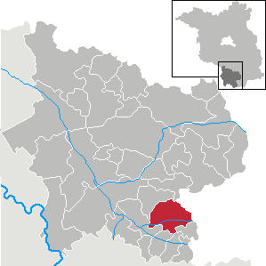
Elbe-Elster is a Kreis (district) in the southern part of Brandenburg, Germany. Neighboring districts are Teltow-Fläming, Dahme-Spreewald, Oberspreewald-Lausitz, Meißen, Nordsachsen and Wittenberg. The district has a partnership with the Märkischer Kreis.
Herzberg (Elster) (German pronunciation:[ˈhɛʁt͡sˌbɛʁk] ) is a town in the Elbe-Elster district of the German federal state of Brandenburg.
Finsterwalde is a town in the Elbe-Elster district, in Lower Lusatia, Brandenburg, Germany.
Bad Liebenwerda is a spa town in the Elbe-Elster district, in southwestern Brandenburg, Germany. It is situated on the river Schwarze Elster, 57 km northwest of Dresden, and 28 km east of Torgau.
Falkenberg is a town in the Elbe-Elster district, in southwestern Brandenburg, Germany. It is situated near the river Schwarze Elster, 16 km east of Torgau, and 13 km northwest of Bad Liebenwerda.
Schlieben is a town in the Elbe-Elster district, in southwestern Brandenburg, Germany. It is situated 22 kilometres (14 mi) north of Bad Liebenwerda. Schlieben was the site of a concentration camp during the Holocaust.
Sonnewalde is a town in the Elbe-Elster district, in Lower Lusatia, Brandenburg, Germany. It is situated 8 km northwest of Finsterwalde.
Uebigau-Wahrenbrück is a town in the Elbe-Elster district, in southwestern Brandenburg, Germany. It is situated on the river Schwarze Elster, 11 km northwest of Bad Liebenwerda, and 21 km east of Torgau.
Plessa is a municipality in the Elbe-Elster district, in Brandenburg, Germany.
Schraden is a municipality in the Elbe-Elster district, in Brandenburg, Germany.
The Kutschenberg is the highest hill in Brandenburg, Germany. It is part of the low hill range of the Kmehlener Berge and rises near Großkmehlen in the county of Oberspreewald-Lausitz. It is 201 m above sea level (NHN) and located only a few metres from the state border with Saxony.
Bertzit Tower is an investment ruin in the north of Kahla, which belongs to Plessa in the southern part of Brandenburg, itself part of the Elbe-Elster region.
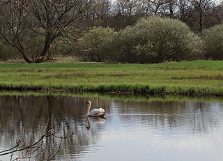
The Alte Röder Nature Reserve lies on the left bank of the Black Elster river between the village of Prieschka in the municipality of Bad Liebenwerda and the village of Würdenhain which belongs to Röderland. It is located within the Lower Lusatian Heath Nature Park, which covers an area of 484 km². The lowland valley of the Röder stream has been protected since 1981 and contains one of the most settled colonies of the Elbe Beaver, a species of beaver threatened by extinction. One of its main conservation aims is the preservation and development of this area as a habitat for the Elbe Beaver and other endangered species.
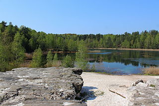
Grube Gotthold is a former brown coal and gravel pit in the South Brandenburg county of Elbe-Elster.
The Elsterwerda–Grödel raft canal, established in the 18th century, serves as a waterway connecting the Pulsnitz River in Elsterwerda with the Elbe River near Grödel in Germany.
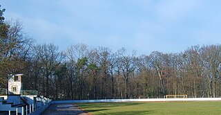
The Holzhof is a traditional sports facility in the small Brandenburg town of Elsterwerda in the Elbe-Elster district. This facility is located on the town's outskirts, toward the direction of Großenhain.
The remains of Saathain Castle and its former manor are situated on the left bank of the Black Elster River in Saathain, which is a district within the southern Brandenburg municipality of Röderland. Following a devastating fire in April 1945, the historic structure was reduced to its foundation walls. These remnants now support a terrace that was once a café. The park that once surrounded the castle has been transformed into a beautiful rose garden, making it a favored destination for excursions.
Prieschka is a district of the spa town of Bad Liebenwerda in Elbe-Elster in southern Brandenburg.
This page is based on this Wikipedia article Text is available under the CC BY-SA 4.0 license; additional terms may apply. Images, videos and audio are available under their respective licenses.