Lochau

Last updated

Lochau
Lochau01.jpg
Wappen at lochau.png
Coat of arms
Lochau im Bezirk B.png
Location in the district
Austria adm location map.svg
Red pog.svg
Lochau
Location within Austria
Coordinates: 47°31′00″N09°45′00″E / 47.51667°N 9.75000°E / 47.51667; 9.75000 Coordinates: 47°31′00″N09°45′00″E / 47.51667°N 9.75000°E / 47.51667; 9.75000
Country Austria
State Vorarlberg
District Bregenz
Government
   Mayor Michael Simma
Area
[1]
  City10.27 km2 (3.97 sq mi)
Elevation
416 m (1,365 ft)
Population
 (2018-01-01) [2]
  City5,747
  Density560/km2 (1,400/sq mi)
   Urban
200,000
Time zone UTC+1 (CET)
  Summer (DST) UTC+2 (CEST)
Postal code
6911
Area code 05574
Vehicle registration B
Website www.lochau.at

Lochau is a municipality in the westernmost Austrian state of Vorarlberg. It is located on Lake Constance, in the Bregenz district, near the border to Germany.

Contents

About 50.3% of the municipality's area is forest. The Pfänder, the landmark mountain of the neighboring municipality of Bregenz, also lies within Lochau's boundaries. In the west, the Leiblach river forms the border to the German county (Landkreis) of Lindau.

History

The Habsburgs ruled over their Vorarlberg lands alternately from Tyrol and Further Austria. From 1805 to 1814 Lochau belonged to Bavaria, then reverted to Austria. In 1861 it became part of the Austrian Federal State of Vorarlberg. During World War II, a subcamp of Dachau concentration camp was located there. [3] Between 1945 and 1955 the municipality was part of the French occupation zone in Austria.

Population

Historical population
YearPop.±%
1869972    
1880925−4.8%
18901,259+36.1%
19001,362+8.2%
19101,526+12.0%
19231,455−4.7%
19341,727+18.7%
19391,717−0.6%
19513,030+76.5%
19613,745+23.6%
19714,638+23.8%
19815,239+13.0%
19915,472+4.4%
20015,242−4.2%
20115,434+3.7%

Related Research Articles

Bregenz Place in Vorarlberg, Austria

Bregenz (German pronunciation: [ˈbʁeːgɛnt͡s], is the capital of Vorarlberg, the westernmost state of Austria. The city lies on the east and southeast shores of Lake Constance, the third-largest freshwater lake in Central Europe, between Switzerland in the west and Germany in the northwest.

Dornbirn Place in Vorarlberg, Austria

Dornbirn[ˈdɔʁnbɪʁn] is a city in the westernmost Austrian state of Vorarlberg. It is the administrative centre for the district of Dornbirn, which also includes the town of Hohenems, and the market town Lustenau.

Reuthe Place in Vorarlberg, Austria

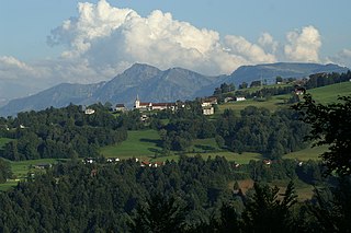
Reuthe is a municipality of the Bregenzerwald,in the westernmost Austrian state of Vorarlberg. It is located in the district of Bregenz. Its main industry is tourism.

Hard, Austria Place in Vorarlberg, Austria

Hard is a town in the west of the westernmost Austrian state of Vorarlberg, directly on the southern shores of Lake Constance. Hard's attractions include the Strandbad and the Grünerdamm. Hard is also known for its skatepark.

Au, Vorarlberg Place in Vorarlberg, Austria

Au is a town in the Bregenz Forest in the westernmost Austrian state of Vorarlberg.

Mellau Place in Vorarlberg, Austria

Mellau is a town in the Bregenz Forest in the westernmost Austrian state of Vorarlberg, part of the district of Bregenz.
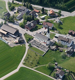
Alberschwende Place in Vorarlberg, Austria

Alberschwende is a municipality in the district of Bregenz in the Austrian state of Vorarlberg.

Damüls Place in Vorarlberg, Austria

Damüls is a village community and popular tourist resort in the district of Bregenz in the westernmost Austrian state of Vorarlberg. Damüls also holds the European record as the village with the highest annual snowfall – the average is 9.30 meters per year. In 2006, Damüls was awarded the honorary title "the snowiest village in the world".

Bildstein Place in Vorarlberg, Austria

Bildstein is a municipality in the district of Bregenz in the Austrian state of Vorarlberg.

Andelsbuch Place in Vorarlberg, Austria

Andelsbuch is a municipality in the district of Bregenz in the Austrian state of Vorarlberg.

Doren Place in Vorarlberg, Austria

Doren is a municipality in the district of Bregenz in the western Austrian state of Vorarlberg.

Hittisau Place in Vorarlberg, Austria

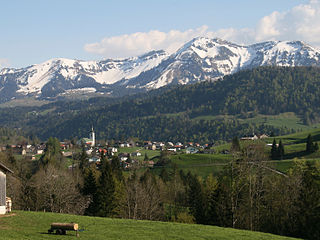
Hittisau is a municipality in the district of Bregenz in the Austrian state of Vorarlberg. Hittisau has a surface area of 46.65 km². It lies in the Bregenzerwald in the west of the country.

Höchst, Austria Place in Vorarlberg, Austria

Höchst is a municipality in the district of Bregenz in the Austrian state of Vorarlberg.

Hörbranz Place in Vorarlberg, Austria

Hörbranz is a municipality in the district of Bregenz in the Austrian state of Vorarlberg.

Langen bei Bregenz Place in Vorarlberg, Austria

Langen bei Bregenz is a municipality in the district of Bregenz in the Austrian state of Vorarlberg.

Langenegg Place in Vorarlberg, Austria

Langenegg is a municipality with approx. 1,200 inhabitants in the westernmost Austrian state, Vorarlberg.

Lingenau Place in Vorarlberg, Austria

Lingenau is a municipality in the district of Bregenz, in the westernmost Austrian state of Vorarlberg.

Mittelberg Place in Vorarlberg, Austria

Mittelberg is a municipality in the district of Bregenz in the Austrian state of Vorarlberg.

Schröcken Place in Vorarlberg, Austria

Schröcken is a municipality in the district of Bregenz, in the westernmost Austrian state of Vorarlberg.

Sibratsgfäll Place in Vorarlberg, Austria

Sibratsgfäll is a municipality in the district of Bregenz in the Austrian state of Vorarlberg.

References

  1. "Dauersiedlungsraum der Gemeinden Politischen Bezirke und Bundesländer - Gebietsstand 1.1.2018". Statistics Austria. Retrieved 10 March 2019.
  2. "Einwohnerzahl 1.1.2018 nach Gemeinden mit Status, Gebietsstand 1.1.2018". Statistics Austria. Retrieved 9 March 2019.
  3. "Archived copy". Archived from the original on 2009-02-09. Retrieved 2008-11-01.CS1 maint: archived copy as title (link)