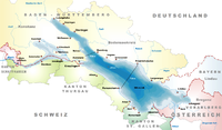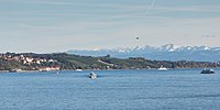
Lake Constance refers to three bodies of water on the Rhine at the northern foot of the Alps: Upper Lake Constance (Obersee), Lower Lake Constance (Untersee), and a connecting stretch of the Rhine, called the Seerhein. These waterbodies lie within the Lake Constance Basin in the Alpine Foreland through which the Rhine flows. The nearby Mindelsee is not considered part of Lake Constance. The lake is situated where Germany, Switzerland, and Austria meet. Its shorelines lie in the German states of Baden-Württemberg and Bavaria; the Swiss cantons of St. Gallen, Thurgau, and Schaffhausen; and the Austrian state of Vorarlberg. The actual locations of the country borders within the lake are disputed.

Fairbanks Township is a civil township of Delta County in the U.S. state of Michigan. As of the 2020 census, the township population was 297, up from 281 at the 2010 census.
Bodenseekreis is a Landkreis (district) in the south-east of Baden-Württemberg, Germany. Neighboring districts are Konstanz, Sigmaringen and Ravensburg, and in Bavaria, Lindau district. To the south, on the opposite shores of Lake Constance, lies Switzerland.
Konstanz is a Landkreis (district) in the south of Baden-Württemberg on the German-Swiss border, situated along the shores of Lake Constance. Neighboring districts are Schwarzwald-Baar, Tuttlingen, Sigmaringen and Bodenseekreis. To the south it borders the Swiss cantons of Zurich, Thurgau and Schaffhausen. The municipality of Büsingen am Hochrhein is an exclave of Germany surrounded by Swiss territory.
Lindau is a Landkreis (district) in Swabia, Bavaria, Germany; its capital is the city of Lindau. It is bounded by the district of Oberallgäu, Austria, Lake Constance and the state of Baden-Württemberg.

Unteruhldingen is a small village, part of the town of Uhldingen-Mühlhofen, on the northwestern shore of Lake Constance, Germany. It is home to the Pfahlbauten, an open-air museum displaying reconstructions of Neolithic and Bronze Age pile dwellings. The buildings are idealized reconstructions from between the 1922 and 1941, which were designed based on archeological digs of the Wasserburg Buchau at Federsee. After 1945 the museum was led by the controversial but knowledgeable archeologist Hans Reinerth, one of the leading Nazi archaeologists of Amt Rosenberg. This museum has been expanded since to incorporate modern research.

Petershausen Abbey was a Benedictine imperial abbey at Petershausen, now a district of Konstanz in Baden-Württemberg, Germany.
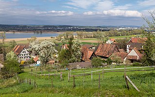
Triboltingen is a small village in the canton of Thurgau in Switzerland, situated on the south shore of the Untersee part of Lake Constance. Since 1975, it is politically part of Ermatingen.
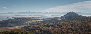
Hegau either refers to a region of the Duchy of Swabia or to only that part of said region which is presently located in the country of Germany. It is known for its extinct, partly eroded volcanoes, most of which are crowned with ruins of medieval fortresses.

Bodanrück is the 112 km2 (43 sq mi) wide peninsula that divides Lake Constance into Überlinger See and Gnadensee, which is part of Untersee. At its southern end, it reaches the Seerhein, which links Obersee with Untersee.
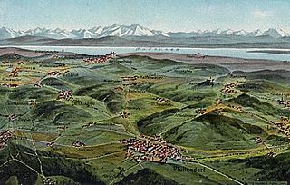
Linzgau is a historic region in Southern Germany, in the state of Baden-Württemberg. It is located north of Lake Constance and south of the Danube valley.
Lozna is a village in the municipality of Trstenik, Serbia. According to the 2002 census, the village has a population of 380 people.

The Obersee, also known as Upper Lake Constance, is the much larger of the two parts of Lake Constance, the other part being the Untersee. The two parts are separated by the Bodanrück peninsula. The narrow, northwestern branch of Obersee is also called Überlinger See.

Lake Überlingen is the northwestern "finger" of the Obersee, the lower part of Lake Constance. The boundary of lake is defined as the ferry link from Meersburg to Constance. It extends north to Bodman-Ludwigshafen.

The Alter Rhein is the old river bed of the Alpine Rhine in St. Gallen and Vorarlberg in the Alpine Rhine Valley, which was cut off when the Rhine was straightened during the 20th century. These cut-off arms have become valuable recreational areas and a nature reserve.
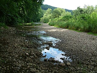
The Danube Sinkhole is an incipient underground stream capture in the Upper Danube Nature Park. Between Immendingen and Möhringen and also near Fridingen (Tuttlingen), the water of the Danube sinks into the riverbed in various places. The main sinkhole is next to a field named Brühl between Immendingen and Möhringen.

The border between the modern states of Germany and Switzerland extends to 362 kilometres (225 mi), mostly following Lake Constance and the High Rhine, with territories to the north mostly belonging to Germany and territories to the south mainly to Switzerland. Exceptions are the Swiss canton of Schaffhausen, the Rafzerfeld and hamlet of Nohl of the canton of Zürich, Bettingen and Riehen municipalities and part of the city of Basel in the canton of Basel-City and the old town of the German city of Konstanz, which is located south of the Seerhein. The canton of Schaffhausen is located almost entirely on the northern side of the High Rhine, with the exception of the southern part of the municipality of Stein am Rhein. The German municipality of Büsingen am Hochrhein is an enclave surrounded by Swiss territory.

The border between the modern states of Austria and Germany has a length of 815.9 km (507.0 mi), or 815.0 km (506.4 mi) respectively. It is the longest international border of Austria and the second longest border of Germany with another country.
The Jura was a wooden, flush deck, paddle steamer, originally built for service on Lake Neuchâtel, but which was sold after seven years to work on Lake Constance, and sank in 1864 after a collision with the Stadt Zürich.

The Vogelinsel is an island in Lake Constance with an area of around 600 square metres. It lies around 230 metres northwest of the mouth of the Leiblach opposite the Gemarkung of Reutin of the town of Lindau. On the island is the red mole beacon at the harbour entrance of the marina in Lindau-Zech. The island has been designated as a bird reserve.


