Bregenz District

Last updated
Bregenz District
Bezirk Bregenz
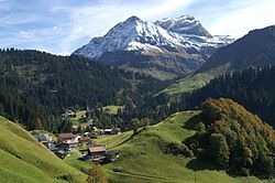
Schrocken1.JPG
View of Schröcken
Bregenz District
Country Austria
State Vorarlberg
Number of municipalities40
Area
  Total863.37 km2 (333.35 sq mi)
Population
 (2012 [1] )
  Total130,425
  Density150/km2 (390/sq mi)
Time zone UTC+01:00 (CET)
  Summer (DST) UTC+02:00 (CEST)

The Bezirk Bregenz is an administrative district ( Bezirk ) in Vorarlberg, Austria. It comprises the Bregenz Forest region, the Leiblach valley, and the Austrian part of Lake Constance.

Contents

The area of the district is 863.37 km², its population is 130,425 (2012), and the population density is 151 people per km². The administrative centre of the district is Bregenz.

Historical population
YearPop.±%
1869 41,186    
1880 41,628+1.1%
1890 44,864+7.8%
1900 49,479+10.3%
1910 53,785+8.7%
1923 51,644−4.0%
1934 56,304+9.0%
1939 56,407+0.2%
1951 70,056+24.2%
1961 78,958+12.7%
1971 95,235+20.6%
1981 105,345+10.6%
1991 115,500+9.6%
2001 121,123+4.9%
Source: Statistik Austria

Administrative divisions

The district is divided into 40 municipalities, one of them is a town, and six are market towns.

Towns

  1. Bregenz (28,012)

Market towns

  1. Bezau (1,976)
  2. Egg (3,452)
  3. Hard (12,696)
  4. Hörbranz (6,357)
  5. Lauterach (9,612)
  6. Wolfurt (8,173)

Municipalities

  1. Alberschwende (3,139)
  2. Andelsbuch (2,356)
  3. Au (1,684)
  4. Bildstein (714)
  5. Bizau (1,015)
  6. Buch (556)
  7. Damüls (324)
  8. Doren (1,024)
  9. Eichenberg (379)
  10. Fußach (3,726)
  11. Gaißau (1,700)
  12. Hittisau (1,852)
  13. Höchst (7,764)
  14. Hohenweiler (1,261)
  15. Kennelbach (1,860)
  16. Krumbach (2,252)
  17. Langen (1,300)
  18. Langenegg (1,066)
  19. Lingenau (1,341)
  20. Lochau (5,490)
  21. Mellau (1,311)
  22. Mittelberg (5,013)
  23. Möggers (517)
  24. Reuthe (611)
  25. Riefensberg (1,024)
  26. Schnepfau (472)
  27. Schoppernau (934)
  28. Schröcken (228)
  29. Schwarzach (3,746)
  30. Schwarzenberg (1,822)
  31. Sibratsgfäll (395)
  32. Sulzberg (1,760)
  33. Warth (1,521)

(population numbers 2012)

Notes and references

  1. "vorarlberg.at Landesstatistik Bevölkerung". Land Vorarlberg. Retrieved 2008-08-04.

Coordinates: 47°24′N10°00′E / 47.4°N 10°E / 47.4; 10

Related Research Articles

<span class="mw-page-title-main">Vorarlberg</span> State of Austria

Vorarlberg is the westernmost state of Austria. It has the second-smallest geographical area after Vienna and, although it also has the second-smallest population, it is the state with the second-highest population density. It borders three countries: Germany, Switzerland, and Liechtenstein. The only Austrian state that shares a border with Vorarlberg is Tyrol, to the east.

<span class="mw-page-title-main">Dornbirn</span> Place in Vorarlberg, Austria

Dornbirn is a city in the westernmost Austrian state of Vorarlberg. It is the administrative centre for the district of Dornbirn, which also includes the town of Hohenems, and the market town Lustenau.

<span class="mw-page-title-main">Au, Vorarlberg</span> Place in Vorarlberg, Austria

Au is a town in the Bregenz Forest in Vorarlberg (Austria).

The Bezirk Kitzbühel is an administrative district (Bezirk) in Tyrol, Austria. It borders Bavaria (Germany) in the north, the Kufstein and Schwaz districts in the west, and the Pinzgau region (Salzburg) in the east and south.

The Bezirk Kufstein is an administrative district (bezirk) in Tyrol, Austria. It borders Bavaria (Germany) in the north, the Kitzbühel district in the southeast, and the Schwaz district in the southwest.

The Bezirk Landeck is an administrative district (Bezirk) in Tyrol, Austria. It borders the district Reutte in the north, the district Imst in the east, South Tyrol (Italy) and Graubünden (Switzerland) in the south, and the district Bludenz (Vorarlberg) in the west.

The Bezirk Reutte is an administrative district in Tyrol, Austria. It borders Bavaria (Germany) in the north, the districts Imst and Landeck in the south, and Bregenz and Bludenz in the west. The district is also referred to as Außerfern.

The Bezirk Imst is an administrative district (Bezirk) in Tyrol, Austria. It borders the district Reutte in the north, as well as sharing a small border with Bavaria (Germany). It borders the district Innsbruck-Land in the east, South Tyrol (Italy) in the south, and the district Landeck in the west.

The Bezirk Feldkirch is an administrative district (Bezirk) in Vorarlberg, Austria.

<span class="mw-page-title-main">Bludenz District</span> District in Vorarlberg, Austria

The Bezirk Bludenz is an administrative district (Bezirk) in Vorarlberg, Austria.

The Bezirk Dornbirn is an administrative district (Bezirk) in Vorarlberg, Austria. A rather young district, it was separated from the Feldkirch district in 1969.

<span class="mw-page-title-main">Hallein District</span> District in Salzburg, Austria

The Bezirk Hallein is an administrative district (Bezirk) in the federal state of Salzburg, Austria, and congruent with the Tennengau region.

<span class="mw-page-title-main">St. Johann im Pongau District</span> District in Salzburg, Austria

The Bezirk Sankt Johann im Pongau is an administrative district (Bezirk) in the federal state of Salzburg, Austria, and congruent with the Pongau region.

<span class="mw-page-title-main">Zell am See District</span> District in Salzburg, Austria

The Bezirk Zell am See is an administrative district (Bezirk) in the federal state of Salzburg, Austria, and congruent with the Pinzgau region.

Bezirk Tamsweg is an administrative district (Bezirk) in the federal state of Salzburg, Austria. It is congruent with the Lungau region. The administrative centre of the district is Tamsweg.

<span class="mw-page-title-main">Salzburg-Umgebung District</span> District in Salzburg, Austria

The Bezirk Salzburg-Umgebung is an administrative district (Bezirk) in the federal state of Salzburg, Austria, and congruent with the Flachgau region, except for the Statutarstadt of Salzburg, which forms a district of its own.

The Bezirk Eisenstadt-Umgebung is an administrative district (Bezirk) in the federal state of Burgenland, Austria.

The Bezirk Güssing is an administrative district (Bezirk) in the federal state of Burgenland, Austria, bordering on Vas Megye (County) Hungary, of which it had been a part prior to 1921.

Bezirk Spittal an der Drau is an administrative district (Bezirk) in the state of Carinthia, Austria.

<span class="mw-page-title-main">NUTS statistical regions of Austria</span>

The Nomenclature of Territorial Units for Statistics (NUTS) is a geocode standard for referencing the subdivisions of Austria for statistical purposes. The standard is developed and regulated by the European Union. The NUTS standard is instrumental in delivering the European Union's Structural Funds. The NUTS code for Austria is AT and a hierarchy of three levels is established by Eurostat. Below these is a further levels of geographic organisation - the local administrative unit (LAU). In Austria, the LAU 2 is municipalities.