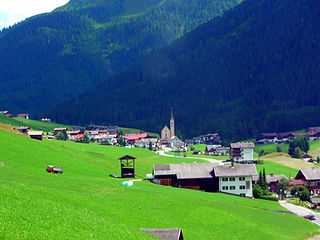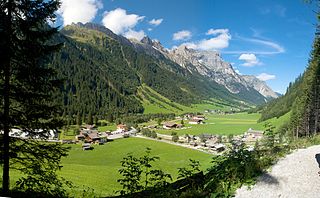
Reuthe is a municipality of the Bregenzerwald,in the westernmost Austrian state of Vorarlberg. It is located in the district of Bregenz. Its main industry is tourism.

Hard is a town in the west of the westernmost Austrian state of Vorarlberg, directly on the southern shores of Lake Constance. Hard's attractions include the Strandbad and the Grünerdamm. Hard is also known for its skatepark.

Mellau is a town in the Bregenz Forest in the westernmost Austrian state of Vorarlberg, part of the district of Bregenz.

Bezau is a town in the Bregenz Forest region, in the western Austrian state of Vorarlberg. It is part of the district of Bregenz. Bezau is a popular tourist destination around the year, due to its vicinity to ski resorts and hiking trails. Its picturesque church was built in 1906 and has as its patron saint St. Jodok. Another attraction is the museum of local history (Heimatmuseum), which is housed in a traditional Bregenz Forest wooden home.

Bizau is a town in the Bregenz Forest in the Austrian state of Vorarlberg, part of the district Bregenz. The municipality has around 1080 inhabitants.

Egg is a market town in the Bregenz Forest, in the western Austrian state of Vorarlberg, part of the district of Bregenz. It is the has the highest population of any community in the Bregenzerwald.

Krumbach is a village in the westernmost Austrian state of Vorarlberg, in the Bregenz district. The municipality has about 1,000 inhabitants.

Arriach is a municipality in the district of Villach-Land in the Austrian state of Carinthia.

Hohenthurn is a municipality in the district of Villach-Land in the Austrian state of Carinthia.

Bad Sankt Leonhard im Lavanttal is a spa town in the district of Wolfsberg in the Austrian state of Carinthia.

Kartitsch is a municipality in the district of Lienz in the Austrian stateof Tyrol.

Terfens is a municipality in the Schwaz district with 2116 inhabitants in the Austrian state of Tyrol. It is located about 20 km northeast of Innsbruck in the Lower Inn Valley.

Gschnitz is a municipality with 415 inhabitants in the south of North Tyrol.

Obernberg am Brenner is a municipality in the southern district of Innsbruck-Land in the Austrian state of Tirol.

Doren is a municipality in the district of Bregenz in the western Austrian state of Vorarlberg.

Langenegg is a municipality with approx. 1,200 inhabitants in the westernmost Austrian state, Vorarlberg.

Lingenau is a municipality in the district of Bregenz, in the westernmost Austrian state of Vorarlberg.

Riefensberg is a municipality in the district of Bregenz in the westernmost Austrian state of Vorarlberg. The community of Riefensberg covers an area of 14.85 square kilometers. Riefensberg is located within the Nagelfluhkette Nature Park.

Sibratsgfäll is a municipality in the district of Bregenz in the Austrian state of Vorarlberg.

Raaba-Grambach is a market town in the district Graz-Umgebung in Styria, Austria since 2015. It was created as part of the Steiermärkische Gemeindestrukturreform of Styria at the end of 2014, dissolving the towns Raaba and Grambach. One complaint from both communities against merging was raised at the Constitutional Court but ended unsuccessfully.


