
Hohenems is a town in the Austrian state of Vorarlberg in the Dornbirn district. It lies in the middle of the Austrian part of the Rhine valley. With a population of 15,200, it is the fifth largest municipality in Vorarlberg. Hohenems' attractions include a Renaissance palace dating back to the 16th century, a Jewish history museum, and the old town center.

Reuthe is a municipality of the Bregenzerwald, in the westernmost Austrian state of Vorarlberg. It is located in the district of Bregenz. Its main industry is tourism.
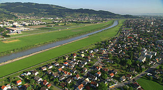
Lustenau is a town in the westernmost Austrian state of Vorarlberg in the district of Dornbirn. It lies on the river Rhine, which forms the border with Switzerland. Lustenau is Vorarlberg's fourth largest town.

Hard is a town in the west of the westernmost Austrian state of Vorarlberg, directly on the southern shores of Lake Constance. Hard's attractions include the Strandbad and the Grünerdamm. Hard is also known for its skatepark.

Lochau is a municipality in the westernmost Austrian state of Vorarlberg. It is located on Lake Constance, in the Bregenz district, near the border to Germany.

Rankweil is a town in the westernmost Austrian state of Vorarlberg, in the district Feldkirch. It is the second largest town in the district Feldkirch and the eighth largest town in Vorarlberg.

Au is a town in the Bregenz Forest in Vorarlberg (Austria).

Schwaz is a city in the Austrian state of Tyrol. It is the administrative center of the Schwaz district. Schwaz is located in the lower Inn valley.

Feldkirch is a medieval town in the western Austrian state of Vorarlberg, bordering on Switzerland and Liechtenstein. It is the administrative centre of the Feldkirch district. After Dornbirn, it is the second most populous town in Vorarlberg. The westernmost point in Austria lies in Feldkirch on the river Rhine, at the tripoint between Austria, Switzerland, and Liechtenstein.
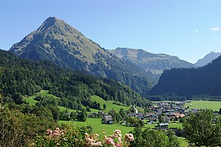
Schoppernau is a town in the Bregenzerwald Region of the Austrian state of Vorarlberg. Schoppernau has an area of 47.64 km2.

Potzneusiedl is the smallest village in the district of Neusiedl am See in Burgenland in Austria.
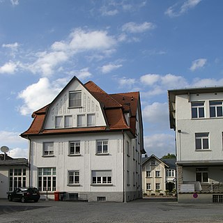
Altach is a municipality in the district of Feldkirch, in the westernmost Austrian state of Vorarlberg.
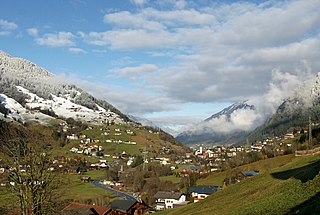
Gemeinde Gaschurn-Partenen is a municipality in the district of Bludenz in the westernmost Austrian state of Vorarlberg. The two largest villages are Gaschurn Dorf and Partenen.

Langenegg is a municipality with approx. 1,200 inhabitants in the westernmost Austrian state, Vorarlberg.

Lingenau is a municipality in the district of Bregenz, in the westernmost Austrian state of Vorarlberg.

Mittelberg is a municipality in the district of Bregenz in the Kleinwalsertal,in the Austrian state of Vorarlberg. It is accessible by road only from Germany.

Riefensberg is a municipality in the district of Bregenz in the westernmost Austrian state of Vorarlberg. The community of Riefensberg covers an area of 14.85 square kilometers. Riefensberg is located within the Nagelfluhkette Nature Park.

Schröcken is a municipality in the district of Bregenz, in the westernmost Austrian state of Vorarlberg.

Sibratsgfäll is a municipality in the district of Bregenz in the Austrian state of Vorarlberg.
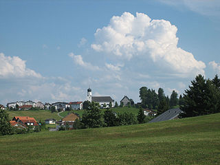
Sulzberg is a municipality in the district of Bregenz, in the westernmost Austrian state of Vorarlberg.


