Lingenau

Last updated
Lingenau
Lingenau Hof Ortspanorama.jpg
AUT Lingenau COA.svg
Lingenau im Bezirk B.png
Location in the district
Austria adm location map.svg
Red pog.svg
Lingenau
Location within Austria
Coordinates: 47°27′00″N09°55′12″E / 47.45000°N 9.92000°E / 47.45000; 9.92000 Coordinates: 47°27′00″N09°55′12″E / 47.45000°N 9.92000°E / 47.45000; 9.92000
Country Austria
State Vorarlberg
District Bregenz
Government
   Mayor Annette Sohler (ÖVP)
Area
[1]
  Total6.89 km2 (2.66 sq mi)
Elevation
685 m (2,247 ft)
Population
 (2018-01-01) [2]
  Total1,466
  Density210/km2 (550/sq mi)
Time zone UTC+1 (CET)
  Summer (DST) UTC+2 (CEST)
Postal code
6951
Area code 05513
Vehicle registration B
Website www.lingenau.at

Lingenau is a municipality in the district of Bregenz, in the westernmost Austrian state of Vorarlberg.

Contents

Geography

Lingenau is located southeast of Lake Constance, at an altitude of 685m. 30.8% of the area is wooded. There are no other cadastral communities in Lingenau. It is a member of the German-Austrian joint project Naturpark Nagelfluhkette.

The town of Lingenau borders on four other Vorarlberg communities: Langenegg, Hittisau, Egg and Alberschwende.

History

"Lindigenowe" was first mentioned in documents in 1227. It is the oldest settlement of the Vorderwald (also known as Vorderer Bregenzerwald) and belonged to the monastery estate of Mehrerau for a long period of time.

The Habsburgs ruled parts of Vorarlberg alternately from Tyrol and Vorderösterreich (Freiburg im Breisgau). From 1805 to 1814, Lingenau belonged to Bavaria, then reverted to Austria. Since the formation of the Austrian state of Vorarlberg in 1861, Lingenau has belonged to Vorarlberg.

For centuries, up to the beginning of World War II, inhabitants benefitted from Bad Hohl, which is located at a ferruginous spring called Maxriese.

From 1945 to 1955, Lingenau was part of the French occupation zone in Austria.

Culture

The parish church Hl. Johannes der Täufer ("St. John the Baptist") was built in the 19th century.

The Baroque Hl. Anna Chapel was built in 1722 and is made of tufa.

The tufa nature trail (Quelltuff-Naturlehrpfad) is located to a creek that has created over 40 vertical meters of massive Quelltuff (tufa).

The wooden Gschwendtobel bridge between Lingenau and Egg, over the river Subersach, was constructed in 1834 by Alois Negrelli, one of the main architects of the Suez Canal. Given its age, the bridge is considered to be a masterpiece of engineering and carpentry.

The suspension bridge between Lingenau and Egg (over the river Subersach), a steel wire footbridge, was constructed in 1901. The bridge has a length of 57 meters and is only suitable for walkers.

The Bregenzerwälder Käsekeller opened in Lingenau in 2002. More than 32,000 cheese wheels are stored for aging in this cheese cellar. It was an initiative of the Käsestraße Bregenzerwald, to preserve small-scale agriculture and the diversity of local products in the Bregenz Forest, and to support Vorarlberg's cheese culture. With more than 6.5 million euros, the cheese cellar was the largest investment ever made in the Vorarlberg dairy industry.

Lingenau is part of the Bregenzerwald Umgang (literally "Bregenzerwald Walking Tour"). This walking tour offers insights into the architecture and community planning of 12 traditional villages in the Bregenzerwald. While walking over various landscapes, visiting public buildings, homes and everyday objects, walkers gain a comprehensive overview of typical Bregenzerwald architectural styles as they developed throughout the ages.

Panoramic view of Lingenau's city center Lingenau Hof Ortspanorama.jpg
Panoramic view of Lingenau's city center

Population

Historical population
YearPop.±%
18691,022    
1880912−10.8%
1890932+2.2%
1900953+2.3%
19101,068+12.1%
19231,923+80.1%
1934954−50.4%
1939912−4.4%
19511,007+10.4%
19611,081+7.3%
19711,171+8.3%
19811,240+5.9%
19911,327+7.0%
20011,328+0.1%
20111,337+0.7%

Related Research Articles

<span class="mw-page-title-main">Vorarlberg</span> State of Austria

Vorarlberg is the westernmost state of Austria. It has the second-smallest geographical area after Vienna and, although it also has the second-smallest population, it is the state with the second-highest population density. It borders three countries: Germany, Switzerland, and Liechtenstein. The only Austrian state that shares a border with Vorarlberg is Tyrol, to the east.

<span class="mw-page-title-main">Bregenz Forest</span>

The Bregenzerwald is one of the main regions in the state of Vorarlberg (Austria). It overlaps, but is not coterminous with, the Bregenz Forest Mountains, which belong to a range of the Northern Limestone Alps, specifically the northern flysch zone. It is the drainage basin of the Bregenzer Ach river.

<span class="mw-page-title-main">Reuthe</span> Place in Vorarlberg, Austria

Reuthe is a municipality of the Bregenzerwald, in the westernmost Austrian state of Vorarlberg. It is located in the district of Bregenz. Its main industry is tourism.

<span class="mw-page-title-main">Au, Vorarlberg</span> Place in Vorarlberg, Austria

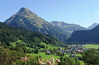
Au is a town in the Bregenz Forest in Vorarlberg (Austria).

<span class="mw-page-title-main">Mellau</span> Place in Vorarlberg, Austria

Mellau is a town in the Bregenz Forest in the westernmost Austrian state of Vorarlberg, part of the district of Bregenz.

<span class="mw-page-title-main">Bezau</span> Place in Vorarlberg, Austria

Bezau is a town in the Bregenz Forest region, in the western Austrian state of Vorarlberg. It is part of the district of Bregenz. Bezau is a popular tourist destination around the year, due to its vicinity to ski resorts and hiking trails. Its picturesque church was built in 1906 and has as its patron saint St. Jodok. Another attraction is the museum of local history (Heimatmuseum), which is housed in a traditional Bregenz Forest wooden home.

<span class="mw-page-title-main">Bizau</span> Place in Vorarlberg, Austria

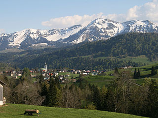
Bizau is a town in the Bregenz Forest in the Austrian state of Vorarlberg, part of the district Bregenz. The municipality has around 1080 inhabitants.

<span class="mw-page-title-main">Egg, Austria</span> Place in Vorarlberg, Austria

Egg is a market town in the Bregenz Forest, in the western Austrian state of Vorarlberg, part of the district of Bregenz. It is the has the highest population of any community in the Bregenzerwald.

<span class="mw-page-title-main">Schwarzenberg, Austria</span> Place in Vorarlberg, Austria

Schwarzenberg is a municipality in the Bregenz Forest in the western Austrian state of Vorarlberg, part of the district of Bregenz. Schwarzenberg has an area of 25.76 km². It lies south of Lake Constance. The village center is heritage-protected for its traditional rustic wooden houses.

<span class="mw-page-title-main">Krumbach, Vorarlberg</span> Place in Vorarlberg, Austria

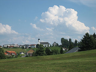
Krumbach is a village in the westernmost Austrian state of Vorarlberg, in the Bregenz district. The municipality has about 1,000 inhabitants.

<span class="mw-page-title-main">Schoppernau</span> Place in Vorarlberg, Austria

Schoppernau is a town in the Bregenzerwald Region of the Austrian state of Vorarlberg. Schoppernau has an area of 47.64 km2.

<span class="mw-page-title-main">Damüls</span> Place in Vorarlberg, Austria

Damüls is a village community and popular tourist resort in the district of Bregenz in the westernmost Austrian state of Vorarlberg.

<span class="mw-page-title-main">Andelsbuch</span> Place in Vorarlberg, Austria

Andelsbuch is a municipality in the district of Bregenz in the Austrian state of Vorarlberg.

<span class="mw-page-title-main">Doren</span> Place in Vorarlberg, Austria

Doren is a municipality in the district of Bregenz in the western Austrian state of Vorarlberg.

<span class="mw-page-title-main">Hittisau</span> Place in Vorarlberg, Austria

Hittisau is a municipality in the district of Bregenz in the Austrian state of Vorarlberg. Hittisau has a surface area of 46.65 km². It lies in the Bregenzerwald in the west of the country.

<span class="mw-page-title-main">Kennelbach</span> Place in Vorarlberg, Austria

Kennelbach is a community in the district of Bregenz in the westernmost Austrian state of Vorarlberg.

<span class="mw-page-title-main">Langenegg</span> Place in Vorarlberg, Austria

Langenegg is a municipality with approx. 1,200 inhabitants in the westernmost Austrian state, Vorarlberg.

<span class="mw-page-title-main">Sibratsgfäll</span> Place in Vorarlberg, Austria

Sibratsgfäll is a municipality in the district of Bregenz in the Austrian state of Vorarlberg.

<span class="mw-page-title-main">Sulzberg, Austria</span> Place in Vorarlberg, Austria

Sulzberg is a municipality in the district of Bregenz, in the westernmost Austrian state of Vorarlberg.

<span class="mw-page-title-main">KäseStrasse Bregenzerwald</span>

The KäseStrasse Bregenzerwald is a non-profit organisation and route which links cheese-producing businesses of the Bregenz Forest in Vorarlberg (Austria).

References

  1. "Dauersiedlungsraum der Gemeinden Politischen Bezirke und Bundesländer - Gebietsstand 1.1.2018". Statistics Austria. Retrieved 10 March 2019.
  2. "Einwohnerzahl 1.1.2018 nach Gemeinden mit Status, Gebietsstand 1.1.2018". Statistics Austria. Retrieved 9 March 2019.