Bludenz District

Last updated
Bludenz District
Bezirk Bludenz
Lech am Arlberg 2006.jpg
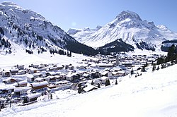
Omeshorn rising above Lech am Arlberg
Bludenz District
Country Austria
State Vorarlberg
Number of municipalities29
Area
  Total1,287.63 km2 (497.16 sq mi)
Population
 (2012)
  Total61,407
  Density48/km2 (120/sq mi)
Time zone UTC+01:00 (CET)
  Summer (DST) UTC+02:00 (CEST)
Website bludenz.at

The Bezirk Bludenz is an administrative district ( Bezirk ) in Vorarlberg, Austria.

Contents

Area of the district is 1,287.63 km², population is 61,407 (January 1, 2012), and population density 48 persons per km². Administrative center of the district is Bludenz.

Historical population
YearPop.±%
1869 21,436    
1880 22,448+4.7%
1890 23,290+3.8%
1900 24,307+4.4%
1910 25,461+4.7%
1923 26,346+3.5%
1934 30,621+16.2%
1939 31,672+3.4%
1951 38,360+21.1%
1961 43,000+12.1%
1971 49,539+15.2%
1981 53,104+7.2%
1991 56,944+7.2%
2001 60,471+6.2%
Source: Statistik Austria

Administrative divisions

The district is divided into 29 municipalities, one of them is a town, and two of them are market towns.

Towns

  1. Bludenz (13,801)

Market towns

  1. Nenzing (5,976)
  2. Schruns (3,683)

Municipalities

  1. Bartholomäberg (2,281)
  2. Blons (324)
  3. Bludesch (2,220)
  4. Brand (666)
  5. Bürs (3,113)
  6. Bürserberg (528)
  7. Dalaas (1,512)
  8. Fontanella (433)
  9. Gaschurn (1,515)
  10. Innerbraz (933)
  11. Klösterle (690)
  12. Lech am Arlberg (1,636)
  13. Lorüns (281)
  14. Ludesch (3,375)
  15. Nüziders (4,880)
  16. Raggal (822)
  17. Sankt Anton im Montafon (751)
  18. Sankt Gallenkirch (2,190)
  19. Sankt Gerold (361)
  20. Silbertal (860)
  21. Sonntag (679)
  22. Stallehr (288)
  23. Thüringen (2,158)
  24. Thüringerberg (683)
  25. Tschagguns (2,169)
  26. Vandans (2,599)

(population numbers January 1, 2012)

Coordinates: 47°06′N9°54′E / 47.1°N 9.9°E / 47.1; 9.9

Related Research Articles

The Bezirk Kitzbühel is an administrative district (Bezirk) in Tyrol, Austria. It borders Bavaria (Germany) in the north, the Kufstein and Schwaz districts in the west, and the Pinzgau region (Salzburg) in the east and south.

The Bezirk Kufstein is an administrative district (bezirk) in Tyrol, Austria. It borders Bavaria (Germany) in the north, the Kitzbühel district in the southeast, and the Schwaz district in the southwest.

The Bezirk Schwaz is an administrative district (Bezirk) in Tyrol, Austria. It borders Bavaria (Germany) in the north, the districts of Kufstein, Kitzbühel and Pinzgau (Salzburg) in the east, South Tyrol (Italy) in the south, and the Innsbruck-Land district in the west.

The Bezirk Landeck is an administrative district (Bezirk) in Tyrol, Austria. It borders the district Reutte in the north, the district Imst in the east, South Tyrol (Italy) and Graubünden (Switzerland) in the south, and the district Bludenz (Vorarlberg) in the west.

The Bezirk Reutte is an administrative district in Tyrol, Austria. It borders Bavaria (Germany) in the north, the districts Imst and Landeck in the south, and Bregenz and Bludenz in the west. The district is also referred to as Außerfern.

The Bezirk Imst is an administrative district (Bezirk) in Tyrol, Austria. It borders the district Reutte in the north, as well as sharing a small border with Bavaria (Germany). It borders the district Innsbruck-Land in the east, South Tyrol (Italy) in the south, and the district Landeck in the west.

<span class="mw-page-title-main">Innsbruck-Land District</span> District in Tyrol, Austria

The Bezirk Innsbruck-Land is an administrative district (Bezirk) in Tyrol, Austria. It encloses the Statutarstadt Innsbruck, and borders Bavaria (Germany) in the north, the district Schwaz in the east, South Tyrol in Italy to the south, and the district of Imst in the west.

The Bezirk Feldkirch is an administrative district (Bezirk) in Vorarlberg, Austria.

The Bezirk Dornbirn is an administrative district (Bezirk) in Vorarlberg, Austria. A rather young district, it was separated from the Feldkirch district in 1969.

<span class="mw-page-title-main">Bregenz District</span> District in Vorarlberg, Austria

The Bezirk Bregenz is an administrative district (Bezirk) in Vorarlberg, Austria. It comprises the Bregenz Forest region, the Leiblach valley, and the Austrian part of Lake Constance.

<span class="mw-page-title-main">Hallein District</span> District in Salzburg, Austria

The Bezirk Hallein is an administrative district (Bezirk) in the federal state of Salzburg, Austria, and congruent with the Tennengau region.

<span class="mw-page-title-main">St. Johann im Pongau District</span> District in Salzburg, Austria

The Bezirk Sankt Johann im Pongau is an administrative district (Bezirk) in the federal state of Salzburg, Austria, and congruent with the Pongau region.

<span class="mw-page-title-main">Zell am See District</span> District in Salzburg, Austria

The Bezirk Zell am See is an administrative district (Bezirk) in the federal state of Salzburg, Austria, and congruent with the Pinzgau region.

Bezirk Tamsweg is an administrative district (Bezirk) in the federal state of Salzburg, Austria. It is congruent with the Lungau region. The administrative centre of the district is Tamsweg.

<span class="mw-page-title-main">Salzburg-Umgebung District</span> District in Salzburg, Austria

The Bezirk Salzburg-Umgebung is an administrative district (Bezirk) in the federal state of Salzburg, Austria, and congruent with the Flachgau region, except for the Statutarstadt of Salzburg, which forms a district of its own.

Bezirk Neusiedl am See is a district of the state of Burgenland in Austria.

The Bezirk Eisenstadt-Umgebung is an administrative district (Bezirk) in the federal state of Burgenland, Austria.

The Bezirk Güssing is an administrative district (Bezirk) in the federal state of Burgenland, Austria, bordering on Vas Megye (County) Hungary, of which it had been a part prior to 1921.

Bezirk Perg is a district of the state of Upper Austria in Austria.

<span class="mw-page-title-main">NUTS statistical regions of Austria</span>

The Nomenclature of Territorial Units for Statistics (NUTS) is a geocode standard for referencing the subdivisions of Austria for statistical purposes. The standard is developed and regulated by the European Union. The NUTS standard is instrumental in delivering the European Union's Structural Funds. The NUTS code for Austria is AT and a hierarchy of three levels is established by Eurostat. Below these is a further levels of geographic organisation - the local administrative unit (LAU). In Austria, the LAU 2 is municipalities.