
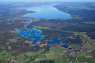
Lake Constance refers to three bodies of water on the Rhine at the northern foot of the Alps: Upper Lake Constance (Obersee), Lower Lake Constance (Untersee), and a connecting stretch of the Rhine, called the Lake Rhine (Seerhein). These waterbodies lie within the Lake Constance Basin in the Alpine Foreland through which the Rhine flows.

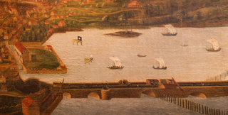
Lindau is a major town and island on the eastern side of Lake Constance in Bavaria, Germany. It is the capital of the county (Landkreis) of Lindau, Bavaria and is near the borders of the Austrian state of Vorarlberg, and the Swiss cantons of St. Gallen and Thurgau. The coat of arms of Lindau town is a linden tree, referring to the supposed origin of the town's name. The historic town of Lindau is located on the 0.68-square-kilometre (0.26 sq mi) island of the same name, which is connected with the mainland by a road bridge and a railway causeway leading to Lindau station.
Lindau is a Landkreis (district) in Swabia, Bavaria, Germany; its capital is the city of Lindau. It is bounded by the district of Oberallgäu, Austria, Lake Constance and the state of Baden-Württemberg.

Lake Starnberg, or Starnberger See ) — called Lake Würm or Würmsee until 1962 — is Germany's second-largest body of fresh water, having great depth, and fifth-largest lake by area. It and its surroundings lie in three different Bavarian districts, or Landkreise. The lake is property of the state and accordingly managed by the Bavarian Administration of State-Owned Palaces, Gardens and Lakes.

Wasserburg am Bodensee is one of the three Bavarian municipalities on the shores of Lake Constance. It is a well known resort, sought out for the supposedly healthy nature of its atmosphere.
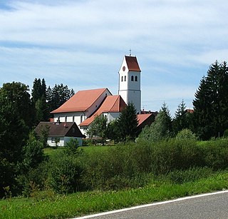
Hergatz is a municipality in the district of Lindau in Bavaria in Germany. The contemporary town was formed from the former municipalities of Wohmbrechts and Maria-Thann in the course of the municipal reform at the end of the 1970s.

Bad Grönenbach is a market town in the district of Unterallgäu in Bavaria, Germany. It belongs to the region of Upper Swabia and the headquarters of the Gemeindeverband of the same name.
Osterseen is a group of lakes in Bavaria, Germany, about 50 km south-south-west of Munich. At an elevation of 588 m, its surface area is 223.55 ha.

The Bavarian Border Police is a police division within the Bavarian State Police. It is the third arm of the police force alongside the state police and the riot police (Bereitschaftspolizei) It existed from 1946 to 1998 and was responsible for the federal borders in Bavaria. It was re-established as an independent arm in 2018, having no responsibility for border control.

Nikolassee is a locality (Ortsteil) of Berlin in the borough (Bezirk) of Steglitz-Zehlendorf, named after the small Nikolassee lake. Located in the affluent Southwest of the city, the area comprises parts of the Schlachtensee neighbourhood and the eastern shore of the Großer Wannsee lake with the large Strandbad Wannsee lido, as well as the islets of Schwanenwerder and Lindwerder.
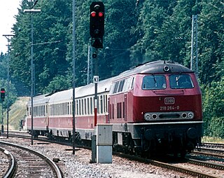
The Buchloe–Lindau railway is a double-track, largely non-electrified main line in the German state of Bavaria. It runs through the Allgäu from Buchloe to Lindau in Lake Constance via Kaufbeuren and Kempten. Together with the connecting Munich–Buchloe railway it is known in German as the Bayerische Allgäubahn.

Werd Island is the main island of the small island group Werd Islands in the westernmost part of the Lower Lake of Lake Constance just before the High Rhine leaves the part of the lake known as Rheinsee. It is located on Swiss territory between Stein am Rhein and Eschenz.
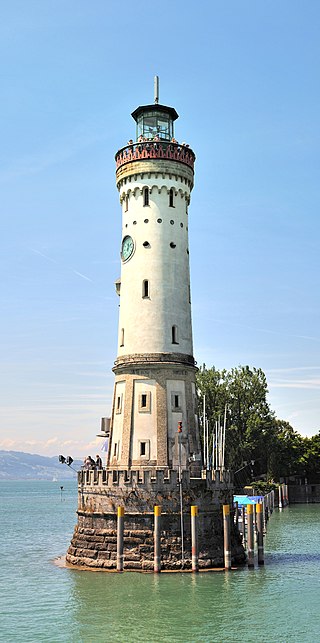
The Lindau Lighthouse is a lighthouse in Lindau, on Lake Constance. It is the southernmost lighthouse in Germany, and the only lighthouse in Bavaria. It is 33 metres (108 ft) tall and has a circumference of 24 metres (79 ft) at its base. Notably, it has a clock in its facade.

The Dominican Island or Constance Island is an island in Lake Constance immediately east of the city of Constance. With an area of 1.8 hectares, it is one of the smaller islands in the lake. The island is separated from the city center by a six-metre-wide (20 ft) channel, and connected to it by a bridge. The island is dominated by the Steigenberger hotel, which is housed in the former Dominican convent.

Lindau-Insel station is the largest station in the city of Lindau (Bodensee) and was its most important station until passenger service resumed at Lindau-Reutin station on December 13, 2020. In the urban area there is also Lindau-Aeschach station and Lindau-Reutin freight yard. Formerly there were also Lindau-Siebertsdorf, Lindau Langenweg, Lindau Strandbad, Schoenau, Oberreitnau and Rehlings.
The Jura was a wooden, flush deck, paddle steamer, originally built for service on Lake Neuchâtel, but which was sold after seven years to work on Lake Constance, and sank in 1864 after a collision with the Stadt Zürich.
The Galgeninsel is a peninsula on the shore of Lake Constance near Lindau in the Bay of Reutin in Germany.

On the island of Lindau in the eastern Lake Constance is the Altstadt of the Bavarian county town of Lindau, which occupies the eastern part of the island. The island of Lindau, which forms 2% of the area and 12% of the population of the entire town, is one of the town's ten administrative districts. The district is just called Insel ("Island").

Hoy is an uninhabited island in Lake Constance in Germany. It lies 400 metres east of the island of Lindau in the Bay of Reutin and 100 metres south of the lakeshore near the mouth of the Oberreitnauer Ach. With an area of 53 square metres it is the smallest island in Lake Constance.
The Friedrichshafen–Lindau railway is a single-track main-line railway in Southern Germany, that has been electrified since December 2021. It connects the rail junction of Friedrichshafen Stadt in Baden-Württemberg with Lindau in Bavaria, where it meets the Buchloe–Lindau railway at a junction in the district of Aeschach. The 22.575 kilometre-long line runs consistently on the north shore of Lake Constance (Bodensee), with the western part lying in Bodenseekreis and the eastern part in the district of Lindau. The line is part of the route known as the Bodenseegürtelbahn, connecting Radolfzell and Lindau-Insel.


.JPG)
.JPG)
.JPG)
.JPG)