List of islands in Lake Constance

Last updated

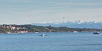
Lake Constance, in Europe, has about a dozen islands, including some former islands that are now attached to the mainland.

IslandArea (m²)PopulationMunicipalityCountryCoordinates
1 Galgeninsel peninsula since 19th century- Lindau (Reutin district)Germany

47°33′00″N09°42′14″E / 47.55000°N 9.70389°E / 47.55000; 9.70389 (Galgeninsel)

2 Hoy 53- Lindau (Reutin district)Germany

47°32′57.35″N09°41′48″E / 47.5492639°N 9.69667°E / 47.5492639; 9.69667 (Hoy)

3 Lindau 680,0003,000 Lindau (Island district)Germany

47°32′47″N09°41′00″E / 47.54639°N 9.68333°E / 47.54639; 9.68333 (Lindau)

4Wasserburg peninsula since 172027 Wasserburg (Island district)Germany

47°34′02″N09°37′46″E / 47.56722°N 9.62944°E / 47.56722; 9.62944 (Wasserburg)

5 Mainau 447,584185 Konstanz (Litzelstetten district)Germany

47°42′18″N09°11′46″E / 47.70500°N 9.19611°E / 47.70500; 9.19611 (Mainau)

6 Dominicans Island 18,31821 Konstanz (Altstadt district)Germany

47°39′51″N09°10′42″E / 47.66417°N 9.17833°E / 47.66417; 9.17833 (Dominikanerinsel)

7Mittlerer Langbohl31,254- Konstanz (Industriegebiet district)Germany

47°40′18″N09°07′32″E / 47.67167°N 9.12556°E / 47.67167; 9.12556 (Mittlerer Langbohl)

8 Triboldingerbohl 135,570- Konstanz (Industriegebiet district)Germany

47°40′20″N09°07′22″E / 47.67222°N 9.12278°E / 47.67222; 9.12278 (Triboldingerbohl)

9 Reichenau 4,300,0003,200 Reichenau (Niederzell|Mittelzell|Oberzell)Germany 47°41′40″N09°03′48″E / 47.69444°N 9.06333°E / 47.69444; 9.06333 (Reichenau)
10 Liebesinsel 300- Radolfzell (Mettnau district)Germany

47°43′18″N09°00′19″E / 47.72167°N 9.00528°E / 47.72167; 9.00528 (Liebesinsel)

11 Werd 15,8549 Eschenz (Untereschenz district)Switzerland

47°39′19″N08°52′00″E / 47.65528°N 8.86667°E / 47.65528; 8.86667 (Werd)

12 Mittleres Werdli 4,000- Stein am Rhein Switzerland

47°39′24″N08°51′57″E / 47.65667°N 8.86583°E / 47.65667; 8.86583 (Mittleres Werdli)

13 Unteres Werdli 6,000- Stein am Rhein Switzerland

47°39′25″N08°51′50″E / 47.65694°N 8.86389°E / 47.65694; 8.86389 (Unteres Werdli)

 Lake Constance Islands5,637,0796,4006 municipalities  

Related Research Articles

Cayman Islands British Overseas Territory in the Caribbean

The Cayman Islands is a self-governing British Overseas Territory, the largest by population, in the western Caribbean Sea. The 264-square-kilometre (102-square-mile) territory comprises the three islands of Grand Cayman, Cayman Brac and Little Cayman, which are located to the south of Cuba and northeast of Honduras, between Jamaica and Mexico's Yucatán Peninsula. The capital city is George Town on Grand Cayman, which is the most populous of the three islands.

Canary Islands Spanish archipelago and region in the Atlantic Ocean

The Canary Islands, also known informally as the Canaries, are a Spanish region and archipelago in the Atlantic Ocean, in Macaronesia. At their closest point to the African mainland, they are 100 kilometres west of Morocco. They are the southernmost of the autonomous communities of Spain. The archipelago is economically and politically European and is part of the European Union.

Guernsey Island in the English Channel off the coast of Normandy

Guernsey is an island in the English Channel off the coast of Normandy that is part of the Bailiwick of Guernsey, a British Crown Dependency.

Maldives Country in South Asia

Maldives, officially the Republic of Maldives, is an archipelagic country in the Indian subcontinent of Asia, situated in the Indian Ocean. It lies southwest of Sri Lanka and India, about 750 kilometres from the Asian continent's mainland. The chain of 26 atolls stretches from Ihavandhippolhu Atoll in the north to Addu Atoll in the south. Comprising a territory spanning roughly 90,000 square kilometres (35,000 sq mi) including the sea, land area of all the islands comprises 298 square kilometres (115 sq mi), Maldives is one of the world's most geographically dispersed sovereign states and the smallest Asian country as well as one of the smallest Muslim-majority countries by land area and, with around 557,751 inhabitants, the 2nd least populous country in Asia. Malé is the capital and the most populated city, traditionally called the "King's Island" where the ancient royal dynasties ruled for its central location.

Mauritius Island nation in the Indian Ocean

Mauritius, officially the Republic of Mauritius, is an island nation in the Indian Ocean about 2,000 kilometres (1,200 mi) off the southeast coast of the African continent, east of Madagascar. It includes the main island, as well as Rodrigues, Agaléga and St. Brandon. The islands of Mauritius and Rodrigues, along with nearby Réunion, are part of the Mascarene Islands. The capital and largest city, Port Louis, is located in Mauritius, where most of the population is concentrated. The country spans 2,040 square kilometres (790 sq mi) and has an exclusive economic zone covering 2.3 million square kilometres.

Nauru Country in Oceania

Nauru, officially the Republic of Nauru and formerly known as Pleasant Island, is an island country and microstate in Oceania, in the Central Pacific. Its nearest neighbour is Banaba Island in Kiribati, 300 km (190 mi) to the east. It further lies northwest of Tuvalu, 1,300 km (810 mi) northeast of Solomon Islands, east-northeast of Papua New Guinea, southeast of the Federated States of Micronesia and south of the Marshall Islands. With only a 21 km2 (8.1 sq mi) area, Nauru is the third-smallest country in the world behind Vatican City and Monaco, making it the smallest republic as well as the smallest island nation. Its population of about 10,000 is the world's second-smallest, after Vatican City.

Oceania Geopolitical region in the Pacific Ocean

Oceania is a geographic region that includes Australasia, Melanesia, Micronesia and Polynesia. Spanning the Eastern and Western Hemispheres, Oceania has a land area of 8,525,989 square kilometres (3,291,903 sq mi) and a population of over 41 million. When compared with the continents, the region of Oceania is the smallest in land area and the second smallest in population after Antarctica.

Pacific Ocean Ocean between Asia, Australia and the Americas

The Pacific Ocean is the largest and deepest of Earth's five oceanic divisions. It extends from the Arctic Ocean in the north to the Southern Ocean in the south and is bounded by the continents of Asia and Australia in the west and the Americas in the east.

Pitcairn Islands British overseas territory in the South Pacific

The Pitcairn Islands, officially the Pitcairn, Henderson, Ducie and Oeno Islands, is a group of four volcanic islands in the southern Pacific Ocean that form the sole British Overseas Territory in the Pacific Ocean. The four islands—Pitcairn, Henderson, Ducie, and Oeno—are scattered across several hundred miles of ocean and have a combined land area of about 18 square miles (47 km2). Henderson Island accounts for 86% of the land area, but only Pitcairn Island is inhabited. The islands nearest to the Pitcairn Islands are Mangareva to the west and Easter Island to the east.

Rhode Island U.S. state

Rhode Island, officially the State of Rhode Island, is a state in the New England region of the Northeastern United States. It is the smallest U.S. state by area and the seventh-least populous, with slightly fewer than 1.1 million residents as of 2020, but it is the second-most densely populated after New Jersey. It takes its name from the eponymous island, though most of its land area is on the mainland. Rhode Island borders Connecticut to the west, Massachusetts to the north and east, and the Atlantic Ocean to the south via Rhode Island Sound and Block Island Sound; it also shares a small maritime border with New York. Providence is its capital and most populous city.

Seychelles Country in the Indian Ocean

Seychelles, officially the Republic of Seychelles, is an archipelagic island country consisting of 115 islands in the Indian Ocean at the eastern edge of the Somali Sea. Its capital and largest city, Victoria, is 1,500 kilometres east of mainland Africa. Nearby island countries and territories include the Comoros, Madagascar, Mauritius, and the French overseas regions of Mayotte and Réunion to the south; and Maldives and the Chagos Archipelago to the east. It is the least populous sovereign African country, with an estimated 2020 population of 98,462.

South Georgia and the South Sandwich Islands British Overseas Territory in the South Atlantic

South Georgia and the South Sandwich Islands (SGSSI) is a British Overseas Territory in the southern Atlantic Ocean. It is a remote and inhospitable collection of islands, consisting of South Georgia and a chain of smaller islands known as the South Sandwich Islands. South Georgia is 165 kilometres (103 mi) long and 35 kilometres (22 mi) wide and is by far the largest island in the territory. The South Sandwich Islands lie about 700 kilometres (430 mi) southeast of South Georgia. The territory's total land area is 3,903 km2 (1,507 sq mi). The Falkland Islands are about 1,300 kilometres (810 mi) west from its nearest point.

United States Virgin Islands Territory of the United States

The United States Virgin Islands, officially the Virgin Islands of the United States, are a group of Caribbean islands and an unincorporated and organized territory of the United States. The islands are geographically part of the Virgin Islands archipelago and are located in the Leeward Islands of the Lesser Antilles to the east of Puerto Rico and west of the British Virgin Islands.

Kuril Islands Island chain located in Northeast Asia

The Kuril Islands or Kurile Islands is a volcanic archipelago part of Sakhalin Oblast in the Russian Far East. It stretches approximately 1,300 km (810 mi) northeast from Hokkaido in Japan to Kamchatka Peninsula in Russia separating the Sea of Okhotsk from the north Pacific Ocean. There are 56 islands and many minor rocks. The Kuril Islands consist of the Greater Kuril Chain and the Lesser Kuril Chain. They cover an area of around 10,503.2 square kilometres (4,055.3 sq mi), with a population of roughly 20,000.

Territories of the United States Sub-national administrative divisions overseen by the United States federal government

Territories of the United States are sub-national administrative divisions overseen by the U.S. federal government. The various U.S. territories differ from the U.S. states and Native American tribes in that they are not sovereign entities. In contrast, each state has a sovereignty separate from that of the federal government and each federally recognized Native American tribe possesses limited tribal sovereignty as a "dependent sovereign nation". Territories are classified by incorporation and whether they have an "organized" government through an organic act passed by the Congress. U.S. territories are under U.S. sovereignty and, consequently, may be treated as part of the United States proper in some ways and not others. Unincorporated territories in particular are not considered to be integral parts of the United States, and the Constitution of the United States applies only partially in those territories.

Falkland Islands Group of islands in the South Atlantic

The Falkland Islands are an archipelago in the South Atlantic Ocean on the Patagonian Shelf. The principal islands are about 300 miles east of South America's southern Patagonian coast and about 752 miles from the northern tip of the Antarctic Peninsula, at a latitude of about 52°S. The archipelago, with an area of 4,700 square miles, comprises East Falkland, West Falkland, and 776 smaller islands. As a British overseas territory, the Falklands have internal self-governance, and the United Kingdom takes responsibility for their defence and foreign affairs. The capital and largest settlement is Stanley on East Falkland.

Faroe Islands Group of islands in the North Atlantic; autonomous territory of Denmark

The Faroe Islands, or simply the Faroes or Faeroes, are a North Atlantic archipelago located 320 kilometres (200 mi) north-northwest of Scotland, and about halfway between Norway and Iceland. Like Greenland, it is a constituent country of the Kingdom of Denmark. The islands have a total area of about 1,400 square kilometres (540 sq mi) with a population of 53,664 as of January 2022.

Bouvet Island Norwegian uninhabited subantarctic volcanic island

Bouvet Island is a Norwegian uninhabited protected nature reserve. As a subantarctic volcanic island, it is situated in the South Atlantic Ocean at the southern end of the Mid-Atlantic Ridge, making it the world's most remote island. It is not part of the southern region covered by the Antarctic Treaty System.