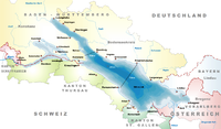
Frauenfeld District

Last updated
Frauenfeld District
Bezirk Frauenfeld
District
Frauenfeld District
Country Flag of Switzerland (Pantone).svg  Switzerland
Canton Flag of Canton of Thurgau.svg  Thurgau
Capital Frauenfeld
Area
  Total279.6 km2 (108.0 sq mi)
Population
 (2020)
  Total69,773
  Density250/km2 (650/sq mi)
Time zone UTC+1 (CET)
  Summer (DST) UTC+2 (CEST)
Municipalities23

Frauenfeld District is one of the five districts of the canton of Thurgau, Switzerland. It has a population of 69,773 (as of 31 December 2020). [1] Its capital, and the capital of Thurgau, is the city of Frauenfeld. The district shares borders with canton Zurich and canton Schaffhausen as well a river border with the German enclave of Büsingen am Hochrhein.

The district contains the following municipalities:

Coat of armsMunicipalityPopulation
(31 December 2020) [1]
Area
km2
[2]
BasadingenSchlattingen-blazon.svg Basadingen-Schlattingen 1,81815.7
Berlingen Wappen.svg Berlingen 9064.0
Diessenhofen-blazon.svg Diessenhofen 4,08510.0
Eschenz-blazon.svg Eschenz 1,86812.0
FelbenWellhausen-blazon.svg Felben-Wellhausen 2,8747.3
Frauenfeld-blazon.svg Frauenfeld 25,97427.4
Gachnang-blazon.svg Gachnang 4,4839.7
Herdern-blazon.svg Herdern 1,11713.7
Homburg-blazon.svg Homburg 1,54324.1
Huttlingen-blazon.svg Hüttlingen 82911.6
Huttwilen-blazon.svg Hüttwilen 1,76517.6
Mammern-blazon.svg Mammern 6775.5
Matzingen-coat of arms.svg Matzingen 3,0297.7
Mullheim-blazon.svg Müllheim 3,0028.7
Neunforn-blazon.svg Neunforn 1,08611.4
Pfyn-blazon.svg Pfyn 2,10313.0
Schlatt TG-blazon.svg Schlatt TG 1,81415.5
Steckborn-blazon.svg Steckborn 3,8408.8
Stettfurt-blazon.svg Stettfurt 1,2166.4
Thundorf-blazon.svg Thundorf 1,51315.6
UesslingenBuch-blazon.svg Uesslingen-Buch 1,09614.0
Wagenhausen-blazon.svg Wagenhausen 1,77011.2
WarthWeiningen-blazon.svg Warth-Weiningen 1,3658.3
Total (23)69,773279.6

Related Research Articles

<span class="mw-page-title-main">Cantons of Switzerland</span> Member states of the Swiss Confederation

The 26 cantons of Switzerland are the member states of the Swiss Confederation. The nucleus of the Swiss Confederacy in the form of the first three confederate allies used to be referred to as the Waldstätte. Two important periods in the development of the Old Swiss Confederacy are summarized by the terms Acht Orte and Dreizehn Orte.

<span class="mw-page-title-main">Thurgau</span> Canton of Switzerland

Thurgau, anglicized as Thurgovia, and formally as the Canton of Thurgau, is one of the 26 cantons forming the Swiss Confederation. It is composed of five districts. Its capital is Frauenfeld.
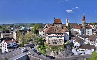
<span class="mw-page-title-main">Frauenfeld</span> Municipality in Switzerland

Frauenfeld is the capital of the canton of Thurgau in Switzerland.

<span class="mw-page-title-main">Weinfelden</span> Municipality in Thurgau, Switzerland

Weinfelden is a municipality in the canton of Thurgau in Switzerland. It is the capital of the district of the same name.

<span class="mw-page-title-main">Hüttwilen</span> Municipality in Thurgau, Switzerland

Hüttwilen is a municipality in Frauenfeld District in the canton of Thurgau in Switzerland.

<span class="mw-page-title-main">Wängi</span> Municipality in Thurgau, Switzerland

Wängi is a municipality in the district of Münchwilen in the canton of Thurgau in Switzerland.

<span class="mw-page-title-main">Felben-Wellhausen</span> Municipality in Thurgau, Switzerland

Felben-Wellhausen is a municipality in the district of Frauenfeld in the canton of Thurgau in Switzerland.
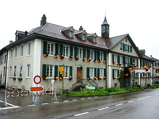
<span class="mw-page-title-main">Gachnang</span> Municipality in Thurgau, Switzerland

Gachnang is a municipality in the district of Frauenfeld in the canton of Thurgau in Switzerland.

Hüttlingen is a municipality in the district of Frauenfeld, in the canton of Thurgau in Switzerland.

<span class="mw-page-title-main">Matzingen</span> Municipality in Thurgau, Switzerland

Matzingen is a municipality in the district of Frauenfeld in the canton of Thurgau in Switzerland.
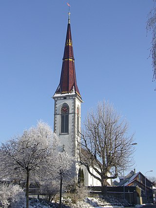
<span class="mw-page-title-main">Stettfurt</span> Municipality in northern Switzerland

Stettfurt is a municipality in the district of Frauenfeld in the canton of Thurgau in Switzerland.

<span class="mw-page-title-main">Thundorf, Switzerland</span> Municipality in Thurgau, Switzerland

Thundorf is a municipality in the district of Frauenfeld in the canton of Thurgau in Switzerland.
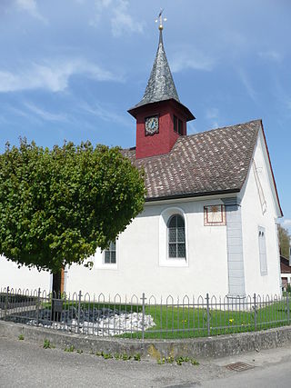
<span class="mw-page-title-main">Uesslingen-Buch</span> Municipality in Thurgau, Switzerland

Uesslingen-Buch is a municipality in the district of Frauenfeld in the canton of Thurgau in Switzerland.

Münchwilen District is one of the five districts of the canton of Thurgau, Switzerland. It has a population of 48,285. Its capital is the town of Münchwilen.

Arbon District is one of the five districts of the canton of Thurgau in Switzerland. It has a population of 58,414. Its capital is the town of Arbon.

<span class="mw-page-title-main">Diessenhofen District</span> District in Switzerland

Diessenhofen District is a former district of the canton of Thurgau in Switzerland. It had a population of 6,621. Its capital was the town of Diessenhofen.

<span class="mw-page-title-main">Steckborn District</span> District in Switzerland

Steckborn District is a former district of the canton of Thurgau, Switzerland. It had a population of 18,215. Its capital was the town of Steckborn.

Kreuzlingen District is one of the five districts of the canton of Thurgau in Switzerland. It has a population of 49,760. Its capital is the city of Kreuzlingen.

Weinfelden District is one of the five districts of the canton of Thurgau, Switzerland. It has a population of 56,677. Its capital is the town of Weinfelden.
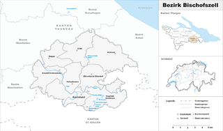
<span class="mw-page-title-main">Bischofszell District</span> District in Switzerland

Bischofszell District is a former district of the canton of Thurgau in Switzerland. It had a population of 31,773. Its capital was the town of Bischofszell.

References

  1. 1 2 "Ständige und nichtständige Wohnbevölkerung nach institutionellen Gliederungen, Geburtsort und Staatsangehörigkeit". bfs.admin.ch (in German). Swiss Federal Statistical Office - STAT-TAB. 31 December 2020. Retrieved 21 September 2021.
  2. Swiss Federal Statistical Office-Land Use Statistics 2009 data (in German) accessed 25 March 2010

47°33′N8°53′E / 47.550°N 8.883°E / 47.550; 8.883