This article needs additional citations for verification .(June 2025) |
| Appenzell Alps | |
|---|---|
 Churfirsten group, with the Schibestoll, Zuestoll, Brisi, Frümsel, and Selun (left to right) | |
| Highest point | |
| Peak | Säntis |
| Elevation | 2,502 m (8,209 ft) |
| Coordinates | 46°38′28″N8°25′6″E / 46.64111°N 8.41833°E |
| Naming | |
| Native name | Appenzeller Alpen (German) |
| Geography | |
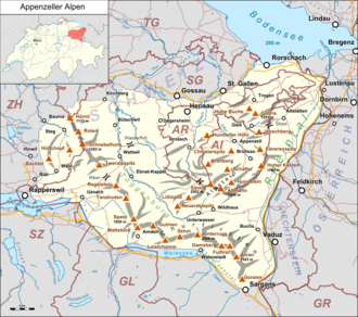 | |
| Country | Switzerland |
| Cantons | Appenzell Ausserrhoden, Appenzell Innerrhoden, St. Gallen and Zurich |
| Parent range | Western Alps |
| Borders on | Glarus Alps, Rätikon and Schwyz Alps |
| Topo map | Swiss Federal Office of Topography swisstopo |
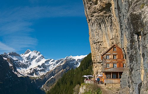
The Appenzell Alps (German : Appenzeller Alpen) are a mountain range in Switzerland on the northern edge of the Alps. They extend into the cantons of Appenzell Ausserrhoden, Appenzell Innerrhoden and St. Gallen (with lower summits occurring also in the cantons of Thurgau and Zurich) [a] and are bordered by the Schwyz Alps to the southwest, the Glarus Alps to the south, and the Rätikon to the south-east, and cover an area of about 1,800 km2 (690 sq mi). [1] The highest summit is the Säntis, with an elevation of 2,502 m (8,209 ft).