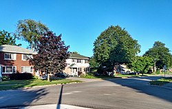
The Glebe is a neighbourhood in Ottawa, Ontario, Canada. It is located just south of Downtown Ottawa in the Capital Ward. As of 2016, the neighbourhood had a population of 13,055.
Riverview is a neighbourhood in Ottawa, Ontario, Canada. It is southeast of the downtown adjacent to the Rideau River, its location on which is its namesake. The 2021 Census population of Riverview is 13,113.

Heron Gate or Herongate is a neighbourhood in Alta Vista Ward and Gloucester-Southgate Ward in the south end of Ottawa, Ontario, Canada. It is defined by the Herongate Tenant Coalition as being bounded on the north by Heron Road, on the west by Heron-Walkley Park and Albion Road, and by the Walkley rail corridor on the south. The total population for this area according to the Canada 2021 Census was 9,974.

Barrhaven is a suburb of Ottawa, Ontario, Canada. It is located about 17 km (11 mi) southwest of the city's downtown core. Prior to amalgamation with Ottawa in 2001, Barrhaven was part of the City of Nepean. Its population as of the Canada 2021 Census was 103,234.

Centrepointe is a neighbourhood in College Ward in the urban west end of the city of Ottawa, Ontario, Canada. It was formerly part of the city of Nepean. It is a residential subdivision in the west/central part of Ottawa, developed from 1984 onwards, and is informally bounded by Baseline Road to the north, Woodroffe Avenue to the east, the CN railroad to the south, and the Briargreen subdivision and Forest Ridge Apartments to the west. The housing stock includes approximately 1,000 detached homes, with the remainder mostly townhomes and terrace homes.
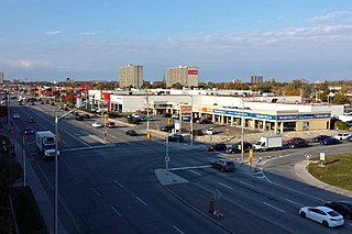
St. Laurent Boulevard is an arterial road in Ottawa, Ontario, Canada. Beginning at the Royal Canadian Mounted Police college complex at Sandridge Road in the Manor Park neighbourhood, St. Laurent Boulevard runs in a straight line, slightly east of south, until it reaches Walkley Road. It then curves west and intersects with Conroy Road and Don Reid Drive. In Ottawa, the name of the street is pronounced exclusively in French, even among Anglophones, as it honours former Canadian Prime Minister Louis St. Laurent. Prior to 1951, it was known as Base Line Road.
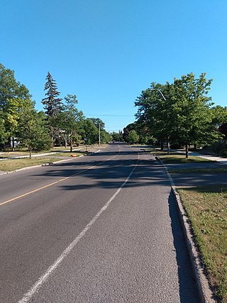
Alta Vista is a neighbourhood in Alta Vista Ward in Ottawa, Ontario, Canada. Its boundaries according to the Alta Vista Community Association are that part of Alta Vista Ward south of Smyth Road in the north, north of Walkley Road and east of the Rideau River, and west of the "greenspace underneath Haig Drive". However, the name is ambiguous, as there are several sub-neighbourhoods in this area,, as the neighbourhood could refer to the ward as a whole, down to the core Alta Vista area,, centred on Alta Vista Drive.
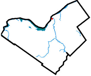
Lower Town (also spelled "Lowertown" is a neighbourhood in Rideau-Vanier Ward in central Ottawa, Ontario, Canada, to the east of downtown. It is the oldest part of the city. It is bounded by Rideau Street to the south, the Ottawa River to the west and north and the Rideau River to the east. It includes the commercial Byward Market area in the south-western part, and is predominantly residential in the north and east.
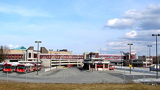
Bayshore is a station on the transitway in Ottawa, Ontario, served by OC Transpo buses. It is located in the western transitway section at the Bayshore Shopping Centre in the neighbourhood of Bayshore.

Carlingwood is a neighbourhood in Bay Ward in the west end of Ottawa, Ontario, Canada. The neighbourhood is roughly bounded on the north by Richmond Road, on the east by Sherbourne Road, on the south by Carling Avenue and on the west by Woodroffe Avenue. This area corresponds to census tract 5050032.01, which had a population of 3,558 according to the Canada 2016 Census.
Smyth Road, is a main road in eastern Ottawa, Ontario, Canada. It runs from Riverside Drive to St. Laurent Boulevard. This residential area was developed in the 1950s. The street was originally lined with large elm trees, giving the area the name Elmvale Acres.

Parkwood Hills is a neighbourhood in Knoxdale-Merivale Ward in the west end of Ottawa, Canada. Prior to amalgamation in 2001, it was located in the City of Nepean. It is notable for the thriller Parkwood Hills (2002) which was filmed on location in the area by Kolin Casagrande, and for being a typical and illustrative example of town planning and development by Minto in the context of its position as the property manager for the National Capital Commission.
Donald Charles Kay was an alderman on Ottawa City Council for 18 years.
Guildwood Estates is a sub neighbourhood within the Alta Vista area of Ottawa, Ontario, Canada. It can be broadly described as south of Kilborn Ave., west of the Walkley-Kilborn greenspace, east of Parkland and north of Heron Road. The population of this area according to the Canada 2011 Census was 3,179. However, maps usually show Guildwood Estates as the western section of this area, while the eastern half is the neighbourhood of Urbandale Acres. Guildwood Estates is newer, having mostly been built in the early 1970s, while Urbandale Acres was built in the 1960s.

Queensway Terrace North (QTN) is a neighbourhood in Bay Ward in the west end of Ottawa, Ontario, Canada. Its neighbourhood association is bounded to the north by Carling Avenue, to the west by Pinecrest Road, to the south by the Queensway, and to the east by the Transitway. These boundaries include the adjacent neighbourhood of Britannia Heights.

Hawthorne Meadows is a neighbourhood in Alta Vista Ward in southeast Ottawa, Ontario, Canada. It is triangular in shape; it is bounded on the west by St. Laurent Boulevard, on the northeast by Russell Road and on the south by Walkley Road. According to the Canada 2016 Census, the population of this area was 3,577.
Jean L. Cloutier is a Canadian politician. He was the Ottawa City Councillor for Alta Vista Ward from 2014 to 2022. He was elected for the first time in the 2014 Ottawa municipal election.
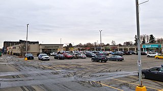
Elmvale Acres Shopping Centre is a strip mall located in the Elmvale Acres neighbourhood of Ottawa, Ontario, Canada. It opened as an enclosed mall in 1961 and was one of the earliest fully enclosed shopping malls in the city.
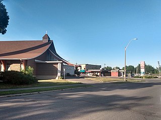
Urbandale is a neighbourhood in Alta Vista Ward in Ottawa, Ontario, Canada. The neighbourhood is roughly located south of Pleasant Park Road, west of St. Laurent Boulevard, north of Walkley Road and east of the Kilborn Allotment Garden. The total population for this area was 4,622 according to the Canada 2016 Census.
