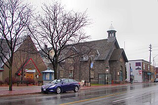
Westboro is an area in the west end of Ottawa, Ontario, Canada. Located along the Ottawa River, Island Park Drive defines Westboro's eastern border, while the Ottawa River defines its northern border. Under this definition, the population of the area is 22,725.
Whitehaven is a neighbourhood located in Bay Ward in the west end of Ottawa, Ontario, Canada, about 10 kilometres west of downtown. It is bounded by Carling Avenue to the north, Fairlawn Avenue to the east, the OC Transpo Transitway to the west and highway 417 to the south. The population of the neighbourhood is about 2350

Rideau View is a sub-neighbourhood of Carleton Heights in River Ward, in the west-end of Ottawa, Ontario, Canada, located near the Rideau River. It is bordered by Meadowlands Drive to the south, Claymor Avenue to the west and Dynes Road to the north. Debra Avenue is the main road that runs through the neighbourhood and there is some residential housing on Eiffel Avenue. Some of parts of the neighbourhoods are east of Prince of Wales Drive and runs parallel along the Rideau River. The area is also located close to the former city of Nepean. A major feature of the neighbourhood is a low-income housing project designed and built by the Ottawa Housing corporation. There are four high-rise condominiums on Prince of Wales at the corner of Dynes and Meadowlands.
Overbrook is a neighbourhood in Rideau-Rockcliffe Ward, in the east end of Ottawa, Ontario, Canada. It is across the Rideau River, from the neighbourhood Sandy Hill and just to the south of Vanier. To the east of Overbrook is the former city of Gloucester.It was constituted as a police village in 1922, and was annexed by the City of Ottawa in 1950.
Pineview is a neighbourhood in Beacon Hill-Cyrville Ward in the east end of Ottawa, Ontario, Canada. Prior to amalgamation in 2001, the neighbourhood was part of the City of Gloucester. As of the Canada 2011 Census, the neighbourhood had a population of 6,163
Waddington is a small village located in the Selwyn District of the Canterbury region of New Zealand's South Island, near the Waimakariri Gorge.
Woodroffe North is a neighbourhood in Bay Ward in the west end of Ottawa, Ontario, Canada. It is bounded on the south by Richmond Road on the west by the Sir John A. Macdonald Parkway, on the north by the Ottawa River and on the east by the northern prolongation of Sherbourne Avenue. Woodroffe North has also been referred to as a community within the neighbourhood of Westboro which claims its western border to be Woodroffe Avenue. The Woodroffe North Community includes residents that live on streets West of Woodroffe Avenue. Originally the homes used to be cottages same as Britannia. Most of the cottages were demolished and changed into houses. Lockhart Avenue is split up at Richmond Road and continues at Byron and ends at Saville Row in front of Carlingwood.
Grenfell Glen is a small neighbourhood in Knoxdale-Merivale Ward in the city of Ottawa in Ontario, Canada.
Viscount Alexander Park is a neighbourhood in Rideau-Rockcliffe Ward in the east end of Ottawa, Ontario, Canada. At its maximum extent, the neighbourhood has a population of 5,430 according to the Canada 2011 Census.
Craig Henry is a residential neighbourhood in Knoxdale-Merivale Ward in the west end of Ottawa, Canada. It is located in the former city of Nepean. It is a residential subdivision that was developed from 1971 onwards. The neighbourhood is bordered by Woodroffe Avenue to the east, Greenbank Road to the west, Knoxdale Road to the south and the CN railroad separating it from Centrepointe and Briargreen to the north. The land previously belonged to the Craig Henry farm, and was developed by Jack Aaron.
Glen Cairn is a neighbourhood in Kanata South Ward in the west end of Ottawa, Ontario, Canada. It is also the name of a public school in the area. Prior to amalgamation in 2001, it was located in the City of Kanata. It is located in South Kanata, about 22 km (14 mi) west of Downtown Ottawa. It was one of the original neighbourhoods in Kanata. The community was built in the 1960s. As of the Canada 2011 Census, there were 9,406 people living in Glen Cairn.
Leslie Park is a suburban neighbourhood in College Ward in the city of Ottawa, Ontario, Canada. It is located in the former city of Nepean.
Trend-Arlington is a suburban neighbourhood in Knoxdale-Merivale Ward in the city of Ottawa, Ontario, Canada. The neighbourhood is located with in the former City of Nepean in the west end of the city. It is located west of Greenbank Road, east of Highway 416 and Cedarview Road, north of West Hunt Club Road and south of the Leslie Park neighbourhood. Its main road is McClellan Road, which is renamed Banner Road at its north end.
Carson Grove is a neighbourhood in the east end of Ottawa, Ontario, Canada. The neighbourhood spans the former Ottawa-Gloucester boundary, which still forms the boundary between Rideau-Rockcliffe Ward and Beacon Hill-Cyrville Ward.
Woodpark is a small neighbourhood in Bay Ward, in the west end of Ottawa, Ontario, Canada. It is bounded in the north by Richmond Road, to the East by Woodroffe Avenue north, in the South by Carling Avenue and in the West by the Sir John A. Macdonald Parkway. The total population of the neighbourhood according to the Canada 2011 Census was 2,159.
Island Park is a neighbourhood in Kitchissippi Ward in the west end of Ottawa, Ontario, Canada. It is bounded on the north by Scott Street, on the west by its namesake, Island Park Drive, on the south by The Queensway and on the east by Holland Avenue. The Island Park Community Association just covers homes on Island Park Drive, and the rest of the neighbourhood is covered by the Wellington Village Community Association. The neighbourhood was originally named Elmdale for the number of elm trees in the area, and was founded in 1922. The homes were built between the 1920s and 1940s. The population of the neighbourhood at the 2011 census was 4,225.
Forbes is a neighbourhood in Rideau-Rockcliffe Ward in the east end of Ottawa, Ontario, Canada.
City View is a neighbourhood in College Ward in the west end of the city of Ottawa, Canada. It is located within the former city of Nepean.
Carleton Square is a sub-neighbourhood of Carleton Heights in the River Ward of Ottawa, Ontario, Canada. It is bounded on the west by Fisher Avenue, to the south Meadowlands Drive, Dynes Road to the north and Claymor Avenue to the east. According to the Canada 2011 Census the population for this area was 719.
Ambleside is a small sub-neighbourhood of Woodroffe North in Bay Ward in the west end of Ottawa, Ontario, Canada. It is bounded in the West and North by the Sir John A. Macdonald Parkway, in the East by New Orchard Avenue (North), and in the South by Richmond Road. The total population of this area was 2,560 according to the Canada 2011 Census.


