
Bank Street is the major commercial north-south street in Ottawa, Ontario, Canada. It runs south from Wellington Street in downtown Ottawa, south through the neighbourhoods of Centretown, The Glebe, Old Ottawa South, Alta Vista, Hunt Club, and then through the villages of Blossom Park, Leitrim, South Gloucester, Greely, Metcalfe, Spring Hill, and Vernon before exiting the city limits at Belmeade Road.
Airport Parkway is an expressway in Ottawa, Ontario, Canada. It runs from the Ottawa Macdonald–Cartier International Airport to an interchange with Heron Road where it turns into Bronson Avenue.

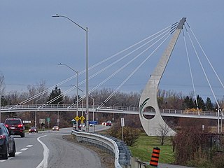
Riverside Drive is a major road in Ottawa, Ontario, Canada, that follows along the eastern bank of the Rideau River. Its northern terminus is at the Transitway/Via Rail underpass just south of the Queensway, and the road proceeds south to Limebank Road where it continues as River Road until the city limits. North of the Queensway, Riverside continues as Vanier Parkway, which travels through Vanier until Beechwood Avenue. The Vanier Parkway name is linked to the neighbourhood of Vanier, which was named for former Governor General of Canada Georges Vanier.

Brookfield Road is a short connecting street in Ottawa, Ontario, Canada. It runs from Riverside Drive past Brookfield High School to the Airport Parkway, and then in a separate segment as a local road in a residential area for some distance toward Bank Street.

Heron Road is a major road in Ottawa, Ontario, Canada. It runs from Walkley Road at an angle to the Rideau River, where it turns into Baseline Road. Heron is home to the Public Works and Government Services Canada headquarters, the Sir Leonard Tilley Building, the Canada Post headquarters, and the Edward Drake Building. It is also home to St. Patrick's Intermediate High School and Herongate Mall.
Wellington Street is a major street in Ottawa, Ottawa, Canada. The street is notable for being the main street of the Parliamentary Precinct of the Parliament of Canada. It is one of the first two streets laid out in Bytown in 1826. The street runs from Vimy Place, just west of Booth Street, to the Rideau Canal where it connects with Rideau Street and delimits the northern border of the downtown core. It is named after the Duke of Wellington, in recognition of his role in the creation of the Rideau Canal, and therefore of Ottawa.
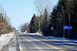
Russell Road is an arterial road in Eastern Ontario, Canada. It begins in Ottawa in the Riverview neighbourhood and runs eastward through the rural communities of Ramsayville, Carlsbad Springs and Bearbrook in Ottawa and through the Municipality of Clarence-Rockland, connecting the communities of Cheney and Bourget, ending at Boundary Road on the eastern border of Clarence Rockland. In Ottawa it is officially Ottawa Road #26, and in Clarence-Rockland as United Counties of Prescott and Russell County Road #2.
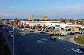
Conroy Road is a road in the City of Ottawa, Ontario, Canada. It runs from Walkley Road in the north to Bank Street in the south. Conroy Road forms the eastern fringe of the neighbourhood of Blossom Park, Ontario and ends in the community of Kemp Park, Ontario. Conroy Road is home to Pine Grove Forest and the Conroy Pit, owned by the National Capital Commission. Conroy Road has recently expanded, and divided between Walkley Road and Hunt Club Road due to residential expansion in Ottawa's south end. The intersection of Conroy and Walkley may be the southern terminus of the controversial Alta Vista Parkway. Conroy Road is also known as Ottawa Road #125.
Mitch Owens Road runs along the border primarily of the former city of Gloucester and Osgoode Township. It was named for former Gloucester mayor Mitch Owens, an RCMP policeman who after Arctic and European service retired to a farm near the Canadian capital and took up local politics.
Innes Road is one of the most important corridors in the east end of the City of Ottawa, Ontario, Canada, running through the former cities of Gloucester and Cumberland. It is the main route serving Blackburn Hamlet and south Orléans, as well as several industrial and commercial areas in east Ottawa.
St. Laurent Boulevard is an arterial road in Ottawa, Ontario, Canada. Beginning at the Royal Canadian Mounted Police college complex at Sandridge Road in the Manor Park neighbourhood, St. Laurent Boulevard runs in a straight line, slightly east of south, until it reaches Walkley Road. It then curves west and intersects with Conroy Road and Don Reid Drive. In Ottawa, the name of the street is pronounced exclusively in French, even among Anglophones, as it honours former Canadian Prime Minister Louis St. Laurent. Prior to 1951, it was known as Base Line Road.

Walkley is a bus station on Ottawa's transitway served by OC Transpo buses. It is located in the south-eastern transitway section at Walkley Road in Ottawa, Ontario, Canada. There are also plans for mixed-use development all around the station which is vacant.
Fourth Line Road is a designated arterial road in the rural portion of Ottawa, Ontario, Canada. The street follows one of the meridian lines first laid out when Carleton County was surveyed. It begins southeast of Richmond, Ontario at Brophy Drive, and runs southeast until it hits the Rideau River, where it turns into Donnelly Drive at Reevcraig Road South. Fourth Line Road passes through the heart of North Gower, Ontario, and when in that town it is known as "Main Street." The road runs just to the west of Highway 416, which is the more important north-south route. The southern portion of it was originally part of Ontario Highway 16.

Albion Road is an important north–south road in the southern part of Ottawa, Ontario, Canada. The street begins in the north as Albion Road North, at Walkley Road.
Blair Road is a road in the eastern part of Ottawa, Ontario, Canada. It begins just south of the Rockcliffe Parkway, but does not connect to the parkway, except for a small bike-path connection to the Ottawa River Pathway - one of the city's main bike trails that runs along the Ottawa River.

Dwyer Hill Road is the longest road within the municipal jurisdiction of the city of Ottawa, Ontario, Canada.
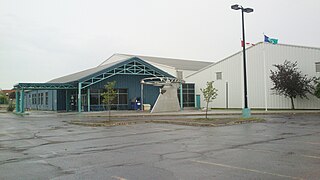
The Jim Durrell Recreation Centre is a multi-purpose dual-pad arena in Ottawa, Ontario, Canada. It is located in the south end of the city on Walkley road close to the intersection of Bank street. The Ottawa Jr. Senators of the Central Canada Hockey League are its primary tenant.
Smyth Road, is a main road in eastern Ottawa, Ontario, Canada. It runs from Riverside Drive to St. Laurent Boulevard. This residential area was developed in the 1950s. The street was originally lined with large elm trees, giving the area the name Elmvale Acres.

Parkdale Avenue is an arterial road located west of downtown Ottawa, Ontario, Canada. It runs in a north-south direction between the Sir John A. Macdonald Parkway and Carling Avenue in the Hintonburg and Civic Hospital neighbourhoods. It is an extremely busy road providing access to Tunney's Pasture, the Parkdale Market, the Ottawa Civic Hospital, and the Central Experimental Farm. Furthermore, it has direct connections to other major east-west arteries such as Scott Street, Wellington Street West, Gladstone Avenue, and Highway 417.

Hog's Back Road is a 1 km (0.62 mi) road in Ottawa, Ontario, Canada. The road connects Meadowlands Drive and Prince of Wales Drive to Riverside Drive and Brookfield Road. The road is used as the boundary line between Mooney's Bay Park and Hog's Back Park. It goes over the dam creating Mooney's Bay and Hog's Back Falls, and continues over the Hog's Back swing bridge over the Rideau Canal, to allow taller boats navigating the canal to pass. The road also runs past the spot where the Rideau Canal separates from the Rideau River.
