
The Trans-Canada Highway is a transcontinental federal–provincial highway system that travels through all ten provinces of Canada, from the Pacific Ocean on the west coast to the Atlantic Ocean on the east coast. The main route spans 7,476 km (4,645 mi) across the country, one of the longest routes of its type in the world. The highway system is recognizable by its distinctive white-on-green maple leaf route markers, although there are small variations in the markers in some provinces.

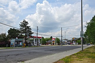
Bank Street is the major commercial north–south street in Ottawa, Ontario, Canada. It runs south from Wellington Street in downtown Ottawa, south through the neighbourhoods of Centretown, The Glebe, Old Ottawa South, Alta Vista, Hunt Club, and then through the villages of Blossom Park, Leitrim, South Gloucester, Greely, Metcalfe, Spring Hill, and Vernon before ending at the city limit at Belmeade Road, becoming Stormont, Dundas and Glengarry county highway 31.
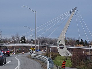
Airport Parkway is an expressway in Ottawa, Ontario, Canada. It runs from the Ottawa Macdonald–Cartier International Airport to an interchange with Heron Road where it turns into Bronson Avenue.
Donnelly Drive is a rural road in Ottawa, Ontario, Canada.
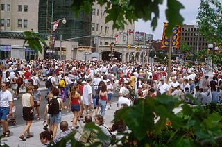
Wellington Street is a major street in Ottawa, Canada. It is notable for being the main street of the Parliamentary Precinct of the Parliament of Canada. It is one of the first two streets laid out in Bytown in 1826. The street runs from Vimy Place, just west of Booth Street, to the Rideau Canal where it connects with Rideau Street and delimits the northern border of the downtown core. It is named after the Duke of Wellington, in recognition of his role in the creation of the Rideau Canal, and therefore of Ottawa.
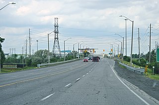
Russell Road is an arterial road in Eastern Ontario, Canada. It begins in Ottawa in the Riverview neighbourhood and runs eastward through the rural communities of Ramsayville, Carlsbad Springs and Bearbrook in Ottawa and through the Municipality of Clarence-Rockland, connecting the communities of Cheney and Bourget, ending at Boundary Road on the eastern border of Clarence Rockland. In Ottawa it is officially Ottawa Road #26, and in Clarence-Rockland as United Counties of Prescott and Russell County Road #2.
King's Highway 17, more commonly known as Highway 17, is a provincially maintained highway and the primary route of the Trans-Canada Highway through the Canadian province of Ontario. It begins at the Manitoba boundary, 50 km (31 mi) west of Kenora, and the main section ends where Highway 417 begins just west of Arnprior. A small disconnected signed section of the highway still remains within the Ottawa Region between County Road 29 and Grants Side Road. This makes it Ontario's longest highway.
King's Highway 417, commonly referred to as Highway 417 and as the Queensway through Ottawa, is a 400-series highway in the Canadian province of Ontario. It connects Ottawa with Montreal via A-40, and is the backbone of the highway system in the National Capital Region. Within Ottawa, it forms part of the Queensway west from Highway 7 to Ottawa Road 174. Highway 417 extends from the Quebec border, near Hawkesbury, to Arnprior, where it continues westward as Highway 17. Aside from the urban section through Ottawa, Highway 417 passes through farmland that dominates much of the fertile Ottawa Valley.

Alta Vista Drive is a suburban road in Ottawa, Ontario, Canada. It runs from Bank Street in the south to Industrial Avenue in the north covering the neighbourhoods of Ridgemont, Alta Vista and Riverview.
Innes Road is one of the most important corridors in the east end of the City of Ottawa, Ontario, Canada, running through the former cities of Gloucester and Cumberland. It is the main route serving Blackburn Hamlet and south Orléans, as well as several industrial and commercial areas in east Ottawa.
Blair Road is a road in the eastern part of Ottawa, Ontario, Canada. It begins just south of the Rockcliffe Parkway, but does not connect to the parkway, except for a small bike-path connection to the Ottawa River Pathway - one of the city's main bike trails that runs along the Ottawa River.

Montreal Road, also known as Ottawa Road #34, is a major east-west Ottawa road that links Lowertown to Vanier and the farther eastern neighbourhoods of Ottawa. Until downloading in 1998, it was part of the provincially managed Highway 17B.
King's Highway 31, commonly referred to as Highway 31 and historically known as the Metcalfe Road, was a provincially maintained highway in the Canadian province of Ontario. The 76.93-kilometre (47.80 mi) route connected Highway 2 in Morrisburg with the Chaudière Bridge at the Ontario–Quebec boundary in downtown Ottawa.
King's Highway 37, commonly referred to as Highway 37, is a provincially maintained highway in the Canadian province of Ontario. It begins at Highway 401 in Belleville and travels 44.2 km (27.5 mi) north to Highway 7 in Actinolite. The route once continued south through Belleville to Highway 62, but was truncated in 1998. Prior to the re-routing, Highway 37 was 47.2 km (29.3 mi) long.

King Edward Avenue is a major thoroughfare in the eastern part of Ottawa, Ontario, Canada. Despite being a municipal road, a portion of the street is designated as part of Canada's National Highway System, as part of an interconnecting route between Ontario Highway 417 in Ottawa and Quebec Autoroute 5 in Gatineau.
King's Highway 15, commonly referred to as Highway 15, is a provincially maintained highway in the Canadian province of Ontario. It travels north from an interchange with Highway 401 in Kingston to Highway 7 in Carleton Place, a distance of 114.7 kilometres (71.3 mi). In addition to Kingston and Carleton Place, the highway provides access to the Eastern Ontario communities of Joyceville, Seeley's Bay, Morton, Elgin, Crosby, Portland, Lombardy and Franktown. Prior to 1998, Highway 15 continued north from Carleton Place, passed Almonte and through Pakenham, to Highway 17 in Arnprior.
King's Highway 41, commonly referred to as Highway 41, is a provincially maintained highway in the Canadian province of Ontario. The 159.6-kilometre (99.2 mi) highway travels in a predominantly north–south direction across eastern Ontario, from Highway 7 in Kaladar to Highway 148 in Pembroke. The majority of this distance crosses through a rugged forested region known as Mazinaw Country. However, the route enters the agricultural Ottawa Valley near Dacre. A significant portion of Highway 41 follows the historic Addington Colonization Road, built in 1854.
Highway 17B was formerly the designation for six business routes of Highway 17, the main route of the Trans-Canada Highway through the Canadian province of Ontario. Each generally followed the original route of Highway 17 through the town or city that it served, and was subsequently given the Highway 17B designation when a newer bypass route was constructed to either reduce traffic pressure on the local street network, or provide a better thoroughfare that avoided urban areas altogether.

Secondary Highway 606, commonly referred to as Highway 606, was a provincially maintained secondary highway in the Canadian province of Ontario. This short spur connected Highway 17 with the community of Markstay and was only 1.5 kilometres (0.93 mi) long. Highway 606 was located entirely within what is now the Municipality of Markstay-Warren in Sudbury District.
