
Beckwith is a township in eastern Ontario, Canada. It is located in Lanark County on the Mississippi River. It is located within Canada's National Capital Region.

Kanata is a suburb and former city within Ottawa, Ontario, Canada. It is located about 22 km (14 mi) west of the city's downtown core. As of 2021, the former City of Kanata had a population of 98,938, with the population centre having a population of 137,118. Before it was amalgamated into Ottawa in 2001, it was one of the fastest-growing cities in Canada and the fastest-growing community in Eastern Ontario. Located just to the west of the National Capital Commission Greenbelt, it is one of the largest of several communities that surround central Ottawa.

Hunt Club Road, also known as Ottawa Road 32, is a major east–west route in Ottawa, Ontario, Canada. It originally ran from a dead end east of Bank Street to the Ottawa Hunt and Golf Club; later, there were many extensions due to the 1970s housing boom, first westward to Riverside Drive, then eastward to Hawthorne Road in the late 1980s. The section between Bank Street and Riverside Drive, originally only one lane in each direction, was expanded to two lanes in each direction in 1993–1994. It was further extended across the Rideau River and the southern edge of the suburbs to Richmond Road by the late 1990s; this extension is signed as West Hunt Club Road by the City of Ottawa. Construction to extend Hunt Club eastward to Highway 417 near Ramsayville was completed on August 21, 2014.

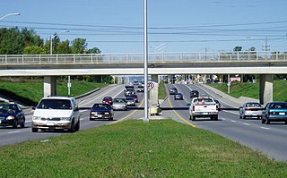
The Transitway is a bus rapid transit (BRT) network operated by OC Transpo in Ottawa, Ontario, Canada. It comprises a series of bus-only roadways and reserved lanes on city streets and highways. The dedicated busways ensure that buses and emergency vehicles on the Transitway rarely intersect directly with the regular traffic, and make it possible for them to continue at full speed even during rush hour. OC Transpo operates a network of rapid routes which use the Transitway to connect communities with the O-Train light rail system. Additional bus routes also use segments of the Transitway.
Baseline Road is a road in Ottawa, Ontario, Canada.

Barrhaven is a suburb of Ottawa, Ontario, Canada. It is located about 17 km (11 mi) southwest of the city's downtown core. Prior to amalgamation with Ottawa in 2001, Barrhaven was part of the City of Nepean. Its population as of the Canada 2021 Census was 103,234.

Carling Avenue is a major east–west arterial road in the west end of Ottawa, Ontario, Canada. It runs from March Road in Kanata to Bronson Avenue in the Glebe. The road is named for John Carling, founder of Carling Brewery and Conservative MP and Senator, Postmaster General and Minister of Agriculture.
Woodroffe Avenue is a major north-south arterial road in Ottawa, Ontario, Canada's west end. It runs south from the Kichi Zibi Mikan through Baseline Road and Barrhaven to just short of Prince of Wales Drive near Manotick. The road runs through the heart of Nepean in Ottawa's west end. A satellite Via Rail station is also located at the intersection of Fallowfield Road.

Bells Corners is a suburban neighbourhood in Ottawa, Ontario, Canada. It is located along Robertson Road west of downtown, within Ottawa's western Greenbelt, in College Ward. As of the Canada 2016 Census, the community had a population of 9,272.
Hazeldean Road is a major road in Ottawa's west end. This road runs between the junction of Highway 7 west of Stittsville and Eagleson Road in Kanata, where it becomes Robertson Road east of the intersection and proceeds towards Bells Corners in the former city of Nepean, Ontario as a four-lane rural route through the Greenbelt.
Eagleson Road is a northwest–southeast road in Ottawa's west end in Kanata. It starts at Highway 417 and ends at Brophy Drive south of Richmond. North of Highway 417 it becomes March Road. It is a key link, primarily for residents of Bridlewood, between both ends of Kanata where housing developments are growing steadily in the north and the south. The primary segment of Eagleson Road is divided and six lanes wide between Highway 417 and Abbeyhill Drive, while between Abbeyhill Drive and just south of Stonehaven Drive it is a four-lane divided arterial. South of that, Eagleson is a two-lane undivided rural road.

Merivale Road is an arterial road in the west end of Ottawa, Ontario, Canada. It starts at Island Park Drive just north of Highway 417 and continues south until it ends at Prince of Wales Drive in Rideau Glen. South of Clyde Avenue, Merivale is known as Ottawa Road #17, while north of Clyde it is Ottawa Road #63.
Cedarview Road is a north–south road in Ottawa, Ontario, Canada. It runs between Bells Corners and Barrhaven. Formerly a major arterial road for Barrhaven residents, its use declined after the opening of Highway 416 in 1999.
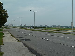
Terry Fox Drive is a major arterial road in Ottawa, Ontario named for the late Canadian humanitarian, activist, and athlete Terry Fox. Located in the suburb of Kanata in the city's west end, the road is a major route for residents traveling to/from the north end of Kanata. Starting in the Kanata North Technology Park at an intersection with Herzberg Road, it crosses March Road and Innovation Drive and bisects an old-growth forest, before heading south past Kanata Centrum. It crosses Highway 417, passes Katimavik-Hazeldean and Glen Cairn, and ends at Eagleson Road, where it continues east as Hope Side Road. Currently, Terry Fox Drive is a four lane arterial between just north of Richardson Side Road and just south of Winchester Drive, and a two lane undivided road elsewhere.
King's Highway 15, commonly referred to as Highway 15, is a provincially maintained highway in the Canadian province of Ontario. It travels north from an interchange with Highway 401 in Kingston to Highway 7 in Carleton Place, a distance of 114.7 kilometres (71.3 mi). In addition to Kingston and Carleton Place, the highway provides access to the Eastern Ontario communities of Joyceville, Seeley's Bay, Morton, Elgin, Crosby, Portland, Lombardy and Franktown. Prior to 1998, Highway 15 continued north from Carleton Place, passed Almonte and through Pakenham, to Highway 17 in Arnprior.

Robertson Road is a road in the west end of Ottawa, Ontario, Canada. It runs approximately 6.1 km (3.8 mi) between Baseline Road east of Bells Corners and Eagleson Road in Kanata where the road continues west as Hazeldean Road. At Baseline Road it continues east as Richmond Road.
Arbeatha Park is a sub-neighbourhood of Lynwood Village, which is in turn a sub-neighbourhood of Bells Corners in the west end of Ottawa, Ontario, Canada. Bounded to the west is Moodie Drive, north is Old Richmond Road, east is Lynwood Village and south is a forest owned by the city of Ottawa.
John Lowry Gourlay (1821–1905) was an Irish Presbyterian minister and missionary in Upper Canada.
Cotton, Larry D. Whiskey and Wickedness. Lanark, ON: Larry D. Cotton Associates, 2007. Print.
