
The Glebe is a neighbourhood in Ottawa, Ontario, Canada. It is located just south of Downtown Ottawa in the Capital Ward. As of 2016, the neighbourhood had a population of 13,055.

Parkdale is a neighbourhood and former village in Toronto, Ontario, Canada, west of downtown. The neighbourhood is bounded on the west by Roncesvalles Avenue; on the north by the CP Rail line where it crosses Queen Street and Dundas Street; on the east by Dufferin Street from Queen Street south; and on the south by Lake Ontario. The original village incorporated an area north of Queen Street, east of Roncesvalles from Fermanagh east to the main rail lines, today known as part of the Roncesvalles neighbourhood. The village area was roughly one square kilometre in area. The City of Toronto government extends the neighbourhood boundaries to the east, south of the CP Rail lines, east to Atlantic Avenue, as far south as the CN Rail lines north of Exhibition Place, the part south of King Street commonly known as the western half of Liberty Village neighbourhood.

Queen Street is a major east–west thoroughfare in Toronto, Ontario, Canada. It extends from Roncesvalles Avenue and King Street in the west to Victoria Park Avenue in the east. Queen Street was the cartographic baseline for the original east–west avenues of Toronto's and York County's grid pattern of major roads. The western section of Queen is a centre for Canadian broadcasting, music, fashion, performance, and the visual arts. Over the past twenty-five years, Queen West has become an international arts centre and a tourist attraction in Toronto.

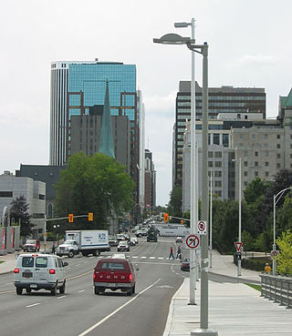
Bank Street is the major commercial north–south street in Ottawa, Ontario, Canada. It runs south from Wellington Street in downtown Ottawa, south through the neighbourhoods of Centretown, The Glebe, Old Ottawa South, Alta Vista, Hunt Club, and then through the villages of Blossom Park, Leitrim, South Gloucester, Greely, Metcalfe, Spring Hill, and Vernon before ending at the city limit at Belmeade Road, becoming Stormont, Dundas and Glengarry county highway 31.
Laurier Avenue is a central east west street running through Ottawa, Ontario, Canada. Originally known as "Maria Street" and "Theodore Street", it was renamed in honour of Canadian Prime Minister Sir Wilfrid Laurier. Laurier House, the residence of Prime Ministers Laurier and William Lyon Mackenzie King, is located at the corner of Laurier Avenue East and Chapel Street.
Wellington Street is a major street in Ottawa, Canada. It is notable for being the main street of the Parliamentary Precinct of the Parliament of Canada. It is one of the first two streets laid out in Bytown in 1826. The street runs from Vimy Place, just west of Booth Street, to the Rideau Canal where it connects with Rideau Street and delimits the northern border of the downtown core. It is named after the Duke of Wellington, in recognition of his role in the creation of the Rideau Canal, and therefore of Ottawa.

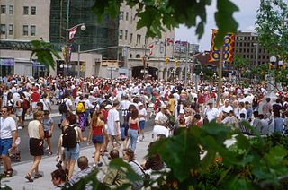
Sparks Street is a pedestrian mall in Ottawa, Ontario, Canada. It was a main street in Ottawa that was converted into an outdoor pedestrian street in 1967, making it the earliest such street or mall in Canada.

Oregon Route 8, also known as Oregon Highway 8, is an Oregon state highway which serves the western suburbs of Portland. The road is locally known as Canyon Road and Tualatin Valley Highway, and travels through the center of the Tualatin Valley. Oregon 8 is located entirely within Washington County. The portion of the route from US 26 to Oregon Route 47 is part of the National Highway System, listed as a principal arterial.
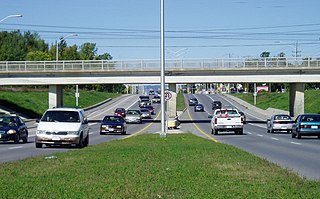
King's Highway 417, commonly referred to as Highway 417 and as the Queensway through Ottawa, is a 400-series highway in the Canadian province of Ontario. It connects Ottawa with Montreal via A-40, and is the backbone of the highway system in the National Capital Region. Within Ottawa, it forms part of the Queensway west from Highway 7 to Ottawa Road 174. Highway 417 extends from the Quebec border, near Hawkesbury, to Arnprior, where it continues westward as Highway 17. Aside from the urban section through Ottawa, Highway 417 passes through farmland that dominates much of the fertile Ottawa Valley.

Carling Avenue is a major east–west arterial road in the west end of Ottawa, Ontario, Canada. It runs from March Road in Kanata to Bronson Avenue in the Glebe. The road is named for John Carling, founder of Carling Brewery and Conservative MP and Senator, Postmaster General and Minister of Agriculture.

Downtown Ottawa is the central area of Ottawa, Ontario, Canada. It is sometimes referred to as the Central Business District and contains Ottawa's financial district. It is bordered by the Ottawa River to the north, the Rideau Canal to the east, Gloucester Street to the south and Bronson Avenue to the west. This area and the residential neighbourhood to the south are also known locally as 'Centretown'. The total population of the area is 5,501.

Hintonburg is a neighbourhood in Kitchissippi Ward in Ottawa, Ontario, Canada, located west of the Downtown core. It is a historically working-class, predominantly residential neighbourhood, with a commercial strip located along Wellington Street West. It is home to the Parkdale Public Market, located along Parkdale Avenue, just north of Wellington. It is considered to be one of Ottawa's most "hipster" neighbourhoods.

Elgin Street is a street in the Downtown core of Ottawa, Ontario, Canada. Originally named Biddy's Lane, it was later named after Lord Elgin.

The Kichi Zībī Mīkan, formerly the Sir John A. Macdonald Parkway, and previously the Ottawa River Parkway, is a four-lane scenic parkway along the Ottawa River in Ottawa, Ontario, Canada. It runs from Carling Avenue near Connaught Avenue, to Booth Street at the Canadian War Museum and National Holocaust Monument. It is maintained by the National Capital Commission. The speed limit is 60 km/h (37 mph). Bicycles are allowed on the road and on a parallel recreational path along the parkway.

Bronson Avenue is a major north-south arterial road in Ottawa, Ontario, Canada. It starts at the south end as a continuation of the Airport Parkway, which is an expressway to the Macdonald-Cartier International Airport. It continues past Carleton University, the Glebe, north through Centretown, and ends downtown at Sparks Street.
Woodroffe Avenue is a major north-south arterial road in Ottawa, Ontario, Canada's west end. It runs south from the Kichi Zibi Mikan through Baseline Road and Barrhaven to just short of Prince of Wales Drive near Manotick. The road runs through the heart of Nepean in Ottawa's west end. A satellite Via Rail station is also located at the intersection of Fallowfield Road.
Parkdale is a mature, inner city neighbourhood in the city of Calgary, Alberta along the north bank of the Bow River between the communities of West Hillhurst and Point McKay. It is bounded on the south by the Bow River, 28 St NW to the east, Shaganappi Trail NW to the west and on the north by 16th Avenue. Parkdale is in close proximity to both the Foothills Medical Centre and the Alberta Children's Hospital constructed in 2006, as well as the University of Calgary. Memorial Drive provides access to downtown Calgary and to Highway 1 which leads to the Rocky Mountains. Parkdale was annexed to the City of Calgary in 1910 when Calgary began to experience a "major economic and building boom." The boom ended in 1913 and further development of the Parkdale Addition as it was called, was halted because of World War I. Following World War II in the 1950s the dominant housing type that characterized Parkdale, was the bungalow. By 2014 Parkdale, like other inner city communities in Calgary, was experiencing gradual gentrification with small cottage-style bungalows being replaced by spacious flat roofed, Prairie School Frank Lloyd Wright inspired infills attracting young families with children away from the long commute suburbs to inner city ease of access to downtown, transit and work.
Parkdale is a central neighbourhood in Edmonton, Alberta, Canada located a short distance north of the downtown core. Located to the south of the neighbourhood is Commonwealth Stadium and to the north east is Northlands Coliseum. Parkdale is part of the Norwood area of Edmonton.

Jameson Avenue is a multi-lane arterial road in the Parkdale neighbourhood in Toronto, Ontario, Canada. It is a north-south roadway from Lake Shore Boulevard to Queen Street. Originally laid out in the 19th century as a two-lane residential street, its traffic and land use has changed considerably from a suburban/semi-rural street to a main arterial connecting to an expressway.
Parkdale Avenue is an arterial road located west of downtown Ottawa, Ontario, Canada. It runs in a north-south direction between the Kichi Zibi Mikan and Carling Avenue in the Hintonburg and Civic Hospital neighbourhoods. It is an extremely busy road providing access to Tunney's Pasture, the Parkdale Market, the Ottawa Civic Hospital, and the Central Experimental Farm. Furthermore, it has direct connections to other major east-west arteries such as Scott Street, Wellington Street West, Gladstone Avenue, and Highway 417.
