
Bank Street is the major commercial north-south street in Ottawa, Ontario, Canada. It runs south from Wellington Street in downtown Ottawa, south through the neighbourhoods of Centretown, The Glebe, Old Ottawa South, Alta Vista, Hunt Club, and then through the villages of Blossom Park, Leitrim, South Gloucester, Greely, Metcalfe, Spring Hill, and Vernon before exiting the city limits at Belmeade Road.

The Transitway is a bus rapid transit (BRT) network operated by OC Transpo in Ottawa, Ontario, Canada. It comprises a series of bus-only roadways and reserved lanes on city streets and highways. The dedicated busways ensure that buses and emergency vehicles on the Transitway rarely intersect directly with the regular traffic, and make it possible for them to continue at full speed even during rush hour. OC Transpo operates a network of rapid routes which use the Transitway to connect communities with the O-Train light rail system. Additional bus routes also use segments of the Transitway.
Baseline Road is a road in Ottawa, Ontario, Canada.
King's Highway 417, commonly referred to as Highway 417 and as the Queensway through Ottawa, is a 400-series highway in the Canadian province of Ontario. It connects Ottawa with Montreal via A-40, and is the backbone of the highway system in the National Capital Region. Within Ottawa, it forms part of the Queensway west from Highway 7 to Ottawa Road 174. Highway 417 extends from the Quebec border, near Hawkesbury, to Arnprior, where it continues westward as Highway 17. Aside from the urban section through Ottawa, Highway 417 passes through farmland that dominates much of the fertile Ottawa Valley.

Carling Avenue is a major east–west arterial road in the west end of Ottawa, Ontario, Canada. It runs from March Road in Kanata to Bronson Avenue in the Glebe. The road is named for John Carling, founder of Carling Brewery and Conservative MP and Senator, Postmaster General and Minister of Agriculture.

Hintonburg is a neighbourhood in Kitchissippi Ward in Ottawa, Ontario, Canada, located west of the Downtown core. It is a historically working-class, predominantly residential neighbourhood, with a commercial strip located along Wellington Street West. It is home to the Parkdale Farmer's Market, located along Parkdale Avenue, just north of Wellington. It is considered to be one of Ottawa's most "hipster" neighbourhoods.

The Kichi Zībī Mīkan,, formerly the Sir John A. Macdonald Parkway, and previously the Ottawa River Parkway, is a four-lane scenic parkway along the Ottawa River in Ottawa, Ontario, Canada. It runs from Carling Avenue near Connaught Avenue, to Booth Street at the Canadian War Museum and National Holocaust Monument. It is maintained by the National Capital Commission. The speed limit is 60 km/h (37 mph). Bicycles are allowed on the road and on a parallel recreational path along the parkway.
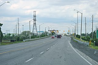
Trim Road is an arterial road in the eastern end of Orléans, Ontario, a suburb of Ottawa. It serves as the only road access to Petrie Island and its public beach in the Ottawa River. From Petrie Island, Trim runs south through the eastern suburban areas of Orleans and then south into rural former Cumberland Township. It travels through the communitiy of Navan before ending at Perreault Road. It has a total length of 14.4 km (8.9 mi) and connects with Ottawa Regional Road 174 that connects with Highway 417 further to the west. Its status as a numbered road in Ottawa's city road status ends at Innes Road on the south side of Orleans.

Tunney's Pasture is the western O-Train light rail terminal train station in Ottawa, Ontario.
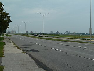
St. Laurent Boulevard is an arterial road in Ottawa, Ontario, Canada. Beginning at the Royal Canadian Mounted Police college complex at Sandridge Road in the Manor Park neighbourhood, St. Laurent Boulevard runs in a straight line, slightly east of south, until it reaches Walkley Road. It then curves west and intersects with Conroy Road and Don Reid Drive. In Ottawa, the name of the street is pronounced exclusively in French, even among Anglophones, as it honours former Canadian Prime Minister Louis St. Laurent. Prior to 1951, it was known as Base Line Road.

Bronson Avenue is a major north-south arterial road in Ottawa, Ontario, Canada. It starts as a continuation of the Airport Parkway, which is an expressway to the Macdonald-Cartier International Airport. It continues past Carleton University, the Glebe, north through Centretown, and ends downtown at Sparks Street.
Blair Road is a road in the eastern part of Ottawa, Ontario, Canada. It begins just south of the Rockcliffe Parkway, but does not connect to the parkway, except for a small bike-path connection to the Ottawa River Pathway - one of the city's main bike trails that runs along the Ottawa River.

Terry Fox station is a bus stop on Ottawa, Ontario, Canada's transitway served by OC Transpo buses and named after cancer research activist Terry Fox. It is located in the western transitway section and is the main western terminal of routes 61 and 62 for all trips not extended to/from Stittsville.

Eagleson Road is a northwest-southeast road in Ottawa's west end in Kanata. It starts at Highway 417 and ends at Brophy Drive south of Richmond. North of Highway 417 it becomes March Road. It is a key link, primarily for residents of Bridlewood, between both ends of Kanata where housing developments are growing steadily in the north and the south. The primary segment of Eagleson Road is divided and six lanes wide between Highway 417 and Abbeyhill Drive, while between Abbeyhill Drive and just south of Stonehaven Drive it is a four-lane divided arterial. South of that, Eagleson is a two-lane undivided rural road.

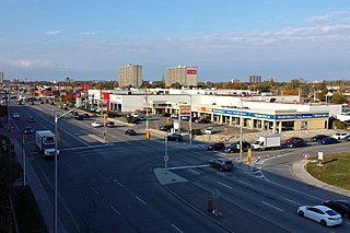
Merivale Road is an arterial road in the west end of Ottawa, Ontario, Canada. It starts at Island Park Drive just north of Highway 417 and continues south until it ends at Prince of Wales Drive in Rideau Glen. South of Clyde Avenue, Merivale is known as Ottawa Road #17, while north of Clyde it is Ottawa Road #63.

Nicholas Street is an arterial road in the central area of Ottawa, Ontario which connects Highway 417 with the downtown core. Despite being a municipal road, the street is designated as part of Canada's National Highway System, as part of an interconnecting route between Highway 417 and Quebec Autoroute 5 in Gatineau.
Terry Fox Drive is a major arterial road in Ottawa, Ontario named for the late Canadian humanitarian, activist, and athlete Terry Fox. Located in the suburb of Kanata in the city's west end, the road is a major route for residents traveling to/from the north end of Kanata. Starting in the Kanata North Technology Park at an intersection with Herzberg Road, it crosses March Road and Innovation Drive and bisects an old-growth forest, before heading south past Kanata Centrum. It crosses Highway 417, passes Katimavik-Hazeldean and Glen Cairn, and ends at Eagleson Road, where it continues east as Hope Side Road. Currently, Terry Fox Drive is a four lane arterial between just north of Richardson Side Road and just south of Winchester Drive, and a two lane undivided road elsewhere.

Gladstone Avenue is a street in Ottawa running east from the Rideau Canal west to Parkdale Avenue. It is a historically residential street running just south of the downtown core, with a number of small houses in the downtown section now converted to commercial uses. The local pronunciation is phonetic, unlike that of William Ewart Gladstone's surname.

Metcalfe Street is a downtown arterial road in Ottawa, Ontario, Canada. It is named for Charles Theophilus Metcalfe, a nineteenth-century Governor General of the Province of Canada. It is a north-south route, operating one way northbound, providing a key thoroughfare from Highway 417. In the late 19th century and the early 20th century, its homes included those of Ottawa mayor Thomas Birkett, Canada's lumber and railroad baron John Rudolphus Booth, inventor Thomas Willson a.k.a. Carbide Willson, and Alexander Campbell, law partner of John A. Macdonald.

Civic Hospital is a neighbourhood in Kitchissippi Ward in central Ottawa, Canada. It is named after the Ottawa Civic Hospital, which is located in the neighbourhood.
