
Bank Street is the major commercial north–south street in Ottawa, Ontario, Canada. It runs south from Wellington Street in downtown Ottawa, south through the neighbourhoods of Centretown, The Glebe, Old Ottawa South, Alta Vista, Hunt Club, and then through the villages of Blossom Park, Leitrim, South Gloucester, Greely, Metcalfe, Spring Hill, and Vernon before ending at the city limit at Belmeade Road, becoming Stormont, Dundas and Glengarry county highway 31.

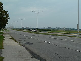
Riverside Drive is a major road in Ottawa, Ontario, Canada, that follows along the eastern bank of the Rideau River. Its northern terminus is at the Transitway/Via Rail underpass just south of the Queensway, and the road proceeds south to Limebank Road where it continues as River Road until the city limits. North of the Queensway, Riverside continues as Vanier Parkway, which travels through Vanier until Beechwood Avenue. The Vanier Parkway name is linked to the neighbourhood of Vanier, which was named for former Governor General of Canada Georges Vanier.

Heron Road is a major road in Ottawa, Ontario, Canada. It runs from Walkley Road at an angle to the Rideau River, where it turns into Baseline Road. Heron is home to the Sir Leonard Tilley Building, the Canada Post headquarters, and the Edward Drake Building. It is also home to St. Patrick's Intermediate High School and Herongate Mall.
Baseline Road is a road in Ottawa, Ontario, Canada.

Alta Vista Drive is a suburban road in Ottawa, Ontario, Canada, and is the main north-south street in the city's Alta Vista Ward. It runs from Bank Street in the south to Industrial Avenue in the north covering the neighbourhoods of Ridgemont, Alta Vista and Riverview.
Innes Road is one of the most important corridors in the east end of the City of Ottawa, Ontario, Canada, running through the former cities of Gloucester and Cumberland. It is the main route serving Blackburn Hamlet and south Orléans, as well as several industrial and commercial areas in east Ottawa.
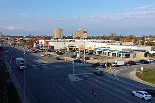
St. Laurent Boulevard is an arterial road in Ottawa, Ontario, Canada. Beginning at the Royal Canadian Mounted Police college complex at Sandridge Road in the Manor Park neighbourhood, St. Laurent Boulevard runs in a straight line, slightly east of south, until it reaches Walkley Road. It then curves west and intersects with Conroy Road and Don Reid Drive. In Ottawa, the name of the street is pronounced exclusively in French, even among Anglophones, as it honours former Canadian Prime Minister Louis St. Laurent. Prior to 1951, it was known as Base Line Road.
Provincial Trunk Highway 1 is Manitoba's section of the Trans-Canada Highway. It is a heavily used, 4-lane divided highway, with the exception of a short 18 km section in the southeastern corner of the province. It is the main link between southern Manitoba's largest cities, and also serves as the province's main transportation link to the neighbouring provinces of Saskatchewan and Ontario. The highway is the only major east-west divided highway in Manitoba, and carries a large majority of east-west traffic within and through the province. It has full freeway status sections at Portage la Prairie and Winnipeg. The total distance of the Trans-Canada Highway in Manitoba is approximately 490 km (300 mi).

The South Wales Main Line, originally known as the London, Bristol and South Wales Direct Railway or simply as the Bristol and South Wales Direct Railway, is a branch of the Great Western Main Line in Great Britain. It diverges from the core London-Bristol line at Royal Wootton Bassett beyond Swindon, first calling at Bristol Parkway, after which the line continues through the Severn Tunnel into South Wales.
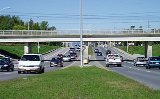
Woodroffe Avenue is a major north-south arterial road in Ottawa, Ontario, Canada's west end. It runs south from the Kichi Zibi Mikan through Baseline Road and Barrhaven to just short of Prince of Wales Drive near Manotick. The road runs through the heart of Nepean in Ottawa's west end. A satellite Via Rail station is also located at the intersection of Fallowfield Road.
Blair Road is a road in the eastern part of Ottawa, Ontario, Canada. It begins just south of the Sir George-Étienne Cartier Parkway, but does not connect to the parkway, except for a small bike-path connection to the Ottawa River Pathway - one of the city's main bike trails that runs along the Ottawa River.

Route 47, locally known as Logan Avenue, is a city route in Winnipeg, Manitoba, Canada. It runs from Route 90 to Route 42. It is primarily a collector road through industrial and older residential areas of north-central Winnipeg.
Route 155 is a city route in Winnipeg, Manitoba. It runs from the Perimeter Highway to Route 42.

Interstate 95 (I-95) is a part of the Interstate Highway System that runs north–south from Miami, Florida to Houlton, Maine. The highway enters Maine from the New Hampshire state line in Kittery and runs for 303 miles (488 km) to the Canada–United States border at Houlton. It is the only primary Interstate Highway in Maine. In 2004, the highway's route between Portland and Gardiner was changed so that it encompasses the entire Maine Turnpike, a toll road running from Kittery to Augusta. As an Interstate Highway, all of I-95 in Maine is included in the National Highway System, a network of roads important to the country's economy, defense, and mobility.
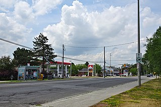
Hazeldean Road is a major road in Ottawa's west end. This road runs between the junction of Highway 7 west of Stittsville and Eagleson Road in Kanata, where it becomes Robertson Road east of the intersection and proceeds towards Bells Corners in the former city of Nepean, Ontario as a four-lane rural route through the Greenbelt.
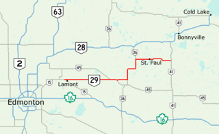
Highway 29 is a 153-kilometre (95 mi) highway in east–central Alberta, Canada that connects Highway 15 near Lamont to Highway 41 north of Elk Point. It runs mostly west to east across aspen parkland through Hairy Hill, turning north through Duvernay, Brosseau, Foisy, St. Brides, and east to St. Paul before ending at Highway 41 approximately 9 km (5.6 mi) north of Elk Point, concurrent with Highways 36 and 45 for lengthy sections.

State Route 191 is a 24.02 miles (38.66 km) north-south secondary state highway in Benton County, Tennessee.

Groat Road is a major roadway in Edmonton, Alberta. It is named after Malcolm Groat, a former Hudson's Bay Company employee who settled in the present-day Groat Estates area in the 1880s. Groat Road is part of a 40-kilometre-long (25 mi) continuous roadway that runs through Sherwood Park, Edmonton, and St. Albert that includes Wye Road, Sherwood Park Freeway, Whyte Avenue, portions of University Avenue and Saskatchewan Drive, and St. Albert Trail. Groat Road functions as a grade-separated parkway between 87 Avenue and 111 Avenue.

Alberta Provincial Highway No. 563, commonly referred to as Highway 563, is a short highway in the province of Alberta, Canada. It runs mostly west-east from Highway 1 exit 172 at Range Road 31 to Calgary city limits at Range Road 24. It is known as Old Banff Coach Road for its entire length, and unlike other provincial highways, has a speed limit of only 50 km/h (31 mph) outside of Calgary.
Highway 57 and Provincial Trunk Highway 57 are two short highways in the Canadian provinces of Saskatchewan and Manitoba.
