| Number | Names | Western/Southern Terminus | Eastern/Northern Terminus | Major Communities | Geographical Township / Region | Notes |
|---|
| 2 | Donnelly Drive | Ottawa/Lanark County Border | Ottawa Road 5 (Donnelly Drive [north], Merlyn Wilson Road [south]) | Burritts Rapids | Marlborough | Continues west as Lanark County Road 2. |
| 3 | Dwyer Hill Road, Upper Dwyer Hill Road | Ottawa Road 2 (Donnelly Drive) | Ottawa Road 22 (Galetta Side Road) | Burritts Rapids, Dwyer Hill, Panmure | Marlborough, Goulbourn, Huntley, Fitzroy | |
| 4 | Dalmeny Road, Marvelville Road | Ottawa Road 19 (River Road) | Ottawa Road 41 (Gregoire Road) | Dalmeny, Marvelville | Osgoode | Originally continued west along Gordon Murdock Road, Osgoode Main Street, Nixon Drive, and Roger Stevens Drive to the Ottawa/Lanark County Border and didn't include the portion of Dalmeny Road west of Gordon Murdock Road. The current routing was established around 1982, with the Roger Stevens Drive portion (and part of Nixon Drive) being replaced by Ottawa-Carleton Regional Road 6 (now Ottawa Road 6) and the portion from Ottawa Road 6 (Snake Island Road) to Dalmeny Road being removed from the network. Osgoode Main Street would become Ottawa-Carleton Regional Road 114 (now Ottawa Road 114) around 1992. Ottawa Road 4 would only be extended easterly to Ottawa Road 41 when it was created (previously ending at Regional Road 29 (Yorks Corners Rd)). |
| 5 | Merlyn Wilson Road, Donnelly Drive, Fourth Line Road, Century Road West, McBean Street, Perth Street, Huntley Road, Stittsville Main Street, Carp Road, Galetta Side Road, Harbour Road, Fitzroy Road, Canon Smith Road, Aylwin Road | Ottawa/Leeds & Grenville United Counties Border (Rideau River) | Ottawa Road 7 (Ferry Road) | North Gower,Richmond, Stittsville,Carp, Fitzroy Harbour | Marlborough, North Gower, Goulbourn, Huntley, Fitzroy | Continues south as Leeds & Grenville United Counties Road 44. Formerly ran along Malakoff Road and Roger Stevens Drive between Becketts Landing and North Gower. Around 1982, the portion south of North Gower was removed. The current routing was established around 1998. |
| 5A | Stittsville Main Street | Ottawa Road 5 (Carp Road) | Ottawa Road 36 (Hazeldean Road) | Stittsville | Goulbourn | Not signed. |
| 6 | Roger Stevens Drive, Nixon Drive, Snake Island Road, Victoria Street | Ottawa/Lanark County Border | Ottawa Road 41 (Gregoire Road (south), Boundary Road (north)) / Ottawa/Prescott & Russell United Counties Border | Malakoff, North Gower, Kars, Metcalfe | Marlborough, North Gower, Osgoode | Continues west as Lanark County Road 4 and east as Prescott & Russell United Counties Road 3. Originally ended at Nixon Drive in the west, while the current route west of this point was part of Ottawa-Carleton Regional Road 4 (now Ottawa Road 4). The current routing was established around 1982. |
| 6A | Cartwright Road | Ottawa Road 6 (Victoria Street) | Ottawa Road 41 (Boundary Road) | | Osgoode | |
| 7 | Ferry Road | Ottawa Road 22 (Galetta Side Road) | Toll ferry to Quyon, Quebec | | Fitzroy | |
| 8 | Brophy Drive, Bankfield Road, Manotick Main Street, Bridge Street, Mitch Owens Road, Boundary Road, Devine Road, Rockdale Road, Russland Road, Saumure Road | Ottawa Road 49 (Eagleson Road) | Ottawa Road 37 (Saumure Road) / Ottawa/Prescott & Russell United Counties Border | Manotick, Manotick Station, Greely, South Gloucester, Edwards, Vars | Nepean, North Gower, Osgoode, Gloucester, Cumberland | Originally ended at Vars in the east |
| 9 | Dunrobin Road | Ottawa Road 49 (March Road) | Ottawa Road 22 (Galetta Side Road) | Dunrobin, Malwood | March, Torbolton | |
| 10 | Franktown Road, Perth Street | Ottawa/Lanark County Border | Ottawa Road 49 (Eagleson Road) | Richmond | Goulbourn | Continues west as Lanark County Road 10. Ottawa Road 10 originally followed Old Richmond Road and Moodie Drive up to Carling Avenue. The portion south of Ottawa Road 86 (Hope Side Road) has been replaced by Ottawa Road 59 since around 1984. The portion between Ottawa Road 86 (Hope Side Road) and Ottawa Road 12 (Fallowfield Road) was replaced by Ottawa Road 59 around 1998. Ottawa Road 10 was shortened to end at Ottawa Road 49 (Eagleson Road) at the same time. |
| 11 | Moodie Drive | Ottawa Road 8 (Brophy Drive) | Ottawa Road 32 (West Hunt Club Road) | | Nepean | Originally continued north to Regional Road 10 (Richmond Road, now Ottawa Road 59 (Old Richmond Road)). |
| 12 | Fallowfield Road | Ottawa Road 3 (Dwyer Hill Road) | Ottawa Road 73 (Prince of Wales Drive) | Fallowfield, Barrhaven | Goulbourn, Nepean | Originally ran along Flewellyn Road west of Ottawa-Carleton Regional Road 5 (Huntley Road, now Ottawa Road 5) to Ashton and the Ottawa/Lanark County border. The current routing was established in around 1992. |
| 13 | Dilworth Road, Rideau Valley Drive South, Roger Stevens Drive, Rideau Valley Drive North, Manotick Main Street, Rideau Valley Drive, Longfields Drive, Jockvale Road, Greenbank Road, Pinecrest Road | Ottawa Road 5 (Fourth Line Road) | Ottawa Road 38 (Carling Avenue) | Nepean, Barrhaven, Manotick, Kars | North Gower, Nepean | Formerly continued along the current Ottawa Road 5 path to Grenville County, until Highway 16 was downloaded to the City of Ottawa in 1998. |
| 14 | Leitrim Road | Ottawa Road 19 (River Road) | Ottawa Road 26 (Russell Road) | Leitrim | Gloucester | |
| 15 | Woodroffe Avenue, Fairlawn Avenue, Lenester Avenue | Ottawa Road 73 (Prince of Wales Drive) | Kichi Zibi Mikan | Nepean, Barrhaven | Nepean | Intersection with Prince of Wales Drive has been closed. Fairlawn Avenue and Lenester Avenue from Carling Avenue to Woodroffe Avenue helps form a rectangle with Woodroffe Ave and Carling Avenue. |
| 16 | Holly Acres Road, Richmond Road, Baseline Road, Heron Road | Ottawa Road 38 (Carling Avenue) | Ottawa Road 74 (Walkley Road) | Nepean, Ottawa | Nepean, Ottawa | |
| 17 | Merivale Road, Clyde Avenue, Maitland Avenue | Ottawa Road 73 (Prince of Wales Drive) | Ottawa Road 38 (Carling Avenue) | Nepean, Ottawa | Nepean | Originally continued north along Merivale Road past Clyde Avenue |
| 19 | River Road, Riverside Drive, Vanier Parkway | Ottawa/Leeds & Grenville United Counties Border | Ottawa Road 44 (Beechwood Avenue) | Manotick, Riverside South, Ottawa, Vanier | Osgoode, Gloucester, Ottawa | Continues south as Leeds & Grenville United Counties Road 19. |
| 20 | Kinburn Side Road | Ottawa/Lanark County Border | Ottawa Road 9 (Dunrobin Road) | Antrim, Kinburn, Woodlawn | Fitzroy, Torbolton | Continues west as Lanark County Road 20 |
| 21 | Sixth Line Road, Torwood Drive | Ottawa Road 109 (Cameron Harvey Drive) | Ottawa Road 129 (Vances Side Road) | | Torbolton | |
| 22 | Galetta Side Road | Ottawa Road 29 | Ottawa Road 9 (Dunrobin Road) | Galetta, Dirleton | Fitzroy, Torbolton | Continues west as Lanark County Road 22. |
| 23 | Cedarview Road | Ottawa Road 12 (Fallowfield Road) | Ottawa Road 16 (Baseline Road) | Barrhaven, Nepean | Nepean | Formerly continued south of Ottawa Road 12 |
| 24 | Lester Road | Ottawa Road 25 (Albion Road) | Ottawa Road 31 (Bank Street) | Gloucester | Gloucester | |
| 25 | Stagecoach Road, Mitch Owens Road, Albion Road | Ottawa/Stormont, Dundas & Glengarry United Counties Border | Ottawa Road 24 (Lester Road) | Reids Mills, West Osgoode, Enniskerry, Greely, Gloucester | Osgoode, Gloucester | Continues south as Stormont, Dundas & Glengarry United Counties Road 1. Originally ended at Ottawa-Carleton Regional Road 4 (Dalmeny Road, now Ottawa Road 4) in the north and was extended to Ottawa-Carleton Regional Road 8 (Mitch Owens Road, now Ottawa Road 8) around 1982. |
| 26 | St. Laurent Boulevard, Ramsayville Road, Russell Road | Ottawa Road 44 (Hemlock Road) | Ottawa/Prescott & Russell United Counties Border | Rockcliffe Park, Vanier, Ottawa, Gloucester, Ramsayville, Carlsbad Springs, Bearbrook | Ottawa, Gloucester, Cumberland | Continues east as Prescott & Russell United Counties Road 2 |
| 27 | 8th Line Road, Anderson Road, Blair Road | Ottawa Road 6 (Victoria Street) | Ottawa Road 34 (Montreal Road) | Metcalfe, Gloucester | Osgoode, Gloucester | Used to be numbered north beyond Ottawa Road 34 to Blair Road's northern dead-end. Originally terminated at Ottawa-Carleton Regional Road 8 (Mitch Owens Road, now Ottawa Road 8) in the north. Formerly ran along some portions of Ogilvie Road to the Aviation Parkway. |
| 28 | Bearbrook Road, Innes Road, Blackburn Hamlet Bypass, Navan Road, Colonial Road | Ottawa Road 34 (Montreal Road) | Ottawa/Prescott & Russell United Counties Border | Blackburn Hamlet, Orleans, Notre-Dame-des-Champs, Navan, Sarsfield | Gloucester, Cumberland | Continues on as Prescott & Russell United Counties Road 1 (du Golf Road). Concurrent with Ottawa Road 30 along Blackburn Hamlet Bypass. Innes Road and Blackburn Hamlet Bypass portions may no longer be numbered. |
| 29 | Ottawa Road 29 | Ottawa/Lanark County Border | Ottawa Road 117 (Madawaska Boulevard), Highway 17 | | Fitzroy | Continues south as Lanark County Road 29. Formerly part of Highway 15 (and before that, 29). |
| 30 | Industrial Avenue, Innes Road, Blackburn Hamlet Bypass | Ottawa Road 19 (Riverside Drive) | Ottawa Road 35 (Dunning Road) | Ottawa, Gloucester,Blackburn Hamlet, Orleans | Gloucester, Cumberland, Ottawa | Originally ran down Cyrville Road and passed through Blackburn along Innes Rd. Now bypasses the town via the Blackburn Hamlet Bypass. |
| 31 | Bank Street | Ottawa/Stormont, Dundas & Glengarry United Counties Border | Ottawa Road 34 (Wellington Street) | Vernon, Spring Hill, Greely, Leitrim, Ottawa | Gloucester, Osgoode, Ottawa | Continues south as Stormont, Dundas & Glengarry United Counties Road 31. Briefly known as Ottawa Road 85. Bank Street north of Heron Road was formerly Ottawa Road 85. Bank Street south of Heron Road was formerly Highway 31. |
| 32 | West Hunt Club Road, Hunt Club Road, Hawthorne Road | Ottawa Road 59 (Old Richmond Road) | Ottawa Road 26 (Russell Road) (Hawthorne Road) / Highway 417 (Hunt Club Road) | Nepean, Ottawa,Gloucester | Nepean, Gloucester | Splits into two at end (Hawthorne Road for access to Russell Road and Hunt Club Road for access to Highway 417). Numbered since around 1992. Replaced most of former Ottawa Road 52 (Knoxdale Road) around 1998 when the Hunt Club Road expansion was completed to Old Richmond Road. |
| 33 | Rockdale Road, Colonial Road, Frank Kenny Road | Ottawa/Prescott & Russell United Counties Border | Ottawa Road 30 (Innes Road) | Vars, Orleans | Cumberland | Continues south as Prescott & Russell United Counties Road 28 (St-Guillaume Road). Concurrent with Ottawa Road 28 along Colonial Road from Rockdale Road to Frank Kenny Road. |
| 34 | Wellington Street, Commissioner Street, Rideau Street, Montreal Road, St. Joseph Boulevard, Old Montreal Road | Ottawa Road 77 (Booth Street) | Ottawa Road 35 (Dunning Road) | Ottawa, Vanier, Gloucester, Orleans, Cumberland | Ottawa, Gloucester, Cumberland | Former route of Highway 17, also of Highway 17B west of Ottawa Road 174. Commissioner Street is Ottawa Road 34 only in extension (formerly part of Wellington Street). |
| 35 | Dunning Road, Old Montreal Road, Cameron Street | Ottawa Road 26 (Russell Road) | Ferry to Masson-Angers, Quebec | Bearbrook, Leonard, French Hill, Cumberland | Cumberland | The ferry connects to Chemin du Quai in Gatineau. |
| 36 | Hazeldean Road, Robertson Road, Richmond Road, Wellington Street West, Somerset Street West | Spruce Ridge Rd | Ottawa Road 91 (Elgin Street) | Stittsville, Kanata, Bells Corners, Nepean, Ottawa | Goulbourn,Nepean, Ottawa | Not signed east of Ottawa Road 59 (Moodie Drive). Formerly Highways 7 and 15 approaching Ottawa from the west. |
| 37 | Saumure Road | Ottawa Road 8 (Saumure Road) [west], Indian Creek Road [east] | Ottawa Road 26 (Russell Road) | | Cumberland | |
| 38 | Carling Avenue | Ottawa Road 49 (March Road) | Ottawa Road 79 (Bronson Avenue) | Kanata, Nepean, Ottawa | March, Kanata, Nepean, Ottawa | The section from Ottawa Road 36 (Richmond Road) to Ottawa Road 79 (Bronson Avenue) was part of Highway 17B prior to 1998. |
| 39 | Champlain Street | Ottawa Road 34 (St. Joseph Boulevard) | Ottawa Road 174 (Regional Road 174) | Orleans | Orleans | Intersection with Ottawa Rd 34 no longer exists. Road ends in Place d'Orleans Shopping Centre. Originally continued north to Champlain Street dead-end. |
| 40 | Scott Street, Albert Street, Slater Street | Ottawa Road 65 (Churchill Avenue North) | Ottawa Road 91 (Elgin Street) | Ottawa | Ottawa | One way eastbound. |
| 41 | Gregoire Road, Boundary Road, Mer Bleue Road | Marionville Road (south section); Ottawa Road 28 (Navan Road) (north section) | Ottawa Road 26 (Russell Road) (south section); Ottawa Road 30 (Innes Road) (north section) | Orleans, Cumberland | Cumberland | Boundary Road forms the boundary between the City of Ottawa and Prescott & Russell United Counties. Two sections, separated by the Mer Bleue Conservation Area. Only extended south to Marionville around 1992, from Ottawa Road 6 (Victoria St). |
| 42 | Albert Street | Slater Street | Ottawa Road 91 (Elgin Street) | Ottawa | Ottawa | One way westbound |
| 43 | Ramsayville Road | Ottawa Road 8 (Mitch Owens Road) | Ottawa Road 74 (Walkley Road) | Gloucester, Osgoode | Gloucester, Osgoode | |
| 44 | St. Patrick Street, Beechwood Avenue, Hemlock Road | Alexandra Bridge | Ottawa Road 26 (St. Laurent Boulevard) | Ottawa, Vanier, Rockcliffe Park | Ottawa | May have included Murray Street from King Edward Avenue to Alexandra Bridge in the past. |
| 45 | Munster Road | Ottawa Road 10 (Franktown Road) | Ottawa Road 12 (Fallowfield Road) | Munster, Goulbourn | Goulbourn | Originally continued north to Flewellyn Road while it was designated Ottawa-Carleton Regional Road 12 (now Ottawa Road 12). When this designation was changed to Fallowfield Road, Ottawa Road 45 was modified accordingly. |
| 46 | Thomas A. Dolan Parkway | Ottawa Road 5 (Carp Road) | Ottawa Road 9 (Dunrobin Road) | Dunrobin, Huntley, March | Huntley. March | |
| 47 | Tenth Line Road | Ottawa Road 28 (Navan Road) | Jeanne d'Arc Boulevard North | Burromee, Orleans, Cumberland | Cumberland | |
| 47A | Old Tenth Line Road | Ottawa Road 47 (Tenth Line Road) | Ottawa Road 34 (St. Joseph Boulevard) | Orleans | Orleans | In 1993, a small portion of Tenth Line Road was realigned near St. Joseph Boulevard. The re-alignment was placed slightly to the west. The old portion was kept and renamed Old Tenth Line Road which connects to a Highway 174 exit ramp. |
| 48 | Laurier Avenue West, Laurier Avenue East, Charlotte Street | Ottawa Road 79 (Bronson Avenue) | Ottawa Road 34 (Rideau Street) | Ottawa | Ottawa | |
| 49 | Eagleson Road, March Road | Ottawa Road 8 (Brophy Drive) | Ottawa/Lanark County Border | Richmond, Kanata, South March, Westwood, Carp, Corkery, March | Goulbourn, Huntley, March, Kanata | Continues west as Lanark County Road 49.
Was Highway 44 prior to April 1, 1997 from then-Highway 17 to Ottawa/Lanark County border.
March Road intersects Highway 417 at two separate interchanges. Ottawa Road 49 used to only include a portion from Ottawa Road 12 (Fallowfield Road) to Kanata. It was extended to include March Road to then-Highway 17 and south to Ottawa Road 8 (Brophy Drive) around 1984. |
| 50 | Coventry Road, Ogilvie Road | Ottawa Road 19 (Vanier Parkway) | Ottawa Road 34 (Montreal Road) | Ottawa, Gloucester | Gloucester, Ottawa | Possibly formerly partially part of Ottawa Road 27 |
| 51 | Meadowlands Drive West, Meadowlands Drive East, Hog's Back Road, Brookfield Road | Ottawa Road 15 (Woodroffe Avenue) | Ottawa Road 79 (Airport Parkway) | Nepean, Ottawa | Nepean, Ottawa | An east–west road with an odd number, against the convention. |
| 54 | Trail Road | Ottawa Road 11 (Moodie Drive) | Barnsdale Road | Nepean | Nepean | |
| 55 | Jeanne d'Arc Boulevard South | Ottawa Road 30 (Innes Road) | Ottawa Road 174 | Orleans | Orleans | |
| 56 | Orléans Boulevard | Ottawa Road 30 (Innes Road) | Ottawa Road 34 (St. Joseph Boulevard) | Orleans | Orleans | A mostly north-south road with an even number, against the convention |
| 57 | Trim Road | Ottawa Road 30 (Innes Road) | Ottawa Road 174 | Orleans | Orleans | Formerly Ottawa-Carleton Regional Road 31. This was changed around 1982 |
| 59 | Old Richmond Road, Moodie Drive | Ottawa Road 12 (Fallowfield Road) | Ottawa Road 38 (Carling Avenue) | Bells Corners, Fallowfield, Nepean | Nepean | |
| 60 | Catherine Street | Ottawa Road 79 (Bronson Avenue) | Ottawa Road 91 (Elgin Street) | Ottawa | Ottawa | One way westbound. The section from Ottawa Road 79 (Bronson Avenue) to Ottawa Road 87 (O'Connor Street) was part of Highway 17B prior to 1998 |
| 61 | Terry Fox Drive | Ottawa Road 36 (Hazeldean Road) | Campeau Drive | Kanata | Kanata | |
| 62 | Imperial Avenue, Chamberlain Avenue, Isabella Street | Ottawa Road 79 (Bronson Avenue) | Ottawa Road 91 (Elgin Street) | Ottawa | Ottawa | One way eastbound. The section from Ottawa Road 79 (Bronson Avenue) to Ottawa Road 83 (Kent Street) was part of Highway 17B prior to 1998 |
| 63 | Merivale Road | Ottawa Road 17 (Clyde Avenue) | Ottawa Road 38 (Carling Avenue) | Nepean, Ottawa | Nepean, Ottawa | Merivale Road south of Clyde Avenue is part of Ottawa Road 17 |
| 64 | Greenfield Avenue, Mann Avenue | Ottawa Road 72 (Main Street) | Chapel Street | Ottawa | Ottawa | |
| 65 | Churchill Avenue North | Ottawa Road 36 (Richmond Road) | Scott Street | Ottawa | Ottawa | |
| 66 | Lees Avenue | Ottawa Road 72 (Main Street) | Chapel Crescent | Ottawa | Ottawa | |
| 67 | Kirkwood Avenue | Ottawa Road 63 (Merivale Road) | Ottawa Road 36 (Richmond Road) | Ottawa | Ottawa | |
| 68 | North River Road, McArthur Avenue | Ottawa Road 34 (Montreal Road) | Ottawa Road 26 (St. Laurent Boulevard) | Vanier, Ottawa | Ottawa | |
| 69 | Fisher Avenue, Holland Avenue | Ottawa Road 73 (Prince of Wales Drive) | Scott Street | Nepean, Ottawa | Nepean, Ottawa | |
| 70 | Besserer Street | Ottawa Road 95 (Nicholas Street) | Cumberland Street | Ottawa | Ottawa | |
| 71 | Parkdale Avenue | Ottawa Road 38 (Carling Avenue) | Kichi Zibi Mikan | Ottawa | Ottawa | |
| 72 | Main Street, Smyth Road | Colonel By Drive | Ottawa Road 26 (St. Laurent Boulevard) | Ottawa | Ottawa | |
| 73 | Prince of Wales Drive, Preston Street | Ottawa Road 5 (Fourth Line Road) | Albert Street | North Gower, Manotick, Ottawa, Nepean | North Gower, Nepean, Ottawa | Much of this route was part of Highway 16 (originally the "Prescott Highway") prior to 1998 |
| 74 | Walkley Road | Ottawa Road 19 (Riverside Drive) | Ottawa Road 43 (Ramsayville Road) | Ottawa, Gloucester | Gloucester, Ottawa | |
| 75 | Rochester Street | Ottawa Road 38 (Carling Avenue) | Gladstone Avenue | Ottawa | Ottawa | |
| 76 | Commissioner Street | Ottawa Road 34 (Former route of Wellington Street (now an extension of Commissioner Street, near where Queen St would meet Commissioner if extended)) | Ottawa Road 79 (Bronson Avenue) / Ottawa Road 40 (Slater Street) | Ottawa | Ottawa | |
| 77 | Booth Street, Chaudière Crossing | Albert Street | Ontario/Quebec Border | Ottawa | Ottawa | |
| 78 | Boteler Street | Ottawa Road 93 (Sussex Drive) | Dalhousie St | Ottawa | Ottawa | |
| 79 | Airport Parkway, Bronson Avenue | Macdonald-Cartier International Airport | Ottawa Road 42 (Albert Street) | Ottawa | Ottawa | Airport Parkway is a controlled access Super two freeway that is scheduled to be upgraded to a four lane freeway from Brookfield Road to Ottawa Road 32 (Hunt Club Road). Used to split into two one-way streets at the north end (Commissioner Street (Southbound), Bronson Avenue (Northbound)). |
| 80 | Bayview Station Road, Bayswater Avenue | Scott Street | Ottawa Road 36 (Somerset Street West) | Ottawa | Ottawa | |
| 81 | Lyon Street North | Ottawa Road 60 (Catherine Street) | Ottawa Road 34 (Wellington Street) | Ottawa | Ottawa | One way southbound |
| 82 | Murray Street | Alexandra Bridge | Ottawa Road 99 (King Edward Avenue) | Ottawa | Ottawa | Mistakenly shown as Ottawa Road 44 on many maps |
| 83 | Kent Street | Ottawa Road 62 (Chamberlain Avenue) | Ottawa Road 34 (Wellington Street) | Ottawa | Ottawa | One way northbound. Was part of Highway 17B prior to 1998. |
| 84 | Place d'Orléans Drive | Ottawa Road 34 (St. Joseph Boulevard) | Ottawa Road 34 (St. Joseph Boulevard) | Orleans | Orleans | Crescent serving Place d'Orléans. |
| 85 | Milton Road | Ottawa Road 26 (Russell Road) | Ottawa Road 28 (Navan Road) | Cumberland | Cumberland | Some maps mislabel Bank Street as Ottawa Road 85, a former designation of Bank north of Heron Road that was briefly extended to all of Bank after the downloading of Highway 31, around 1998. Ottawa Road 85 was formerly Ottawa Road 31. |
| 86 | Hope Side Road | Ottawa Road 49 (Eagleson Road) | Ottawa Road 59 (Old Richmond Road) | Kanata | Kanata | |
| 87 | O'Connor Street | Ottawa Road 62 (Isabella Street) | Ottawa Road 34 (Wellington Street) | Ottawa | Ottawa | One way southbound. Was part of Highway 17B prior to 1998. |
| 88 | Huntmar Drive, Campeau Drive, Palladium Drive | Ottawa Road 88 (Palladium Drive) | Ottawa Road 61 (Terry Fox Drive) | Kanata | Kanata | Western section is a loop. |
| 89 | Metcalfe Street | Ottawa Road 62 (Isabella Street) | Ottawa Road 34 (Wellington Street) | Ottawa | Ottawa | One way northbound. |
| 91 | Hawthorne Avenue, Elgin Street | Ottawa Road 72 (Main Street) | Ottawa Road 34 (Wellington Street) | Ottawa | Ottawa | |
| 93 | Colonel By Drive, Mackenzie Avenue, Sussex Drive, Princess Avenue | Daly Avenue | Sir George-Étienne Cartier Parkway | Ottawa, Rockliffe Park | Ottawa | Mackenzie Avenue is only Ottawa Road 93 from Colonel By Drive to Ottawa Road 34 (Rideau Street). |
| 95 | Nicholas Street | Mann Avenue | Ottawa Road 34 (Rideau Street) | Ottawa | Ottawa | The section north of Laurier Avenue is one way southbound. |
| 97 | Waller Street | Mackenzie King Bridge | Ottawa Road 34 (Rideau Street) | Ottawa | Ottawa | |
| 99 | Lees Avenue, King Edward Avenue | Chapel Crescent | Sussex Drive | Ottawa | Ottawa | |
| 103 | Alta Vista Drive | Ottawa Road 72 (Smyth Road) | Ottawa Road 30 (Industrial Avenue) | Ottawa | Ottawa | |
| 105 | | | | | | Listed in official City of Ottawa registers, but its location is unknown. |
| 107 | Uplands Drive | Ottawa Road 79 (Airport Parkway) | Ottawa Road 32 (Hunt Club Drive) | Gloucester | Gloucester | |
| 109 | Cameron Harvey Drive | Ottawa Road 9 (Dunrobin Road) | Ottawa Road 21 (Sixth Line Road) | March | March | Formerly Riddell Drive. |
| 111 | Data Centre Road | Ottawa Road 16 (Heron Road) | Ottawa Road 19 (Riverside Drive) | Ottawa | Ottawa | |
| 113 | Mackenzie Avenue | Ottawa Road 34 (Rideau Street) | Ottawa Road 93 (Sussex Drive) / Ottawa Road 44 (St Patrick Street) | Ottawa | Ottawa | Mistakenly shown as part of Ottawa Road 93 on many maps. |
| 114 | Osgoode Main Street | Ottawa Road 19 (River Road) | Ottawa Road 25 (Stagecoach Road) | Osgoode | Osgoode | |
| 117 | Madawaska Boulevard | Ottawa Road 29, Highway 17 | Ottawa/Arnprior Border | Fitzroy | Fitzroy | Was part of Highway 17 prior to construction of Highway 417 bypass. A section from here south through Antrim almost to Grants Side Road is still officially part of Highway 17. Continues north as Renfrew County Road 1. Created by the downloading of Highway 7203 in 1998. |
| 125 | Conroy Road | Ottawa Road 31 (Bank Street) | Ottawa Road 74 (Walkley Road) | Gloucester, Ottawa | Gloucester, Ottawa | |
| 128 | Cyrville Road | Ottawa Road 26 (St. Laurent Boulevard) | Ottawa Road 30 (Innes Road) | Gloucester | Gloucester | Originally, Ottawa Road 128 was Innes Road west of Cyrville, while Ottawa Road 30 followed Cyrville. Used to run down Innes Road and Blackburn Hamlet Bypass to Innes Road. |
| 129 | Vances Side Road | Ottawa Road 9 (Dunrobin Road) | Ottawa Road 21 (Torwood Road) | | Torbolton | An east-west road with an odd number, against the convention. |
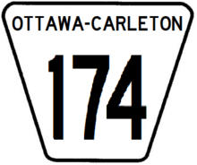
| 174 | Queensway, Ottawa Road 174, "Highway 174", or simply "The 174" | Highway 417 | Ottawa/Prescott & Russell United Counties Border | Orleans, Cumberland, Gloucester | Gloucester, Cumberland | Was Highway 17 prior to January 1, 1998. The Queensway name dates to the 1950s, before the construction of Highway 417, when this was part of the original freeway. Ottawa's highest numbered road and only municipally maintained controlled access freeway. Continues east as Prescott & Russell United Counties Road 17. |
|

