
Burlington is a city and lower-tier municipality in the Regional Municipality of Halton at the west end of Lake Ontario in Ontario, Canada. Located approximately halfway between Toronto and Niagara Falls, it is part of the Greater Toronto and Hamilton Area and Hamilton metropolitan census area.

Paris is a community located in the County of Brant, Ontario, Canada. It lies just northwest from the city of Brantford at the spot where the Nith River empties into the Grand River. Paris was voted "the Prettiest Little Town in Canada" by Harrowsmith Magazine. The town was established in 1850. In 1999, its town government was amalgamated into that of the County of Brant, ending 149 years as a separate incorporated municipality, with Paris as the largest population centre in the county.

The County of Brant is a single-tier municipality in the Canadian province of Ontario. Although it retains the word "county" in its name, the municipality is a single-tier municipal government and has no upper tier. The County of Brant has service offices in Burford, Paris, Oakland, Onondaga and St. George. The largest population centre is Paris.
A routenumber, designation or abbreviation is an identifying numeric designation assigned by a highway authority to a particular stretch of roadway to distinguish it from other routes and, in many cases, also to indicate its classification, general geographical location and/or orientation. The numbers chosen may be used solely for internal administrative purposes; however, in most cases they are also displayed on roadside signage and indicated on maps.

A county highway is a road in the United States and in the Canadian province of Ontario that is designated and/or maintained by the county highway department. Route numbering can be determined by each county alone, by mutual agreement among counties, or by a statewide pattern.
King's Highway 5, commonly referred to as Highway 5 and historically as the Dundas Highway and Governor's Road, is a provincially maintained highway in the Canadian province of Ontario. The east–west highway travels a distance of 12.7 km (7.9 mi) between Highway 8 at Peters Corners, north of Hamilton, and Highway 6 at Clappison's Corners. Prior to several sections being downloaded to the municipalities in which they were located, Highway 5 served as bypass to Highway 2, connecting with it in both Paris and Toronto, a distance of 114.3 km (71.0 mi).

New York State Route 249 (NY 249) is a 13.50-mile (21.73 km) long state highway located within Erie County, New York, in the United States. It runs east–west across southwestern Erie County from the shores of Lake Erie in the village of Farnham to the hamlet of Langford in the town of North Collins. The route was designated as NY 249 in the 1930 renumbering of state highways in New York from Farnham to the village of North Collins. By the next year, the route was extended to its current length.

New York State Route 438 (NY 438) is a north–south state highway located entirely in Erie County, New York, in the United States. Though signed as north–south, the route runs in an almost east–west direction for 11.78 miles (18.96 km) between Gowanda and Irving through the Cattaraugus Indian Reservation. The southern terminus of the route is at an intersection with U.S. Route 62 (US 62) and NY 39 in Gowanda. Its northern terminus is at a junction with US 20 and NY 5 in Irving. The route was assigned in the mid-1940s. Although it is signed as a state route, the state does not maintain any of the route.

The North Carolina Highway System consists of a vast network of Interstate, United States, and state highways, managed by the North Carolina Department of Transportation. North Carolina has the second largest state maintained highway network in the United States because all roads in North Carolina are maintained by either municipalities or the state. Since counties do not maintain roads, there is no such thing as a "county road" within the state.
King's Highway 24, commonly referred to as Highway 24, is a highway in the Canadian province of Ontario that currently begins at Highway 3 in Simcoe, and ends at the southern city limits of Cambridge. The south–north route travels through Brantford, as well as the community of Scotland. Outside of those communities, Highway 24 travels through a predominantly agricultural area.

Maryland Route 53 is a state highway in the U.S. state of Maryland. Known as Winchester Road, the state highway runs 3.33 miles (5.36 km) from U.S. Route 220 in Cresaptown north to US 40 Alternate in La Vale. MD 53 is the northernmost part of the Winchester Road, a colonial era road between Cumberland and Winchester, Virginia. The modern MD 53 was constructed in the mid-1920s and updated in the 1950s.
King's Highway 53, commonly referred to as Highway 53, was a provincially maintained highway in the southern portion of the Canadian province of Ontario that connected Woodstock to Hamilton via Brantford. The 76.5-kilometre (47.5 mi) route served as a southerly bypass to Highway 2, avoiding Paris, Ancaster and Hamilton. In addition to the previously mentioned cities, Highway 53 served the communities of Cathcart and Burford.
Cainsville is a community straddling the boundary of Brantford and Brant County in Ontario, Canada.
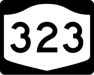
New York State Route 323 (NY 323) was a state highway in Erie County, New York, in the United States. The route was 5.24 miles (8.43 km) long and stretched from the town of Brant to the hamlet of Evans Center within the town of Evans. NY 323 began at an intersection with NY 249 and County Route 9 (CR 9) in Brant and headed north to a junction with NY 5 in Evans Center. In between, it passed over the New York State Thruway and intersected U.S. Route 20 (US 20).
Isle of Wight Wildlife Management Area is a state wildlife management area (WMA) of Maryland located on the Isle of Wight, a small peninsula between the St. Martin's River and Isle of Wight Bay in Worcester County. Although called Isle of Wight, a small strip of marsh and road connects it with the mainland.

Brant is a hamlet in southern Alberta, Canada within Vulcan County. It is located 6 kilometres (3.7 mi) south of Highway 23, approximately 71 kilometres (44 mi) southeast of Calgary. It is named after the number of Brant in the area. Brant is home to a grain elevator and a Christian School.
Highways are split into at least four different types of systems in the United States: Interstate Highways, U.S. Highways, state highways, and county highways. Highways are generally organized by a route number or letter. These designations are generally displayed along the route by means of a highway shield. Each system has its own unique shield design that will allow quick identification to which system the route belongs.
King's Highway 99, also known as Highway 99 or The Governor's Road, was a provincially maintained highway in the Canadian province of Ontario that connected Highway 24 north of Brantford with Highway 8 in Dundas, lying approximately midway between Highway 2 to the south and Highway 5. The Governor's Road, an important historical highway that is a part Dundas Street, continues west of Highway 24 to Woodstock and onwards to London. Highway 99 was first designated as Highway 5B in 1938, but was renumbered by 1940. The route was paved in 1953, but otherwise remained unchanged until the 1980s, when it was truncated at the Brant County – Hamilton-Wentworth boundary. The remainder of the route was decommissioned in 1997.
The 407 Transitway is a bus rapid transit system (BRT) being planned along Ontario Highway 407, spanning the Greater Toronto Area between Brant Street in Burlington, and Enfield Road in Durham Region.