| Route number [1] | Name(s) [1] | Western/Southern Terminus [1] | Eastern/Northern Terminus [1] | Communities [1] | Comments |
|---|
| (West) | Michener Road, Farr Avenue | Point Abino Road | Gorham Road | Ridgeway, Crystal Beach | Originally included Michener Road, Pleasant Beach Road, and Beach Road from RR 98 (Empire Road) to Point Abino Road; remainder downloaded in 2012 [2] |
| Dominion Road | RR 116 (Gorham Road) | Lakeshore Road (Niagara Parkway) | Ridgeway, Crystal Beach, Fort Erie | Former Highway 3C |
| Caistorville Road | Indian Line (Haldimand County border; continues as Haldimand Road 2) | RR 65 (Silver Street) | Caistorville | |
 | Niagara Regional Road 3 |
(West) | Lakeshore Road, Station Road, Wainfleet Concession Road 1 | Haldimand County border (continues as Haldimand Road 3) | Highway 3 | Willow Bay, Long Beach | |
| Niagara Regional Road 3 |
(Centre) | Main Street | Highway 3 at Port Colborne/Wainfleet boundary | Intersection of Highway 3 and Highway 140 | Port Colborne | Former Highway 3 |
| Niagara Regional Road 3 |
| Garrison Road | Highway 3 and Rosehill Road | RR 124 (Central Avenue) | Fort Erie | Former Highway 3 |
| Mellanby Avenue, Welland Street | RR 3 (Main Street) west of Bridge 19 of Welland Canal | RR 3 (Main Street) east of Bridge 19 | Port Colborne, Ontario | Mellanby Avenue formerly RR 503, Welland Street former part of RR 68 (South) |
| Wellandport Road | Highway 3 | RR 27 (Riverside Road) | Wellandport | Formerly RR 20 before download of Highway 20 |
 | Niagara Regional Road 5 |
(West) | Killaly Street West | Highway 3 | RR 3A (Mellanby Avenue) | Port Colborne | Downloaded 2002, then uploaded back to the Region in 2008 |
| Niagara Regional Road 5 |
(East) | Killaly Street East | RR 68 (Welland Street) | Highway 3 | Port Colborne, Gasline | Downloaded after 2002 |
| Caistor Centre Road, Twenty Road, South Grimsby Road 15 | RR 65 (Bismark Road) | Former Highway 20, now RR 20 | Caistor Centre | Downloaded after 2002 |
| Marshagan Road | Haldimand County border (continues as Haldimand Road 7) | RR 45 (Creek Road) | Dunnville (via Haldimand Road 7) | Originally numbered RR 545 in original 1969 regional road plan, renumbered later [3] |
| Grassie Road, Woolverton Road | Former Highway 20 (now RR 20) | RR 79 (Ridge Road) | Grassie | Downloaded after 2002 |
| York Road | Haldimand County border (continues as Haldimand Road 9) | RR 2 (Caistorville Road) | Empire Corners, York (via Haldimand Road 9) | Originally numbered RR 502 in original 1969 regional road plan, renumbered later [3] |
 | Niagara Regional Road 10 |
| Casablanca Boulevard | RR 81 (Main Street) | RR 39 (North Service Road West) | Grimsby | |
| Erie Road | Point Abino Road | Ridgeway Road | Bay Beach, Crystal Beach | Downloaded after 2002 |
 | Niagara Regional Road 12 |
| Grimsby Road, Mountain Road, Mountain Street, Christie Street | RR 20 (Former Highway 20) | Olive Street | Grimsby | |
 | Niagara Regional Road 14 |
(South) | Smithville Road, Townline Road, Canborough Street, Griffin Street South | Haldimand County border (continues as Haldimand Road 14) | RR 20 (Former Highway 20) | Caistor Corners, Smithville | |
| Niagara Regional Road 14 |
(Centre) | Station Street, Thirty Road | RR 20 (Former Highway 20) | RR 73 (Mud Street East) | Smithville | Originally included Thirty Road north of RR 73, Ridge Road East and Park Road to RR 81 (Main Street East) downloaded after 2002 |
| Niagara Regional Road 14 |
(North) | Bartlett Avenue | RR 81 (Main Street East) | Lake Street | Grimsby | |
| (Original) | Garrison Road | Highway 3 at RR 126 (Concession St) | RR 124 (Centre St) | Fort Erie | Part of original 1969 regional road grid, renumbered as eastern part of RR 3 sometime later [3] |
| Robinson Road | Haldimand County border (continues as Haldimand Road 15) | RR 63 (Canborough Road) | Dunnville (via Haldimand Road 15) | Originally numbered RR 563 in original 1969 regional road plan, renumbered later |
| Port Davidson Road | RR 63 (Canborough Road) | RR 14 (Twenty Road) | Port Davidson, Smithville | Downloaded after 2002 |
 | Niagara Regional Road 17 |
| Bertie Street | Queen Elizabeth Way | Niagara Parkway | Fort Erie | Downloaded after 2002 |
 | Niagara Regional Road 18 |
| Mountain Road, Ontario Street | RR 73 (Fly Road) | RR 39 (North Service Road) | Beamsville | Once extended south on Mountain Road and Beamsville Road to RR 69 (Twenty Mile Creek Road) |
 | Niagara Regional Road 19 |
| Gilmore Road | Queen Elizabeth Way | Niagara Parkway | Fort Erie | |
 | Niagara Regional Road 20 |
(West) | Highway 20, West Street, Griffin Street North. St. Catharines Street, Highway 20, Bismark Road, Canboro Road | Hamilton border (continues as Hamilton Road 20) | Intersection of Highway 58 and Highway 20 | Smithville, Fonthill, Allanburg | Former Highway 20. Offers a scenic route in comparison to the Queen Elizabeth Way. Concurrent with Highway 58 between Highway 406 and Centre Street. |
| Niagara Regional Road 20 |
(East) | Lundy's Lane, Ferry Street | Intersection of Highway 20 and RR 70 (Thorold Townline Road) | RR 102 (Stanley Avenue) | Niagara Falls | Former part of RR 51, renumbered after downloading of Highway 20 |
 | Niagara Regional Road 21 |
| Bowen Road, Philips Street | RR 116 (Stevensville Road) | Niagara Parkway | Stevensville, Fort Erie | |
 | Niagara Regional Road 22 |
(South) | Campden Road | RR 69 (Twenty Mile Creek Road) | RR 73 (Fly Road) | Campden | Downloaded after 2002 |
| Niagara Regional Road 22 |
(North) | Merritt Road | RR 81 (King Street) | South Service Road | Lincoln | Downloaded before 2002 |
 | Niagara Regional Road 23 |
| Forks Road | Highway 3 and RR 24 (Vineland Townline Road) | Highway 58 | Originally extended to RR 68 (Kingsway) in Dain City |
 | Niagara Regional Road 24 |
| Vineland Townline Road, Victoria Avenue | Highway 3 and RR 23 (Forks Road) | RR 39 (North Service Road) | Chambers Corners, Vineland | Part of route between Highway 3 and RR 27 was formerly a portion of Highway 3A |
 | Niagara Regional Road 25 |
| Netherby Road | RR 84 (Doan's Ridge Road) | Niagara Parkway | Welland, Netherby, Snyder | |
 | Niagara Regional Road 26 |
| Jordan Road | RR 81 (King Street) | RR 39 (North Service Road) | Jordan | |
| Wellandport Road, "Regional Road 27" (formerly River Road), Riverside Drive, West Main Street, East Main Street, Shisler Road | RR 20 (Former Highway 20) and RR 65 (Bismark Road) | RR 98 (Montrose Road) | Bismark, Wellandport, Welland | Section between RR 24 (Vineland Townline Road) and RR 54 (Prince Charles Drive) was formerly a portion of Highway 3A. Section between RR 20 and RR 24 was formerly Highway 57 |
| (South) | Balfour Road, Metler Road, Cream Street, Sixteen Road, Effingham Street | RR 63 (Canborough Road) | RR 69 (Pelham Road) | Fenwick, North Pelham | Downloaded after 2002 |
| (North) | Fifth Street Louth | RR 69 (Pelham Road) | RR 81 (St. Paul Street West) | St. Catharines | |
| Webber Road, Lincoln Street | RR 24 (Vineland Townline Road) | RR 54 (Prince Charles Drive) | Welland | Before 2002, continued east to RR 62 (Memorial Park Drive) |
| Lakeshore Road, Golf Course Road | RR 3 (Lakeshore Road at Station Road) | Highway 3 | Burnaby | Downloaded after 2002 |
| Broadway Avenue, Ontario Road | RR 27 (Riverside Drive) | RR 62 (Memorial Park Drive) | Welland | Downloaded after 2002 |
| Effingham Street | RR 20 (Former Highway 20) | RR 28 (Sixteen Road at Effingham Street) | Ridgeville, Effingham | Downloaded after 2002 |
| Humberstone Road | Feeder Road (Welland) | Highway 58, Highway 58A and RR 54 (Prince Charles Drive) | Welland | |
| (Old) | Humberstone Road | Highway 58A | RR 60 (Southworth Street) | Welland | Downloaded after 2002 |
 | Niagara Regional Road 34 |
| Seventh Street Louth | RR 81 (St. Paul Street West) | RR 87 (Lakeshore Road) | St. Catharines | |
| Dunn Street | RR 104 (Dorchester Road) | RR 102 (Stanley Avenue) | Niagara Falls | Downloaded after 2002 |
| South Pelham Road | RR 29 (Webber Road) | RR 41 (Woodlawn Road) | Welland, Fonthill | Originally extended to RR 20 via Pelham Street South (downloaded 2006) |
 | Niagara Regional Road 37 |
| Merritt Road | RR 50 (Merrittville Highway) | Highway 406 | Welland | Former part of Highway 58 / Highway 406 concurrency |
| Niagara Regional Road 37 |
(Old) | Murray Street | RR 102 (Stanley Avenue) | Niagara Parkway | Niagara Falls | Downloaded after 2002 |
 | Niagara Regional Road 38 |
| Martindale Road | RR 77 (Fourth Avenue) and RR 72 (Louth Street) | RR 87 (Lakeshore Road) | St. Catharines | |
 | Niagara Regional Road 39 |
(West) | North Service Road | Hamilton border | Olive Street | Grimsby | |
| Niagara Regional Road 39 |
(East) | North Service Road | Grimsby-Lincoln border | Third Street Louth | Beamsville, St. Catharines | |
| Niagara Regional Road 39 |
(Old) | Clifton Hill | RR 51 (Victoria Avenue) | Niagara Parkway | Niagara Falls | Downloaded after 2002 |
| (West) | South Service Road | Hamilton border | RR 12 (Christie Street) | Grimsby | |
| (Centre) | South Service Road | Nelles Road North | Twenty-first Street Louth | Grimsby, Beamsville, Jordan Harbour | |
| (East) | Bayview Boulevard, South Service Road | Dead end at Jordan Harbour | RR 38 (Martindale Road) | Jordan Station, St. Catharines | |
| (Old) | Niagara Street | RR 27 (West Main Street) | Then Highway 58 (Thorold Road at Niagara Street) | Welland | Renumbered to RR 50 after downloading of parts of Highway 58 in early 1970s |
 | Niagara Regional Road 41 |
(Original) | Queen Street | RR 51 (Victoria Avenue) | Niagara Parkway | Niagara Falls (downtown) | Part of original 1969 regional road grid, downloaded sometime later [3] |
| Niagara Regional Road 41 |
| Woodlawn Road | RR 36 (South Pelham Road) | Highway 406 | Welland | Section Between Seaway Dr. and Highway 406 formerly unsigned Highway 7236 |
 | Niagara Regional Road 42 |
| Ontario Street | RR 91 (Westchester Avenue) and RR 81 (St. Paul Street/St. Paul Street West) | RR 87 (Lakeshore Road) and RR 44 (Lakeport Road) | St. Catharines | |
 | Niagara Regional Road 43 |
| Bridge Street | RR 102 (Stanley Avenue) | Niagara Parkway at the Whirlpool Rapids Bridge | Niagara Falls | |
 | Niagara Regional Road 44 |
| Lake Street, Lakeport Road | Queen Elizabeth Way (Exit 46) | RR 87 (Lakeshore Road at Lakeport Road) and RR 42 (Ontario Street) | Port Dalhousie, St. Catharines | Downloaded after 2002 |
| Creek Road | RR 63 (Canborough Road) | RR 27 (Riverside Road) | Wellandport | |
 | Niagara Regional Road 46 |
| Geneva Street | Interchange with Highway 406 and RR 91 (Westchester Avenue) | RR 581 (Church Street) | St. Catharines | Originally extended north to RR 87 (Lakeshore Road) |
 | Niagara Regional Road 47 |
| Lyons Creek Road | RR 98 (Montrose Road) | RR 116 (Sodom Road) | Chippawa | Once extended west on Biggar Road to RR 84 (Moyer Road) |
| Niagara Regional Road 47 |
(West) | Carl Road | RR 84 (Moyer Road) | RR 98 (Montrose Road) | Crowland Twp. | Rerouted along Biggar Road before 1983 |
 | Niagara Regional Road 48 |
| Niagara Street | Interchange with Highway 406, RR 46 (Geneva Street) and RR 91 (Westchester Avenue) | RR 87 (Lakeshore Road) | St. Catharines | |
 | Niagara Regional Road 49 |
| McLeod Road, Marineland Parkway | Queen Elizabeth Way | RR 102 (Stanley Avenue) | Niagara Falls | Originally extended east to Portage Road then along Portage Road to RR 116 (Main Street); extended west to RR 70 (Thorold Townline Road) |
 | Niagara Regional Road 50 |
| Niagara Street, Merritville Highway, Glenridge Avenue | RR 27 (West Main Street) | RR 91 (Westchester Avenue) | Welland, Thorold, St. Catharines | |
| Lundy's Lane, Ferry Street, Victoria Avenue | Highway 20 and RR 70 (Thorold Townline Road) | Niagara Parkway | Niagara Falls | Renumbered as RR 20 west of RR 102 (Stanley Avenue), downloaded remainder after 2002 |
| Richmond Street, Ormond Street, Merritt Street, Hartzel Road, Bunting Road | RR 56 (Collier Road) | RR 87 (Lakeshore Road) | Thorold, Merritton, St. Catharines, Port Weller | Downloaded after 2002 |
 | Niagara Regional Road 53 |
| Niagara Falls Road, Beaverdams Road | RR 553 (Allanburg Road) | RR 20 (Lundy's Lane) | Thorold South, Niagara Falls | Downloaded after 2002 |
 | Niagara Regional Road 54 |
| Prince Charles Drive, Rice Road | Intersection of Highway 58, Highway 58A, and RR 33 (Humberstone Road) | RR 20 (Former Highway 20) | Welland, Fonthill | Section between RR 41 and RR 20 downloaded to local municipalities between 2002–2006 |
| (Original) | Richmond Street | RR 56 (Collier Road) | (Then) Highway 58 (Ormond St) | Thorold | Original part of 1969 regional road grid, later renumbered as part of RR 52 when Highway 58 along Ormond St was downloaded to the region [3] |
| Niagara Stone Road
Mississagua Street | RR 81 (Queenston Road) and RR 70 (Taylor Road) | RR 87 (Mary Street) | Homer, Virgil, Niagara-on-the-Lake | Former Highway 55 |
 | Niagara Regional Road 56 |
| Collier Road, Burleigh Hill Drive | RR 67 (Beaverdams Road) | RR 89 (Glendale Avenue) | Thorold, St. Catharines | Downloaded in 2002, then uploaded back to the Region in 2007 |
 | Niagara Regional Road 57 |
| Thorold Stone Road | RR 70 (Thorold Townline Road) east of Highway 58 | RR 102 (Stanley Avenue) | Thorold, Niagara Falls | |
| Homer Road | RR 89 (Glendale Avenue) | RR 70 (Taylor Road) | Niagara College Glendale Campus | Formerly known as Coon Road |
| Morrison Street | RR 104 (Dorchester Avenue) | Zimmerman Avenue | Niagara Falls | Downloaded after 2002 |
| Southworth Street, Crowland Avenue | RR 33 (Humberstone Road) | RR 27 (East Main Street) | Welland | Downloaded after 2002 |
 | Niagara Regional Road 61 |
| Townline Road, Portage Rd. | RR 100 (Four Mile Creek Road) | Niagara Parkway | St. David's, Queenston | Extended onto Portage Rd. After the removal of the 405 and Niagara Parkway interchange in 2006. |
| Memorial Park Drive, Wellington Street | RR 31 (Ontario Road) | RR 27 (East Main Street) | Welland | Downloaded after 2002 |
| (West) | Canborough Road | Haldimand County border (continues as Haldimand Road 63) | RR 24 (Vineland Townline Road) | Wellandport, Fenwick, Ridgeville, Fonthill | Originally extended east to RR 36 (Pelham Street South) via Church Hill |
| (Centre) | Port Robinson Road | RR 36 (Pelham Street South) | Highway 406 | Fonthill, Port Robinson | Downloaded after 2002. Originally extended across Bridge 12 of the Welland Canal until 1974 when bridge was destroyed. |
| (East) | Chippawa Creek Road | RR 82 (Allanport Road) | RR 98 (Montrose Road) | Port Robinson | Originally extended west across Bridge 12 of the Welland Canal until 1974 when bridge was destroyed. |
| Steele Street, Westside Road | RR 66 (Sugarloaf Street) | Highway 3 at Highway 58 | Port Colborne | Downloaded after 2002 |
| Bismark Road | Hamilton border (continues as Hamilton Road 65) | Intersection of RR 20 (Former Highway 20) and RR 27 (Former Highway 57) | Bismark | |
| Sugarloaf Street, King Street | RR 64 (Steele Street) | RR 3 (Main Street West) | Port Colborne | Downloaded after 2002 |
 | Niagara Regional Road 67 |
| Beverdams Road, Pine Street | RR 50 (Merrittville Highway) | Highway 58 | Thorold | Originally extended north to RR 52 (Richmond Street) |
| King Street | RR 527 (Division Street) | RR 27 (East Main Street) | Welland | Originally included King Street down to RR 31 (Ontario Street), plus Canal Bank Street & Kingsway from RR 31 to RR 23 (Forks Road). Remainder downloaded after 2002. |
| (South) | Clarence Street, Welland Street | RR 64 (Steele Street) | RR 3 (Main Street East) | Port Colborne | Downloaded after 2002. Part of road currently part of RR 3A. |
| Twenty Mile Creek Road, Twenty Road, Pelham Road, | RR 20 (Former Highway 20) | Intersection with RR 89 (Glendale Avenue) | St. Ann's, St. Catharines | Originally extended east to RR 81 (St. Paul Street West) |
 | Niagara Regional Road 70 |
| Taylor Road, Thorold Townline Road | RR 63 (Chippawa Creek Road) | Intersection of RR 81 (Queenston Road) and RR 55 (Niagara Stone Road) | Homer | |
 | Niagara Regional Road 71 |
| Sir Isaac Brock Way (formerly St. David's Road) [4] | RR 50 (Merrittville Highway at Glenridge Avenue) | Highway 406 | Brock University area of St. Catharines | Originally extended east to RR 52 (Ormond Street) |
| Louth Street | RR 69 (Pelham Road) | RR 77 (Fourth Avenue) and RR 38 (Martindale Road) | St. Catharines | |
| Mud Street, Fly Road | Hamilton border (once continued as Hamilton-Wentworth Road 411) | RR 24 (Victoria Avenue) | Grassie, Grimsby Centre, Campden | |
| Twenty-First Street Louth, Sixth Avenue Louth | RR 669 (Eighth Avenue Louth) | RR 24 (Victoria Avenue) | Balls Falls | Downloaded before 2006 |
 | Niagara Regional Road 77 |
| Fourth Avenue, Welland Avenue | RR 26 (Jordan Road) | Queen Elizabeth Way | Jordan, St. Catharines | Originally extended east to RR 52 (Bunting Road) |
| Chippawa Road, Humberstone Concession 2 | RR 3 (Main Street) | RR 68 (Welland Street) | Port Colborne | Part of original 1969 regional road grid, downloaded sometime later [3] |
| Ridge Road | Hamilton border (once continued as Hamilton-Wentworth Road 425) | RR 14 (Park Road) | Grimsby | Downloaded after 2002 |
| Elm Street | RR 66 (Sugarloaf Street) | RR 23 (Forks Road) | Port Colborne, Dain City | Downloaded after 2002 |
| Main Street East, Main Street West, King Street, St. Paul Street, Queenston Street, York Road | Hamilton Boundary (Continues as Hamilton Road 8) | Niagara Parkway | Grimsby, Beamsville, Vineland, Jordan, St. Catharines, Homer, St. David's, Queenston | Former Highway 8 & Highway 8A. Includes part of original QEW alignment built before the Garden City Skyway was constructed. Portion between Regional Road 42 and Regional Road 91 downloaded after 2002. |
 | Niagara Regional Road 82 |
| Allanport Road | RR 63 (Chippawa Creek Road) | Highway 20, Highway 58 and RR 20 (Lundy's Lane) | Allanburg, Port Robinson | |
 | Niagara Regional Road 83 |
| Carlton Street, Carlton Road | RR 42 (Ontario Street) | RR 55 (Niagara Stone Road) | St Catharines | |
| Miller Road, Doan's Ridge Road, Moyer Road | Highway 3 | RR 63 (Chippawa Creek Road) | Gasline, Cook's Mills | Originally extended south to RR 5 (Killaly Street East). |
 | Niagara Regional Road 85 |
| East-West Line | RR 87 (Lakeshore Road) | Niagara Parkway | Virgil, Niagara-on-the-Lake | Downloaded after 2002 |
 | Niagara Regional Road 86 |
| Stewart Road | RR 55 (Niagara Stone Road) | RR 87 (Lakeshore Road) | Homer | |
 | Niagara Regional Road 87 |
| Lakeshore Road, Main Street, Lakeport Road, Lakeshore Road, Mary Street, King Street, Picton Street, Queen's Parade | RR 34 (Seventh Street Louth) | Niagara Parkway | Port Dalhousie, St. Catharines, Port Weller, Niagara-on-the-Lake | |
| Seaway Haulage Road | RR 83 (Carlton Road) | Read Road | St. Catharines | Only public open section of a former cargo haulage route to the east of the Welland Canal. |
 | Niagara Regional Road 89 |
| Glendale Avenue | RR 69 (Pelham Road) and RR 72 (Louth Street) | Queen Elizabeth Way, RR 81 (York Road) | St. Catharines, Merritton | |
| Airport Road | RR 81 (York Road) | RR 55 (Niagara Stone Road) | Niagara-on-the-Lake | Serves St. Catharines/Niagara District Airport |
 | Niagara Regional Road 91 |
| Westchester Avenue | RR 81 (St. Paul Street) | RR 81 (Queenston Road) | St. Catharines | Originally extended to RR 52 (Bunting Road) via Eastchester Avenue |
| Scott Street | RR 44 (Lake Street) | RR 52 (Bunting Road) | St. Catharines | Downloaded after 2002. |
| Linwell Road | RR 42 (Ontario Street) | RR 52 (Bunting Road) | St. Catharines | Downloaded after 2002. |
 | Niagara Regional Road 98 |
| Wilhelm Road, Forkes Road, Schihl Road, Montrose Road | Highway 3 | RR 101 (Mountain Road) | Niagara Falls | Originally extended south on Empire Rd. to RR1 (Beach Rd.) before 2002 downloading |
| Quaker Road | RR 36 (Pelham Street South) | RR 50 (Niagara Street) | Fonthill, Welland | Downloaded after 2002 |
 | Niagara Regional Road 100 |
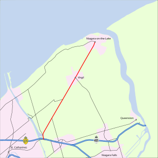
| Four Mile Creek Road | RR 101 (Mountain Road) | RR 55 (Niagara Stone Road) | Virgil, St. David's, Niagara Falls | Former Highway 8. Originally extended south to RR 49 (McLeod Road) and north to RR 87 (Lakeshore Road) |
 | Niagara Regional Road 101 |
| Mountain Road | RR 70 (Taylor Road) | RR 102 (Stanley Avenue) | Niagara Falls | |
 | Niagara Regional Road 102 |
| Stanley Avenue | RR 47 (Lyons Creek Road) | RR 61 (Townline Road) at Highway 405 | Niagara Falls | Passes by Marineland |
| Niagara Regional Road 104 |
| Dorchester Road | RR 49 (McLeod Road) | RR 101 (Mountain Road) | Niagara Falls | Downloaded after 2002 |
| Niagara Regional Road 106 |
| Niagara Concenssion 7 | RR 81 (York Road) | RR 55 (Niagara Stone Road) | Niagara-on-the-Lake | Downloaded after 2002 |
| Niagara Regional Road 108 |
| Portage Road, Main Street | RR 20 (Ferry Street) | RR 100 (Portage Road at Drummond Street) and RR 57 (Thorold Stone Road) | Niagara Falls | Downloaded after 2002 |
| Niagara Regional Road 112 |
| Point Abino Road | Michener Road | Highway 3 | | Originally extended north to RR 25 (Netherby Road) and south to RR 11 (Erie Road); remainder downloaded in 2012 [2] |
| Niagara Regional Road 114 |
| Niagara Concession 1 Road | RR 81 (York Road) | RR 85 (East-West Line) | Queenston, Niagara-on-the-Lake | Downloaded after 2002 |
 | Niagara Regional Road 116 |
| Gorham Road, Stevensville Road, Sodom Road | RR 1 (Dominion Road) | RR 47 (Lyons Creek Road) | Ridgeway, Stevensville, Chippawa | Originally extended south to RR 11 (Erie Road) and north along Main Street to Niagara Parkway at RR 49 (Marineland Parkway); portion between Farr Avenue and Dominion Road downloaded in 2012 [2] |
| Niagara Regional Road 118 |
| Pettit Road | Highway 3 | RR 19 (Gilmore Road) at Queen Elizabeth Way | Fort Erie | Downloaded after 2002 |
| Niagara Regional Road 118 |
(Old) | Graeber Avenue, Ridge Road South, Thunder Bay Road, Prospect Point Road | RR 116 (Ridgeway Road) | RR 1 (Dominion Road) | Crystal Beach, Ridgeway | Downloaded before 2002 |
| Niagara Regional Road 120 |
| Stonemill Road, Ridgemount Road | RR 1 (Dominion Road) | RR 21 (Bowen Road) | Fort Erie | Downloaded after 2002 |
 | Niagara Regional Road 122 |
| Thompson Road, Helena Street | RR 1 (Dominion Road) | RR 21 (Bowen Road at Phipps Street) | Fort Erie | |
 | Niagara Regional Road 124 |
| Central Avenue | Niagara Parkway south of RR 3 (Garrison Road) | Niagara Parkway north of RR 21 (Phipps Street) | Fort Erie | First exit (Toronto-bound on Queen Elizabeth Way) / Last Exit (Fort Erie/Buffalo-bound) |
 | Niagara Regional Road 126 |
| Concession Road | RR 3 (Garrison Road) | RR 19 (Gilmore Road) | Fort Erie | Downloaded after 2002 |
| Niagara Regional Road 140 |
| Elizabeth Street | RR 5 (Killaly Street East) | Highway 3 at Highway 140 | Port Colborne | Southern extension of Highway 140. Downloaded after 2002 |
| Niagara Regional Road 216 |
| Sixteen Road | RR 24 (Vineland Townline Road) | RR 28 (Cream Street at Sixteen Road) | North Pelham | Downloaded after 2002. Spur route of RR 28. |
| Roberts Street, Newman Hill, Falls Avenue | Highway 420 and RR 102 (Stanley Avenue) | Rainbow Bridge | Niagara Falls | Former part of Highway 420, connecting the QEW to the Rainbow Bridge |
| Niagara Regional Road 503 |
| Mellanby Avenue | RR 3 (Main Street) | RR 68 (Welland Street) | Port Colborne | Renumbered as part of RR 3A after 2002. |
| Niagara Regional Road 512 |
| Livingston Avenue | RR 10 (Casablanca Boulevard) | RR 81 (Main Street) | Grimsby | Spur of RR 81 |
| Niagara Regional Road 514 |
| Thirty Road | RR 14 (Thirty Road at Ridge Road) | RR 81 (King Street) | Beamsville | Spur of RR 14. Downloaded after 2002 |
 | Niagara Regional Road 525 |
| Townline Tunnel Road | Highway 58A | RR 25 (Netherby Road) east of RR 84 (Doan's Ridge Road) | Welland | Spur of RR 25 |
| Niagara Regional Road 527 |
| Division Street, Burger Street | RR 27 (West Main Street) and RR 50 (Niagara Street) | RR 27 (East Main Street) | Welland | Eastbound portion of one-way pair (along with RR 27) through downtown Welland |
| Niagara Regional Road 529 |
| River Road, Effingham Street | Welland-Port Colborne Airport | RR 29 (Webber Road) | Welland | Spur of RR 29. Connects to Niagara Central Airport |
| Niagara Regional Road 538 |
| Thorold Road | RR 36 (South Pelham Road) | RR 50 (Niagara Street) | Welland | Downloaded after 2002. |
| Niagara Regional Road 549 |
| Main Street, Bridgewater Street | RR 49 (Portage Road) at RR 116 (Main Street) | Niagara Parkway | Chippawa | One-way streets. Main St. northbound; Bridgewater St. southbound. Later renumbered as an extension of RR 116? |
| Niagara Regional Road 553 |
| Allanburg Road | Highway 58 | RR 53 (Niagara Falls Road) | Thorold South | Spur of RR 53. Downloaded after 2002 |
| Niagara Regional Road 569 |
| St. Ann's Road | RR 20 (Former Highway 20) | RR 69 (Twenty Mile Creek Road) | St. Ann's | Spur of RR 69. Downloaded after 2002 |
| Niagara Regional Road 575 |
| Glen Road, Nineteenth Street Louth | RR 75 (Twenty-First Street Louth) | RR 81 (King Street) | Balls Falls, Jordan | Spur of RR 75. Downloaded before 2002 |
| Niagara Regional Road 581 |
| Church Street | RR 48 (Geneva Street) | RR 46 (Niagara Street) | St. Catharines | Westbound portion of one-way pair (along with RR 81) through downtown St. Catharines. Originally extended west along Church Street and King Street to RR 42 (Ontario Street). |
| Niagara Regional Road 612 |
| Ontario Street | RR 81 (Main Street) | Queen Elizabeth Way | Grimsby | Spur of RR 14, originally part of 1969 regional road plan, downloaded later [3] |
| Niagara Regional Road 614 |
| Townline Road | RR 14 (Townline Road at Canborough Street) | RR 20 (Former Highway 20) | Smithville | Spur of RR 14 |
| Niagara Regional Road 627 |
| O'Reilly's Road | RR 27 (Riverside Road) | RR 529 (River Road) | Welland | Spur of RR 27. Connects to Niagara Central Airport |
| Niagara Regional Road 669 |
| Eighth Avenue Louth | RR 24 (Victoria Avenue) | RR 69 (Twenty Road) | | Spur of RR 69 |
| Niagara Regional Road 675 |
| Twenty-first Street Louth | RR 75 (Twenty-first Street Louth at Sixth Avenue Louth) | RR 575 (Glen Road) | Ball's Falls | Short spur route of RR 75. Downloaded before 2002 |
| Niagara Regional Road 681 |
| King Street, William Street | RR 42 (Ontario Street) | St. Paul Street | St. Catharines | Northbound portion of one-way pair (along with RR 42) through downtown St. Catharines. |
| Niagara Regional Road 714 |
| Park Road | RR 73 (Mud Street) | RR 79 (Ridge Road East) at RR 14 (Park Road) | Grimsby | Spur of RR 14. Downloaded after 2002 |
| Niagara Regional Road 801 |
| Brookfield Road | Highway 3 (Garrison Road) | RR 25 (Netherby Road) | Gasline, Port Colborne | Part of original 1969 regional road grid, downloaded sometime later [3] |
| Niagara Regional Road 802 |
| Point Abino Road | Highway 3 (Garrison Road) | RR 25 (Netherby Road) | | Part of original 1969 regional road grid, renumbered as part of RR 112 later [3] |
| Niagara Regional Road 803 |
| Ridge Road | Highway 140 | RR 84 (Doan's Ridge Road) | Welland, Cooks Mills | Part of original 1969 regional road grid, downloaded sometime later [3] |
| Former Route |