List of numbered roads in Chatham-Kent

Last updated

This article lists all of the numbered roads in Chatham-Kent, Ontario. Some older road signs (before 1998) still exist on roadsides that still say "Kent County", while newer ones say "C-K Road" instead. Since 2014, Chatham-Kent has re-rehabilitated its busier, former King's Highways to a better standard, and upgraded their speed limits in rural areas to 90 km/h from 80 km/h. [1] [2]

NumberNamesWestern/Southern TerminusEastern/Northern TerminusMajor CommunitiesComments
1Wheatley Road, Queen Street, Baptiste RoadDead end at a factory plant just south of Wheatley, Ontario CR 2 Wheatley, Tilbury Forms most of the border with Essex County (aside from a small diversion south of Essex County Road 8).
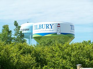
2Queen's Line, Richmond Street, Keil Drive, Grand Avenue, Longwoods, RoadCR 1 in Tilbury, Ontario (CK-Essex County Line)CR 121/Elgin County Road 7, just southeast of Bothwell, Ontario at the County Line Tilbury, Ontario, Chatham, Ontario, Thamesville, Ontario, Bothwell, Ontario Formerly Highway 2
3Talbot Trail, Chatham StreetCR 1 in Wheatley, Ontario at the Essex County LineElgin County Line Wheatley, Ontario, Blenheim, Ontario Morpeth, Ontario Formerly part of Highway 3
4Coatsworth RoadCR 3, just south of CoatsworthCR 1, south of Tilbury Coatsworth, Ontario
5King & Whittle Road, Goodreau Line, Stevenson RoadCR 3CR 1 in Tilbury, Ontario Stevenson, Ontario
6A.D. Shadd RoadCR 3 in Ouvry, Ontario CR 14 in North Buxton, Ontario North Buxton, Ontario, South Buxton, Ontario
7Merlin RoadCR 3, just east of Port Crewe, Ontario CR 36 in Prairie Siding, Ontario Merlin, Ontario
8Middle Line, Marlborough StreetCR 1, just south of TilburyIntersection with CR 3 and CR 11 in Blenheim, Ontario Tilbury, Ontario, Merlin, Ontario, Charing Cross, Ontario, Blenheim, Ontario Formerly Highway 98, turned back in 1970 after Highway 401 was completed.
9Scane RoadCR 19 just southwest of Ridgetown, Ontario CR 18
10Charing Cross Road, Queen StreetErie Beach, Ontario, just south of CR 3CR 45 (Indian Creek Road), Chatham, Ontario Chatham, Ontario, Charing Cross, Ontario, Erie Beach, Ontario
11Communication Road, Chatham Street, New Scotland LineCR 15 in New Scotland, Ontario Interchange of Highway 40/Highway 401 (Exit 90) Blenheim, Ontario, Shrewsbury, Ontario, New Scotland, Ontario Formerly southern part of Highway 40 (From Highway 401 to Highway 3/CR 3), turned back in 1998.
12Erieau Road, Mariner's RoadCR 3, 5 km south of Blenheim Erieau, Ontario Erieau, Ontario
14Port Road, 8th Line, Doyle Line, CReek Road, Garden Road, Pinehurst Line, McKay's LineCR 3 at Port Alma, Ontario CR 21 North Buxton, Ontario, Chatham, Ontario A spur, also named CR 14 leads north along Garden Road to Indian Creek Road (CR 45), continuing north on Creek Road before terminating at Park Avenue (CR 18). This may be an unsigned alternate route (which would normally be signed as 14A), but this is unknown.
15Base Line, Kent Bridge Road Highway 40 in Wallaceburg, Ontario Rondeau Provincial Park Entrance (Concurrent with CR 17) Wallaceburg, Ontario, Dresden, Ontario, Kent Bridge, Ontario, Rondeau Provincial Park One of the longest County Roads in Chatham-Kent, Ontario. From Highway 3 (CR 3) to Rondeau Prov. Park, it was also Highway 51, until it was turned back in 1998. Also has a spur of the same name (CR 15) leading along Dawn Mills Road (through Dawn Mills, Ontario), continuing in Lambton County as Lambton CR 15
16Cairo Road, Tower Road, Main Line, West Bothwell RoadCR 2 (Longwoods Road)Chatham-Kent/Lambton County Line (Continues as Lambton CR 79) Bothwell, Ontario Formerly a part of Highway 79
17Victoria Road, Main Street, Erie Street, Hill Road, Rose Beach Line Rondeau Provincial Park Entrance (Concurrent with CR 15)Intersection of CR 21-17 and Highway 401 (Exit 109) (Continues as C-K CR 21) Ridgetown, Ontario, Morpeth, Ontario, Rondeau Provincial Park Formerly part of Highway 21, turned back in 1998 south of Highway 402
18Park Avenue, Fairview Line, Fysh Line, Selton Line, Littlejohn RoadCR 27 (Bloomfield Road)CR 2 (Longwoods Road), 3 km south of Bothwell, Ontario Chatham, Ontario, Thamesville, Ontario, Bothwell, Ontario Not signed west of Highway 40, but signed as part of the EDR (Emergency Detour Route) for Highway 401, in the event that freeway is closed for any reason.
19Talbot Street, Ridge Line, Main StreetIntersection with CR 3 and CR 11 in BlenheimMacPherson Road (Elgin County Line (Continues as Elgin CR 104) Blenheim, Ontario, Ridgetown, Ontario, Highgate, Ontario Also had a spur until the late 1990s, CR 19A
19AFront LineIntersection of CR 19 and CR 17 in Ridgetown, Ontario (Continues as C-K CR 19)Kenesserie Road (Continues as C-K CR 19. Ridgetown, Ontario Now part of CR 19.
20Orford Road, King Street, Bury RoadCR 3CR 18 Highgate, Ontario
21Irish School Road, North Street, Community Road, Base Line, Industrial Road, Victoria Street, Victoria RoadIntersection of CR 21-17 and Highway 401 (Exit 109) (Continues as C-K CR 17)Chatham-Kent/Lambton County Line (Continues as Lambton CR 21) Dresden, Ontario, Thamesville, Ontario Formerly part of Highway 21. Parts south of Highway 402 were turned back in 1998
22Lambton Line, Cairo Road, Tower Road, Main Line, Main Street, Peter Street, Peter RoadCR 26/Lambton County Line in Florence, Ontario CR 2 (Longwoods Road), just south of Bothwell Florence, Ontario, Bothwell, Ontario Continues in Lambton County as Lambton CR 22 (Before looping back into Kent County, as CR 25). Has Dual-designation as C-K Road 22 and Lambton Road 22.
23Jane Road, Jane StreetCR 21 (Industrial Road)CR 22 (Lambton Line) Thamesville, Ontario
24Zone Center Line, Elm StreetCR 23CR 22 in Bothwell, Ontario Bothwell, Ontario
25Oakdale RoadCR 21Kent Line (road acting as Chatham-Kent/Lambton County Line) Croton, Ontario Continues as Lambton CR 22, looping back towards Florence, Ontario as C-K CR 22
26Florence RoadCR 21CR 22 Florence, Ontario Continues in Lambton County as Lambton CR 22
27Bloomfield RoadCR 3 (Talbot Trail)CR 36 (River View Line) Chatham, Ontario Signed as part of EDR (Emergency Detour Route)
28Tupperville Road, Center Side RoadCR 2 (Longwoods Road)CR 78 (McCreary Line), halfway between Dresden, Ontario and Wallaceburg, Ontario Tupperville, Ontario
29Countryview Line, Lindsay Road, Cedar Hedge Line, North Street, Croton LineHighway 40 at Oungah, Ontario CR 25 at Croton, Ontario Dresden, Ontario, Croton, Ontario Has a spur, CR 29A
29ACountryview LineIntersection of CR 28 and CR 29CR 15 Dresden, Ontario, Dawn Mills, Ontario Spur of CR 29
30Prince Albert RoadIntersection of Communication Road / Grand Avenue (Highway 40) and CR 2 (Longwoods Road)CR 29 (Countryview Line)Basically an extension of Communication Road
31Kimball RoadCR 78, just east of WallaceburgKent Line (Chatham-Kent/Lambton County Boundary) Wallaceburg, Ontario Continues in Lambton County as CR 31
32Techumseh Road Walpole Island/Walpole Island Indian Reservation CR 33 (Payne Road) Walpole Island Main access into Walpole Island
33Dufferin Avenue, Payne Road, St. Clair ParkwayWhitebread Line (Chatham-Kent/Lambton County Boundary)Highway 40 in Wallaceburg Walpole Island, Wallaceburg, Ontario Continues in Lambton County as the St. Clair Parkway (Lambton CR 33). Former alignment of Highway 40, turned back in sections: From Sombra to Walpole Island in 1980, and from Walpole Island to Wallaceburg in 1984.
34Grande River Line, Grand AvenueCR 35 (Jacob Road)CR 2 (Keil Drive) Chatham, Ontario, Prairie Siding, Ontario Also has a spur along Winter Line Road, travelling north-west through Paincourt, Ontario ("Pain Court, Ontario" on signs), terminating at CR 42 (Bay Line) east of Mitchell's Bay, Ontario.
35Jacob Road, Pain Court Line, St. Andrew's LineCR 36 (River View Line/Techumseh Line) in Prairie Siding, Ontario CR 28 in Eberts, Ontario Prairie Siding, Ontario, Paincourt, Ontario Has an operational signalized drawbridge across the Thames River
36Tecumseh Line, River View LineCR 1 (Baptiste Road) in Jeannette's Creek, Ontario CR 2 (Keil Drive) Jeannette's Creek, Ontario, Prairie Siding, Ontario, Chatham, Ontario Continues as Essex CR 2
37Rivard LineTown Line RoadCR 43
38Mull RoadCR 19CR 18
39Colborne Street, River LineHighway 40 (Communication Road)CR 15 (Kent Bridge Road) Chatham, Ontario, Kent Bridge, Ontario
40Freedom Road, Park StreetCR 15CR 21 Dresden, Ontario Freedom Road was called Uncle Tom's Road until mid-2022. [3]
42Bay Line, Electric Line, Oldfield Line Mitchell's Bay, Ontario CR 15 just south of Tupperville, Ontario Mitchell's Bay, Ontario, Electric, Ontario, Oldfield, Ontario Main road to Mitchell's Bay
43Bear Line RoadCR 34 (Grande River Line)CR 42 (Bay Line/Electric Line) Bearline, Ontario, Chatham, Ontario
44Mandaumin RoadCR 78 (McCreary Line)Kent Line (Chatham-Kent/Lambton County Boundary)Continues as Lambton CR 26
45Indian Creek RoadCR 10 (Charing Cross Road)CR 14 (Creek Road/Garden Road) Chatham, Ontario
78McCreary LineHighway 40CR 21 Wallaceburg, Ontario, Dresden, Ontario Formerly Highway 78, turned back in 1998.
121MacEwen Street, MacEwen Line, Clachan Road, Turin Line, Duart RoadCR 3 in Clearville, Ontario Bothwell, Ontario, Clachan, Ontario, Duart, Ontario, Clearville, Ontario Straddles the Chatham-Kent/Middlesex County and Elgin County Boundaries. Dual Designation of Elgin CR 7, and of Middlesex CR 14. Formerly numbered as CR 21 until Highway 21 was turned back.

Related Research Articles

<span class="mw-page-title-main">Dartford Crossing</span> Tunnel and bridge between Kent and Essex, UK

The Dartford–Thurrock River Crossing, commonly known as the Dartford Crossing and until 1991 the Dartford Tunnel, is a major road crossing of the River Thames in England, carrying the A282 road between Dartford in Kent in the south and Thurrock in Essex in the north.

<span class="mw-page-title-main">Trans-Canada Highway</span> Transcontinental highway system in Canada

The Trans-Canada Highway is a transcontinental federal–provincial highway system that travels through all ten provinces of Canada, from the Pacific Ocean on the west coast to the Atlantic Ocean on the east coast. The main route spans 7,476 km (4,645 mi) across the country, one of the longest routes of its type in the world. The highway system is recognizable by its distinctive white-on-green maple leaf route markers, although there are small variations in the markers in some provinces.

<span class="mw-page-title-main">Speed limit</span> Maximum legal speed of vehicles

Speed limits on road traffic, as used in most countries, set the legal maximum speed at which vehicles may travel on a given stretch of road. Speed limits are generally indicated on a traffic sign reflecting the maximum permitted speed, expressed as kilometres per hour (km/h) or miles per hour (mph) or both. Speed limits are commonly set by the legislative bodies of national or provincial governments and enforced by national or regional police and judicial authorities. Speed limits may also be variable, or in some places nonexistent, such as on most of the Autobahnen in Germany.

<span class="mw-page-title-main">Chatham-Kent</span> Municipality in Ontario, Canada

Chatham-Kent is a single-tier municipality in Southwestern Ontario, Canada. It is mostly rural, and its population centres are Chatham, Wallaceburg, Tilbury, Blenheim, Ridgetown, Wheatley and Dresden. The current Municipality of Chatham-Kent was created in 1998 by the amalgamation of Blenheim, Bothwell, Camden, the City of Chatham, the Township of Chatham, Dover, Dresden, Erie Beach, Erieau, Harwich, Highgate, Howard, Orford, Raleigh, Ridgetown, Duart, Thamesville, Tilbury East, Tilbury, Wallaceburg, Wheatley and Zone.

<span class="mw-page-title-main">Tilbury, Ontario</span> Unincorporated community in Ontario, Canada

Tilbury is a community within the municipality of Chatham-Kent, Ontario, Canada. It is located 26.5 kilometres (16.5 mi) southwest of Chatham-Kent and 57.3 kilometres (35.6 mi) east of Windsor on Highway 401.

Provincial Trunk Highway 1 is Manitoba's section of the Trans-Canada Highway. It is a heavily used, 4-lane divided highway, with the exception of a short 18 km section in the southeastern corner of the province. It is the main link between southern Manitoba's largest cities, and also serves as the province's main transportation link to the neighbouring provinces of Saskatchewan and Ontario. The highway is the only major east-west divided highway in Manitoba, and carries a large majority of east-west traffic within and through the province. It has full freeway status sections at Portage la Prairie and Winnipeg. The total distance of the Trans-Canada Highway in Manitoba is approximately 490 km (300 mi).

<span class="mw-page-title-main">Speed limits in the United States</span> Overview of the speed limits on roads in the United States

In the United States, speed limits are set by each state or territory. States have also allowed counties and municipalities to enact typically lower limits. Highway speed limits can range from an urban low of 25 mph (40 km/h) to a rural high of 85 mph (137 km/h). Speed limits are typically posted in increments of five miles per hour (8 km/h). Some states have lower limits for trucks, some also have night and/or minimum speed limits.

<span class="mw-page-title-main">Dresden, Ontario</span> Community in Ontario, Canada

Dresden is an agricultural community in southwestern Ontario, Canada, part of the municipality of Chatham-Kent. It is located on the Sydenham River. The community is named after Dresden, Germany. The major field crops in the area, by both acreage and production, are grain corn, soybean, and winter wheat. The main horticultural crop is tomatoes, followed by sweet corn and carrots.

<span class="mw-page-title-main">National Maximum Speed Law</span> Defunct U.S. federal highway legislation

The National Maximum Speed Limit (NMSL) was a provision of the federal government of the United States 1974 Emergency Highway Energy Conservation Act that effectively prohibited speed limits higher than 55 miles per hour (89 km/h). The limit was increased to 65 miles per hour (105 km/h) in 1987. It was drafted in response to oil price spikes and supply disruptions during the 1973 oil crisis. Even after fuel costs began to decrease over time the law would remain in place until 1995 as proponents claimed it reduced traffic fatalities.

<span class="mw-page-title-main">High-speed rail in Canada</span> Overview of the high-speed rail system in Canada

Several plans have been proposed for high-speed rail in Canada, the only G7 country that does not have any high-speed rail. In the press and popular discussion, there have been two routes frequently proposed as suitable for a high-speed rail corridor: Edmonton to Calgary via Red Deer and Windsor to Quebec City via London, Kitchener-Waterloo, Toronto, Ottawa and Montreal.

King's Highway 40, commonly referred to as Highway 40, is a provincially maintained highway in the southwestern portion of the Canadian province of Ontario. The 91.4-kilometre (56.8 mi) route links Chatham and Sarnia via Wallaceburg, following close to the St. Clair River. The southern terminus is at Highway 401 south of Chatham, while the northern terminus is at Highway 402 in Sarnia. The portion of Highway 40 between Highway 401 and north of Wallaceburg is within the municipality of Chatham-Kent, while the portion north of there is within Lambton County.

<span class="mw-page-title-main">Ion rapid transit</span> Rapid transit network in Waterloo Region, Ontario

Ion, stylized as ION, is an integrated public transportation network in the Regional Municipality of Waterloo in Ontario, Canada. It is operated by Keolis and is part of the Grand River Transit (GRT) system, partially replacing GRT's Route 200 iXpress bus service. The section of the bus route serving Cambridge has been renamed "Ion Bus", and renumbered as 302. The first phase commenced operations on June 21, 2019, between the north end of Waterloo and the south end of Kitchener. A future extension of light rail to the downtown Galt area of Cambridge is planned but construction may not begin on that line until 2028.

Vision Zero is a multi-national road traffic safety project that aims to achieve a roadway system with no fatalities or serious injuries involving road traffic. It started in Sweden and was approved by their parliament in October 1997. A core principle of the vision is that "Life and health can never be exchanged for other benefits within the society" rather than the more conventional comparison between costs and benefits, where a monetary value is placed on life and health, and then that value is used to decide how much money to spend on a road network towards the benefit of decreasing risk.

<span class="mw-page-title-main">Speed limits by country</span> Overview of speed limits in various countries

A speed limit is the limit of speed allowed by law for road vehicles, usually the maximum speed allowed. Occasionally, there is a minimum speed limit. Advisory speed limits also exist, which are recommended but not mandatory speeds. Speed limits are commonly set by the legislative bodies of national or local governments.

Canadian speed limits are set by different levels of government, depending on the jurisdiction under which the road falls, resulting in differences from province to province. The limits have been posted in kilometres per hour (km/h) since September 1, 1977. Before then, when Canada used Imperial units, speed limits were in miles per hour (mph).

30 km/h zones and the similar 20 mph zones are forms of speed management used across areas of urban roads in some jurisdictions. The nominal maximum speed limits in these zones are 30 kilometres per hour (19 mph) and 20 miles per hour (32 km/h) respectively. Although these zones do have the nominal speed limit posted, speeds are generally ensured by the use of traffic calming measures, though limits with signs and lines only are increasingly used in the UK.

<span class="mw-page-title-main">Hamilton LRT</span> Light rail line in Hamilton, Ontario, Canada

The Hamilton LRT is a planned light rail line in Hamilton, Ontario, Canada, to operate along Main Street, King Street, and Queenston Road. It is one of five planned rapid transit lines which form Hamilton's proposed BLAST network. The 14 km (8.7 mi), 17-stop route is planned to extend from McMaster University to Eastgate Square via downtown Hamilton.

<span class="mw-page-title-main">Jennifer Keesmaat</span> Canadian politician and urban planner (born 1970)

Jennifer Keesmaat is a Canadian urban planner who served as Chief City Planner of Toronto from 2012 to 2017 and the runner-up in the 2018 Toronto mayoral election to Mayor John Tory, where she only won 23.6% of the vote and lost to Tory in each of Toronto's 25 wards.

<span class="mw-page-title-main">2013 Ottawa bus–train crash</span>

The Ottawa bus–train crash was a collision that occurred between an OC Transpo double-decker bus and a Via Rail train in the Ottawa suburb of Barrhaven on September 18, 2013, that killed six people.

King's Highway 78, commonly referred to as Highway 78, was a provincially maintained highway in the Canadian province of Ontario. The 17.60-kilometre (10.94 mi) route connected Highway 40 in downtown Wallaceburg with Highway 21 in Dresden.

References

  1. "More roads to see speed limit hike | Chatham Daily News". Archived from the original on 2017-02-02. Retrieved 2017-01-30.
  2. "Council Minutes August 11, 2014: 90 km/h Speed Limits on Chatham-Kent Roadways (Phase 2)". Municipality of Chatham-Kent. 11 August 2014. pp. 37–46. Retrieved 4 January 2024.
  3. CBC News (21 June 2022). "Southwestern Ontario council renames Uncle Tom's Road over links to anti-Black racism". www.cbc.ca. CBC/Radio-Canada. Retrieved 4 January 2024.