List of numbered roads in the United Counties of Prescott and Russell

Last updated

This page lists all of the numbered county roads in United Counties of Prescott and Russell, Ontario.

NumberNamesWestern/Southern TerminusEastern/Northern TerminusMajor CommunitiesComments
1Du Golf Road, St. Pascal RoadCanaan Road (Boundary with the City of Ottawa. Continues as Ottawa Road 28)Dead end, near the city limits of the City of Clarence-Rockland St. Pascal Baylon, Ontario
2 Russell Road, Boudreau Road, Plantagenet Concession 8Canaan Road (Boundary with the City of Ottawa. Continues as Ottawa Road 26)CR 9 Bourget, Ontario
3Craig Street, Castor Street, Notre Dame Street, Rue Notre Dame (Notre Dame Road), Ouest Route 500 (Route 500 West), Rue Principale (Principal Street), Chemin St. Isidore (St. Isidore Road), Route 600 East, Concession Road 18CR 5 (Grove Lane, Boundary with the City of Ottawa. Continues as Ottawa Road 6)CR 9 Russell, Ontario, Embrun, Ontario, Casselman, Ontario, Ste-Rose-de-Prescott, Ontario, St. Isidore de Prescott, Ontario
4Main Street, Front RoadCR 17Interchange with Highway 417 and CR 14 (Exit 5) Hawkesbury, Ontario Even older alignment leads off into the Ottawa River towards Pointe-Fortune, Quebec, having since been flooded by the Carillon hydroelectric dam project in the late 1950s.
5Russland Road, Finch Concession 10-11 Road (intersection at the boundary of Stormont, Dundas and Glengarry United Counties), just north of Crysler, Ontario. Continues as SDG CR 12.Concurrency with Ottawa Road 8, northwest of Limoges, Ontario Crysler, Ontario
6Marionville RoadOttawa Road 41CR 3 (SDG CR 7 turns back south as CR 6 turns north) Russell, Ontario Acts as the Stormont, Dundas and Glengarry United Counties boundary. Is concurrent with SDG CR 7.
7Route 900, Albert Road, St. Albert StreetCR 5CR 3 Casselman, Ontario, Mayerville, Ontario, St. Albert, Ontario
8Old Highway 17, Landry Street, Labonte Road, Champlain Road, Clarence-Cambridge Road, Boundary Road, County Road 8, Concession Road 20Interchange with Highway 417 and Highway 138 (Exit 58)Ferry Dock north of Clarence, Ontario on the Ottawa River Clarence, Ontario, Rockland, Ontario, Bourget, Ontario From CR 17 to Dallaire Road, CR 8 (Old Highway 17) is the former alignment of Highway 17
9Treadwell Road, Lefaivre Road, Old Highway 17, Rue Ste. Catherine (St. Catherine Street), Highland RoadInterchange with Highway 417 and SDG CR 20 (Exit 50, on the county boundary)CR 24 Treadwell, Ontario, Plantagenet, Ontario, St. Isidore de Prescott, Ontario, Parkers Corners, Ontario From CR 26 to CR 17, road travels on an old alignment of Highway 17.
10Concession Road 14, Ridge Road, Vankleek Hill Road, Main Street, Barb Road, Labrosse StreetCR 9 Quebec Provincial Boundary (Continues into the Vaudreuil-Soulanges Regional County Municipality, Quebec as Chemin du Haut-de-la-Chute (Upper Falls Road) Parkers Corners, Ontario, Vankleek Hill, Ontario, Barb, Ontario, St. Eugene, Ontario Has a brief concurrency with CR 12
11Longueuil Street, Cassburn RoadCR 10CR 24 L'Orignal, Ontario
12Barb Road, Golf Club RoadOverpass of Highway 417 (continues into United Counties of Stormont, Dundas and Glengarry, Ontario as SDG CR 23Has a brief concurrency with CR 10
14St. Eugene RoadHope-Quimet Road (Boundary with Stormont, Dundas and Glengarry United Counties. Continues as SDG CR 21)Interchange with Highway 417 and CR 4 (Exit 5) St. Eugene, Ontario
15Station Road, St. Philippe Street, Peat Moss Road, Concession Road 4, Lafaivre RoadCR 10CR 14 Alfred, Ontario
16Ridge RoadCR 8CR 9 near Fournier Formerly served the ghost town of Lemieux.Has a brief abandoned alignment near its southern terminus, where part of the road was destroyed by the Lemieux landslide of 1993.
17County Road 17Canaan Road (Boundary with the City of Ottawa. Continues as Ottawa Road 174.)Interchange with Highway 417 (Exit 9), westbound access and eastbound egress only. Rockland, Ontario, Clarence, Ontario, Wendover, Ontario, Plantagenet, Ontario, L'Orignal, Ontario, Hawkesbury, Ontario Formerly part of Highway 17, until segments west of Highway 417 were downloaded in 1998. Has several former alignments, such as Chemin de la Baie (Bay Road) and Rue Laurier (Laurier Street) in Rockland, an abandoned alignment near Clarence, and CR 8 from CR 17, north to Clarence ("Old Highway 17"). This continues close to the Ottawa River as CR 55. Even older alignments lead off into the Ottawa River, having since been flooded by the Carillon hydroelectric dam project in the late 1950s.
18County Road 18, Chemin du Ruban (Ribbon Road)Boundary with Stormont, Dundas and Glengarry United Counties. Continues as SDG CR 24 Quebec Boundary (Continues as Ribbon Road for around 100 metres (300 feet) until meeting Route 325 (Montée Cardinal).
19Avenue du Quai (Quay Avenue), 9 Mile Road, County Road 19, Ettyville RoadCR 8CR 55 Clarence, Ontario, Wendover, Ontario, Pendleton, Ontario, Ettyville, Ontario
20Caledonia Springs Road, Concession Road 1, Pearl Road, County Road 20CR 17CR 10
21County Road 21, Plantagenet Concession 1CR 17CR 9 Treadwell, Ontario
22St. Bernardin RoadOverpass of Highway 417 (Continues into Stormont, Dundas and Glengarry United Counties as SDG CR 30)CR 10 St. Bernardin, Ontario
23Concession Road 7, McCrimmon RoadCR 22Interchange with Highway 417 (Exit 45). (Continues as CR 23A on the Stormont, Dundas and Glengarry United Counties boundary.
23AMcCrimmon Road Stormont, Dundas and Glengarry United Counties CR 34 in McCrimmon, Ontario Interchange with Highway 417 (Exit 35). (Continues as CR 23). McCrimmon, Ontario Straddles the SDG/Prescott-Russell County boundary
24Alfred Concession 1, Bay Road, Front RoadCR 9CR 4 Treadwell, Ontario, L'Orignal, Ontario Former alignment of Highway 17. Even older alignment leads off into the Ottawa River (as Chemin du Domaine/Domaine Road), having since been flooded by the Carillon hydroelectric dam project in the late 1950s.
25Concession Road 7, County Road 25CR 18CR 14
26Prescott Russell Road, Old Highway 17, County Road 26CR 17CR 9 Plantagenet, Ontario Former alignment of Highway 17
27County Road 27Route 1000 (County Boundary with Stormont, Dundas and Glengarry United Counties)CR 7Continues as SDG CR 6
28Chemin St. Guillaume (St. Guillaume Road)CR 3Interchange with Highway 417 (Exit 88). Continues into the City of Ottawa as Rockdale Road, to the community of Vars. Embrun, Ontario, Vars, Ontario
29Ste-Marie RoadMarionville Road (County Boundary with Stormont, Dundas and Glengarry United Counties. Continues as SDG CR 32.)CR 3 Embrun, Ontario
41Boundary Road, Gregoire RoadPR CR 6/SDG 7City of Ottawa limitsThis is an Ottawa Road, however, it acts as the border line for Prescott and Russell United Counties.
55Old Highway 17PR CR 17/PR CR 26PR CR 17/PR CR 8 Wendover, Ontario Former alignment of Highway 17. No longer maintained or signed as a county road.


Related Research Articles

Long Island Island in New York, United States

Long Island is a densely populated island in the southeast part of the U.S. state of New York, in the northeastern United States. At New York Harbor it is approximately 0.35 miles (0.56 km) from Manhattan Island and extends eastward over 100 miles (160 km) into the Atlantic Ocean. The island comprises four counties; Kings and Queens counties and Nassau County share the western third of the island, while Suffolk County occupies the eastern two thirds. More than half of New York City's residents live on Long Island, in Brooklyn and in Queens. However, people in the New York metropolitan area colloquially use the term Long Island to refer exclusively to Nassau and Suffolk counties, and conversely, employ the term the City to mean Manhattan alone. While the Nassau plus Suffolk definition of Long Island does not have any legal existence, it is recognized as a "region" by the state of New York.

Nevada State of the United States of America

Nevada is a state in the Western region of the United States. It is bordered by Oregon to the northwest, Idaho to the northeast, California to the west, Arizona to the southeast, and Utah to the east. Nevada is the 7th-most extensive, the 19th-least populous, and the 9th-least densely populated of the U.S. states. Nearly three-quarters of Nevada's people live in Clark County, which contains the Las Vegas–Paradise metropolitan area, including three of the state's four largest incorporated cities. Nevada's capital is Carson City.

New Jersey State of the United States of America

New Jersey is a state in the Mid-Atlantic and Northeastern regions of the United States. It is bordered on the north and east by the state of New York; on the east, southeast, and south by the Atlantic Ocean; on the west by the Delaware River and Pennsylvania; and on the southwest by Delaware Bay and the State of Delaware. New Jersey is the fourth-smallest state by area but the 11th-most populous, with 8,882,190 residents as of 2019 and an area of 8,722.58 square miles, making it the most densely populated of the 50 U.S. states. The capital is Trenton, while the largest city is Newark. All but one county in New Jersey lie within the combined statistical areas of New York City or Philadelphia; consequently, the state's largest metropolitan area falls within Greater New York.

Yorkshire Historic county of Northern England

Yorkshire, formally known as the County of York, is a historic county of Northern England and the largest in the United Kingdom. Because of its great size in comparison to other English counties, functions have been undertaken over time by its subdivisions, which have also been subject to periodic reform. Throughout these changes, Yorkshire has continued to be recognised as a geographic territory and cultural region. The name is familiar and well understood across the United Kingdom and is in common use in the media and the military, and also features in the titles of current areas of civil administration such as North Yorkshire, South Yorkshire, West Yorkshire and the East Riding of Yorkshire.

Orange County, California County in California, United States

Orange County is located in the Los Angeles metropolitan area in the U.S. state of California. As of the 2010 census, the population was 3,010,232, making it the third-most populous county in California, the sixth most populous in the U.S., and more populous than 21 U.S. states. Although mostly suburban, it is the second most densely populated county in the state, behind San Francisco County. The county's three most populous cities are Anaheim, Santa Ana, and Irvine, each of which has a population exceeding 250,000. Santa Ana is also the county seat. Six cities in Orange County are on the Pacific coast, including Seal Beach, Huntington Beach, Newport Beach, Laguna Beach, Dana Point, and San Clemente.

Lancashire County of England

Lancashire is a ceremonial county and geographical area in North West England. The ceremonial county's administrative centre is Preston, while Lancaster is still the county town. The borders of the ceremonial county were created by the Local Government Act 1972 and enclose a population of 1,449,300 and an area of 1,189 square miles (3,080 km2).

A county seat is an administrative center, seat of government, or capital city of a county or civil parish. The term is used in Canada, China, Romania, Taiwan, Hungary and the United States. County towns have a similar function in the United Kingdom and Republic of Ireland, as well as historically in Jamaica.

Southern California American geographic and cultural region

Southern California is a geographic and cultural region that generally comprises the southern portion of the U.S. state of California. It includes the Los Angeles metropolitan area, the second most populous urban agglomeration in the United States. The region generally contains ten of California's 58 counties: Imperial, Kern, Los Angeles, Orange, Riverside, San Bernardino, San Diego, Santa Barbara, San Luis Obispo and Ventura counties. The Colorado Desert and the Colorado River are located on southern California's eastern border with Arizona, and San Bernardino County shares a border with Nevada to the northeast. Southern California's southern border with Baja California is part of the Mexico–United States border.

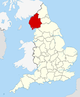
Cumbria Ceremonial (geographic) county of England, UK

Cumbria is a ceremonial and non-metropolitan county in North West England. The county and Cumbria County Council, its local government, came into existence in 1974 after the passage of the Local Government Act 1972. Cumbria's county town is Carlisle, in the north of the county; the only other major urban area is Barrow-in-Furness on the south-western tip of the county.

Los Angeles County, California County in California, United States

Los Angeles County, officially the County of Los Angeles, is the most populous county in the United States and in the U.S. state of California, with more than ten million inhabitants as of 2018. It is the most populous non–state-level government entity in the United States. Its population is greater than that of 41 individual U.S. states. It has the third-largest metropolitan economy in the world, with a Nominal GDP of more than $700 billion. It has 88 incorporated cities and many unincorporated areas and, at 4,083 square miles (10,570 km2), it is larger than the combined areas of Delaware and Rhode Island. The county is home to more than one-quarter of California residents and is one of the most ethnically diverse counties in the United States. Its county seat, Los Angeles, is also California's most populous city and the second most populous city in the United States, with about four million residents.

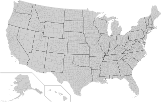
County (United States) Subdivision used by most states in the United States of America

In the United States, a county is an administrative or political subdivision of a state that consists of a geographic region with specific boundaries and usually some level of governmental authority. The term "county" is used in 48 U.S. states, while Louisiana and Alaska have functionally equivalent subdivisions called parishes and boroughs, respectively.

Counties of England Englands administrative, geographical and political demarcation

The counties of England are areas used for different purposes, which include administrative, geographical, cultural and political demarcation. The term 'county' is defined in several ways and can apply to similar or the same areas used by each of these demarcation structures. These different types of county each have a more formal name but are commonly referred to just as 'counties'. The current arrangement is the result of incremental reform.

Ceremonial counties of England Collective name for areas, in England, to which a Lord Lieutenant is appointed

The counties and areas for the purposes of the lieutenancies, also referred to as the lieutenancy areas of England and informally known as ceremonial counties, are areas of England to which lords-lieutenant are appointed. Legally, the areas in England, as well as in Wales and Scotland, are defined by the Lieutenancies Act 1997 as "counties and areas for the purposes of the lieutenancies in Great Britain", in contrast to the areas used for local government. They are also informally known as "geographic counties", to distinguish them from other types of counties of England.

Central Time Zone Time zone in North America

The North American Central Time Zone (CT) is a time zone in parts of Canada, the United States, Mexico, Central America, some Caribbean Islands, and part of the Eastern Pacific Ocean.

Boroughs of New York City Administrative division of New York City

New York City is composed of five boroughs: The Bronx, Brooklyn, Manhattan, Queens, and Staten Island. Each borough is coextensive with a respective county of New York State. The boroughs of Queens and the Bronx have the same borders as the counties of the same name. The other three counties are named differently from their boroughs: Manhattan is New York County, Brooklyn is Kings County, and Staten Island is Richmond County.

Essex County of England

Essex is a county in the south-east of England, north-east of London. One of the home counties, it borders Suffolk and Cambridgeshire to the north, Hertfordshire to the west, Kent across the estuary of the River Thames to the south and London to the south-west. The county town is Chelmsford, the only city in the county. For the purposes of government statistics, Essex is placed in the East of England region.