
The Regional Municipality of Ottawa–Carleton was a Regional Municipality and Census Division in Ontario, Canada, that existed between January 1, 1969, and January 1, 2001, and was primarily centred on the City of Ottawa. It was created in 1969 by restructuring Carleton County and annexing Cumberland Township from the United Counties of Prescott and Russell into the newly created Region of Ottawa–Carleton.
Goulbourn Township, Ontario, was formed in 1818, roughly 20 km southwest of downtown Ottawa, with the first major settlement occurring in Richmond. Other communities in the township include Stittsville, Munster, and Ashton. Stittsville is the largest community in the township, owing in part to its proximity to Kanata and the Queensway. The township was amalgamated into the current City of Ottawa in 2001.
Constance Bay is a population centre in West Carleton-March Ward in the rural northwest of the city of Ottawa, Ontario, Canada. Prior to amalgamation in 2001, the community was part of West Carleton Township. It is situated 25 km northwest of the suburb of Kanata. The community surrounds the Torbolton Forest and is located on a peninsula between Constance and Buckham's Bay on the Ottawa River. According to the Canada 2016 Census, the population of the community was 2,314. 86% of dwellings are occupied by usual residents.

Osgoode Township is a former township that is now a part of the city of Ottawa, Ontario, Canada. The township along the Rideau River was established in 1798 and incorporated in 1850. It was an independent township in Carleton County until its amalgamation with the city in 2001. It remains a largely rural area with only some 23,285 inhabitants as of the 2016 census. As of the Canada 2021 Census, this had increased to 24,199. On Ottawa city council it is represented by George Darouze.

Carleton is a federal electoral district in Ontario, Canada, represented in the House of Commons of Canada from 1867 to 1968 and since 2015. It was represented in the Legislative Assembly of Upper Canada from 1821 to 1840 and in the Legislative Assembly of the Province of Canada from 1841 until 1866.
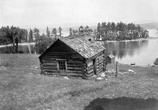
West Carleton was a township municipality in Eastern Ontario, Canada. It was located in the rural parts of what is now the City of Ottawa, west of Kanata. Its northern boundary was the Ottawa River.
Lanark–Renfrew–Carleton was a federal electoral district represented in the House of Commons of Canada from 1968 to 1988. It was located in the province of Ontario.

Carp is a compact rural community in West Carleton-March Ward in the City of Ottawa, Ontario, Canada, located in the northwestern portion of the municipality on the Carp River. It is about 33 km (21 mi) from downtown Ottawa. Prior to amalgamation in 2001, Carp was located in the West Carleton Township.
Dunrobin is a community in West Carleton-March Ward in the City of Ottawa, Ontario, Canada. It is located about 35 kilometres northwest of Downtown Ottawa. Dunrobin lies within a valley, nestled between the Ottawa River and the Carp escarpment, and is located at 45.18° latitude and 75.55° longitude. Dunrobin is located on the former boundary between West Carleton Township and Kanata. Dunrobin was amalgamated with the city of Ottawa in 2000. Dunrobin is expanding steadily with a current population of about 1,000 people.
March Township is a geographic township and former municipality originally part of Carleton County in eastern Ontario, Canada. It is currently part of the City of Ottawa. It is located in the western part of the county, bordered to the northwest by Torbolton Township, to the southwest by Huntley Township, to the east by Nepean, to the south by Goulbourn Township and to the north by the Ottawa River. According to the Canada 2001 Census, the Township had a population of approximately 26,650.

Huntley is a former incorporated and now geographic township in Carleton County in eastern Ontario, Canada.
Torbolton is a geographic township and former municipality that was originally part of Carleton County in eastern Ontario, Canada.
Charles Shirreff was an early Canadian businessman and public official.

Fitzroy Harbour is a small village within the city of Ottawa in eastern Ontario, Canada. It is located on the Ottawa River at the mouth of the Carp River. A branch of the Mississippi River, known as the Snye, also empties into the Ottawa to the west of the village.

Galetta is a dispersed rural community in West Carleton-March Ward in rural western Ottawa, Ontario, Canada. It is located on the Mississippi River near its mouth in the Ottawa River. Once part of Fitzroy Township and later West Carleton, it is now part of the city of Ottawa.
Carp Road is an arterial road in Ottawa, Ontario, Canada that runs between Fitzroy Harbour and Stittsville, through the village of Carp. The road is located in the city's west end, beginning in Fitzroy Harbour at Galetta Side Road and ending in Stittsville at Stittsville Main Street. Most of the route is rural with the exception of Stittsville where the road travels in a residential development. Ottawa Regional Road #5 continues as Stittsville Main Street south of Carp Road, then becomes Huntley Road south of Stittsville toward the town of Richmond.

West Carleton-March Ward is a city ward in Ottawa, Ontario, Canada.
The Carp River is a river in the city of Ottawa, Ontario, Canada. It is 42 kilometres long and its watershed drains an area of approximately 306 km2 spread across Stittsville, Kanata, and West Carleton-March. The headwaters originate as the upper Carp River, which runs southwest from Appaloosa Park under Eagleson Road through Glen Cairn where it empties into the marshes and storm water ponds south of the Canadian Tire Centre. From there it flows north through West Carleton-March into the Ottawa River at Fitzroy Harbour. The Carp River has four major tributaries: Poole Creek, Feedmill Creek, Huntley Creek, and Corkery Creek. The watershed is administered by the Mississippi Valley Conservation Authority.

This is the outline of the geography of the city of Ottawa, the capital of Canada. Ottawa's current borders were formed in 2001, when the former city of Ottawa amalgamated with the ten other municipalities within the former Regional Municipality of Ottawa–Carleton. Ottawa is now a single-tiered census division, home to 1,017,449 people.