
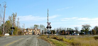
Casselman is a village in eastern Ontario, Canada, in the United Counties of Prescott and Russell. Situated on the South Nation River about 55 km (34 mi) southeast of downtown Ottawa, along the Trans-Canada Highway 417. It is served by a station on the Montreal-Ottawa Via Rail train, twice a day in each direction.
Carlsbad Springs is a rural community on Bear Brook in Cumberland Ward in Ottawa, Ontario, Canada; Prior to amalgamation in 2001, the community was on the border between Gloucester and Cumberland. According to the Canada 2011 Census, the population of the surrounding area is 916.
Whitewater Region is a township on the Ottawa River in Renfrew County, located within the Ottawa Valley in eastern Ontario, Canada. Whitewater Region is made up of the former municipalities of Beachburg, Cobden, Ross and Westmeath, which were amalgamated into the current township on January 1, 2001.
Russell Road is an arterial road in Eastern Ontario, Canada. It begins in Ottawa in the Riverview neighbourhood and runs eastward through the rural communities of Ramsayville, Carlsbad Springs and Bearbrook in Ottawa and through the Municipality of Clarence-Rockland, connecting the communities of Cheney and Bourget, ending at Boundary Road on the eastern border of Clarence Rockland. In Ottawa it is officially Ottawa Road #26, and in Clarence-Rockland as United Counties of Prescott and Russell County Road #2.

Ottawa South is a federal electoral district in Ottawa, Ontario, Canada. It is represented in the House of Commons of Canada by David McGuinty, brother of former Premier of Ontario and Ottawa South MPP Dalton McGuinty. It has been held continuously by Liberal candidates since it was first contested in 1988, and is regarded as one of the strongest Liberal ridings in Canada. Ottawa South is a suburban, generally middle class riding, notable for having the highest Arab population in Ontario.

Orléans is a federal electoral district in Ottawa, Ontario, Canada, that has been represented in the House of Commons of Canada since 1988.
King's Highway 417, commonly referred to as Highway 417 and as the Queensway through Ottawa, is a 400-series highway in the Canadian province of Ontario. It connects Ottawa with Montreal via A-40, and is the backbone of the highway system in the National Capital Region. Within Ottawa, it forms part of the Queensway west from Highway 7 to Ottawa Road 174. Highway 417 extends from the Quebec border, near Hawkesbury, to Arnprior, where it continues westward as Highway 17. Aside from the urban section through Ottawa, Highway 417 passes through farmland that dominates much of the fertile Ottawa Valley.

Nepean—Carleton was a federal electoral district in Ontario, Canada that was represented in the House of Commons from 1979 to 1988, and again from 1997 to 2015.

Carleton is a federal electoral district in Ontario, Canada, represented in the House of Commons of Canada from 1867 to 1968 and since 2015. It was represented in the Legislative Assembly of Upper Canada from 1821 to 1840 and in the Legislative Assembly of the Province of Canada from 1841 until 1866. It has been represented by Pierre Poilievre, the current Leader of the Opposition, since its creation in 2015.

Unorganized North Algoma District is an unorganized area in northeastern Ontario, Canada, comprising all areas in Algoma District, north of the Sault Ste. Marie to Elliot Lake corridor, which are not part of an incorporated municipality or a First Nation. It covers 44,077.03 km2 (17,018.24 sq mi) of land, and had a population of 6050 in 2021. Many of these communities were/are stations on the Algoma Central Railway or were logging/mining towns.

Canadian Forces Station Leitrim, also referred to as CFS Leitrim, is a Canadian Forces Station located in the neighbourhood of Leitrim in Ottawa, Ontario. It is concerned with the interception, decrypting and processing of communication for the Communications Security Establishment and the Canadian Forces, and forms part of the ECHELON system.
Overbrook is an urban neighbourhood situated in Rideau-Rockcliffe Ward, in the east end of Ottawa, Ontario, Canada. It is located across the Rideau River from the neighbourhood of Sandy Hill and is just to the south of Vanier. To the east of Overbrook is the former City of Gloucester. It was constituted as a police village in 1922 and was annexed by the City of Ottawa in 1950.
Leitrim is a dispersed rural community in the South Gloucester section of Ottawa, Ontario, Canada, and is named for the Irish County Leitrim. The area comprises the rapidly growing Findlay Creek suburban neighbourhood.
Kempark is a community in Gloucester-Southgate Ward in the south end of Ottawa, Ontario, Canada. Prior to amalgamation in 2001, it located in City of Gloucester. The community is located at the south end of Conroy Road when it meets with Bank Street. It is located right next to the village of Leitrim, Ontario. It is about 12 km south of Downtown Ottawa. The community is home to approximately 200 people.

Pineview is a neighbourhood in Beacon Hill-Cyrville Ward in the east end of Ottawa, Ontario, Canada. Prior to amalgamation in 2001, the neighbourhood was part of the City of Gloucester. As of the Canada 2021 Census, the neighbourhood had a population of 6,179.

Crystal Beach is a neighbourhood in Ottawa, Ontario, Canada. It is located in the west end of Ottawa, in Bay Ward. The neighbourhood is triangular in shape, and its boundaries can broadly be described as Carling Avenue to the northeast, Moodie Drive to the west, and Corkstown Road to the south. It is. According to the Canada 2011 Census, the total population of the neighbourhood was 2,416.
Orléans is a provincial electoral district in eastern Ontario, Canada. It elects one member to the Legislative Assembly of Ontario. Before the 2018 election, it was known as Ottawa—Orléans.

Findlay Creek is a suburban neighbourhood in Riverside South-Findlay Creek Ward in the south end of Ottawa, Ontario, Canada. According to the 2021 Canadian Census, the population of the community was 14,089 and there were 4,395 dwellings.

Kanata—Carleton is a federal electoral district in Ottawa, Ontario.

