Baseline runs from Richmond Road (almost directly over Highway 416) east in a straight line until it ends at the Heron Road Bridge over the Rideau River and Rideau Canal when it becomes Heron Road. Before the 2001 City of Ottawa amalgamation, Baseline formed the border of the city of Ottawa and Nepean. The street is named for its location as the baseline for Nepean Township. When Nepean Township was surveyed, Baseline formed the northern boundary of Nepean's six north–south concessions. Currently, Baseline is a major east–west street, and in the late 1990s it became so busy that Hunt Club Road had to be extended west of the Rideau River to alleviate pressure.
Baseline Road is a four-lane principal arterial road for its entire length, except between Centrepointe Drive and Navaho Drive, where it is a five-lane/six-lane arterial (three eastbound lanes and three westbound lanes – a bus lane is present from Constellation west to Centrepointe in lieu of the third westbound lane). The speed limit is 60km/h (37mph) for most of its length except a short section west of Greenbank Road, where it is 70km/h (43mph).
Ramsayville Road in southeast Ottawa used to be called Base Line Road before 2003. The name had to be changed when the former city of Gloucester amalgamated with the city of Ottawa, to avoid confusion.
In the future, Baseline Road will have bus lanes between Navaho Drive and Prince of Wales Drive to speed up transit service in this stretch (OC Transpo bus route 88) due to consistent heavy traffic.
Bank Street is the major commercial north–south street in Ottawa, Ontario, Canada. It runs south from Wellington Street in downtown Ottawa, south through the neighbourhoods of Centretown, The Glebe, Old Ottawa South, Alta Vista, Hunt Club, and then through the villages of Blossom Park, Leitrim, South Gloucester, Greely, Metcalfe, Spring Hill, and Vernon before ending at the city limit at Belmeade Road, becoming Stormont, Dundas and Glengarry county highway 31.
Hunt Club Road, also known as Ottawa Road 32, is a major east–west route in Ottawa, Ontario, Canada. It originally ran from a dead end east of Bank Street to the Ottawa Hunt and Golf Club; later, there were many extensions due to the 1970s housing boom, first westward to Riverside Drive, then eastward to Hawthorne Road in the late 1980s. The section between Bank Street and Riverside Drive, originally only one lane in each direction, was expanded to two lanes in each direction in 1993–1994. It was further extended across the Rideau River and the southern edge of the suburbs to Richmond Road by the late 1990s; this extension is signed as West Hunt Club Road by the City of Ottawa. Construction to extend Hunt Club eastward to Highway 417 near Ramsayville was completed on August 21, 2014.
Riverside Drive is a major road in Ottawa, Ontario, Canada, that follows along the eastern bank of the Rideau River. Its northern terminus is at the Transitway/Via Rail underpass just south of the Queensway, and the road proceeds south to Limebank Road where it continues as River Road until the city limits. North of the Queensway, Riverside continues as Vanier Parkway, which travels through Vanier until Beechwood Avenue. The Vanier Parkway name is linked to the neighbourhood of Vanier, which was named for former Governor General of Canada Georges Vanier.
Heron Road is a major road in Ottawa, Ontario, Canada. It runs from Walkley Road at an angle to the Rideau River, where it turns into Baseline Road. Heron is home to the Sir Leonard Tilley Building, the Canada Post headquarters, and the Edward Drake Building. It is also home to St. Patrick's Intermediate High School and Herongate Mall.
Ottawa West—Nepean is a federal electoral district in Ontario, Canada, that has been represented in the House of Commons of Canada since 1997.
Nepean is an area of Ottawa, Ontario, Canada. Located west of Ottawa's inner core, it was an independent city until amalgamated with the Regional Municipality of Ottawa–Carleton in 2001 to become the new city of Ottawa. However, the name Nepean continues in common usage in reference to the area. The population of Nepean is about 186,593 people.
King's Highway 417, commonly referred to as Highway 417 and as the Queensway through Ottawa, is a 400-series highway in the Canadian province of Ontario. It connects Ottawa with Montreal via A-40, and is the backbone of the highway system in the National Capital Region. Within Ottawa, it forms part of the Queensway west from Highway 7 to Ottawa Road 174. Highway 417 extends from the Quebec border, near Hawkesbury, to Arnprior, where it continues westward as Highway 17. Aside from the urban section through Ottawa, Highway 417 passes through farmland that dominates much of the fertile Ottawa Valley.
Barrhaven is a suburb of Ottawa, Ontario, Canada. It is located about 17 km (11 mi) southwest of the city's downtown core. Prior to amalgamation with Ottawa in 2001, Barrhaven was part of the City of Nepean. Its population as of the Canada 2021 Census was 103,234.
Carling Avenue is a major east–west arterial road in the west end of Ottawa, Ontario, Canada. It runs from March Road in Kanata to Bronson Avenue in the Glebe. The road is named for John Carling, founder of Carling Brewery and Conservative MP and Senator, Postmaster General and Minister of Agriculture.
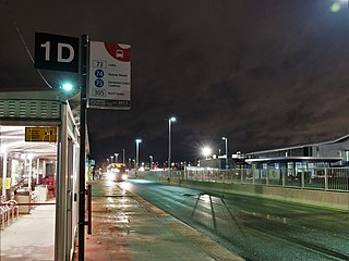
Baseline (Transitway) or Algonquin (O-Train) is a public transit station directly across from the main campus of Algonquin College in Ottawa's west end, near the intersection of Woodroffe Avenue and Baseline Road. Many Algonquin College students and Centrepointe residents use this station to get to various points in the city, and to and from the college. Several residential and business areas such as Centrepointe and College Square are also served by this station.
Island Park Drive is a scenic parkway in Ottawa, Ontario, Canada.
Woodroffe Avenue is a major north-south arterial road in Ottawa, Ontario, Canada's west end. It runs south from the Kichi Zibi Mikan through Baseline Road and Barrhaven to just short of Prince of Wales Drive near Manotick. The road runs through the heart of Nepean in Ottawa's west end. A satellite Via Rail station is also located at the intersection of Fallowfield Road.
Merivale Road is an arterial road in the west end of Ottawa, Ontario, Canada. It starts at Island Park Drive just north of Highway 417 and continues south until it ends at Prince of Wales Drive in Rideau Glen. South of Clyde Avenue, Merivale is known as Ottawa Road #17, while north of Clyde it is Ottawa Road #63.
Meadowlands Drive is a suburban road in Ottawa, Ontario, Canada. It begins at Prince of Wales Drive as a continuation of Hog's Back Road in the neighborhood of Rideauview. There are two small shopping plazas and a Shell station at its corner with Prince of Wales. It then continues westward towards Fisher Avenue and consists of low-income housing projects, low-rise apartment buildings, townhouses and semi-detached homes. The speed limit here is 50 km/h (31 mph). most of Meadowlands is one lane, other than between Prince of Wales to Fisher, and from Chesterton to Merivale.
Strandherd Drive is a major road serving the community of Barrhaven in southwest Ottawa.
Prince of Wales Drive is a road serving Ottawa, Ontario. The northern section is a low-speed street running along the west bank of the Rideau River, while southern portions of the road were formerly Highway 16.
College Ward or Ward 8 is a city ward in Ottawa, Canada's west end. The ward covers the neighbourhoods of Bells Corners, Qualicum, Graham Park, Leslie Park, Redwood, Kenson Park, Parkway Park, Bel-Air Park, Bel-Air Heights, Braemar Park, Copeland Park, Briargreen, Centrepointe, Navaho, City View, Ryan Farm, Meadowlands and Crestview.
Redwood is a neighbourhood located in Ottawa's west end. The boundaries of the neighbourhood is Greenbank Road to the east, Baseline Road to the south, Morrison Drive to the west and Highway 417 to the north.
This page is based on this Wikipedia article Text is available under the CC BY-SA 4.0 license; additional terms may apply. Images, videos and audio are available under their respective licenses.