Hawthorne Meadows | |
|---|---|
Neighbourhood | |
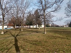 Hawthorne Park | |
 Hawthorne Meadows | |
| Coordinates: 45°23′32″N75°35′57″W / 45.39222°N 75.59917°W | |
| Country | Canada |
| Province | Ontario |
| City | Ottawa |
| Government | |
| • MPs | David McGuinty |
| • MPPs | John Fraser |
| • Councillors | Marty Carr |
| Area | |
• Total | 0.606 km2 (0.234 sq mi) |
| Elevation | 75 m (246 ft) |
| Population (2016) | |
• Total | 3,577 [1] |
| • Density | 5,903/km2 (15,290/sq mi) |
| Canada 2016 Census | |
| Time zone | UTC-5 (Eastern (EST)) |
| Forward sortation area | K1G |
Hawthorne Meadows is a neighbourhood in Alta Vista Ward in southeast Ottawa, Ontario, Canada. It is triangular in shape; it is bounded on the west by St. Laurent Boulevard, on the northeast by Russell Road and on the south by Walkley Road. [2] According to the Canada 2016 Census, the population of this area was 3,577. [1]